I am Kiran Basnet, a licensed trekking guide from Dhading and the founder of Manaslu Treks and Expedition. I have completed the Manaslu Circuit more than 20 times, and I updated this route guide in July 2026 after my most recent crossing of the Larkya La this spring. Everything below is the trail as it exists right now, in 2026, not the trail as it existed in an old guidebook or a blog post recycled from 2019.
That distinction matters more on Manaslu than on almost any other trek in Nepal. The road project along the Budhi Gandaki changed the lower valley again this year, the solo trekking permit rule changed on March 22, 2026, and landslide reroutes in the gorge move the trail every monsoon. A route guide that is even one season old will send you along paths that no longer exist. This one will not.
The short version for anyone in a hurry: the Manaslu Circuit in 2026 runs anticlockwise from Machha Khola at 869 meters to Dharapani at 1,963 meters, covers roughly 110 to 120 kilometers of walking over 10 to 11 trekking days, and crosses one high pass, the Larkya La at 5,106 meters. The rest of this guide explains every stage in the detail you need to actually plan the trek.
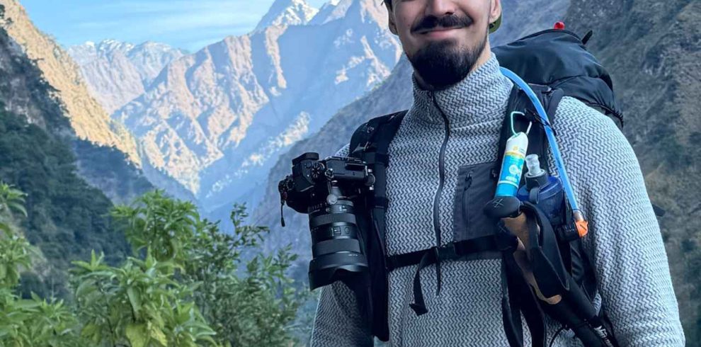
The Manaslu Circuit Trek is a spectacular journey around Mount Manaslu (8,163 m), the eighth-highest mountain in the world. Located…
Manaslu Circuit Route at a Glance: 2026
This is the itinerary we run at Manaslu Treks and Expedition, refined over years of departures. Distances are trail distances, not straight lines. Walking times are for a normally fit trekker carrying a daypack while a porter carries the main bag.
| Stage | From → To | Altitude | Distance | Time |
|---|---|---|---|---|
| 1 | Kathmandu → Machha Khola (drive) | 1,400m → 869m | 157 km by road | 7 to 9 hours |
| 2 | Machha Khola → Jagat | 869m → 1,410m | 13 to 14 km | 6 to 7 hours |
| 3 | Jagat → Deng | 1,410m → 1,804m | 19 to 20 km | 7 to 8 hours |
| 4 | Deng → Namrung | 1,804m → 2,630m | 18 to 19 km | 6 to 7 hours |
| 5 | Namrung → Lho or Shyala | 2,630m → 3,180m or 3,500m | 10 to 17 km | 4 to 6 hours |
| 6 | Lho or Shyala → Sama Gaun | → 3,530m | 8 to 10 km | 3 to 4 hours |
| 7 | Acclimatisation day at Sama Gaun | hikes to 4,000m to 4,800m | optional | 3 to 6 hours |
| 8 | Sama Gaun → Samdo | 3,530m → 3,875m | 8 km | 3 to 4 hours |
| 9 | Samdo → Dharamsala | 3,875m → 4,460m | 6 km | 3 to 4 hours |
| 10 | Dharamsala → Larkya La → Bimthang | 4,460m → 5,106m → 3,720m | 15 to 16 km | 9 to 11 hours |
| 11 | Bimthang → Dharapani | 3,720m → 1,963m | 22 to 24 km | 7 to 8 hours |
| 12 | Dharapani → Kathmandu (drive) | → 1,400m | by road | 8 to 10 hours |
The circuit runs anticlockwise only. Crossing the Larkya La clockwise from Dharapani would force you to gain altitude far too fast on the Bimthang side, where there is nowhere sensible to acclimatise between 3,720 metres and the pass. No responsible company offers it, and after 20 plus crossings I can tell you the anticlockwise profile is the reason most of our trekkers cross the pass without serious altitude problems.
This route matches our 13 day Manaslu Circuit Trek day for day. If you want the full day by day plan with inclusions and prices, that page has it.
What Changed on the Manaslu Route in 2026
Three updates matter this year, and I have walked through all three myself.
The solo trekking rule changed on March 22, 2026. The government revised the permit rules for restricted areas, including Manaslu, on that date. If you read a 2024 or 2025 article about trekking Manaslu alone, it is out of date. I wrote a full explanation of what the change means in practice in our guide to solo trekking in the Manaslu Circuit and in the guide requirement explained. The short version: restricted area permits are still issued through registered agencies, and you should confirm the current rule before booking anything, because forums are full of advice that predates March 2026.
The army road project has reached 154 kilometres of alignment, with partial completion. The road pushing up the Budhi Gandaki changes the character of the lower valley every season. In 2026 the practical effect is this: the drive now reliably reaches Machha Khola in one day, and between Jagat and Philim a stretch of road walking is unavoidable. There is no forest path around it; the old trail on that section was cut by the roadworks. It is about an hour and a half of walking on graded track, dusty in dry weather, and I tell every guest about it before they book because I would rather you hear it from me than discover it on day three. Above Philim the road ends and the trail is pure trekking route all the way over the pass.
Landslide reroutes moved the trail again after the 2025 monsoon. Two sections between Yaru Bagar and Deng were rerouted over the winter. The new paths are stable and obvious on the ground, but they do not match GPS traces recorded before October 2025. More on that in the maps section below, because this catches out more trekkers than anything else on the route.
Getting to the Trailhead: Kathmandu to Machha Khola
The trek starts with a long drive west from Kathmandu: 157 kilometres by road, 7 to 9 hours depending on season and traffic out of the valley. The route runs along the Prithvi Highway to Dhading Besi, then north on rougher road through Arughat and Soti Khola to Machha Khola at 869 metres. I grew up in Dhading, so this drive passes through my home district, and I can tell you the section after Arughat is where a private jeep earns its money. Local buses do run, but they take longer and stop everywhere.
Machha Khola is a warm, low riverside village with simple teahouses. Most groups arrive by late afternoon, eat dal bhat, and sleep early, because stage two starts the real walking.
Stage by Stage: The Complete 2026 Route
Machha Khola to Jagat (869m to 1,410m)
The first walking day follows the Budhi Gandaki upstream through the bottom of the gorge. The trail character is constant up and down: stone staircases cut into the cliffside, suspension bridges swapping you from bank to bank, and short steep climbs past waterfalls. About an hour in you reach Tatopani, whose name means hot water, and the natural hot spring by the trail is worth ten minutes even on a schedule.
The day ends at Jagat, a flagstoned village at 1,410 metres and the first restricted area checkpoint. Your permits are inspected and logged here, which is why they must be arranged before you leave Kathmandu. The full permit breakdown, with 2026 prices, is in our Manaslu permit cost and process guide.
Count on 6 to 7 hours for the 13 to 14 kilometres. It sounds gentle on paper. The accumulated climbing on the staircases makes it a proper first day.
Jagat to Deng (1,410m to 1,804m)
The longest low altitude day on the circuit at 19 to 20 kilometres, and the day that includes the unavoidable road walk between Jagat and Philim from the army road project. After Philim the valley narrows into the most dramatic part of the gorge. You cross the mouth of the Tsum Valley, where trekkers on our 19 day Manaslu Circuit and Tsum Valley Trek branch northeast, and continue through bamboo forest where langur monkeys are common in the morning.
This is also the section with the freshest landslide reroutes in 2026. Where old and new paths both remain visible, the correct line is obvious to a guide who walked it last month and much less obvious from a two year old GPS trace. Deng, at 1,804 metres, is a small huddle of teahouses and the most basic overnight stop on the whole route. It is the one place on our itinerary where rooms do not have attached bathrooms; everywhere else we book does. I explain the room standard at every stop in our guide to accommodation on the Manaslu Circuit.
Deng to Namrung (1,804m to 2,630m)
Above Deng everything changes. The gorge relents, pine and fir replace bamboo, and the culture shifts from Hindu hill villages to Tibetan Buddhist Nupri, the historic name for the upper valley. Mani walls appear in every settlement from here on; pass them on the left, clockwise, the same direction the prayer wheels turn. Your guide will remind you the first few times until it becomes habit.
The climb through the day is steady rather than brutal, gaining a bit over 800 metres across 18 to 19 kilometres. Namrung at 2,630 metres is the second permit checkpoint and the first village with a properly comfortable lodge standard, good coffee, and the first big mountain views if the evening is clear.
Namrung to Lho or Shyala (2,630m to 3,180m or 3,500m)
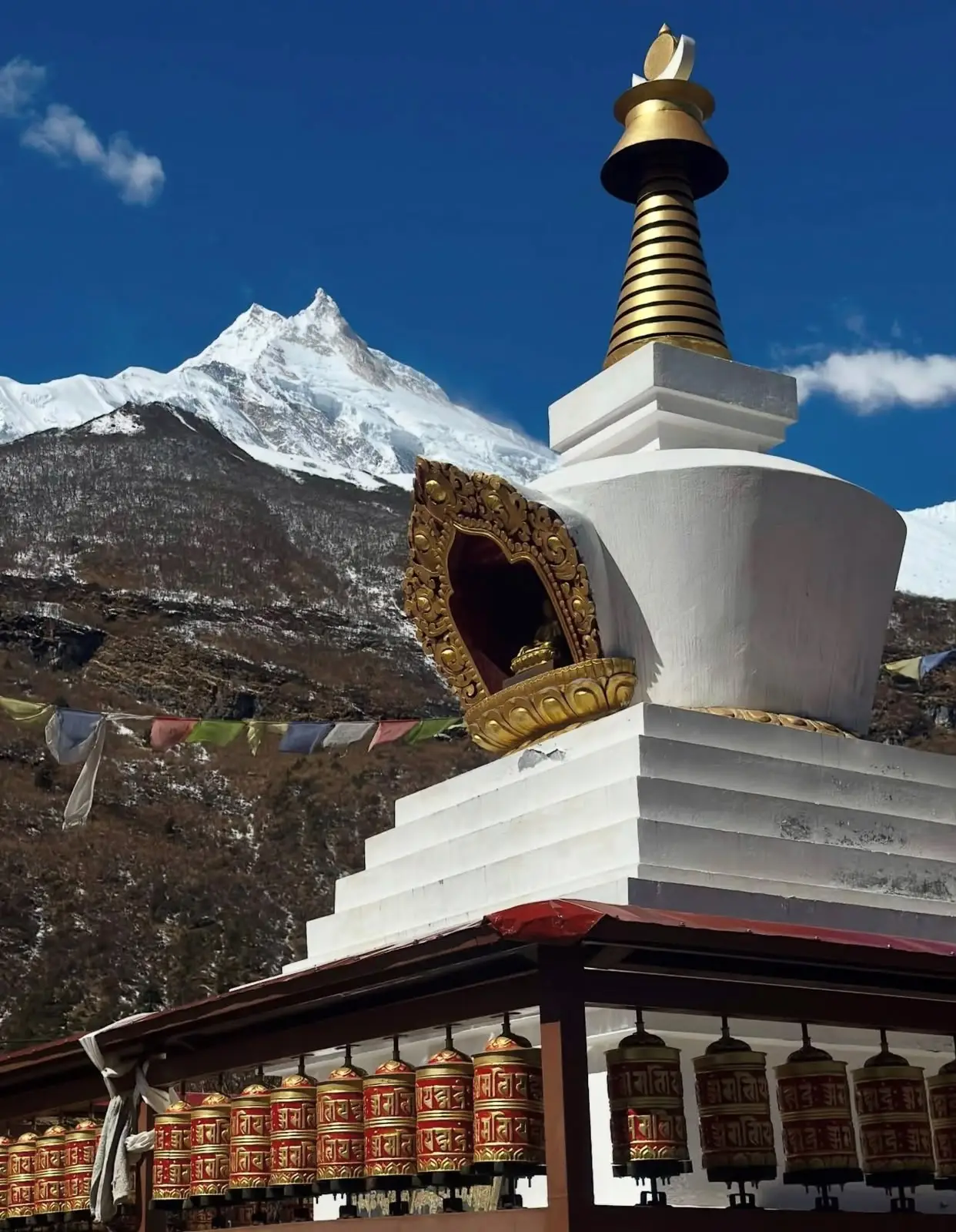
A shorter day and one of the most beautiful on the circuit. The trail climbs through Lihi and Sho, each village more Tibetan than the last, with chortens framing the trail and barley fields terraced against the hillside. From Lho at 3,180 metres you get the classic head on view of Manaslu itself, 8,163 metres, the eighth highest mountain on earth, with its distinctive double summit filling the head of the valley.
Many of our groups continue 90 minutes higher to sleep at Shyala at 3,500 metres. Shyala sits in a natural amphitheatre with Himalchuli, Ngadi Chuli, and Manaslu arranged around it, and sunrise there is the single best photography moment of the trek in my opinion. Sleeping slightly higher at Shyala also smooths the acclimatisation curve into Sama Gaun. I covered the villages along this stretch in more detail in villages of the Manaslu Circuit Trek and the gompas in monasteries on the Manaslu Circuit.
Lho or Shyala to Sama Gaun (to 3,530m)
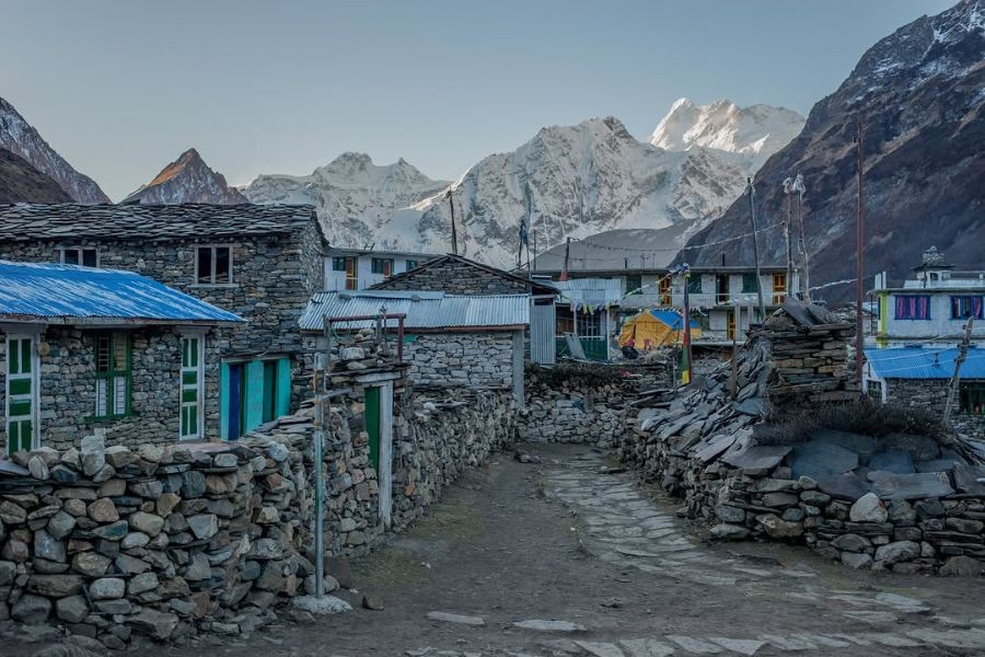
A deliberately short stage of 3 to 4 hours, because arriving at altitude early and resting is part of the acclimatisation plan. Sama Gaun at 3,530 metres is the capital of the upper valley: a large village of stone houses, yak pastures, a monastery, a health post, and the best equipped lodges on the circuit. You will spend two nights here, and by design.
The Acclimatisation Day at Sama Gaun
Do not treat this as a rest day where you lie in your sleeping bag. The rule that keeps you safe over the Larkya La is climb high, sleep low, and Sama Gaun offers two classic ways to do it.
| Acclimatisation hike | High point | Round trip time | Character |
|---|---|---|---|
| Manaslu Base Camp via Birendra Lake | about 4,800m | 5 to 6 hours | Steep, big altitude gain, glacier views |
| Pungyen Gompa | about 4,000m | 4 to 5 hours | Gentler, quieter, under the east face |
| Birendra Lake only | about 3,690m | 1.5 to 2 hours | Easy option for tired legs |
I usually recommend Pungyen Gompa for guests who felt the altitude on the way to Sama Gaun and Base Camp for those who are moving well. Either one, followed by a second night at 3,530 metres, is what prepares your body for the pass. Skipping the acclimatisation day to save one trekking day is the single most common cause of turned around trekkers at Dharamsala, and I have watched it happen to fit marathon runners. Altitude does not care about your gym schedule. If you want to understand how your body responds up here, read our Manaslu Circuit difficulty guide and what actually happens if you get sick on the Manaslu Circuit.
Sama Gaun to Samdo (3,530m to 3,875m)
A short, gorgeous half day up an ever widening valley where the trees give up and the landscape turns high, dry, and Tibetan. Samdo at 3,875 metres is the last real village on the route, settled by Tibetan refugees in the 1960s, and the old trade route to the Tibetan border climbs the hill behind it. If your group is strong, the afternoon side walk toward the Lajyang Bhanjyang viewpoint above Samdo is a superb bonus acclimatisation hike. Yaks outnumber people here, and the night sky, with no electric light for a day’s walk in any direction, is something guests talk about for years.
Samdo to Dharamsala (3,875m to 4,460m)
Three hours of gradual climbing on moraine and scree brings you to Dharamsala at 4,460 metres, also called Larkya Phedi, the foot of the pass. Understand what Dharamsala is before you arrive: not a village, but a seasonal collection of stone shelters, dormitory rooms, and tents, run for one purpose only, which is putting trekkers within striking distance of the Larkya La. Beds are limited and in the October peak they run out. This is exactly why booking with a company that reserves ahead matters; we confirm Dharamsala beds before our groups leave Sama Gaun. The afternoon plan is simple: arrive early, eat, hydrate, and sleep at 7pm, because the next day starts in the dark.
Pass Day: Dharamsala over the Larkya La to Bimthang
The hardest and finest day of the circuit, and after more than 20 crossings I still feel the same knot of respect for it every time. Here is how the day actually unfolds on our departures:
| Time | Where you are | What is happening |
|---|---|---|
| 3:30 to 4:30 am | Dharamsala, 4,460m | Breakfast by headlamp, final water fill |
| 4:30 to 7:00 am | Moraine ridges | Steady climbing past a line of frozen lakes |
| 7:00 to 9:00 am | Upper slopes | The cold hours; wind picks up near the top |
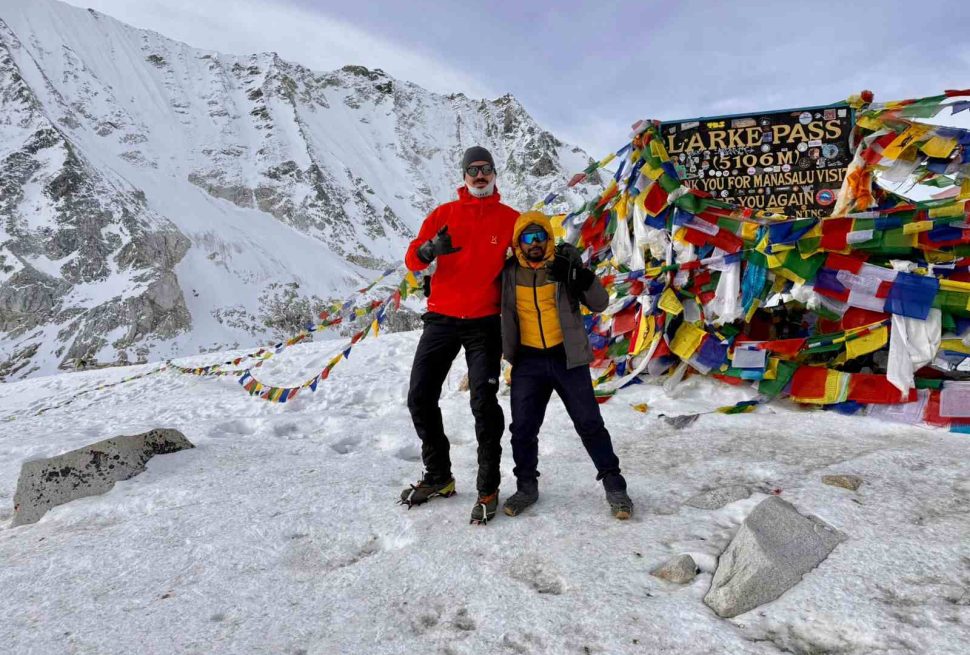
| 8:30 to 10:00 am | Larkya La, 5,106m | Prayer flags, photos, 20 to 30 minutes maximum |
| 10:00 am to 12:00 pm | West side descent | Steep scree, often icy; microspikes earn their weight |
| 12:00 to 3:00 pm | Descending meadows | The gradient eases into a long green walk |
| 3:00 to 4:00 pm | Bimthang, 3,720m | Soup, sleep, and the best kind of tiredness |
Nothing on the crossing is technical. There is no climbing, no rope, no glacier travel on the trekking line. What makes it hard is arithmetic: 650 metres of ascent starting at 4,460 metres, in the cold and dark, followed by nearly 1,400 metres of descent, over 9 to 11 hours. From the pass itself, Himlung Himal, Cheo Himal, Kang Guru, and Annapurna II stand across the western horizon, and on a clear morning it is the best mountain panorama I know that can be reached without mountaineering.
The descent deserves as much respect as the climb. The first hour drops steeply on scree that holds ice in early spring and late autumn, and this is where most pass day injuries happen, not on the way up. Microspikes go in every kit list I write for departures from late October onward; the full list is in our Manaslu Circuit packing list. I also marked the sections that need real attention in the risky parts of the Manaslu Circuit.
Bimthang at 3,720 metres is a meadow basin below the Manaslu icefall, and many of our trekkers name it their favourite night of the whole trip. There is something about eating dinner while looking back up at a pass you crossed that morning.
Bimthang to Dharapani (3,720m to 1,963m)
The final trekking stage drops nearly two vertical kilometres through rhododendron forest that turns entire hillsides red and pink through April. Your knees feel this day far more than your lungs do; trekking poles matter more here than anywhere else on the circuit. At Tilije the trail becomes gentler, and at Dharapani you join the Annapurna Circuit trail, check out of the restricted area at the final checkpoint, and meet the road.
The drive back to Kathmandu takes 8 to 10 hours via Besi Sahar. Most groups sleep in Kathmandu that night, at the Moonlight Hotel in Thamel on our itineraries, with the kind of shower you spend the last three days imagining.
Elevation Profile: Where the Altitude Actually Comes From
Numbers on a table understate how well designed this route is. Here is the sleeping altitude progression, which is what your body cares about:
| Night | Sleep at | Altitude | Gain from previous night |
|---|---|---|---|
| 1 | Machha Khola | 869m | start |
| 2 | Jagat | 1,410m | 541m |
| 3 | Deng | 1,804m | 394m |
| 4 | Namrung | 2,630m | 826m |
| 5 | Lho or Shyala | 3,180m or 3,500m | 550m to 870m |
| 6 | Sama Gaun | 3,530m | 30m to 350m |
| 7 | Sama Gaun | 3,530m | 0m, hike high |
| 8 | Samdo | 3,875m | 345m |
| 9 | Dharamsala | 4,460m | 585m |
| 10 | Bimthang | 3,720m | pass day |
| 11 | Dharapani | 1,963m | descent |
From night five onward, no sleeping gain exceeds 600 metres, and the two nights at Sama Gaun reset the curve before the push to the pass. This profile is why the anticlockwise direction is not a preference but a rule.
Permits and Checkpoints Along the Route in 2026
You need three permits for the circuit: the Manaslu Restricted Area Permit, the Manaslu Conservation Area Permit, and the Annapurna Conservation Area Permit for the exit through Dharapani. All three are arranged through a registered agency before departure; there is nowhere to buy them on the trail. Current prices and the application process are kept up to date in our permit cost and process guide.
Your permits are physically checked at these points along the route:
| Checkpoint | Location | What is checked |
|---|---|---|
| Jagat | 1,410m | Restricted Area Permit entry, registration |
| Namrung | 2,630m | Restricted Area Permit, MCAP |
| Sama Gaun | 3,530m | MCAP, occasional police check |
| Dharapani | 1,963m | Restricted area exit, ACAP entry |
Remember the March 22, 2026 rule change when researching this. Any permit article written before that date describes a system that has since been revised, and the details of who can obtain a restricted area permit and how changed with it. Our solo trekking in Manaslu guide covers the current rule.
Where You Sleep and Eat Along the Route
The Manaslu Circuit is a full teahouse trek; no tents are needed at any point. Lodge standards in 2026 are far better than the trek’s rough reputation suggests. On our departures, every overnight stop except Deng has rooms with attached bathrooms; Deng remains the one simple night, and I would rather tell you that in advance than let a booking site surprise you. Dharamsala is dormitory and shelter accommodation by nature, since it is a pass camp rather than a village. If bathroom logistics are a real concern for you, and for many guests they are, I wrote an honest guide to toilet facilities on the Manaslu Circuit.
Food is dal bhat, noodles, soups, potatoes, eggs, and pancakes, cooked in the lodge kitchen. Dal bhat remains the smart order: it is fresh, unlimited, and what the kitchen cooks best. Above Namrung, meat has been carried for days, so we advise guests to eat vegetarian from Namrung to Dharapani. Every guest on our treks also receives an NTC SIM card in Kathmandu, because NTC has the only signal worth having in the Budhi Gandaki valley, and even that disappears for stretches above Samdo. Lodges in Sama Gaun and a few other villages sell wifi cards of variable quality. Plan for disconnection on pass day and treat anything more as a bonus.
Maps, GPS and Offline Apps: What Actually Works in 2026
I get asked about maps more than almost anything else, so here is my working answer as someone who walks this route professionally.
Paper maps. The Himalayan Map House Manaslu sheet at 1:125,000 is the standard, sold in any Thamel bookshop for a few hundred rupees. It is excellent for planning and evening reading, and inadequate as a sole navigation tool in the gorge, where the trail moves faster than print runs.
Offline apps. Download the full region before leaving Kathmandu, because there is no data connection above Namrung worth relying on. The open map layers most apps use are generally accurate for villages and the main trail line, and generally wrong for this season’s landslide reroutes.
GPS traces. Useful for interest, dangerous for navigation. After the post monsoon reroutes between Yaru Bagar and Deng, any track recorded before October 2025 shows trail segments that no longer exist. In the gorge, treat a downloaded track older than one season as historical fiction. I mean that literally: following a stale trace across an old landslide zone is how trekkers end up on abandoned paths above the river.
The honest answer. On a restricted route, the best navigation tool is a licensed guide who walked the trail within the last month. Mine walk it monthly year round, which is also how this article stays accurate.
Route Variations: Matching the Circuit to Your Time
The stage list above is the standard route, but the circuit flexes to fit different schedules and legs:
| Itinerary | Days | Best for | Trip page |
|---|---|---|---|
| Compressed circuit | 10 | Experienced, pre acclimatised trekkers | 10 day Manaslu Circuit Trek |
| Slightly fuller pace | 11 | Fit trekkers on a tight schedule | 11 day Manaslu Circuit Trek |
| The standard route | 13 | First time high altitude trekkers | 13 day Manaslu Circuit Trek |
| Relaxed pace, extra margin | 14 | Anyone who wants breathing room | 14 day Manaslu Circuit Trek |
| Circuit plus hidden valley | 19 | Trekkers with three weeks | Manaslu Circuit and Tsum Valley Trek |
My advice after two decades of watching groups on this trail: do not buy days off the acclimatisation schedule to save money. The 10 day version works for people who have recently been to altitude. For everyone else, the 13 day profile exists because it is the one that gets people over the pass feeling strong.
When to Walk This Route
The route itself does not change with the seasons, but its character does. October and November give stable air, sharp views, and the busiest trail; book Dharamsala early or have your company do it. March to May gives rhododendron bloom on the Bimthang descent and warmer gorge days, with more afternoon cloud. December to February is possible for experienced winter trekkers, but the pass holds snow and Dharamsala partially closes. The monsoon months of June to September bring landslides in the gorge and leeches below Jagat, and this is when the trail gets rerouted for the following season. The full month by month picture is in our guide to the best time to trek the Manaslu Circuit, and if you are aiming at peak season specifically, read Manaslu Circuit in October.
How We Run This Route
Every stage above is exactly how we operate our departures at Manaslu Treks and Expedition. We are registered with TAAN and the NMA, our guides are licensed and walk this route monthly, and the trip includes your nights at the Moonlight Hotel in Thamel before and after the trek, all three permits, and an NTC SIM on arrival. We also run a no advance payment booking policy: you reserve your dates without paying anything up front, and pay after you arrive in Kathmandu and meet us. Trekkers keep telling me this policy is why they first emailed us, and you can read what they say afterward on our reviews.
If you have read this far, you already understand the route better than most people standing at the Jagat checkpoint. Send me your dates and I will build the rest, or compare this trek against its bigger neighbour first in Manaslu Circuit vs Annapurna Circuit. For a full trip report of how these stages feel on the ground day by day, my guest diary from this spring is at my 14 day Manaslu Circuit trek experience.
FAQs About the Manaslu Circuit Trek Route
How long is the Manaslu Circuit Trek route?
The trekking route covers roughly 110 to 120 kilometres from Machha Khola at 869 metres to Dharapani at 1,963 metres, walked over 10 to 11 trekking days. Side trips like Manaslu Base Camp or Pungyen Gompa add distance. Including the drives from and back to Kathmandu, the standard itinerary takes 13 days.
Which direction does the Manaslu Circuit route go?
Anticlockwise only, from Machha Khola up the Budhi Gandaki valley and over the Larkya La to Bimthang and Dharapani. Crossing clockwise would force dangerous altitude gain on the Bimthang side, where there is no sensible acclimatisation stop between 3,720 metres and the 5,106 metre pass. No responsible company runs it clockwise.
How high is the Larkya La pass?
The Larkya La is 5,106 metres, the highest point of the Manaslu Circuit. Pass day starts between 3:30 and 4:30 am from Dharamsala at 4,460 metres, takes 9 to 11 hours in total, and descends to Bimthang at 3,720 metres. The crossing is not technical, but the altitude, cold, and length make it the hardest day of the route.
Is there road walking on the Manaslu Circuit in 2026?
Yes, one unavoidable section. The army road project along the Budhi Gandaki has reached 154 kilometres of alignment with partial completion, and in 2026 the stretch between Jagat and Philim must be walked on the road, about an hour and a half on graded track. Above Philim the route is pure trekking trail all the way to Dharapani.
Can I trek the Manaslu Circuit route solo in 2026?
The solo trekking permit rule for restricted areas changed on March 22, 2026, so any older article you find is out of date. Restricted area permits for Manaslu are issued through registered agencies, and the current requirements are explained in our updated solo trekking guide. Confirm the rule as it stands before you book flights.
Where does the Manaslu Circuit Trek start and end?
The walking starts at Machha Khola at 869 metres, reached by a 157 kilometre, 7 to 9 hour drive from Kathmandu, and ends at Dharapani at 1,963 metres, where the route joins the Annapurna Circuit trail. The drive back to Kathmandu from Dharapani takes 8 to 10 hours via Besi Sahar.
How many days do I need for acclimatisation on the route?
At minimum, two nights at Sama Gaun at 3,530 metres with a hike to Manaslu Base Camp at about 4,800 metres or Pungyen Gompa at about 4,000 metres in between. The route’s sleeping profile after Namrung never gains more than 600 metres a night, which is why the standard 13 day itinerary gets first time high altitude trekkers over the pass safely.
What permits do I need for the Manaslu Circuit route?
Three: the Manaslu Restricted Area Permit, the Manaslu Conservation Area Permit, and the Annapurna Conservation Area Permit for the exit section from Dharapani. All are arranged through a registered trekking agency before departure and checked at Jagat, Namrung, Sama Gaun, and Dharapani. None can be bought on the trail.
Are there teahouses along the whole Manaslu route?
Yes, the entire circuit is a teahouse trek and no camping equipment is needed. Lodge standards have improved sharply; on our departures every overnight stop except Deng has rooms with attached bathrooms. Dharamsala at 4,460 metres is basic dormitory and shelter accommodation because it is a seasonal pass camp, not a village.
Do offline maps and GPS work on the Manaslu Circuit?
Offline map apps work if you download the region in Kathmandu, since there is no reliable data above Namrung. But GPS traces recorded before October 2025 show trail segments in the gorge that no longer exist after landslide reroutes. Use apps for reference, carry the Himalayan Map House 1:125,000 sheet, and rely on a guide who has walked the current trail.
Is there phone signal along the Manaslu Circuit route?
NTC has the only useful network in the Budhi Gandaki valley, which is why we give every guest an NTC SIM in Kathmandu. Coverage is patchy above Samdo and absent on pass day. Some lodges in Sama Gaun and other villages sell wifi cards of variable quality. Plan to be disconnected between Dharamsala and Bimthang.
What is the hardest part of the Manaslu Circuit route?
Pass day: 650 metres of climbing from Dharamsala at 4,460 metres to the Larkya La at 5,106 metres, starting by headlamp, followed by nearly 1,400 metres of descent to Bimthang, over 9 to 11 hours. The steep, often icy first hour of the descent causes more injuries than the climb, which is why microspikes are on our kit list from late October onward.
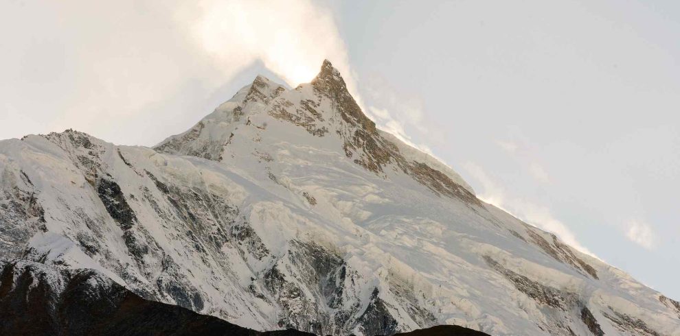
The 9 Days Manaslu Circuit Trek, also known as the Short Manaslu Circuit Trek, is designed for trekkers who want…