Villages of the Manaslu Circuit Trek: Soti Khola to Gho Village
A complete guide to every village along Nepal’s greatest restricted area trek — altitude, mountain views, culture, people, and the living traditions that make this route unlike anywhere else in the Himalayas. Contact our manaslu trek company for competitive pricing and guaranteed departures.
The Manaslu Circuit Trek is not simply a high-altitude trail to a famous pass. It is a journey through living communities that have shaped this valley for centuries. From the subtropical river villages of the lower Budhi Gandaki gorge to the wind-swept Tibetan Buddhist settlements above 3,500 metres, every village on this route has its own altitude, its own view, its own people, and its own quiet way of living that no photograph can fully capture.
At Manaslu Treks and Expedition, we have been walking these villages since the route opened to foreign trekkers in 1991. This guide is our attempt to introduce you to each settlement before you arrive, so that when you do walk through a stone gateway into a Nubri village or share butter tea with a family in Samagaun, you understand something of where you are and who you are with.
The route described here follows the classic Manaslu Circuit Trek from its starting point at Soti Khola, north along the Budhi Gandaki river valley, over Larkya La Pass at 5,160 metres, and down through the Dudh Khola valley to Gho village before reaching Dharapani. For our recommended 14-day schedule, see the 14-day Manaslu Circuit Trek itinerary.
The villages are presented in trekking order. Altitudes are approximate and vary slightly between maps and GPS devices.
Soti Khola is where the Manaslu Circuit begins in earnest. The name means “cool stream” in Nepali, a reference to a small side stream that meets the Budhi Gandaki river here. The village sits at just 730 metres in a narrow river valley flanked by dense subtropical jungle where banana trees grow alongside the trail and the air carries a thick, warm humidity that feels nothing like what lies ahead.
The community here is primarily Gurung and Magar, two hill tribes who have farmed this valley and served in the Gurkha regiments of the British and Indian armies for generations. The houses are simple stone and mud construction with small kitchen gardens growing mustard, maize, and vegetables. You will see mani walls here for the first time on the trek, low stone structures inscribed with Tibetan Buddhist prayers — an early hint of the cultural shift that deepens as you climb north.
There is no dramatic mountain view from Soti Khola itself. The valley walls rise steeply on both sides and the sky above is a narrow strip of blue above the tree canopy. The significance here is not the view but the feeling of arrival — the moment a trekker steps off the road and onto the trail that will carry them, step by step, through one of the most diverse and beautiful landscapes in Nepal.
Machha Khola means “fish river” in Nepali, and the name tells you a great deal about this community. The village sits at the confluence of a small stream and the Budhi Gandaki, and fishing has long been a part of local livelihood alongside subsistence farming of rice, millet, and vegetables on the terrace fields cut into the steep valley walls.
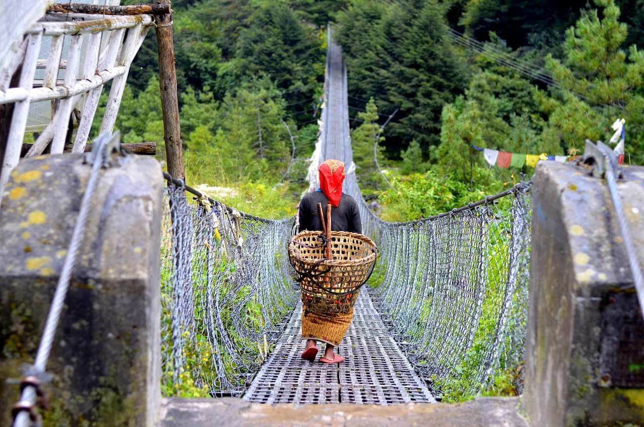
The trail to Machha Khola from Soti Khola is one of the most dramatic opening days of any Himalayan trek. It follows the east bank of the Budhi Gandaki through a narrowing gorge, crossing multiple suspension bridges and passing through sections of trail blasted from the cliff face above the river. The gorge walls rise hundreds of metres on both sides and the river below is loud and green. On a clear morning, shafts of light cut through the gorge between the ridgelines above.
Machha Khola itself is a small collection of tea houses and homes huddled close to the river. The accommodation is basic but functional. A good meal of dal bhat (rice, lentils, and vegetables), which you will eat many more times on this trek, tastes particularly satisfying after the physical demands of the gorge trail.
The people here maintain a warmth and openness to trekkers that has been built over three decades of trek tourism passing through. Children often line the trail to watch groups pass, calling out “Namaste!” with genuine enthusiasm rather than the habit it becomes closer to Kathmandu.
Tatopani means “hot water” in Nepali, and this small settlement is named for the natural geothermal springs that seep from the hillside above the river. There are two or three bathing pools fed by these springs, heated naturally to around 40 degrees Celsius. Trekkers who have been walking since early morning in Soti Khola find this an irresistible mid-trail stop.
The village itself is little more than a few stone tea houses and a handful of permanent family homes, but its position on a widening of the gorge gives it a more open feeling than Machha Khola. The views up and down the Budhi Gandaki from the tea house terraces are excellent, particularly in the late afternoon when the light turns the gorge walls a warm amber.
In October, when the autumn colour begins in the forest above, Tatopani is genuinely beautiful. The combination of the hot springs, the changing leaves, and the sound of the river below makes it one of the most pleasant rest stops on the lower section of the trek. Many trekkers stay longer than planned.
Jagat is the first official checkpoint on the Manaslu Circuit. Here, a Nepali Army or police post verifies your Manaslu Restricted Area Permit and records your entry into the protected zone. The checkpoint building is a formal stone structure set above the river, and the process of having permits checked by uniformed officers is a reminder that you are entering one of Nepal’s most strictly controlled trekking areas.
Beyond the checkpoint formalities, Jagat is a genuinely interesting village with a history that predates the trekking era by many centuries. The name refers to a traditional trading post or customs point — “jagat” comes from a Sanskrit root related to tolls and border crossings — and the village was indeed a toll point on the ancient salt trading route that connected Tibetan salt merchants with the lower valleys of Nepal. Long before trekkers arrived, yak caravans passed through Jagat carrying salt southward and grain northward.
The architecture in Jagat is more substantial than the lower villages. The main tea houses are solid stone buildings with wide overhanging roofs and carved wooden window frames. The main street, such as it is, has a few small shops selling biscuits, batteries, noodles, and trekking snacks at prices that begin their steady climb with altitude.
The Gurung families who have lived in Jagat for generations have a particularly strong military tradition. It is common to meet returned Gurkha veterans here, men who served in the British or Indian armies and returned home to run small shops or tea houses. Their English is often surprisingly good, and they are almost always willing to share stories of their service years over a glass of local rakshi (grain spirit).
Philim sits at a point where the Budhi Gandaki valley widens briefly into a bowl of cultivated land before narrowing again into the gorge above. This bowl of farmland — terraced rice paddy and millet fields cut into the hillsides on both sides of the river — gives Philim a more settled, agricultural character than the gorge villages below. In late September and early October, the rice harvest is underway and the terraces glow yellow-gold in the afternoon light.
The village has a more substantial population than its small size suggests because it serves as a market centre for the smaller hamlets in the surrounding valleys. On certain days of the week a small bazaar operates where farmers trade vegetables, grain, and basic goods. You might find a group of Gurung women in their traditional coloured skirts haggling over dried chilies or a pot of ghee with the same focused intensity you would see in any city market.
Philim is also the last point where the vegetation and climate feel recognisably lowland Nepali. Above here, the flora changes and the air takes on a cooler, more mountain quality. The rhododendron forests that will frame much of the route from here onward begin to appear on the upper slopes as you look ahead toward Deng.
Deng marks one of the most significant cultural transitions on the entire Manaslu Circuit. Below Deng, the villages are primarily Hindu Gurung and Magar communities. Above Deng, the culture shifts decisively toward Tibetan Buddhism, and the entire character of the route — its architecture, its sounds, its spiritual atmosphere — changes accordingly.
The village itself sits at a river junction where a tributary stream meets the Budhi Gandaki from the east. The surrounding forest is temperate mixed woodland — pine, fir, and the first stands of rhododendron — and the air at nearly 1,900 metres has a noticeably cooler, cleaner quality than the subtropical lower sections.
In Deng you will notice the first chortens (Buddhist stupas) and mani walls that are unmistakably Tibetan in style rather than the simpler stone mani walls of the lower valley. Coloured prayer flags strung between houses and trees signal that the Himalayan Buddhist culture of the upper Manaslu valley is reaching down to meet you here. The tea house owners in Deng are often from mixed Hindu-Buddhist backgrounds, reflecting the cultural boundary the village straddles.
Ghap is the first fully Tibetan Buddhist village on the Manaslu Circuit, and the difference from the lower valley communities is immediate and striking. The stone houses here are built in a distinctly Himalayan style with flat roofs piled with firewood for the coming winter. Prayer flags fly from every rooftop and from tall wooden poles planted in the village square. The sound of chanting drifts from the monastery in the early morning, and carved mani stones line every path through the village.
The monastery at Ghap is believed to be more than 500 years old, making it one of the oldest surviving Buddhist structures in the Budhi Gandaki valley. The main assembly hall contains ancient thangka paintings (religious scroll paintings on cloth), butter lamps that burn continuously, and carved wooden pillars painted in traditional Tibetan style. The monastery is active, meaning it is home to resident monks who perform daily prayers and rituals. Trekkers are welcome to observe, though silence and respectful behaviour are expected.
The Nubri people of Ghap are the first community on the circuit who speak Tibetan as their primary language. The Nubri language is a Tibetan dialect that has been spoken in the upper Budhi Gandaki valley for over a thousand years. Children here may have limited Nepali and little English, but the warmth of the welcome is communicated clearly regardless of language.
Life in Ghap revolves around a combination of small-scale farming (barley, buckwheat, and potato are the main crops at this altitude), animal herding (yak, dzo, and sheep), and increasingly, income from trekking tourism. The integration of tourism into the village economy has happened gradually over the past 30 years and the community has managed it without losing the substance of its culture.
Namrung is the largest village on the middle section of the Manaslu Circuit and serves as the gateway to the high-altitude Nubri valley above. At 2,660 metres the air is noticeably thinner than the river gorge below, and the surrounding landscape has fully transitioned into high Himalayan terrain. The rhododendron and pine forests above the village are dense and beautiful, and in spring they explode into red and pink bloom that covers the hillsides visible from the village square.
The village itself is built on a wide terrace above the river with houses arranged in tight clusters connected by stone pathways and stairways. The architecture is classic Nubri Tibetan style with thick stone walls, small windows with ornate carved frames, and flat roofs. Namrung has a substantial monastery, several chortens, and prayer wheels set into walls along the main paths that trekkers are encouraged to spin clockwise as they pass.
From certain points above the village, the first major Himalayan summit becomes clearly visible: Himalchuli at 7,893 metres appears to the south-southeast on clear days, its upper snowfields catching the morning light. This is a significant moment for many trekkers — the first sight of a genuine 8,000-metre class peak from the trail.
The people of Namrung maintain a lifestyle that balances traditional practices with modern connectivity. Mobile phone signals reach Namrung and solar panels power tea house lighting. But the daily rhythms remain firmly rooted in Tibetan Buddhist tradition: morning prayers at the monastery, the movement of livestock between grazing grounds, the gathering of firewood, and the communal work of maintaining the terraced fields and irrigation channels that have fed this community for generations.
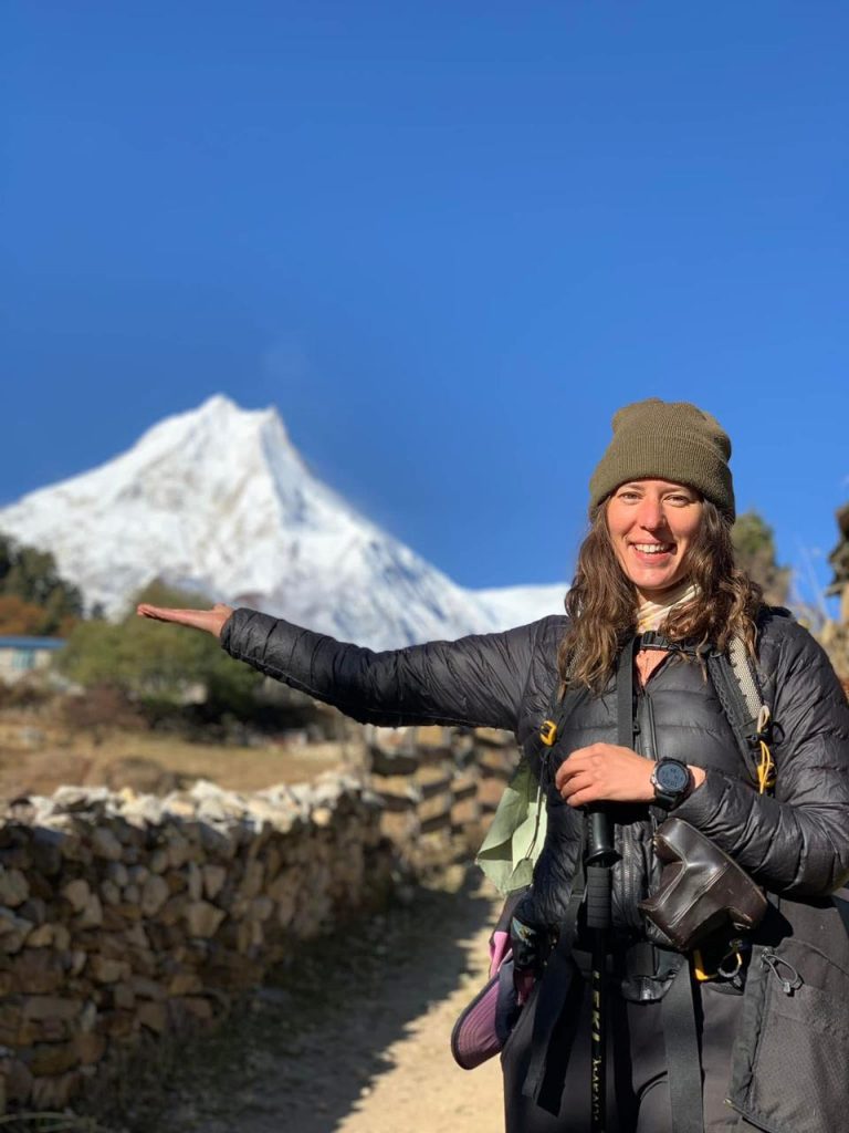
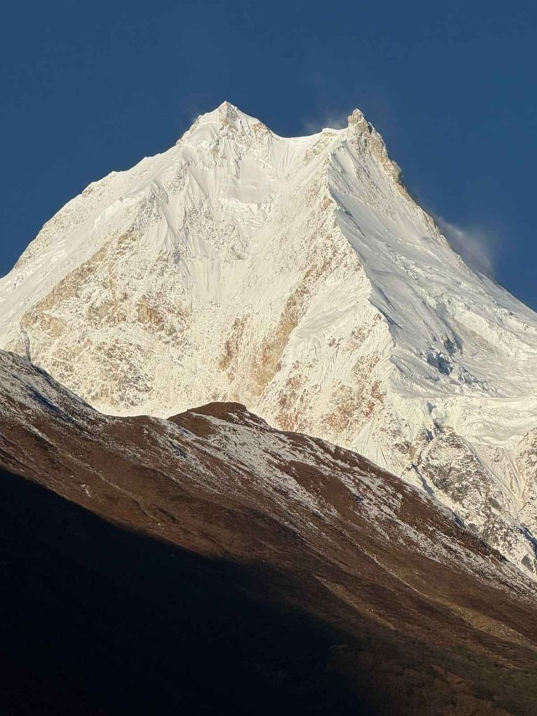
Lho is the village that stops trekkers in their tracks. Not because of its size — it is a relatively small collection of stone houses arranged on a broad terrace — but because of what is visible from that terrace on a clear morning. Manaslu’s full north face rises directly above the village to the north, its glaciated summit pyramid appearing impossibly large and close at 8,163 metres. There is no other viewpoint on the entire circuit where this mountain fills the sky so completely.
The Ribung Gompa monastery above Lho village is one of the most significant religious sites on the Manaslu Circuit. It is believed to have been founded more than 600 years ago and the current structure, while rebuilt and restored multiple times, contains some of the oldest surviving religious art in the Nubri valley. The monastery sits on a promontory above the village with unobstructed views of Manaslu, and on festival days the monks perform masked dance rituals (cham dances) in the monastery courtyard that attract people from villages across the entire upper valley.
The community of Lho practises a form of Tibetan Buddhism called Nyingma, the oldest of the four main schools of Tibetan Buddhism. The Nyingma tradition places particular emphasis on direct religious experience, meditation practice, and the recognition of sacred natural features in the landscape. For the Lho community, Manaslu itself is a sacred mountain — a deity in physical form — rather than simply a geographical feature. This relationship between mountain and community gives the village an atmosphere of quiet spiritual weight that many trekkers find profoundly affecting.
Agriculture in Lho is limited by altitude to potato, buckwheat, barley, and some root vegetables. The main animal wealth is in yak, which provide milk, butter, meat, and wool, as well as serving as pack animals for carrying trade goods between the upper and lower valley. The yak butter produced here goes into the butter tea (po cha) that is the social lubricant of every interaction in the upper Manaslu villages.
Want to Experience These Villages Yourself?
Our licensed guides have personal relationships with families in every village on this route. See our full trek package details below.
Shyala, also written as Sho on some maps, is a small village on the broad upper valley above Lho. At 3,500 metres the landscape is fully open and alpine. The tree line has been left behind and the surrounding terrain is a mix of high pasture, glacial moraine, and rocky hillside dotted with grazing yak. The views here are extraordinary: Himalchuli dominates the southern skyline, Peak 29 (Ngadi Chuli) appears to the east, and the broad white flank of Manaslu fills the northern horizon.
Shyala functions partly as a permanent village and partly as a seasonal herding settlement. The lower houses are occupied year-round, while the upper pasture shelters (kharka) are used only during the summer months when yak herders bring their animals to the high grazing grounds. The distinction between permanent house and seasonal shelter is visible in the architecture: permanent homes are solid stone construction with carved details, while the herding shelters are simple dry-stone walls with temporary roofing.
The people of Shyala are Nubri Tibetans like their neighbours in Lho and Samagaun. Life here is harder than the lower villages because the growing season is shorter and the winters are severe. The community depends heavily on yak products — butter, cheese, dried meat — to sustain them through the months when the upper valley is closed by snow.
Samagaun is the largest and most important village in the upper Manaslu valley, and it is the cultural heart of the entire Nubri region. The village sits on a wide, flat river terrace at 3,520 metres surrounded by some of the most spectacular mountain scenery in Nepal. Manaslu Base Camp is a four to five hour walk above the village. Birendra Tal, a sacred glacial lake, is just 30 minutes above the village. And from the roof of almost any tea house in Samagaun, the view of Manaslu’s south face is simply breathtaking.
The village has a genuine, lived-in quality that distinguishes it from more tourist-oriented Himalayan settlements. The central monastery, Pungyen Gompa, is an active religious institution with a community of resident monks and a large assembly hall used for regular prayers and seasonal festivals. The sound of the monastery bell marking prayer times structures the daily rhythm of village life.
Samagaun’s population is predominantly Nubri Tibetan, but the village also has a small number of families from the broader Himalayan hill communities who have settled here as the trekking economy has grown. The Nubri residents maintain their own language, their own festival calendar, and their own social structures that operate somewhat separately from Nepali national governance. Village decisions are made collectively by the community elders, and the headman (mukhiya) is a respected figure who mediates both internal disputes and the village’s relationship with outside authorities.
The trekking economy has brought visible change to Samagaun in recent decades. Tea houses range from very basic to surprisingly comfortable. Solar panels power LED lighting. A satellite phone and a basic medical post with a trained health worker serve the community’s emergency needs. A helicopter landing pad enables evacuation when necessary. Yet despite all this, Samagaun remains unmistakably a traditional Himalayan village where the monastery bell, the yak herd moving to pasture, and the prayer flag lines snapping in the afternoon wind are the defining sounds and sights of daily life.
Samdo is the highest permanently inhabited village on the Manaslu Circuit and one of the most remote communities in the entire Himalayan arc. At 3,875 metres the landscape is fully barren and wind-swept. There are no trees. The surrounding terrain is a grey-brown expanse of glacial rock and high-altitude gravel dotted with cairns and prayer flags. The peaks of the Manaslu massif and its satellite summits — Manaslu North, Larkya Peak, and the unnamed ridgelines toward Tibet — surround the village on three sides.
Samdo sits very close to the Tibetan border, and historically it was a significant trading village on the route that carried salt from Tibet southward into Nepal. Tibetan salt was essential to Nepali hill communities before Indian sea salt became widely available in the mid-20th century, and the villages of the upper Budhi Gandaki valley — Samdo, Samagaun, Namrung — were all stations on this ancient trade route. The economic relationships between Samdo families and their counterparts across the border in Tibet continued in various forms until relatively recently.
The people of Samdo are Tibetan in language and culture, closely related to the communities of the Nubri valley below them. Their lifestyle is perhaps the most traditional of any community on the Manaslu Circuit, shaped entirely by the demands of high-altitude living: short growing seasons, severe winters, dependence on yak herding, and a deep reliance on Buddhist practice as both spiritual and social framework.
The village has a small monastery and several tea houses that have developed to serve the trekking trade. The tea house food at Samdo is simple: dal bhat, noodles, tsampa (roasted barley flour), and the ever-present butter tea. At 3,875 metres cooking takes longer because water boils at a lower temperature, and trekkers who are used to rapidly cooked meals at sea level need to adjust their expectations. Patience is part of the altitude experience.
Dharamsala is not a village in the conventional sense. It is a cluster of rough stone tea houses at 4,460 metres that exist entirely to serve trekkers preparing for the crossing of Larkya La Pass. There is no permanent population here. The tea house families who operate the facilities at Dharamsala come up from the lower villages for the trekking season and return when the first heavy snows close the pass, typically in late November or December.
Yet despite its seasonal and purely functional character, Dharamsala has an atmosphere unlike any other place on the Manaslu Circuit. At 4,460 metres the air contains roughly half the oxygen of sea level. Every physical action requires conscious effort. The surrounding landscape is otherworldly: a broad glacial basin ringed by snow and ice, with the dark pyramid of Larkya Peak rising to the east and the white expanse of the Larkya Glacier stretching away to the north. At night the sky above Dharamsala — unpolluted by any artificial light for hundreds of kilometres in every direction — is one of the most spectacular starfields visible anywhere on earth.
The accommodation at Dharamsala is dormitory-only, basic in the extreme, and the most coveted beds on the entire circuit during peak October season. Arriving by 1 PM gives you the best chance of securing a space. The tea house operators provide basic meals — noodle soup, boiled potatoes, tsampa, instant noodles — and the social atmosphere in the communal dining area on the evening before the pass crossing has a distinctive quality: a mix of excitement, nervousness, and the deliberate, quiet focus of people preparing themselves mentally for something difficult and significant.
Bimthang is the first settlement trekkers reach after crossing Larkya La Pass, and the emotional significance of arriving here after the long pre-dawn crossing cannot be overstated. After hours of darkness, altitude, cold, and physical effort, descending into the broad green meadow of Bimthang with the morning sun warming the valley floor and the smell of juniper smoke from the tea house chimneys is genuinely moving. Many trekkers report Bimthang as one of the most powerful moments of the entire trip.
The physical setting of Bimthang is extraordinary. The village sits in a wide alpine bowl at 3,590 metres on the south side of the Larkya La, surrounded by the Manaslu massif on the north, the Himlung and Cheo Himal summits to the west, and the descending Dudh Khola valley opening to the south. The west face of Manaslu, rarely seen from other vantage points on the circuit, presents itself fully from the meadows above the village in a wide panorama of ice and rock that photographers spend their entire stay trying to capture.
The village itself is small — a few permanent stone houses and several tea houses that have grown up to serve the trekking trade. The local community here is connected culturally and linguistically to the Nubri people of the upper Budhi Gandaki valley, though they have a slightly distinct local identity. The pastoral life of Bimthang revolves around the summer grazing of yak and cattle in the high meadows visible above the village.
After the austerity of Dharamsala, the tea house food at Bimthang feels almost extravagant. A bowl of hot noodle soup or a plate of fried rice in the morning sun at Bimthang, after the pass crossing, is one of the simple pleasures that trekkers consistently describe as a highlight of the entire Manaslu experience.
Tilje sits in the warm, broad Dudh Khola valley at 2,300 metres on the descent from Bimthang toward Dharapani. After the barren high-altitude terrain of the pass and Bimthang, arriving in Tilje feels like re-entering the living world. The valley here is lush and cultivated. Apple and walnut orchards line the trail, their branches heavy with fruit in October. The air smells of wood smoke, ripe apples, and moist earth. The sensation of descending temperature and increasing oxygen with every step downward is deeply satisfying to a body that has spent days above 4,000 metres.
The village of Tilje is a traditional Gurung settlement with stone and timber houses set among the orchard terraces. The community here is more prosperous than the very high-altitude villages because the climate supports diverse agriculture: apples, walnuts, maize, and vegetables all grow well at this elevation. Some families have developed small apple enterprises selling fresh fruit and apple juice to trekkers — a welcome change from the limited food options of the high sections.
Tilje marks the entry into the Annapurna Conservation Area, which means your ACAP permit (Annapurna Conservation Area Permit) comes into use here if you are continuing to Dharapani and the Annapurna circuit road. The landscape is now recognisably different from the Manaslu side: broader, greener, and more densely settled with farming villages visible across the valley.
Gho is a small but significant village that many trekkers pass through quickly without fully appreciating. Sitting at 2,515 metres on a ridge spur above the Dudh Khola valley, it commands broad views both back toward the Manaslu massif to the north and forward toward the Annapurna range to the west. On a clear morning from the village terrace, the combined panorama of Manaslu, Himalchuli, Ngadi Chuli, and the Annapurna peaks makes Gho one of the finest viewpoints on the entire descent section of the circuit.
The community of Gho is predominantly Gurung, the same ethnic group found in the lower Budhi Gandaki valley at the trek’s starting point, creating a cultural symmetry that bookends the circuit’s diversity. After days of immersion in Tibetan Buddhist culture in the upper Nubri valley, the Gurung character of Gho — the Hindu shrines, the different architectural style, the different clothing and language of the villagers — marks a clear return to the lower Himalayan cultural zone.
The Gurung people have a rich oral tradition, a warrior history connected to the Gurkha regiments, and a distinctive relationship with the forests and wildlife of the middle hills. Gho sits surrounded by temperate forest, and the community maintains traditional knowledge of forest resources — medicinal plants, wild mushrooms, seasonal fruits — that supplements their agricultural income. In October the forests around Gho display some of the finest autumn colour on the entire Manaslu Circuit, with the oak and maple trees turning gold and amber above the village.
Gho represents the end of the Manaslu Circuit’s high-altitude, remote section and the beginning of the return to mainstream Nepal. From Gho the trail descends to Dharapani on the Annapurna Circuit route, where the road connection to Besisahar and Kathmandu begins. Many trekkers feel a particular bittersweetness at Gho, knowing that the next day will bring them back to connectivity, road transport, and the ordinary world. The Manaslu Circuit has a way of reordering priorities and deepening perspective that lingers long after the muscles have stopped aching.
The Broad Cultural Story: Two Worlds in One Valley
One of the most remarkable things about the Manaslu Circuit is how completely the cultural landscape changes between the starting point at Soti Khola and the high-altitude villages around Samagaun and Samdo. In the space of roughly 100 kilometres of trail, you pass through two distinct civilisational worlds: the Hindu hill culture of mid-Nepal’s Gurung and Magar communities, and the Tibetan Buddhist culture of the Nubri people who have lived in the upper Budhi Gandaki valley since before recorded history.
This cultural duality is not incidental to the Manaslu Circuit experience. It is central to it. The shift that begins at Deng and becomes fully apparent at Ghap and Namrung — the chortens replacing Hindu shrines, the Buddhist prayer flags replacing the red tika smear on stone doorways, the sound of the monastery drum replacing the temple bell — is one of the most immersive cross-cultural experiences available to any trekker in the world without crossing an international border.
The Nubri people in particular represent something increasingly rare in the modern world: a community living largely according to traditions that have been unbroken for a thousand years, in an environment so physically demanding that those traditions are not historical curiosity but daily survival strategy. Understanding something of their culture before you walk through their villages makes the experience dramatically richer and more respectful.
Practical Notes for Interacting with Village Communities
The village communities of the Manaslu Circuit welcome trekkers, but they deserve the same respect and consideration you would extend to hosts anywhere. A few practical principles help maintain the relationship between trekkers and local communities that has made this route one of the most positively regarded in Nepal.
Always ask before photographing individuals or family groups, particularly in the high Tibetan villages where older residents may have specific feelings about being photographed. A smile and a gesture toward your camera, followed by a responsive smile or nod from the person you want to photograph, establishes consent more effectively than any language barrier can obstruct.
When you enter monastery buildings, remove your shoes, keep your voice low, walk clockwise around chortens and prayer wheels, and do not touch religious objects. These are not rules invented for trekkers — they are the ordinary behaviour of the Buddhist communities themselves, and following them marks you as a thoughtful guest rather than an extractive tourist.
Buying local products — fresh vegetables in Philim, apples in Tilje, butter tea from a village elder in Samagaun, locally made handicrafts in Namrung — puts money directly into village economies rather than concentrating it in Kathmandu-based operators. It also creates the kind of brief, genuine human exchange that people consistently report as the most memorable part of their Manaslu Circuit experience.
For the complete trek package that takes you through all these villages with experienced local guides who speak the languages and know the people, visit our Manaslu Circuit Trek main. Our 14-day itinerary builds enough time into the schedule at key villages to allow genuine cultural engagement rather than a rushed transit through communities that deserve more than a passing glance.
Village Summary: Altitude, Culture, and Key Features
| Village | Altitude | Culture | Key Feature |
|---|---|---|---|
| Soti Khola | 730m | Gurung / Magar | Trek start, subtropical jungle, river valley |
| Machha Khola | 930m | Gurung / Magar | Gorge scenery, fishing community, suspension bridges |
| Tatopani | 1,190m | Mixed | Natural hot springs, gorge widening |
| Jagat | 1,410m | Gurung (Gurkha tradition) | Restricted area checkpoint, ancient trading post |
| Philim | 1,590m | Gurung | Terraced rice fields, weekly market |
| Deng | 1,860m | Hindu / Buddhist transition | Cultural shift point, temperate forest |
| Ghap | 2,160m | Nubri Tibetan Buddhist | 500-year-old monastery, first fully Tibetan village |
| Namrung | 2,660m | Nubri Tibetan Buddhist | Largest mid-circuit village, first Himalayan peak views |
| Lho | 3,180m | Nubri Tibetan Buddhist (Nyingma) | Best Manaslu view on circuit, Ribung Gompa monastery |
| Shyala | 3,500m | Nubri Tibetan Buddhist | High pasture, yak grazing, open alpine terrain |
| Samagaun | 3,520m | Nubri Tibetan Buddhist | Largest upper village, Pungyen Gompa, Base Camp access |
| Samdo | 3,875m | Nubri Tibetan Buddhist | Highest permanent village, Tibet border, ancient trade route |
| Dharamsala | 4,460m | Seasonal tea house | Larkya La base camp, extraordinary night sky |
| Bimthang | 3,590m | Nubri / mixed | First village after pass, alpine meadow, Manaslu west face |
| Tilje | 2,300m | Gurung | Apple orchards, walnut trees, warm valley |
| Gho | 2,515m | Gurung | Panoramic views of Manaslu and Annapurna, autumn forest |
Frequently Asked Questions
Ready to Walk Through These Villages?
Our guides know these communities personally. Book with us and experience the Manaslu Circuit the right way.