Larke Pass on the Manaslu Circuit Trek: A Complete Trekker’s Guide for 2026
You have been walking for nine days. Your legs are stronger than when you started, your lungs have adjusted to thinner air, and you have crossed more suspension bridges than you can count. You have watched Manaslu’s white face grow larger every morning since Namrung. Now you are sitting in a basic teahouse at Dharamsala (also called Larkya La Phedi), 4,460 meters above sea level, and tomorrow you cross Larkya La Pass. That is 5,106 meters. The highest point of the entire Manaslu Circuit Trek.
The pass is the reason many trekkers choose this route in the first place. It is also the part that causes the most nerves. People lie awake at Dharamsala thinking about the altitude, the weather, and whether their legs will hold up for a long day that starts well before sunrise.
This guide covers what you need to know about crossing Larkya La: the elevation, the difficulty, the views, the preparation, the risks, and what the day actually feels like from the 3 a.m. wake-up call to the moment you collapse into a chair at Bimthang. We keep it practical so you arrive in Dharamsala knowing what to expect, not guessing.
Manaslu Circuit Trek Package
15% Off
$1,350
$1,590
Country: Nepal Duration: 13 Days Difficulty: Challenging Activity: Trekking Max. Altitude: 5,106 m / 16,752 ft Best Season: Mar–May, Sep–Nov…
Where Is Larkya La and Why Does It Matter?
Larkya La, also written Larke Pass or Larkya La Pass, sits at 5,106 meters (16,752 feet) in the Manaslu region of Nepal. It forms the high point of the Manaslu Circuit Trek, a route that circles Manaslu, the world’s eighth-highest mountain at 8,163 metres.
The pass marks the boundary between the Manaslu Conservation Area and the Annapurna Conservation Area. On a standard clockwise itinerary, it sits roughly two-thirds of the way through the trek. You approach from the east, climbing from Samdo through Dharamsala, then descend westward toward Bimthang on a long, knee-testing descent that drops close to 1,400 meters in a single day.
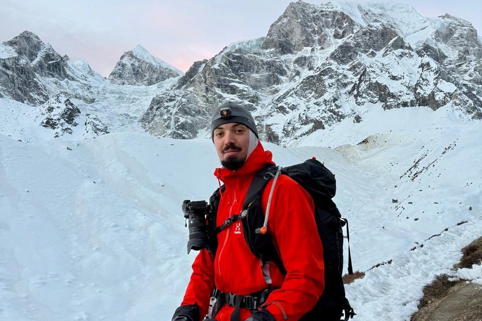
Geographically, the pass sits on a ridge between Larke Peak and Cho Danda. It is not a narrow notch or a sharp col. It is a broad, open saddle exposed to wind from every direction, and that exposure is a large part of what makes the crossing hard. There is no shelter at the top. No teahouse, no wall to duck behind, nowhere to sit out of the wind.
For most trekkers on the 13-day Manaslu Circuit itinerary, crossing Larkya La is the single most demanding day of the trip. It is also the day that produces the best photographs, the strongest sense of achievement, and the stories people tell for years afterward.
The Elevation: What 5,106 Metres Actually Feels Like
Some context helps here. Everest Base Camp sits at 5,364 meters. Thorong La on the Annapurna Circuit reaches 5,416 metres. Kala Patthar, the famous Everest viewpoint, reaches 5,545 meters. Larkya La is high, seriously high, but it sits a little lower than Nepal’s most famous viewpoints and passes.
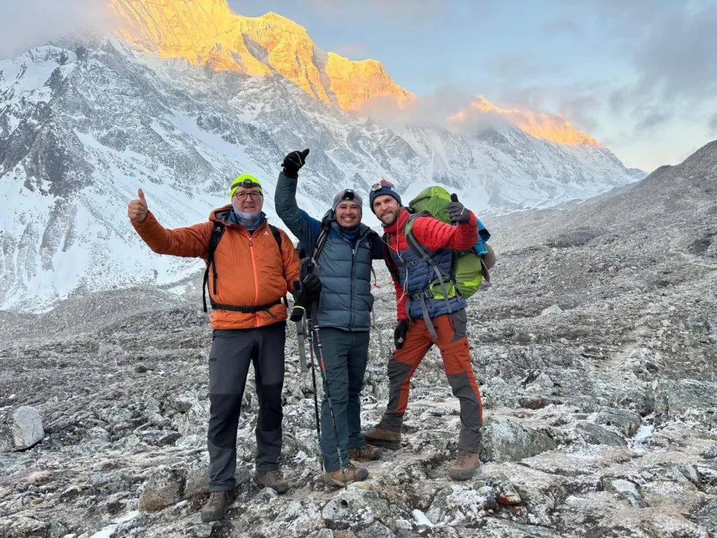
Numbers on a page do not tell you what the altitude actually feels like, though. At 5,106 meters, the air holds roughly half the oxygen you would find at sea level. Your body has been adjusting since you passed 3,000 metres days earlier. By the time you sleep at Dharamsala (4,460 meters), you are already living in conditions most people never experience. The push from Dharamsala to the pass adds another 650 metres, and that final climb happens in the dark, in cold air, on legs that already have nine days of walking behind them.
Trekkers commonly report some combination of the following at this altitude:
- A headache that ranges from mild to pounding
- Shortness of breath that makes normal conversation difficult
- A heart rate that spikes with minimal effort
- Nausea or a flat appetite that comes and goes
- Disrupted sleep, with frequent waking or vivid dreams
- Mental fog that makes simple decisions feel harder than they should
Not everyone gets all of these. Some trekkers feel surprisingly good at 5,106 metres. Others feel rough. There is no reliable way to predict how your own body will react. Fitness helps, but altitude sickness can affect a marathon runner just as easily as a casual hiker. Acclimatization schedule, hydration, pace, and a fair amount of luck matter more than raw fitness.
Building Up to the Pass: The Days Before
Nobody arrives at Larkya La without earning it first. Understanding the build-up explains why the pass day feels the way it does.
The standard Manaslu Circuit route starts with a long jeep drive from Kathmandu to Machha Khola at 930 meters, lower than Kathmandu itself. For the first stretch of walking, the trail follows the Budhi Gandaki river upstream through a steep-sided gorge that repeatedly climbs high above the water, drops to cross a bridge, then climbs again. Some early days involve well over 1,000 meters of cumulative ascent, even when the net elevation gain looks modest on paper.
By the time you reach Namrung at 2,900 meters, the forest has thinned, and the terrain has turned properly alpine. This is usually where Manaslu itself comes into full view for the first time, not just glimpses through the trees but the whole pyramid of the mountain rising above the valley.
Sama Gaon, at 3,530 metres, is the first scheduled acclimatization stop. Most itineraries, including our own, build in a rest day here, and it is worth taking seriously. The usual approach is climb high, sleep low: hike up toward Manaslu Base Camp or Birendra Lake during the day, then sleep back down in the village. That extra altitude exposure trains your body without the risk of sleeping higher than you should.
From there, the trail continues to Samdo at 3,785 metres, a windswept settlement close to the Tibetan border. The air is noticeably thinner here. Nights are cold, teahouses are basic, and the sense of remoteness is real. You are days from a road in any direction.
Then comes Dharamsala at 4,460 metres, the highest sleeping point of the whole trek. Many trekkers feel the altitude most acutely here. The toilet is outside. The dining room stays warm thanks to a stove, but your bedroom will likely drop close to freezing overnight. You need to go to bed early because your guide will wake you around 3 a.m.
That climb from 930 metres to 4,460 metres over the better part of a week is what makes crossing the pass possible at all. Skip the acclimatization and the crossing becomes genuinely dangerous. Follow it properly, and most trekkers manage the day safely, even if it is long and hard.
Dharamsala: Your Last Night Before the Crossing
Dharamsala, sometimes called Larkya La Phedi, is not really a village. It is a single teahouse complex at 4,460 metres, built specifically to house trekkers the night before they cross the pass. There are no permanent residents beyond the people running the lodge. No shops, no reliable Wi-Fi, and mobile signal you should not count on.
Accommodation here is about as basic as it gets on the Manaslu Circuit. Expect a small twin room with two single beds, thin mattresses, and blankets that may or may not be freshly washed. The walls are wooden and offer little insulation against the cold. Leave a water bottle on the floor overnight and there is a good chance it freezes.
The toilet is shared and usually located outside the main building. At 4,460 metres, a night trip to the toilet is an experience of its own. Bring a headlamp, and wear your down jacket even for the short walk.
The dining room is the only genuinely warm space, heated by a central stove that usually burns wood or dried yak dung. This is where everyone gathers for dinner and breakfast, and the atmosphere is distinctive. Every person in that room is thinking about the same thing: tomorrow’s crossing. Conversation tends to circle around weather forecasts, gear checks, and stories from previous treks.
Dinner is early, usually around 6 p.m., because everyone needs to be asleep by 7:30 or 8 p.m. Your guide will typically recommend a carbohydrate-heavy meal such as dal bhat or noodle soup. Skip alcohol entirely at this altitude. Drink as much water as you comfortably can, even if that means more cold trips to the toilet.
Most people sleep poorly at Dharamsala. Altitude disrupts sleep patterns on its own, the cold makes it hard to get comfortable, and the early wake-up creates its own low hum of anxiety. If you manage four decent hours, consider that a good outcome.
Your guide will usually brief the group after dinner, confirming the wake-up time (typically 3 a.m.), walking through the route, and discussing current weather conditions. Listen closely. A guide who has crossed this pass dozens of times is giving you advice based on experience, not theory.
Manaslu Circuit Trek Package
15% Off
$1,350
$1,590
Country: Nepal Duration: 13 Days Difficulty: Challenging Activity: Trekking Max. Altitude: 5,106 m / 16,752 ft Best Season: Mar–May, Sep–Nov…
The Crossing Day: What to Actually Expect
This is the day everything before it has been building toward. Here is roughly how it unfolds.
3 a.m., wake-up. Your guide knocks or calls your name. It is pitch black outside and well below freezing. You dress in layers: thermal base layer, fleece mid-layer, down jacket on top, warm hat, gloves, a buff over your neck and face, headlamp on. Your daypack gets water, snacks, sunscreen, sunglasses, and a spare warm layer.
Breakfast is quick: tea, porridge, maybe an egg if the kitchen can manage it. Plenty of trekkers cannot eat much at this altitude, and that is normal. Force down what you can, because you will need the energy later.
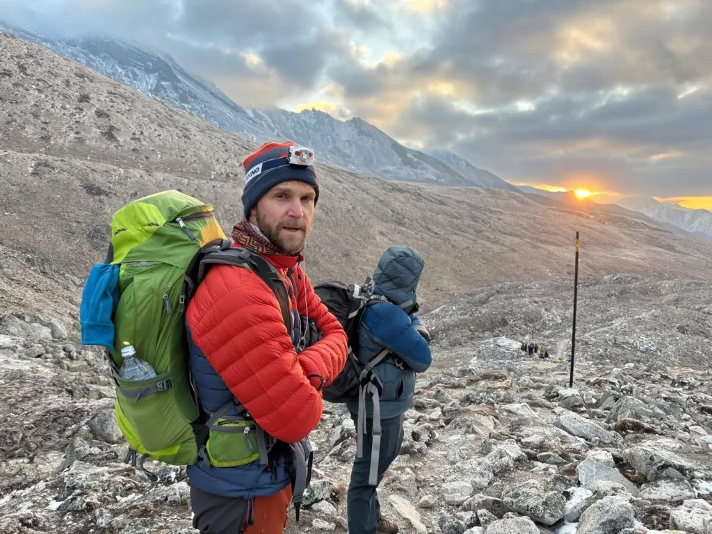
3:30 to 4 a.m., departure. You set off in the dark. A line of headlamps moves slowly up the mountain ahead of and behind you, everyone breathing hard in thin air. The first stretch is a gradual, rocky ascent, not technically difficult, but the altitude makes every step feel harder than the gradient suggests. Expect to stop often, not because the trail demands it but because your lungs do.
5 to 6 a.m., dawn. The sky lightens behind you. On a clear morning, the first sunlight catches the peaks to the east while you are still climbing in shadow. It is one of the more striking moments of the whole trek. The trail steepens here, switching back across loose moraine, and trekking poles earn their keep on this uneven ground.
7 to 8 a.m., approaching the top. The wind picks up as you gain height. Strings of prayer flags come into view, hundreds of them snapping across the pass, and seeing them gives most people a real psychological lift. The final stretch of ascent tends to feel like the longest part of the day: lungs working hard, legs heavy, cold wind finding any gap in your clothing. You keep moving anyway, because stopping in that wind is not really an option.
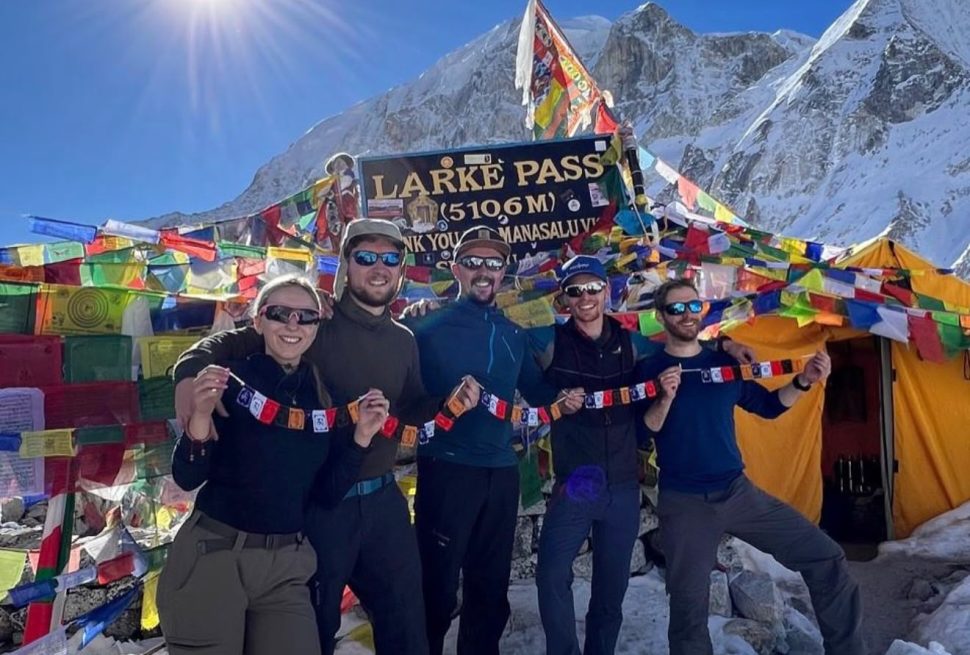
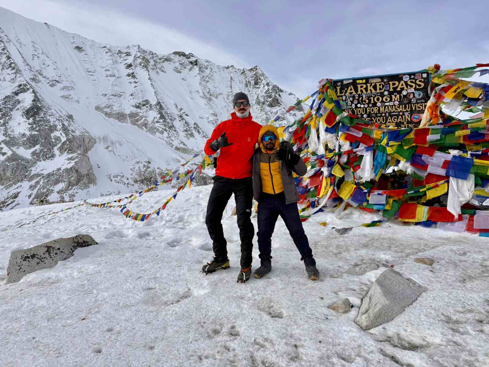
8 to 9 a.m., the pass itself. You reach the top. Prayer flags everywhere, wind strong enough at times to push you off balance, and a view that stops most people mid-sentence. To the north and west, a run of Himalayan peaks spreads out: Himlung Himal, Cheo Himal, and Kang Guru among them, with glaciers spilling down their flanks like frozen rivers. Ten to fifteen minutes at the top is typical, just enough for photos, a snack, and a moment to take it in, before the cold pushes you back downhill.
9 a.m. to early afternoon, the descent to Bimthang. The drop from the pass to Bimthang covers close to 1,400 metres and takes roughly four hours. The trail starts on snow or loose scree depending on the season, shifts to rocky ground, and finally opens onto grassy slopes as you lose altitude. Bimthang appears suddenly, a wide valley ringed by mountains with a small cluster of teahouses that feel close to luxurious after the morning you have just had.
Total crossing day: roughly 18 to 24 kilometres, 8 to 9 hours of walking, about 650 metres of ascent followed by close to 1,400 metres of descent.
How Difficult Is Larkya La Really?
Worth being honest here. Larkya La is demanding, but it is not extreme by Himalayan standards.
Technically, the difficulty is low. You do not need ropes, crampons, or climbing skills under normal conditions. It is a walking route, not a climbing one. In winter or early spring, microspikes may help on icy upper sections, but that is the exception rather than the rule.
Physically, the difficulty runs moderate to high. The day is long, close to nine hours of walking at altitude. The climb from Dharamsala to the pass is steady rather than steep, but thin air makes it feel harder than the gradient implies. The descent to Bimthang is relentless on the knees.
The main factors that make the day hard:
- Altitude. At 5,106 metres, acute mountain sickness is a real risk, and proper acclimatization beforehand is not optional.
- Weather. Wind, cold, and sudden snow can turn a manageable day into a genuinely serious one.
- Length. Close to nine hours of walking at altitude is draining even for fit trekkers.
- The early start. A 3 a.m. wake-up means the day begins sleep-deprived and cold before you have taken a single step.
If you have already done Everest Base Camp or the Annapurna Circuit, Larkya La will feel comparable in altitude but more demanding in terms of the day’s length and how remote the location is. There is no easy exit near the pass, and no quick helicopter landing spot close by. Once you leave Dharamsala, you are committed.
That said, plenty of trekkers cross Larkya La safely each season. With proper preparation, an experienced guide, and reasonable weather, it sits well within reach of anyone who has prepared for it.
The View from the larke-la pass Top
The view from Larkya La is the payoff for everything that came before it, and on a clear day it ranks among the better panoramas in Nepal.
Himlung Himal (7,126 metres) dominates the view to the north, a sharp, pyramid-shaped peak sitting close to the Tibetan border. It is one of the more frequently climbed 7,000-metre peaks in Nepal, and from the pass it looks close enough to touch.
Cheo Himal sits to the northwest, a broad wall of snow and ice that fills much of the horizon. It gets far less attention than its neighbours but holds its own visually.
Kang Guru rises to the west, its face catching the early light. This peak was the site of a serious avalanche in 2005 that killed a number of climbers and support staff. Guides sometimes mention this history, which adds a quieter note to an otherwise celebratory morning.
Below the pass on the descent side, a glacial lake and the surrounding glaciers come into view, their surfaces cracked with crevasses and streaked with rock debris carried down from the peaks above.
Prayer flags cover the pass itself, thousands of them strung between rocks and poles, snapping constantly in the wind. They are not decoration in the ordinary sense. Each flag carries printed prayers that Tibetan Buddhist tradition holds are carried into the wind with every flap. Walking through them at 5,106 metres tends to land as a genuinely moving moment, even for trekkers with no particular religious background.
The best light usually falls between about 7:30 and 9 a.m. Earlier than that, it is too dark to see much. Later, the sun climbs high and the contrast flattens the landscape. On a clear morning, the early light on the eastern peaks is the kind of thing that stays with you.
Best Time to Cross Larkya La
Timing matters more than most first-time trekkers expect. The wrong season can turn a manageable crossing into something genuinely risky.
Autumn (September to November). The most popular window, and for good reason. The monsoon has cleared the air, leaving sharp visibility and deep blue skies. Temperatures at the pass are cold but not extreme, the trail is dry and stable, and every teahouse along the route is open. The trade-off is popularity: October in particular gets busy, and Dharamsala can fill up. If you are planning an autumn departure, book the trek well ahead. For a season-by-season breakdown, our guide to trekking Manaslu in October covers what to expect month by month.
Spring (March to May). A close second. Rhododendrons bloom at lower elevations, days are longer, and temperatures run milder than autumn, especially down in the valley. The trade-off is haze: pre-monsoon weather can bring cloud that softens distant views, and snow on the upper sections is more likely early in the season. By late May, afternoon thunderstorms become a genuine risk.
Winter (December to February). Possible, but not recommended for most trekkers. The pass is often buried in deep snow, temperatures at the top can fall well below -20°C with wind chill, and some teahouses (occasionally including Dharamsala) close for the season. Only experienced winter trekkers with the right gear and a flexible schedule should consider it, and even then, your guide may call off the crossing if conditions look unsafe.
Monsoon (June to August). Not a viable season for this crossing. Heavy rain at lower elevations turns to snow higher up, landslides are common on the approach trails, and visibility drops. Most teahouses in the region close during these months.
Permits You Need for the Manaslu Circuit
The Manaslu Circuit requires three separate permits, since the restricted-area rules here are stricter than almost anywhere else in Nepal open to foreign trekkers. We handle all of this for our clients, but it helps to know what you are paying for.
Manaslu Restricted Area Permit (RAP). The most expensive and most important permit. The Nepal government classifies the Manaslu region as restricted, which means you cannot enter without a licensed guide and this specific permit. From September to November, it costs USD 100 for the first seven days, plus USD 15 per additional day. From December to August, it costs USD 75 for the first seven days, plus USD 10 per additional day. This permit is why independent trekking is not permitted on the Manaslu Circuit.
Manaslu Conservation Area Permit (MCAP). The standard conservation entry fee, currently NPR 3,000 per foreign trekker (SAARC nationals pay less, and children under 10 trek free). It covers the eastern portion of the trek, from around Jagat through Samdo.
Annapurna Conservation Area Permit (ACAP). Also NPR 3,000 for foreign nationals. This covers the western exit route, from Larkya La through Bimthang and Tilije to Dharapani, where the Manaslu Circuit joins the Annapurna trail network. It is checked at Dharapani, so it is worth having sorted before you get there.
On top of these, the local Chum Nubri Rural Municipality collects a one-time fee of NPR 1,000 per foreign trekker, usually paid on the trail around Jagat or Philim. A TIMS card is not required for the Manaslu region.
For a full breakdown, including seasonal totals and how the paperwork actually gets processed, see our Manaslu trekking permit guide. You will carry all of these permits through several checkpoints, including Jagat, Philim, Namrung, Sama Gaon, and Dharapani, so keep them together with your passport copies.
Accommodation Before and After the Pass
Knowing what to expect at the two teahouses that bookend the crossing helps set realistic expectations.
Dharamsala (4,460 metres), the night before. Basic, as already covered. Room numbers are limited, and during busy weeks in October, some trekkers end up in the dining hall or in overflow tents. You do not get to choose your room here. You take what is available. Rooms are twin-share, and solo trekkers are usually paired with another trekker of the same sex. Private rooms are not available at this particular stop. The toilet is shared and outside, hot showers are not really on offer, and the food menu narrows down to hot, calorie-dense basics: dal bhat, noodle soup, fried rice, boiled eggs, tea.
Bimthang (3,720 metres), the night after. Bimthang feels close to luxurious after Dharamsala. It is a wide valley with several teahouses offering noticeably better facilities. You still get twin rooms with shared bathrooms, but the rooms are warmer, the toilets are closer, and the food menu is broader. The mood here is celebratory. Everyone who arrives has just crossed the pass, and there is a genuine sense of shared achievement over dinner as people swap photos and stories. The sunset view from Bimthang, with the peaks you just crossed glowing in evening light, is one of the better ones on the whole circuit. Hot showers are sometimes available for a small fee, and Wi-Fi occasionally works, though neither should be counted on.
Gear You Will Want for the Crossing
The right gear makes the day safer and considerably more comfortable. A full packing rundown for the whole trek is in our Manaslu packing list guide, but here is what matters most specifically for crossing day.
Footwear. Waterproof trekking boots with good ankle support are essential, since the trail is rocky, uneven, and sometimes snowy. Make sure they are well broken in before the trek. New boots on crossing day is a reliable way to end up with blisters. Gaiters help keep snow and debris out, and microspikes are worth packing if you are trekking in spring or late autumn when ice is more likely on the upper section.
Clothing layers. The temperature swing on crossing day is significant, from well below freezing at 3 a.m. to potentially warm and sunny by the time you reach Bimthang. Layering is the only sensible way to manage that range: a thermal base layer, a fleece mid-layer, a waterproof and windproof outer shell, a heavy down jacket for the coldest stretches, warm gloves (ideally a liner pair plus an outer pair), a warm hat, sunglasses with proper UV protection, and a neck gaiter or buff.
Daypack contents. Plan for 2 to 3 litres of water (keep any hydration bladder tube inside your jacket, since it can freeze), high-energy snacks, sunscreen and lip balm with SPF, basic first aid items including blister plasters and any personal medication, a spare warm layer, a headlamp with fresh batteries, and a bit of cash in small Nepali rupee notes for tea or snacks once you reach Bimthang.
Trekking poles. Genuinely useful rather than optional. They add stability on loose rock, take pressure off your knees on the long descent, and give you something to lean on when you are out of breath. If you do not own a pair, we can arrange rentals in Kathmandu.
Manaslu Circuit Trek Package
15% Off
$1,350
$1,590
Country: Nepal Duration: 13 Days Difficulty: Challenging Activity: Trekking Max. Altitude: 5,106 m / 16,752 ft Best Season: Mar–May, Sep–Nov…
Altitude and Safety: The Real Risks
Crossing a pass above 5,000 metres carries genuine risk, and it is worth understanding what that risk actually looks like.
Acute Mountain Sickness (AMS). The most common altitude problem, with symptoms including headache, nausea, dizziness, low appetite, and fatigue. Mild cases usually respond to rest, hydration, and a slower pace. Moderate to severe cases require immediate descent. Risk is highest at Dharamsala, since that is where you sleep at the highest point of the trek. Honest communication with your guide matters here. Do not hide symptoms because you want to attempt the pass regardless; a good guide will assess your condition and make the right call, which sometimes means turning back.
High Altitude Pulmonary Edema (HAPE) and High Altitude Cerebral Edema (HACE). The serious, life-threatening forms of altitude illness. HAPE involves fluid building up in the lungs, with symptoms including a persistent cough, breathlessness at rest, and blue-tinged lips or fingernails. HACE involves swelling in the brain, with symptoms including a severe headache, confusion, poor coordination, and altered consciousness. Both are medical emergencies requiring immediate descent and, where available, supplemental oxygen. This is why travel insurance covering high-altitude trekking and helicopter evacuation is mandatory for this route, not a nice-to-have.
Weather risk. Conditions at Larkya La can change within minutes. Clear skies can turn to whiteout with little warning. Wind is the biggest factor, with gusts over 60 kilometres per hour common, and wind chill can make the air feel 10 to 15 degrees colder than the thermometer suggests. Your guide will assess conditions before leaving Dharamsala and may postpone the crossing or turn back if the forecast looks bad. Trust that call.
Trail hazards. The trail is not technically dangerous, but it is not risk-free either. Loose rock and scree on the upper section can cause falls, snow and ice make foot placement important, and some sections of the descent to Bimthang are steep enough that a slip could turn into a serious tumble. Good boots, trekking poles, and staying focused matter more than they might seem to at the time.
Emergency evacuation. There is no helicopter landing site directly at Larkya La. The nearest realistic evacuation points are Samagaon to the east and Bimthang to the west, both roughly a full day’s walk from the pass in either direction. In a genuine emergency, a helicopter might land on the pass itself if weather allows, but that is never guaranteed. This remoteness is part of what makes the Manaslu region special, but it also means being properly prepared matters more here than on more heavily trafficked routes.
Weather Conditions at Larkya La
Weather is the single biggest variable on crossing day. Here is roughly what to expect by time of day and season.
Early morning (3 to 7 a.m.). The coldest window, with temperatures at the pass ranging from around -5°C to -15°C depending on the season, and wind chill making it feel colder still. Clear skies actually mean colder air, since cloud cover traps some heat. Expect to be cold for the first two hours regardless of what you are wearing. Staying in motion is the best defence.
Mid-morning (7 to 10 a.m.). The sun hits the pass and temperatures climb quickly. Most trekkers start shedding layers, first the down jacket, then the fleece. Wind often drops around sunrise, making this the most pleasant window to be at the top, which is exactly why guides push for an early start.
Late morning onward. Cloud tends to build through the afternoon, visibility drops, and wind frequently picks back up. This is why the plan is always to be descending well before midday.
Seasonally: October is generally the most reliable month, with stable high pressure and strong visibility. September carries some lingering post-monsoon cloud. November turns colder, especially in the second half, with snow becoming more likely. March and April are variable, sometimes clear, sometimes hazy with afternoon cloud, and snow is possible on the pass. May brings a real risk of afternoon thunderstorms, which is another reason for an early departure from Dharamsala.
How Larkya La Compares to Other High Passes
If you have crossed other high passes in Nepal, comparisons come naturally. Here is how Larkya La stacks up.
Versus Thorong La (Annapurna Circuit). Thorong La is higher, at 5,416 metres, and the approach from Thorong Phedi is steeper and more direct. It feels more alpine underfoot, with a narrower trail and heavier trekker traffic. Larkya La is lower, broader, and quieter, with a more gradual approach. Trekkers who have done both often find Thorong La slightly harder because of the elevation, while Larkya La feels wilder and more remote.
Versus Cho La (Everest region). Cho La, at 5,420 metres, involves a rocky and sometimes icy section near the top that calls for more scrambling than Larkya La, along with glacial sections where microspikes are often needed. Larkya La stays a walking route throughout under normal conditions. Cho La feels more technical, Larkya La feels more purely physical.
Versus Kongma La (Everest region). Kongma La, at 5,535 metres, is higher than all three and crossed far less often. The trail is rougher, the descent steeper, and the route less obvious underfoot. Larkya La is easier in most respects, though Kongma La has the advantage of sitting closer to Namche Bazaar if evacuation is ever needed.
Versus Renjo La (Everest region). Renjo La, at 5,360 metres, is roughly comparable in elevation. The approach from Gokyo is gradual and scenic, and many trekkers rate it the easiest of Everest’s three passes. Larkya La sits in similar territory difficulty-wise, perhaps a touch harder given the longer day and more remote setting.
The honest read: Larkya La is a serious high pass that deserves respect and real preparation, but it is not the hardest crossing in Nepal. With proper acclimatization, reasonable weather, and an experienced guide, it is achievable for any reasonably fit trekker with some previous high-altitude experience.
Physical and Mental Preparation
Preparation pays off on this route more than on most.
Cardiovascular fitness. You need a solid aerobic base for close to nine hours of walking at altitude. Fitter trekkers recover faster between efforts, breathe easier, and generally get more out of the experience. In the months before the trek, hike regularly, ideally on hills or stairs, and carry a weighted pack that roughly matches what you will carry on the trail. Long walks of four to six hours build the endurance you will need. If you live at sea level, understand that fitness alone will not fully prepare your body for 5,106 metres; acclimatization matters more than raw fitness once you are up there.
Leg strength. The descent to Bimthang is hard on the knees. Squats, lunges, and step-ups in the months beforehand help. Trekking poles take some of the load off during the descent, but strong legs matter more.
Mental preparation. The crossing tests your head as much as your legs. Expect discomfort, and accept it in advance rather than being caught off guard by it. Break the day into smaller sections rather than thinking about nine hours at once: the next ridge, the next string of prayer flags, then the pass itself. Trust your guide’s pace and advice rather than trying to be a hero. And be genuinely willing to turn back if your guide says conditions are unsafe or if you are showing signs of serious altitude sickness. The pass will still be there next season. That decision is the hardest one to make in the moment, and also the most important.
Practical Tips for the Crossing Day
A handful of small details that make a real difference.
Before leaving Dharamsala: fill your water bottles the night before and keep them inside your sleeping bag, since water freezes fast at this altitude. Put fresh batteries in your headlamp, since cold drains them quickly. Lay your clothes out in order so you can dress fast in the dark. Charge your camera and phone, and keep spare batteries in a warm inner pocket. Eat what breakfast you can manage, even without much appetite.
During the ascent: walk slowly, since this is not a race and a slower pace helps your body cope with the altitude. Take short, frequent breaks rather than long ones, since long stops let your body cool down too much. Sip water regularly rather than forcing large amounts at once, and eat small snacks as you go, since your body still needs calories even with a flat appetite. Keep hands and face covered against the wind, since frostbite is a real risk at these temperatures.
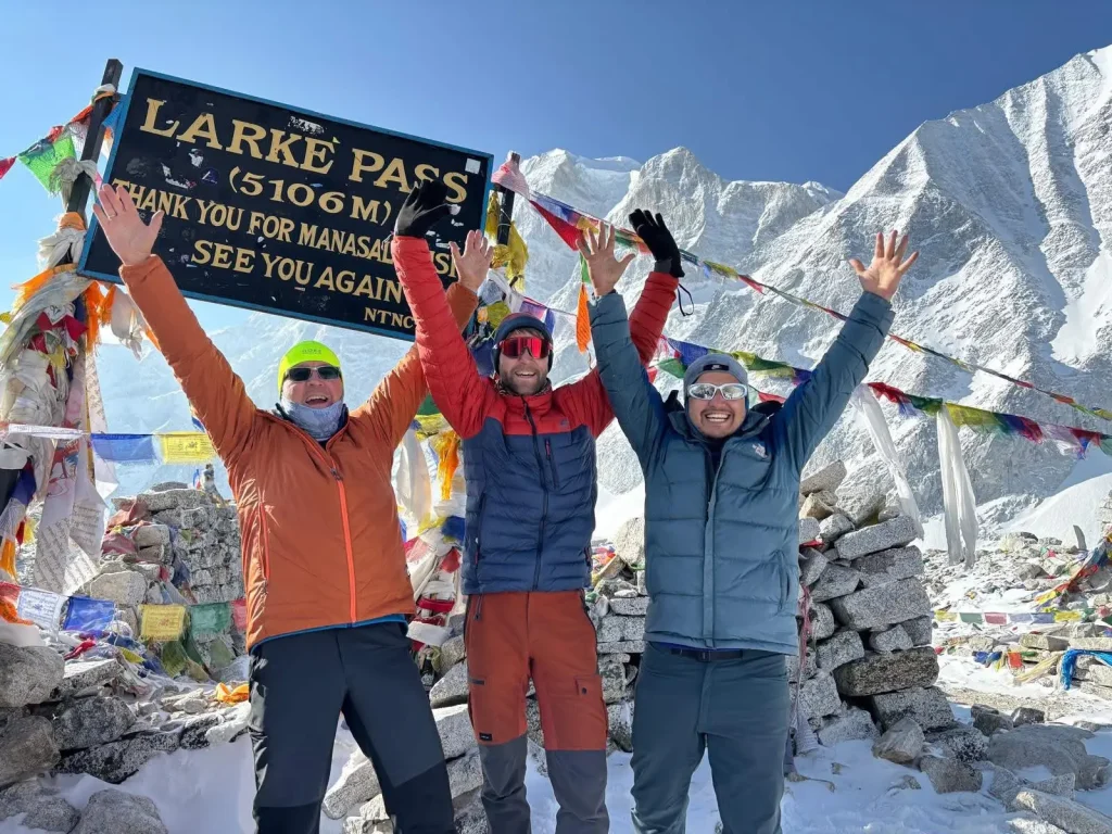
At the pass: keep your visit to around 15 minutes. Wind and cold drain energy fast and raise the risk of hypothermia the longer you linger. Take your photos quickly, since cold drains camera batteries fast too. Add a layer before starting the descent, even if the climb has left you feeling warm, since the long walk down will cool you off again.
During the descent: use trekking poles, your knees will thank you later. Watch your footing on loose rock and scree, especially once fatigue sets in. Stop for lunch somewhere out of the wind if you can find one, since Bimthang is still hours away. Do not rush; a twisted ankle on the way down undoes the whole trip.
Frequently Asked Questions
How high is Larkya La?
Larkya La sits at 5,106 metres (16,752 feet). You will see other figures quoted elsewhere online, since survey methods vary slightly between sources, but 5,106 metres is the figure used across the standard Manaslu Circuit itinerary.
How long is the crossing day?
From Dharamsala to Bimthang via the pass is roughly 18 to 24 kilometres and takes 8 to 9 hours of walking. The climb from Dharamsala (4,460 metres) to the pass (5,106 metres) takes about 4 hours, and the descent to Bimthang (3,720 metres) takes another 4 hours or so.
Do I need climbing experience to cross Larkya La?
No. Under normal conditions this is a trekking route, not a climbing route, and you do not need ropes or technical skills. If there is heavy snow or ice on the upper section, your guide may recommend microspikes for extra grip.
Can I trek the Manaslu Circuit without a guide?
No. The Manaslu region is a restricted area, and the Nepal government requires all foreign trekkers to be accompanied by a licensed guide. This is checked at permit checkpoints along the route, and independent trekking is not permitted here.
What happens if the weather turns bad on crossing day?
Your guide assesses conditions before you leave Dharamsala. If the weather looks unsafe, heavy snow, extreme wind, or whiteout conditions, they may delay the crossing by a day or advise turning back. This is one reason it helps to build a little flexibility into your wider itinerary rather than booking every day back to back.
Is there phone signal or Wi-Fi at the pass?
No. There is no reliable mobile signal and no Wi-Fi at Dharamsala, the pass itself, or Bimthang. Coverage in parts of the lower Manaslu region has improved in recent years, but above roughly 4,000 metres, connectivity essentially disappears.
How much cash should I carry for the trek?
A reasonable buffer is somewhere around NPR 25,000 to 35,000 in cash for extras along the trail. Your package covers accommodation and meals, but you will still want cash for hot showers, device charging, snacks, drinks, and tips for your guide and porter. There are no ATMs once you are on the trekking route itself.
Do I need travel insurance for the Manaslu Circuit?
Yes, and it needs to specifically cover trekking above 5,000 metres along with helicopter evacuation. Many standard travel policies exclude high-altitude trekking by default, so check the fine print before you travel. We do not sell insurance ourselves, so this is one thing you will need to arrange independently.
What is the hardest part of the crossing?
Most trekkers point to the final stretch of ascent before the pass as the hardest part mentally, since you can see the prayer flags but your lungs are working overtime and every step feels slower than it should. Physically, the descent to Bimthang is often harder than the climb, given the sustained impact on your knees over close to 1,400 metres of elevation loss.
Can older trekkers cross Larkya La?
Age matters less than fitness and how well you acclimatize. We have had clients in their sixties cross the pass without major issues, and we have also seen young, fit trekkers turn back because of altitude sickness. The real factors are proper preparation, a realistic pace, and being honest with your guide about how you are feeling.
Is altitude sickness a real risk at Larkya La?
Yes. At 5,106 metres, altitude sickness is a genuine risk for any trekker, regardless of general fitness level. Proper acclimatization, including the rest days at Sama Gaon and the gradual ascent through Samdo, meaningfully lowers the risk. Stay hydrated, keep your pace slow, and talk openly with your guide about any symptoms as they come up.
Who Should Cross Larkya La
Larkya La is not for everyone, and it is worth being upfront about that. If you are after an easy walk in the mountains, the Manaslu Circuit is the wrong trek. If altitude genuinely worries you, a 5,106-metre pass is not the place to test that out for the first time. Anyone with heart or respiratory conditions should talk to a doctor before considering this route at all.
For the right trekker, though, Larkya La ranks among the better achievements available in Himalayan trekking. Reaching those prayer flags after the pre-dawn climb tends to land harder than people expect. The view from the top belongs in its own category. Waking at 3 a.m. in a freezing teahouse and walking uphill in the dark until the sun catches the glaciers is the kind of story that holds up well years later.
The Manaslu Circuit itself remains quieter than the Annapurna Circuit and considerably less developed than the Everest Base Camp trail. The restricted-area permit system keeps numbers manageable, the teahouses stay basic but genuine, and the Nubri communities living in these valleys have kept their Tibetan Buddhist culture intact in a way that feels lived-in rather than staged for visitors. If you would like the fuller picture before deciding, our Manaslu Circuit FAQ guide answers the wider planning questions this article does not cover.
Larkya La is the climax of that journey. It is the day that tests everything built up over the previous week of walking. Arriving in Bimthang that evening, tired, relieved, and looking back at the pass you just crossed, tends to explain fairly quickly why the Manaslu Circuit has the reputation it does among trekkers who have done it.
Before booking, confirm your travel dates, check that your insurance covers high-altitude trekking and helicopter evacuation, and decide whether you want a private porter along the way. We handle the permits, the guide, the transport, and the logistics for everything. The weather, your fitness, and your own determination are the things you bring.
Send us your travel dates, group size, and preferred itinerary through our Manaslu Circuit Trek, or message us directly on WhatsApp at +977 9869225929, and we will take it from there.
Manaslu Treks and Expedition has been organizing treks in the Manaslu region for more than ten years. Our guides are licensed, experienced, and trained specifically for this region. We arrange all permits, transport, accommodation, and logistics so you can focus on the trail itself.
If you are planning your Larke La crossing for November specifically, the Manaslu Circuit Trek in November guide covers exact departure times, ice conditions, gear requirements, and what to expect at Dharamsala high camp in late autumn.