Most trekking blogs about the Manaslu Circuit spend their opening paragraphs on permit costs, trail difficulty, and how many days the circuit takes. Almost none of them dedicate serious space to the thing that trekkers remember longest: the mountains. Not just Manaslu itself, which is everywhere on the circuit and needs no introduction, but the full panorama of peaks that appear, disappear, reappear from different angles, and change character completely as the route climbs from subtropical valleys to high glacial terrain. The Manaslu Circuit passes through one of the most concentrated zones of high Himalayan peaks in Nepal. Trekkers who know what they are looking at will get a completely different experience from the route than those who recognize only the main summit.
This guide covers every significant mountain visible from the Manaslu Circuit Trek: where each peak appears, at what elevation, from which viewpoint it looks best, and what makes it geologically and historically interesting. It covers the great 8,000-meter anchor of the route, the cluster of 7,000-meter satellites that surround it, the distant ranges that frame the southern and eastern horizons in the early days, and the completely different set of peaks that fill the view after the Larke La pass crossing. If you are planning a Manaslu Circuit Trek, this is the mountain context that no other single source has assembled in one place.
The Mountain Context of the Manaslu Circuit
The Manaslu Circuit passes through three distinct mountain-view zones, each with its own dominant peaks and its own visual character. Understanding these three zones helps trekkers orient themselves in the landscape and know what to look for at each stage of the route.
The first zone covers the lower and middle circuit, from the road-end at Soti Khola or Machhakhola up through Jagat, Deng, and Namrung to Lho. In this zone, the dominant peaks are in the Shringi Himal and Ganesh Himal ranges to the south and southeast. Manaslu itself is mostly hidden in this section, visible only in fragments through gaps in the ridgeline above. The mountains here are the backdrop to the gorge country, appearing above the ridge crests and giving scale to the deep valley below them.
The second zone covers the open upper valley, from Lho through Shyala, Samagaun, and Samdo to the Dharmasala high camp. This is the main Mansiri Himal section, where Manaslu and its satellite peaks dominate the skyline with increasing power. Here the mountain fills the view ahead and above, and the surrounding peaks of the Mansiri Himal and Peri Himal close in from all sides. The landscape becomes genuinely alpine, and the mountains feel close in a way that they do not in the gorge below.
The third zone is the Larke La pass itself and the descent to Bimthang and Dharapani. At the pass, the view opens in every direction simultaneously, revealing peaks from three different ranges in a single panorama. After the crossing, the descent brings an entirely new set of mountains into view: the Annapurna region’s western outliers, previously hidden behind the Manaslu massif, begin to appear and take over the skyline as the circuit concludes.
| Mountain | Elevation | Range | Best Viewpoint on Circuit | First Ascent |
|---|---|---|---|---|
| Manaslu | 8,163m (26,781ft) | Mansiri Himal | Shyala, Samagaun, Larke La | 1956, Japanese expedition |
| Himalchuli | 7,893m (25,896ft) | Mansiri Himal | Shyala, Lho | 1960, Japanese expedition |
| Ngadi Chuli (Peak 29) | 7,871m (25,823ft) | Mansiri Himal | Shyala, Lho | 1979, Polish expedition |
| Shringi Himal (Chamar) | 7,187m (23,579ft) | Shringi Himal | Salleri to Philim, lower circuit | 1953, Maurice Bishop |
| Manaslu North | 7,157m (23,480ft) | Mansiri Himal | Samdo, Dharmasala, Larke La | 1980s |
| Nemjung | 7,140m (23,425ft) | Peri Himal | Larke La, Bimthang | 1983, Hirosaki University |
| Himlung Himal | 7,126m (23,379ft) | Peri Himal | Larke La, Bimthang | 1983, Hirosaki University |
| Yangra (Ganesh I) | 7,422m (24,350ft) | Ganesh Himal | Lower circuit near Namrung | 1955, French expedition |
| Ratna Chuli | 7,035m (23,081ft) | Peri Himal | Larke La, upper circuit | 1996, Japanese expedition |
| Thulagi Chuli | 7,059m (23,159ft) | Mansiri Himal | Samagaun area, Larke La | 2015, Russian expedition |
| Annapurna II | 7,937m (26,040ft) | Annapurna Himal | Larke La (on descent side) | 1960, British expedition |
| Gyaji Kang | 7,030m (23,064ft) | Peri Himal | Larke La | 2001 |
| Kang Guru | 6,981m (22,904ft) | Annapurna Himal | Larke La, Bimthang | 1955, German expedition |
| Cheo Himal | 6,820m (22,375ft) | Peri Himal | Larke La, Bimthang | 1978 |
| Baudha Himal | 6,672m (21,890ft) | Shringi Himal | Salleri to Philim | 1954 |
| Naike Peak | 6,211m (20,377ft) | Mansiri Himal | Lho, Shyala | – |
| Larke Peak | 6,249m (20,505ft) | Mansiri Himal | Lho, Dharmasala approach | – |
| Ganesh IV (Pabil) | 7,104m (23,307ft) | Ganesh Himal | Lower circuit | 1978, Japanese expedition |
Manaslu: The Mountain the Circuit Was Named For
Every trekking circuit is anchored by a peak, but few circuits are as completely dominated by their namesake mountain as the Manaslu Circuit is dominated by Manaslu. At 8,163 meters, Manaslu is the eighth-highest mountain in the world and the defining presence of the entire upper valley. Its name derives from the Sanskrit word manasa, meaning intellect or soul, giving it the translation “Mountain of the Spirit.” Whether the mountain deserved this name before anyone climbed it, or whether the name came from the quality of light and presence that the mountain projects across the valley, it fits with unusual accuracy.
Manaslu belongs to the Mansiri Himal, a compact but extraordinarily high subrange of the central Nepal Himalayas. The main summit is at the northwestern end of a complex massif that includes several satellite peaks and a glacier system of considerable size. The mountain’s north and east faces are the sides visible from the Manaslu Circuit’s upper section, and they present a character quite different from the southwest approach used by most climbing expeditions. From the trekking route, Manaslu appears as a steep-faced, heavily glaciated pyramid with a distinctive summit ridge that does not look like the gentle curve shown in many climbing photographs. The northeast face, which the trekker sees most clearly from Shyala and Samagaun, is dramatic and serious, with hanging glaciers at multiple levels and the summit ridge forming a sharp edge against the sky.
The first ascent of Manaslu was made on May 9, 1956, by Toshio Imanishi and Sherpa Gyalzen Norbu, members of a Japanese Alpine Club expedition led by Yuko Maki. Two more team members, Kiichiro Kato and Minoru Higeta, reached the summit two days later. The Japanese connection with Manaslu runs deep in the mountain’s climbing history: they were the first to climb it, they made the second ascent in 1971, and a Japanese climber, Naoko Nakaseko, made the first ascent by a woman in 1974. It is said, among mountaineers, that just as the British consider Everest their mountain, Manaslu has always been a Japanese mountain.
For trekkers on the circuit, Manaslu plays a long game of concealment and revelation. In the gorge section below Lho, the mountain is almost entirely hidden behind the ridge systems that close in on both sides. Occasional glimpses appear through high gaps, but nothing that prepares the trekker for what comes after Lho. When the trail climbs out of the gorge and the valley opens at Lho at approximately 3,180 meters, Manaslu appears for the first time in its full mass, and the effect on trekkers who have spent three or four days not seeing it is consistently described as a shock. The mountain simply fills a large portion of the sky to the north, larger and closer than seems physically possible.
From Shyala at 3,500 meters, Manaslu achieves its best profile view from the circuit. The mountain appears directly ahead and slightly to the north, its full northeast face visible from glacier base to summit ridge. On a clear morning before clouds build, the sunrise light hits the summit first and works its way down the face in shades that shift from deep orange through gold to the blue-white of full day. Samagaun at 3,530 meters offers the closest practical camp to the mountain, and the side trip to Manaslu Base Camp from Samagaun brings trekkers to approximately 4,900 meters, where the mountain’s scale becomes overwhelming. The base camp view is one of the most dramatic single mountain views in Nepal, with the entire north face rising more than 3,000 meters above the camp in a single unbroken wall of ice and rock.
Manaslu North: The Satellite That Stands Alone
Manaslu North, also known as Manaslu II, rises to 7,157 meters to the north of the main Manaslu summit and is a distinct peak in its own right rather than simply a secondary summit of the main mountain. From the upper circuit, particularly from the Dharmasala high camp and the Larke La pass itself, Manaslu North separates visually from the main summit and takes on its own character: a steep, heavily glaciated peak that would be considered a major mountain in any other range in the world.
Trekkers often confuse Manaslu North with the main summit in the early views from Lho and Shyala because the two peaks appear to be part of a single massif from those angles. It is only from Samdo and the high approach to the Larke La that the two summits separate clearly and show their distinct profiles. At 7,157 meters, Manaslu North is taller than any peak in the European Alps and most ranges in the world, yet on the Manaslu Circuit it plays a supporting role to its 8,163-meter neighbor.
The Mansiri Himal Companions: Himalchuli and Ngadi Chuli
Manaslu is not alone in the Mansiri Himal. Two of its near-neighbors are 7,000-meter peaks in their own right, and both are visible from the Manaslu Circuit in positions that allow careful comparison of their very different characters. Himalchuli and Ngadi Chuli are among the most consistently dramatic peaks visible from the circuit’s middle section, and they deserve far more attention than they typically receive in circuit guides that focus entirely on Manaslu.
Himalchuli: The Broad Guardian of the South
Himalchuli stands at 7,893 meters, making it the 18th highest mountain in the world and the second highest peak in the Mansiri Himal. It lies to the southeast of Manaslu and appears from the circuit’s middle and upper sections as a broad, massively built summit rather than the pointed pyramid of Manaslu. Himalchuli has three main summits: the East peak at 7,893 meters (the main summit), the West peak at 7,540 meters, and the North peak at 7,371 meters. This multi-topped character gives it a distinctive wide profile that makes it immediately recognizable from the trekking route even before you know what it is.
The first ascent of Himalchuli was made on May 24, 1960, by Hisashi Tanabe and Masahiro Harada of Japan, via the southwest sickle ridge in an expedition that used bottled oxygen, which was unusual for a sub-8000m peak at the time. The route had been reconnoitered in 1950 and 1954, with failed attempts in 1955, 1958, and 1959 before the 1960 team finally succeeded. The mountain’s climbing history includes a tragic footnote: during the 1960 expedition, an avalanche from the upper glacier struck Camp 1, killing porter Kazi and injuring another who had to be carried down to base camp.
From the trekking route, Himalchuli is best seen from Shyala at 3,500 meters, where it appears to the left (south) of the main Manaslu massif with its broad summit ridge laid out clearly against the sky. At this viewing distance and angle, the relationship between the East, West, and North summits becomes visible as distinct high points on the same ridgeline. Trekkers who are carrying binoculars and looking at the mountain early in the morning, before cloud builds from the valley floor, can sometimes make out individual features of the summit ridge in extraordinary detail.
Ngadi Chuli (Peak 29): One of the Most Rarely Climbed 7000-Meter Peaks
Ngadi Chuli, also known as Peak 29 from its catalog designation in early surveys of the Nepal Himalayas, stands at 7,871 meters and is the 20th highest mountain in the world. It lies between Manaslu and Himalchuli in the Mansiri Himal, and its elevation places it among the select group of mountains above 7,800 meters, yet it remains one of the least climbed high Himalayan peaks, with only a handful of confirmed ascents in its entire mountaineering history.
The climbing history of Ngadi Chuli is one of the most dramatic and contested in Himalayan mountaineering. A Japanese team explored the peak in 1961 and made multiple attempts through the 1960s, reaching as high as 7,350 meters. In 1970, Japanese climbers Hiroshi Watanabe and Sherpa Lhakpa Tsering made what appeared to be the first ascent via the east ridge, but on their descent they fell to their deaths on an ice wall, leaving the question of whether they had actually reached the summit unresolvable. The first confirmed ascent came in 1979, when Polish climbers Ryszard Gajewski and Maciej Pawlikowski climbed via the West buttress. The mountain has seen very few ascents since and remains a genuinely difficult and uncommonly attempted peak.
From the Manaslu Circuit, Ngadi Chuli appears most dramatically from Shyala and the trail sections between Lho and Shyala, where it rises to the left of Manaslu with a sharper, more pointed profile than the broader Himalchuli to its south. The mountain is particularly photogenic at sunrise from Shyala, where the light catches its upper snowfields and summit ridge before the main valley below is illuminated. It is worth noting that Peak 29 was renamed Ngadi Chuli, but many older trekking maps and guides still use the numerical designation.
Thulagi Chuli: The Ice-Separated Neighbor
Thulagi Chuli at 7,059 meters sits between Manaslu and Ngadi Chuli, separated from both by the southward-flowing Thulagi Glacier. It is one of the harder peaks in the Mansiri Himal to identify from the trekking route because it is partially obscured by its higher neighbors and the glacier system below it. However, from Samagaun and on the approach to the Larke La, Thulagi Chuli becomes visible as a distinct summit that adds to the complexity of the Mansiri Himal’s upper structure. Its first ascent was made in September 2015 by a Russian team, making it one of the most recently climbed 7,000-meter peaks in the world.
The Shringi Himal: Mountains of the Lower Circuit
In the lower section of the Manaslu Circuit, before Manaslu itself comes fully into view, the dominant peaks on the horizon belong to the Shringi Himal (also spelled Sringi Himal), a subrange that lies to the west of the Budhi Gandaki valley and forms a high wall above the trail from the road-end through Philim and Jagat. These are the mountains that greet trekkers in the first two or three days of the circuit and that frame the gorge section from above.
Shringi Himal (Chamar): First 7000-Meter Peak to Appear
The highest peak of the Shringi Himal is Chamar, also called Shringi Himal after the range itself, which stands at 7,187 meters (23,579 feet). It is located just south of the Tibetan border, between the Shyar Khola drainage to the east and the Trisuli Gandaki valley to the west, approximately 25 kilometers east of the main Manaslu massif and about 90 kilometers northwest of Kathmandu. The peak was first climbed on June 5, 1953, by Maurice Bishop and Nyagmel Sherpa, making it one of the earlier successful Himalayan ascents by Western climbers in Nepal.
From the Manaslu Circuit, Shringi Himal appears above the western ridge from Salleri through Sirdibas and Philim, rising as a distant but clearly impressive summit above the gorge. In the early days of the circuit, when Manaslu itself is hidden, Shringi Himal often draws the eye as the most obviously high and glaciated peak in sight. Its appearance above the lower valley sets the psychological tone for the circuit that follows: this is a route through serious mountain terrain, not just a hill walk that happens to end near a high pass.
Baudha Himal: The Buddhist Peak of the Western Ridgeline
Baudha Himal, whose name translates roughly as Buddhist Mountain, stands at 6,672 meters and appears as a companion to Shringi Himal on the western ridgeline above the lower Budhi Gandaki valley. Like Shringi, it is most visible in the early section of the circuit before the trail climbs into the more enclosed terrain above Namrung. Baudha Himal was first climbed in 1954 and is less frequently written about than the higher peaks of the Mansiri Himal, but its presence on the western horizon adds to the sense of being enclosed by significant mountains even in the lower valley sections that might otherwise feel simply like deep gorge country without obvious high peaks in sight.
The Ganesh Himal Range: The Eastern Panorama
To the east and southeast of the Manaslu Circuit lies the Ganesh Himal, a distinct subrange of the Nepal Himalayas that is separated from the Mansiri Himal by the Budhi Gandaki and Shyar Khola valleys. The Ganesh Himal contains multiple peaks above 7,000 meters and fourteen peaks above 6,000 meters, and it forms a dramatic backdrop to the circuit’s middle section when conditions are clear enough to see across the valleys to the east.
The Ganesh Himal is named after the Hindu elephant-headed deity, though the range is more associated with Buddhist culture in practice, being close to the Tibetan-influenced communities of the upper Budhi Gandaki valley. On a clear morning from the trail near Namrung and Lho, the Ganesh Himal’s highest peaks appear across the eastern valley as a serrated line of glaciated summits that add a second layer of mountainous drama to a landscape already dominated by the Mansiri Himal group above.
Yangra (Ganesh I): The Highest of the Range
Yangra, also known as Ganesh I, is the highest peak of the Ganesh Himal at 7,422 meters (24,350 feet), making it the most significant summit in the range. It rises as a pyramid-like form above the surrounding peaks and, from the right viewpoint on the Manaslu Circuit’s middle section, appears as a distant but unmistakable high point above the eastern ridgeline. The Ganesh Himal range is separated from the Mansiri Himal by the Budhi Gandaki valley, meaning that from the trekking route, the Ganesh peaks are seen across the valley rather than above it.
The range contains three other peaks above 7,000 meters: Ganesh IV (also called Pabil) at 7,104 meters, Ganesh II at 7,118 meters, and Ganesh III (Salasungo) at 7,043 meters. All are visible, at least partially, from the middle circuit in good weather, and they collectively form the most significant elevated horizon to the east of the trekking route. Trekkers who know to look for the Ganesh Himal across the valley at the right moment will find it one of the circuit’s consistent pleasures in the section between Namrung and Shyala.
| Peak | Elevation | Also Known As | Notes |
|---|---|---|---|
| Yangra | 7,422m (24,350ft) | Ganesh I | Highest peak; pyramid form; visible from middle circuit |
| Pabil | 7,104m (23,307ft) | Ganesh IV | Most accessible of the major Ganesh peaks; first climbed 1978 |
| Ganesh II | 7,118m (23,353ft) | – | Northwest of Yangra; part of the main range profile |
| Ganesh III | 7,043m (23,107ft) | Salasungo | Third highest; contributes to the serrated eastern horizon |
The Peri Himal and the Larke La Panorama
The most dramatic mountain revelation of the entire Manaslu Circuit occurs at the Larke La pass at 5,106 meters. In the days leading up to the pass, trekkers have been focused on Manaslu and its immediate companions. The crossing of the pass changes the view entirely. To the west and northwest, a completely new set of peaks comes into view: the Peri Himal group, a cluster of 7,000-meter summits that forms the wall above the Larke La on the Annapurna side of the pass. These are peaks that are not visible from anywhere else on the Manaslu Circuit but that appear at the pass in a collective display that is among the most impressive Himalayan panoramas accessible to non-technical trekkers.
The Peri Himal is a subrange that sits between the Manaslu region and the Annapurna region, bounded by the upper Budhi Gandaki to the east and the Marsyangdi River system to the west and south. Its highest peaks cluster in an amphitheater that faces the Larke La directly, presenting a wall of glaciated summits that is visible simultaneously from the pass in a way that no individual valley approach could match.
Himlung Himal: The Most Prominent Peak at the Pass
Himlung Himal at 7,126 meters is one of the most visually prominent peaks visible from the Larke La pass and is one of the peaks that most trekkers photograph at the highest point of the circuit. It is located northeast of the Annapurna range, northwest of Manaslu, and presents a classic glaciated summit profile from the pass viewpoint. Himlung Himal is also notable as one of the more accessible 7,000-meter peaks for climbing expeditions, earning it the informal designation as one of the “safer” 7,000-meter peaks in Nepal for mountaineers who are stepping up from 6,000-meter experience.
The first ascent of Himlung Himal was made on October 27, 1983, by a joint Nepal and Hirosaki University Alpine Club expedition led by Junji Kurotaki, via the east ridge. An important footnote to this peak: it was once called Himlung Himal under a different geographical designation, but when Nepal demarcated its border with China in the 1990s, the government reassigned the name “Himlung Himal” to the mountain that now carries it, changing what had previously been called Nemjung.
Nemjung: The Companion of Himlung
Nemjung stands at 7,140 meters, making it slightly higher than the peak currently called Himlung Himal, and the two mountains appear side by side from the Larke La in a pairing that is visually dramatic and geographically close. The naming history of Nemjung is complicated by the same 1990s border demarcation that renamed Himlung: what is now called Nemjung was previously labeled Himlung Himal on older maps, and the current Himlung Himal was a different unnamed summit in older cartography. For trekkers, the practical consequence is that maps and guidebooks from different eras may label these peaks differently. The first ascent of Nemjung (under its earlier name) was also made on October 27, 1983, by the same Hirosaki University expedition that climbed Himlung Himal.
Cheo Himal and Gyaji Kang: The Glacial Wall
Cheo Himal at 6,820 meters and Gyaji Kang at 7,030 meters are two more prominent summits in the Peri Himal amphitheater visible from the Larke La. Together with Himlung and Nemjung, they form a four-peak glaciated wall that multiple trekking accounts describe as overwhelming in its simultaneous scale. Cheo Himal’s glaciers are particularly visible from the pass, with the ice on their flanks catching the morning light and sending streams of glacier descending toward the valley below. Gyaji Kang, also called Gyaji Kung, was climbed for the first time in 2001 and remains one of the less frequently visited peaks in the area despite its impressive 7,000-meter height.
Looking at the Larke La from the pass, these four peaks, Cheo Himal, Gyaji Kang, Himlung Himal, and Nemjung, together with Ratna Chuli (7,035 meters) to their north, create what one mountaineering writer described as “a stupendous wall of glaciers” that ranks among the greatest mountain displays accessible without technical climbing anywhere in Nepal.
Ratna Chuli: The High Peak on the Border
Ratna Chuli stands at 7,035 meters on the border between Nepal and the Tibet Autonomous Region of China, northwest of Manaslu and within the Peri Himal. Its name translates to “Jewel Peak,” which fits the crystalline quality of its glaciated summitin clear morning light from the upper circuit. Ratna Chuli was first climbed in 1996 by a Japanese expedition from Shinshu University and the Nepalese Police Mountaineering Foundation, which put three separate groups of climbers on the summit on October 14, 16, and 18 of that year. From the Larke La and the high approach to the pass from Dharmasala, Ratna Chuli appears to the north and northwest as one of the more distant but clearly visible 7,000-meter peaks above the Tibetan border terrain.
The Annapurna Connection: What Appears After the Pass
The Larke La is a hydrological and geographical divide: on the Manaslu side, the waters flow to the Budhi Gandaki and eventually to the Trishuli and Narayani rivers. On the descent side, the waters flow to the Marsyangdi and eventually to the Gandaki. The mountain geography reflects this divide, and the peaks that come into view as trekkers descend from the pass toward Bimthang are from a completely different mountain group than anything seen in the previous ten or more days of walking.
Annapurna II: The Unexpected Giant on the Horizon
At 7,937 meters, Annapurna II is the 16th highest mountain in the world and the second highest peak of the Annapurna range. It is the eastern anchor of that range and appears from the Larke La on a clear day as one of the most distant but unmistakable peaks on the horizon to the west. Annapurna II was first climbed on May 26, 1960, by Richard Grant, Chris Bonington, and Ang Nyima as part of a large British expedition, making it one of the earlier major Annapurna summits to be reached.
From the Larke La, Annapurna II appears ahead and slightly left as trekkers face the descent, rising in the southwestern direction above the ridge systems of the Marsyangdi watershed. The mountain is significantly farther away than the Peri Himal peaks that dominate the pass panorama, but its great height allows it to rise above the intermediate ridgelines and show its summit clearly on days with good horizontal visibility. Trekkers on the descent to Bimthang and Dharapani pass progressively closer to the Annapurna Himal’s northern fringes, and the views of the range’s western and northern profiles that open up from Bimthang are a preview of the Annapurna Circuit, which begins from Dharapani at the end of the Manaslu Circuit’s descent.
Kang Guru: The Technical Peak Visible from the Pass
Kang Guru at 6,981 meters lies in the Manang district, to the northeast of the main Annapurna Himal, and is visible from the Larke La as part of the western horizon panorama that opens up at the pass. The mountain gained tragic prominence in October 2005 when an avalanche killed 18 people at a high camp on its flanks, one of the deadliest single mountaineering accidents in Nepal’s history. Its first ascent was made in 1955 by a German expedition led by Heinz Steinmetz. From the circuit route, Kang Guru’s profile appears as a distinct 7,000-meter summit west of the Peri Himal group, recognizable by its position beyond the pass wall and its characteristic summit form.
The Smaller Peaks: Naike, Larke, Samdo, and the Circuit’s Local Summits
Beyond the major named peaks in the 7,000-meter and 8,000-meter category, the Manaslu Circuit passes within sight of numerous local summits in the 5,000 to 6,500-meter range that contribute to the circuit’s character without appearing in most peak lists. These are the mountains that form the actual walls of the valleys and passes, that provide the ridgeline backdrops for the villages, and that trekkers see most consistently throughout the walk.
Naike Peak and Larke Peak
Naike Peak at 6,211 meters and Larke Peak at 6,249 meters are both visible from the upper circuit and contribute to the skyline in the area between Lho and the Larke La. They appear as glacier-capped ridges above the main valley rather than as standalone summits, and they form part of the close mountain frame that encircles the upper circuit villages. From Lho and the trail to Shyala, Naike Peak is the closest significant summit to the trekking route and provides a foreground scale reference against which the much larger Manaslu behind it appears in photographs from this section. Larke Peak, visible from the Dharmasala area and the pass approach, gives the pass itself its name and appears as a manageable-looking but crevassed summit directly adjacent to the crossing point.
Samdo Peak and the Upper Valley Summits
Above Samdo village at 3,875 meters, the surrounding landscape is dominated by a series of glaciated summits in the 5,500 to 6,500-meter range that form the immediate walls of the high valley. These peaks have no single dominant name in most trekking guides, but they are a constant presence in the views from Samdo and Dharmasala and provide the close foreground to the more distant Manaslu massif. From Samdo Ri, a non-technical viewpoint above the village at approximately 5,177 meters that can be reached on a rest day, the panorama extends to include Tibet to the north and a 360-degree view of the peaks surrounding the upper valley, making it one of the circuit’s finest off-route viewpoints for those who have the energy and acclimatization to attempt it.
Viewpoint by Viewpoint: Where to See Which Mountains
The circuit’s mountain views are not evenly distributed. Several viewpoints on the route are significantly better than average for specific peaks or combinations of peaks, and knowing which stages have the best mountain views helps trekkers plan their days for early starts and clear morning skies.
| Viewpoint | Elevation | Best Mountains Visible | Best Time of Day | Notes |
|---|---|---|---|---|
| Salleri to Philim section | 1,700 to 1,900m | Shringi Himal (Chamar), Baudha Himal | Morning before cloud builds | First high peaks visible; sets context for the circuit |
| Jagat to Deng gorge section | 1,340 to 1,804m | Shringi Himal above western ridge; occasional Baudha Himal | Early morning; cloud fills gorge by midday | Deep gorge limits view; peaks appear above ridge crests only |
| Deng to Namrung transition | 1,804 to 2,630m | Shringi Himal; first glimpses of Manaslu massif through gaps | Morning | First time Manaslu may appear in any form; builds anticipation |
| Lho village (Lho monastery) | 3,180m | Manaslu (full face), Manaslu North, Naike Peak, Himalchuli | Dawn; first light on Manaslu summit exceptional | First complete view of Manaslu; often described as a revelation moment |
| Shyala village | 3,500m | Manaslu, Himalchuli, Ngadi Chuli, Naike Peak, Ganesh Himal | Pre-dawn and sunrise for best light | Single best panoramic viewpoint on the circuit for combined mountain views |
| Samagaun village | 3,530m | Manaslu (dominant), Manaslu North, Himalchuli | Morning | Base camp side trip from here gives closest practical approach to Manaslu |
| Manaslu Base Camp (side trip) | ~4,900m | Manaslu north face (overwhelming scale), Manaslu North | Morning before cloud | Optional side trip from Samagaun; most dramatic single-mountain view on circuit |
| Samdo village | 3,875m | Manaslu, Manaslu North, Ratna Chuli direction, Tibetan plateau | Morning | Last village before high camp; Tibetan plateau visible to north |
| Samdo Ri (optional side trip) | 5,177m | 360° panorama; Manaslu, Mansiri Himal, Peri Himal, Tibet | Early morning for full panorama | Non-technical but steep; requires good acclimatization |
| Dharmasala high camp | 4,460m | Manaslu, Manaslu North, Larke Peak, approaches to Peri Himal | Evening before pass day; pre-dawn on pass day | Stars over high camp on clear nights exceptional |
| Larke La (Larkya La) pass | 5,106m | Manaslu, Himlung Himal, Nemjung, Cheo Himal, Gyaji Kang, Ratna Chuli, Kang Guru, Annapurna II | Early morning before cloud (pass is crossed at dawn) | Circuit’s panoramic climax; eight or more significant peaks visible simultaneously |
| Bimthang on descent | 3,590m | Manaslu, Lamjung Himal, Himlung, Cheo Himal ranges | Morning | Manaslu appears for the last time in full from here |
Lho: The First Complete View
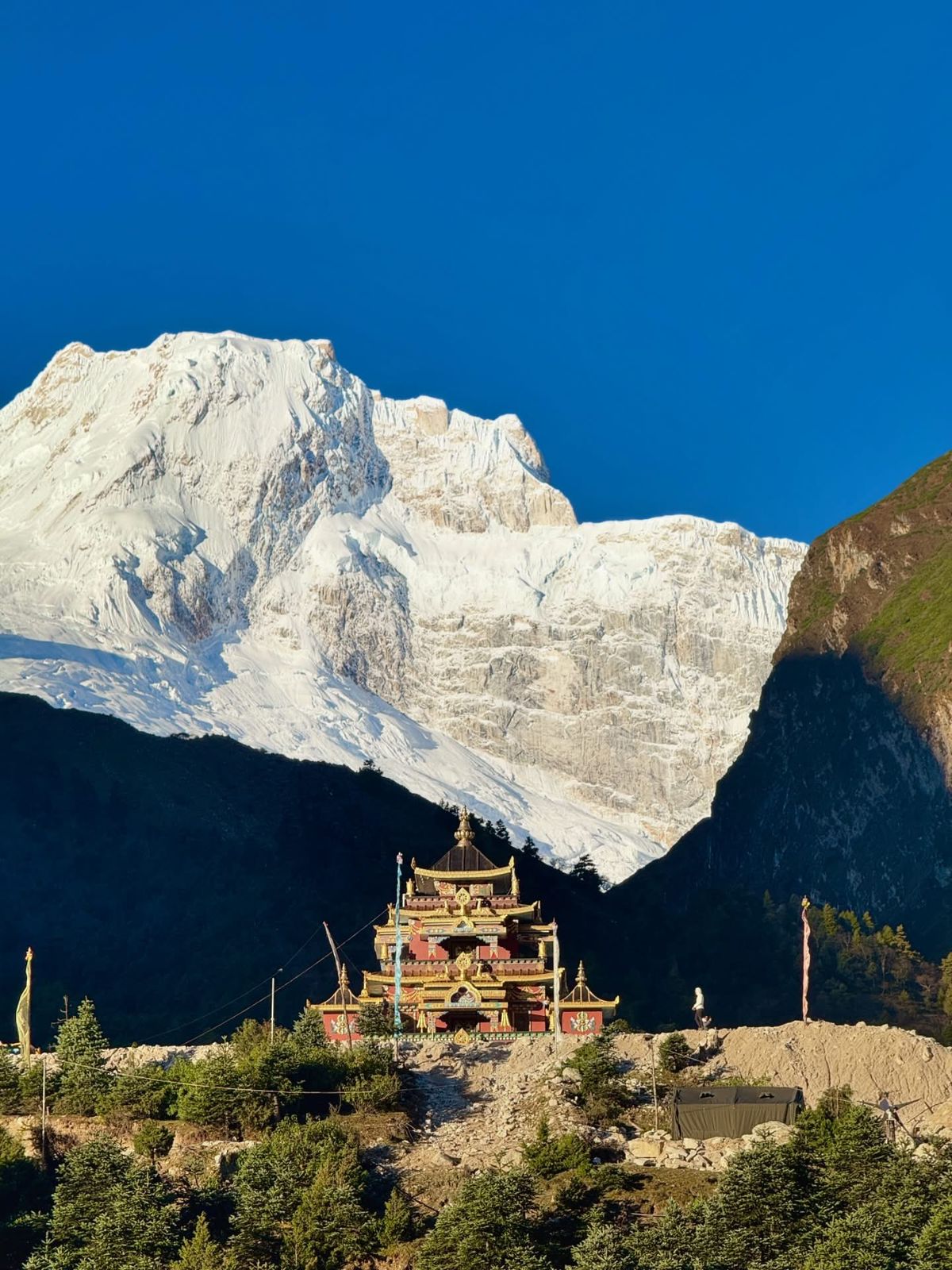
Lho at 3,180 meters is where Manaslu appears for the first time in its complete mass, and the effect on trekkers who have spent three or four days in the gorge below without seeing it is consistently described as a shock. The monastery above Lho village is the classic foreground for the Manaslu view from this stage, and the combination of the ancient stone monastery, the prayer flags, and the 8,163-meter mountain filling the sky behind it is one of the most photographed compositions on the entire route.
But Lho is also where Himalchuli appears clearly for the first time as a recognizably separate and significant summit. From the trail above Lho, looking southeast, Himalchuli’s broad multi-topped profile is visible in a way that is not possible in the gorge below. Trekkers who arrive at Lho in the late afternoon will find the mountain in shadow for photography, but the morning view before the 9am cloud buildup provides exceptional visibility of all the Mansiri Himal group.
Shyala: The Single Best Panoramic Viewpoint
Shyala at 3,500 meters is widely considered the single best general viewpoint on the Manaslu Circuit for combined mountain panoramas. The village sits in an unusually open position in the upper valley, with the ridgelines pulling back to allow visibility in multiple directions simultaneously. From Shyala, trekkers can see Manaslu straight ahead to the north, Himalchuli and Ngadi Chuli to the left (south), Naike Peak rising above the trail ahead, and, on clear mornings, the Ganesh Himal range across the valley to the east. This is the point on the circuit where being organized about early rising pays the largest dividends: the mountains are crisp and clear at first light, and clouds typically build from the valley floor upward through the morning hours.
Photography from Shyala rewards patience. The sunrise alpenglow on Manaslu and Himalchuli, with the valley still in shadow below, is one of the circuit’s signature visual moments. The angle of the sun in October and November creates a sequence of light moving from summit to glacier to valley floor over about 45 minutes, during which every element of the mountain view changes character. Many trekkers who base themselves at Shyala for an acclimatization rest day find it one of the most rewarding single locations on the entire circuit for simply watching the light change on the mountains.
The Larke La: Where Every Direction Pays Off
The Larke La pass crossing is the physical and emotional climax of the Manaslu Circuit, and it is also its mountain-view climax. The pass is crossed in darkness or very early morning light, with most trekkers leaving Dharamshala at 4am or earlier to reach the pass at dawn and begin the long descent to Bimthang before the afternoon cloud rolls in. The timing means that the Larke La view, when it comes, arrives with the first good light of the day, and the combination of high altitude, physical effort, and complete mountain panorama is overwhelming in a way that is difficult to convey in description.
Turning to look back east from the pass, Manaslu and Manaslu North dominate the view in the same way they have dominated the circuit for the previous several days. Turning west, the Peri Himal wall comes fully into view for the first time: Himlung Himal, Nemjung, Cheo Himal, and Gyaji Kang lined up in a display of glacier-hung summits that fills the western horizon. Looking further southwest, Kang Guru appears farther away. Looking south on clear days, Annapurna II rises above the lower ridgelines with the characteristic form that identifies it even at a distance.
The Larke La’s 360-degree view is the reward for every difficult section of the circuit below: the deep gorge, the long climbs, the altitude. For trekkers who arrive at the pass on a clear October or November morning when horizontal visibility extends to 60 or 80 kilometers, the view encompasses eight or more significant peaks above 7,000 meters at once, making it one of the highest-density mountain panoramas accessible to non-technical trekkers anywhere in the Himalayas.
Day by Day: A Mountain Sighting Guide for the Circuit
| Trek Day (Typical 14-day itinerary) | Stage | Mountains to Look For | Direction to Look |
|---|---|---|---|
| Day 1 | Soti Khola to Machha Khola | Distant glimpses of Shringi Himal above western ridge on clear days | West/northwest |
| Day 2 | Machha Khola to Jagat | Shringi Himal becomes clearer; Baudha Himal appears | West/northwest |
| Day 3 | Jagat to Deng | Shringi Himal; gorge limits view; occasional Manaslu massif glimpses through gaps | West; north through gaps |
| Day 4 | Deng to Namrung | Valley opens slightly; Shringi Himal; first real Manaslu fragments | West; north |
| Day 5 | Namrung to Lho | FIRST FULL MANASLU VIEW; Himalchuli; Ngadi Chuli; Naike Peak | North; southeast |
| Day 6 | Lho to Shyala | Full Mansiri Himal panorama: Manaslu, Himalchuli, Ngadi Chuli; Ganesh Himal east | All directions; best north and southeast |
| Day 7 (acclimatization) | Shyala rest day or Samagaun arrival | Manaslu dominates; Manaslu North visible; optional base camp side trip | North |
| Day 8 | Samagaun area | Manaslu overwhelming from base camp side trip; Himalchuli in distance | North; southeast |
| Day 9 | Samagaun to Samdo | Manaslu, Manaslu North; opening toward Tibetan plateau; Ratna Chuli direction | North; northwest |
| Day 10 | Samdo to Dharmasala | Manaslu, Manaslu North; Larke Peak close; Peri Himal begins to appear | North; west |
| Day 11 | Larke La crossing to Bimthang | FULL PANORAMA: Manaslu + Mansiri Himal back; Himlung, Nemjung, Cheo, Gyaji Kang, Kang Guru, Annapurna II ahead | 360 degrees |
| Day 12 | Bimthang to Dharapani | Manaslu last full view; Lamjung Himal; Himlung and Cheo Himal in distance | North; northwest |
Photography Guide: Getting the Best Mountain Images on the Manaslu Circuit
The Manaslu Circuit is exceptional photographic territory, but mountain photography on the circuit follows rules that differ from flatland photography. The elevation, the gorge terrain in the lower section, the cloud patterns, and the direction of key viewpoints all shape when and how the best images are possible.
Light Timing
The best light for mountain photography on the Manaslu Circuit arrives in two windows: the hour around sunrise, and the hour before sunset. The sunrise alpenglow on Manaslu from Shyala and Samagaun, when the summit catches the first red-orange light while the valley is still in pre-dawn blue shadow, is the single most photographically rewarding moment on the circuit for those who prioritize mountain images. This requires being outside with camera ready about 30 minutes before sunrise and patience through the changing light phases.
The afternoon light on Himalchuli and Ngadi Chuli from Shyala is also excellent, as the southwest-facing aspects of those peaks catch the warm evening light from the west. The gorge section’s waterfalls and bridge views photograph well throughout the day because the gorge walls themselves provide shade that prevents the harsh contrast of direct noon sun, but the high peaks above the gorge are best photographed in morning or evening conditions.
Cloud Patterns
In October and November, cloud typically builds from the valley floor upward through the late morning, obscuring the lower sections of the mountains by early afternoon while often leaving the summits visible above the cloud layer. This creates a paradoxical situation where the mountain summits are sometimes better visible in the afternoon, floating above a sea of cloud, than they were in the mid-morning when cloud was building. Learning to observe the cloud patterns at each location is as important as early rising for consistent mountain photography.
At the Larke La, the standard early morning crossing time is actually close to ideal for photography: the pass is reached around or after sunrise, the mountains are illuminated from the east, and the cloud from the valley below has not yet risen to obscure the view. The combination of physical cold, altitude, and extraordinary mountain panorama that greets trekkers at the pass in early morning light makes it one of the most photographed moments on the circuit for good reason.
Equipment Considerations at High Altitude
At the elevations reached on the Manaslu Circuit, particularly at the Larke La (5,106 meters) and on the approach from Dharmasala, battery performance in cameras and phones is significantly reduced in cold morning temperatures. Keeping batteries warm overnight in a sleeping bag or inner jacket pocket and limiting unnecessary display use in the early morning walk will preserve battery life for the critical pass crossing moments. A spare battery for dedicated cameras is worth carrying for the high-altitude sections. UV filters protect against the stronger ultraviolet light at altitude, which can cause haze in images without one, and also protect the lens in rocky terrain.
Understanding Mountain Weather on the Circuit
The Manaslu Circuit’s mountain views are inseparable from the circuit’s weather patterns. Knowing when mountain views are most likely, and when they are typically obscured, helps set expectations and allows trekkers to plan their rest days and photography priorities effectively.
October is the most reliable month for clear mountain views on the Manaslu Circuit. The post-monsoon atmosphere clears progressively through October, and the combination of post-monsoon low humidity and pre-winter cold means that by late October the air is extraordinarily clear. Mountain views of 80 kilometers or more are possible on good days in late October, which is what makes the Larke La panorama so impressive in that month. In early October, residual monsoon cloud means that some days on the lower circuit may be overcast, and the full Mansiri Himal panorama from Shyala may not appear until the third or fourth day of waiting for clear conditions.
November offers similar clarity but shorter days and colder temperatures at high altitude. The December to February winter period brings the highest mountain clarity of the year, as cold temperatures and dry air eliminate the atmospheric haze that affects views in warmer months. The trade-off is that passes can be closed by snow and temperatures at high camp are serious. Spring (March to May) has building visibility early in the season but increasing cloud and sometimes significant afternoon storm development by April and May.
Frequently Asked Questions About Mountains on the Manaslu Circuit
When do you first see Manaslu on the Manaslu Circuit?
The first complete view of Manaslu typically occurs at Lho village, at approximately 3,180 meters elevation, which is reached on day five or six of the standard circuit itinerary depending on route variant. Before Lho, the mountain is largely hidden behind the ridge systems that enclose the gorge. Brief fragments of the massif may appear through gaps in the ridgeline in the section between Namrung and Lho, but the full mountain in its complete mass does not appear until the valley opens at Lho. The revelation of Manaslu from Lho after several days in the gorge below it is consistently described as one of the circuit’s most memorable moments.
Is Manaslu visible from Kathmandu?
Manaslu is not typically visible from Kathmandu city itself, which sits in a valley bowl with mountain visibility limited by surrounding ridgelines and atmospheric haze. However, from elevated viewpoints near Kathmandu, such as the Shivapuri Nagarjun National Park ridgelines to the north of the city, Manaslu can be seen on clear winter mornings as a distant but distinctly tall summit to the northwest. The Ganesh Himal range is also visible from the Kathmandu area on clear days, at a distance of about 80 kilometers to the northwest.
How many peaks above 7,000 meters are visible from the Manaslu Circuit?
On clear days, the Manaslu Circuit provides views of at least ten peaks above 7,000 meters: Manaslu (8,163m), Annapurna II (7,937m), Himalchuli (7,893m), Ngadi Chuli (7,871m), Yangra/Ganesh I (7,422m), Shringi Himal/Chamar (7,187m), Manaslu North (7,157m), Nemjung (7,140m), Himlung Himal (7,126m), Pabil/Ganesh IV (7,104m), Thulagi Chuli (7,059m), Ratna Chuli (7,035m), Gyaji Kang (7,030m), and Ganesh III (7,043m). Not all of these are visible from any single point; the full count accumulates over the course of the entire circuit from the lower trail to the Larke La and back down to Bimthang.
What is the best viewpoint on the Manaslu Circuit for mountain photography?
Shyala at 3,500 meters is the single most rewarding viewpoint for combined mountain photography, offering simultaneous views of Manaslu, Himalchuli, Ngadi Chuli, and the Ganesh Himal in ideal proportion and with strong morning light from the east. For a single-mountain close view, the Manaslu Base Camp side trip from Samagaun provides the most dramatic image of Manaslu itself. For a multi-peak panorama combining the most peaks simultaneously, the Larke La is unmatched on the circuit. For photography specifically of the Shringi Himal, the section around Philim and the lower valley gives the best angles before the trail moves away from that range’s optimal viewing zone.
Can you see Everest or Annapurna I from the Manaslu Circuit?
Everest (8,849m) is not visible from the Manaslu Circuit. It lies too far to the east and is blocked by the intervening ridgelines of the Ganesh Himal and the topography between the Budhi Gandaki and Kosi drainages. Annapurna I (8,091m) is technically visible on exceptionally clear days from the Larke La if horizontal visibility is good, but it is far to the southwest and is not a guaranteed or prominent part of the Larke La panorama. Annapurna II (7,937m) is much more reliably visible from the pass and is the Annapurna range’s most consistent presence on the Manaslu Circuit. Dhaulagiri I (8,167m) is not generally visible from the circuit, lying too far to the west.
Do you need a rest day for acclimatization at a viewpoint village?
The standard Manaslu Circuit itinerary includes an acclimatization rest day at Samagaun at 3,530 meters, which is the most appropriate location physiologically. Many experienced trekkers and guides suggest that Shyala at 3,500 meters is actually a better location for a combined acclimatization and mountain-view day because its panoramic position gives better access to the full range of mountains visible in the upper valley zone. The practical recommendation is to plan an early start on the day of arrival at whichever high village you choose for acclimatization, use the rest day for a shorter acclimatization walk to a slightly higher elevation, and plan your photography around the first two to three hours after sunrise before cloud limits visibility.
What is the hardest mountain to identify correctly on the Manaslu Circuit?
The most common identification confusion on the Manaslu Circuit is between Manaslu North (7,157m) and the main Manaslu summit (8,163m). From the viewpoints between Lho and Shyala, the two peaks appear as part of a single massif and can be difficult to distinguish without a guide or reference image. Manaslu North appears to the right (east) of the main summit from Shyala, slightly lower and with a slightly different profile. From Dharmasala and the Larke La, the two peaks separate more clearly and the distinction becomes easier. The second most common confusion is between Himlung Himal and Nemjung at the Larke La, which are adjacent peaks with a history of name reassignment that makes older guidebooks unreliable for identification.
The Mountains as a Reason to Choose the Manaslu Circuit
The Manaslu Circuit is sometimes sold on the basis of its permits, its remoteness, and its difficulty. These are real attractions. But the mountain experience the circuit provides is arguably its strongest single argument, and it is the argument that is most consistently undersold.
No other trekking circuit in Nepal provides as concentrated a mountain experience as the Manaslu Circuit does in the section between Lho and the Larke La. The Annapurna Circuit’s mountain views are distributed over a longer route with more settled terrain between the high points. The Everest region’s views are focused on a single mountain and its immediate neighbors. The Langtang Circuit provides excellent mountain scenery but in a smaller scale. The Manaslu Circuit’s combination of one 8,000-meter peak, a cluster of seven to ten 7,000-meter peaks visible from the same general zone, and a high pass panorama that connects two different ranges into a single view is simply not replicated elsewhere in Nepal’s trekking routes.
Understanding which peaks you are looking at, what their geological and historical context is, and where on the circuit to prioritize time and attention transforms the experience from a physically demanding walk with impressive views into a genuine engagement with one of the most concentrated zones of high mountain terrain on the planet. The Budhi Gandaki valley that forms the circuit’s lower axis exists because the river found its way through this terrain over millions of years. The villages that line the valley exist because humans found a trade route through the same terrain over millennia. The circuit itself exists because the mountains attracted climbers, and the climbers’ access infrastructure eventually became trekking infrastructure. Every day on the Manaslu Circuit is a day spent in country that was shaped by these peaks, and knowing them by name and character is the most direct way to understand where you are walking.
If you are planning a Manaslu Circuit Trek and want expert guidance on the route, the best itinerary for mountain views, acclimatization strategy, or the logistics of permit and access, contact us at Manaslu Treks. We have walked the circuit in every season and can help you plan a route that gives you the best possible access to the mountains that make this one of the great trekking routes of the Himalayas.
November is widely considered the best month for mountain views on the Manaslu Circuit, with the dry post-monsoon air delivering crystal-clear skies from Manaslu Base Camp all the way to Larkya Peak. The Manaslu Circuit Trek in November guide covers visibility conditions, crowd levels, and what to pack for late-autumn trekking.
The 19-Day Manaslu Circuit with Tsum Valley Trek is one of Nepal’s most rewarding long-distance Himalayan journeys, combining remote valleys, ancient…