The Budhi Gandaki River is the reason the Manaslu Circuit Trek exists in the form it does. Every day from the road-end at Soti Khola to the high villages of Samdo and Dharmasala, trekkers follow this river or walk in its shadow. It is the route-finding logic of the circuit, the water source for every village along the way, the sound that accompanies every camp and every teahouse, and the geological force that carved the gorges and valleys that make the trek one of the most dramatic walks in Nepal. Most agencies describe the river in passing, noting the suspension bridges and the gorge character of the lower section. None of them treat it as the subject it deserves to be: a river of extraordinary character that runs the entire length of the most powerful Himalayan trekking route in central Nepal.
This guide treats the Budhi Gandaki as its own subject. It traces the river from its glacial source above Samdo at more than 3,800 meters to its confluence with the Trishuli River at Benighat at 478 meters above sea level. Along the way, it examines the river’s geological history, its ecology and wildlife, the cultural communities that have built their lives along its banks for centuries, the suspension bridges that carry trekkers across it more times than they can count, the hot springs it has heated along its route, and the proposed hydropower project that would transform its lower section in the years ahead. For trekkers doing the Manaslu Circuit Trek, understanding the Budhi Gandaki means understanding the journey itself.
What Is the Budhi Gandaki River
The name Budhi Gandaki translates loosely from Nepali as “old Gandaki” or “elder Gandaki,” distinguishing it from the other tributaries of the great Gandaki River system that drains central Nepal from the Himalayan watershed to the Gangetic plains. The word “budhi” in Nepali carries the meaning of old, wise, or elder, and the river’s name reflects its status as one of the original tributaries of the Gandaki system: a river old in geological time and deeply embedded in the landscape and cultures of the region it drains.
The Budhi Gandaki rises in the Manaslu Himal in Gorkha District and flows southward for approximately 130 kilometers before joining the Trishuli River at Benighat, at the junction of Dhading and Gorkha Districts. Its drainage basin covers approximately 5,000 square kilometers, encompassing parts of Nepal and the southern margins of the Tibetan Plateau. The river’s gradient is steep and consistent: it descends from glacial sources above 4,000 meters to its confluence at 478 meters, dropping more than 3,500 meters of altitude over 130 kilometers. This steep gradient is what gives the river its power, its gorge-cutting ability, and its hydropower potential, and what makes the trek that follows it one of sustained altitude gain and dramatic landscape change from one day to the next.
| Characteristic | Detail |
|---|---|
| Nepali name | बूढीगण्डकी नदी (Budhi Gandaki Nadi) |
| Meaning | “Old Gandaki” or “elder Gandaki” |
| Length | Approximately 130 km |
| Source area | Manaslu Himal glaciers, above Samdo and Samagaun (~3,800 to 4,000m+) |
| Confluence | Trishuli River at Benighat (478m elevation) |
| Total altitude drop | Over 3,500 meters across its course |
| Drainage basin | ~5,000 km² (mostly Nepal, some Tibet) |
| River system | Gandaki → Narayani → Ganges |
| Districts drained | Gorkha, Dhading (and parts of Rasuwa) |
| Conservation Area | Upper basin within Manaslu Conservation Area |
The river belongs to the broader Gandaki River system, one of the great river systems of South Asia. The Gandaki, known as the Narayani in Nepal and the Gandak in India, flows from the Himalayan watershed through Nepal and into the Indo-Gangetic plain, eventually joining the Ganges in Bihar, India. The Budhi Gandaki’s waters, beginning as glacial melt from the Manaslu massif, ultimately reach the Bay of Bengal after a journey of over 2,500 kilometers through the Himalayan, Terai, and Indian Gangetic landscapes. For trekkers drinking from the Budhi Gandaki’s clear cold streams above Deng or Namrung, this connection to one of the world’s greatest river systems gives the water a poetic dimension that goes beyond mere hydration.
The Luxury Manaslu Circuit Trek is a comfortable way to explore one of Nepal’s most beautiful and less crowded trekking…
The Five Zones of the Budhi Gandaki
The Budhi Gandaki changes character dramatically over its course. It is not a single river in any meaningful ecological or visual sense but five distinct rivers that happen to occupy the same channel at different altitudes. Each zone has its own landscape character, its own ecological community, its own cultural context, and its own relationship to the trekkers who walk alongside it.
Zone One: The Glacial Source (Above 3,500m)
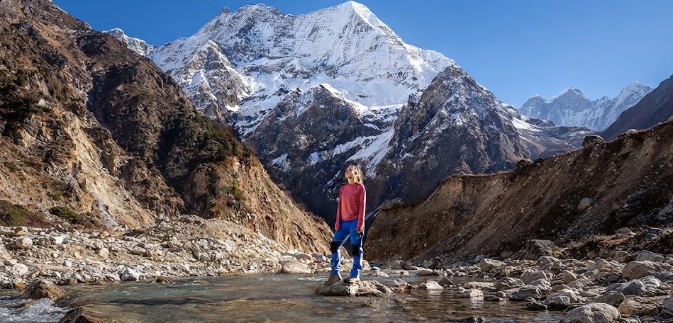
The Budhi Gandaki begins as glacial meltwater in the high alpine terrain above Samdo and Samagaun. At this altitude, the river is a collection of braided glacial streams emerging from the Manaslu massif and the glaciers that descend from the northern and eastern faces of the mountain group. The water at this elevation is intensely cold, crystal-clear in dry conditions and milky with glacial silt after periods of melt. The streambed is filled with rounded boulders and coarse gravel carried down from the glacier’s terminal moraines.
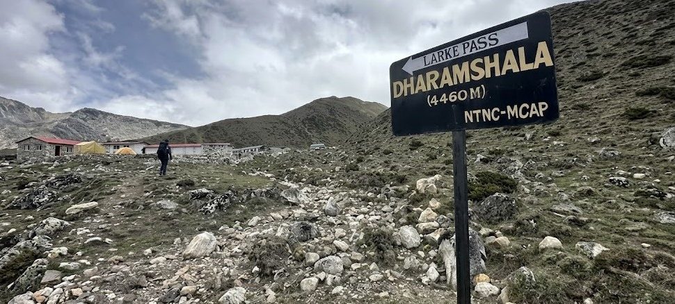
The Larke Glacier, which descends from the ridges north of Samagaun, contributes significantly to the river’s early flow. As trekkers approach Dharmasala and then cross the Larke La, they are walking above the uppermost reaches of the Budhi Gandaki’s catchment, looking down into the valley where the river begins its long journey south. The Birendra Lake near Samagaun, a glacial lake at 3,450 meters, is one of the river’s early bodies of still water, formed behind a moraine dam and fed by the same glacial sources that feed the river’s upper tributaries.
Zone Two: The Upper Valley (2,500m to 3,500m)
Between Samdo and Namrung, the Budhi Gandaki flows through a valley that is broader and more open than the gorge section below. The river here has more volume, having gathered the meltwater from numerous side tributaries, but its character remains relatively controlled: a powerful, fast-flowing mountain river with a clear channel and a bed of polished boulders. The Chuling Khola, draining the Himalchuli massif from the east, is one of the significant tributaries that joins the main river in this zone, adding volume and the milky silt of its own glacial sources.
Villages in this zone, including Samagaun, Samdo, Lho, and Namrung, are built above the river on terraces that protect them from seasonal floods while keeping them close enough to draw irrigation water for the agricultural fields. The river in this zone supports a different ecological community from the gorge below: fewer fish, fewer riverside birds, more open terrain with yak and cattle grazing on the banks in summer.
Zone Three: The Deep Gorge (1,300m to 2,500m)
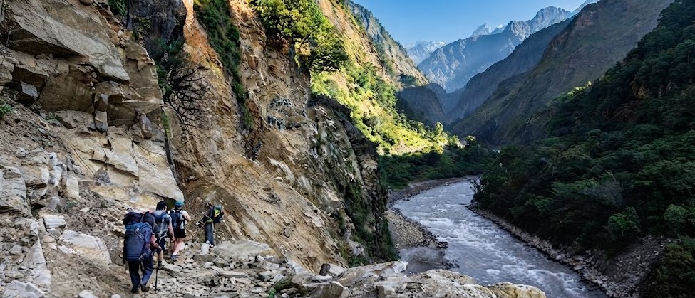
The gorge section of the Budhi Gandaki, from approximately Deng down to Jagat and Machhakhola, is the most dramatically geological section of the river and the most defining landscape of the Manaslu Circuit’s lower section. In this zone, the river has cut through a fault zone in the Himalayan geology, producing walls that in some places are nearly vertical and hundreds of meters high. The river roars through a channel so narrow at its tightest points that the sky above appears as a thin ribbon of light. This is the section where the circuit trail is most often forced high above the river onto paths cut into the cliff face, where suspension bridges carry trekkers across whenever the gorge floor is impassable.
The geological explanation for the gorge is the process of antecedent drainage: the Budhi Gandaki was a river before the Himalayas were as high as they are today, and as the mountains rose, the river kept cutting down into its channel faster than the mountain could rise. The gorge is the result of millions of years of this competition between tectonic uplift and river erosion, with the river winning. The polished walls of the gorge, their smooth surfaces and sharp vertical faces, are the evidence of this geological contest.
Zone Four: The Mid-Valley (700m to 1,300m)
Below Machhakhola and Soti Khola, the Budhi Gandaki enters a wider valley section where the gorge character begins to relax and the river spreads into a broader channel. The villages in this zone, including Arughat, are more developed and more connected to the road network below. The river here carries more sediment, its color changing from the blue-green of the high gorge to a more turbid brown-grey after rain events. The valley walls are still steep but no longer vertical, and the riverbanks support more vegetation: bamboo groves, subtropical trees, and the beginnings of the agricultural landscape that characterizes the lower river.
Zone Five: The Lower River and Confluence (Below 700m)
The Budhi Gandaki’s lowest section passes through the lower hills of Gorkha and Dhading Districts before reaching Benighat and the confluence with the Trishuli. In this zone, the river is broad and powerful, carrying the accumulated flow from its entire catchment and all the sediment it has eroded from the mountains above. The climate here is subtropical: rice paddies, banana trees, and subtropical forest replace the rhododendron and oak of the middle altitudes. The river in this section is navigable and has been proposed as a white-water rafting route for the section below Arughat. At Benighat, the darker waters of the Budhi Gandaki visibly mix with the paler currents of the Trishuli in a confluence that is both geographically and culturally significant: river junctions are considered sacred in the Hindu and Buddhist traditions of the valley communities.
Following the River: The Manaslu Circuit Day by Day
The Manaslu Circuit Trek follows the Budhi Gandaki more closely and for more of its course than almost any other Himalayan trek follows its river. The circuit spends approximately eight to ten days walking in the Budhi Gandaki valley, ascending from the road-end at Soti Khola to the high camps before the Larke La. Understanding each day’s relationship to the river changes the way the trek feels: instead of a series of disconnected village-to-village walks, it becomes a continuous journey up a single river from its lower subtropical reaches to its glacial sources.
| Day / Section | River Zone | River Character | Key River Feature |
|---|---|---|---|
| Soti Khola to Machhakhola | Lower gorge | Wide, powerful, clear | First suspension bridge crossings; river fills valley |
| Machhakhola to Jagat | Gorge begins | Narrows dramatically | Gorge walls close in; trail forced above river |
| Jagat to Deng | Deep gorge | Confined, roaring | Multiple crossings; Tatopani hot springs fed by river geology |
| Deng to Namrung | Gorge to mid-valley | Gorge relaxes above Ghap | Waterfalls entering from side tributaries |
| Namrung to Lho | Upper mid-valley | Wider, clearer | First views of river’s full glacial catchment |
| Lho to Samagaun | Upper valley | Braided, multiple channels | Chuling Khola joins from Himalchuli side |
| Samagaun to Samdo | High alpine | Cold, glacial, narrow | Larke Glacier meltwater joins; Birendra Lake nearby |
| Samdo to Dharmasala | Near source | Small streams and snowmelt | Above the river’s main channel; source area |
The Tatopani Hot Springs: Where Geology Meets River
One of the most remarkable features of the Budhi Gandaki corridor is the Tatopani hot springs near Khorlabesi, between Machhakhola and Jagat on the lower circuit. The name “Tatopani” means “hot water” in Nepali, and the springs are heated by geothermal activity associated with the same fault zone that the river has cut through to create its gorge. The heat comes from deep rock formations where tectonic pressure generates temperatures high enough to heat water before it emerges through cracks in the riverbank.
The hot springs at Khorlabesi emerge directly from the riverbank, sometimes within meters of the cold, fast-flowing Budhi Gandaki itself. The contrast between the scalding hot spring water and the glacially cold river water in the same physical space is a direct expression of the geological drama that underlies the entire river corridor. Trekkers who stop to soak at Tatopani, letting the heat ease the muscles tired from the day’s walk, are sitting at the intersection of two of the forces that make this river valley extraordinary: the heat from the earth below and the cold from the glaciers above.
The Suspension Bridges: Crossing the Budhi Gandaki
One of the defining physical experiences of the Manaslu Circuit’s lower section is crossing the Budhi Gandaki on suspension bridges. In the gorge section between Machhakhola and Namrung, the trail crosses the river multiple times each day, sometimes four or five crossings in a single stage. The bridges are the only practical way to follow whichever bank of the river offers passage, and the gorge character of the terrain means that the trail is constantly forced from one side to the other as cliff faces, waterfalls, and rock obstacles make one bank impassable.
The suspension bridges of the Budhi Gandaki gorge are engineering achievements in their context. Strung on steel cables across a roaring river in a deep canyon, they carry not just trekkers but loaded mule and yak caravans, porters with enormous loads, and the entire supply chain that keeps the upper valley villages functioning. The bridges sway and bounce under load, the river visible far below between the steel mesh of the walking surface, the gorge walls rising on both sides. Crossing a long suspension bridge over the Budhi Gandaki with a fully loaded yak caravan approaching from the other side is one of the most memorable physical experiences the circuit offers.
| Bridge Location | Section of Circuit | Approximate Height Above River | Notes |
|---|---|---|---|
| Khorlabesi to Tatopani | Day 1 to 2 | 15 to 25m | One of the first major crossings; near hot springs |
| Between Machhakhola and Jagat | Day 2 | 20 to 40m | Gorge begins to narrow; multiple crossings |
| Jagat to Philim section | Day 2 to 3 | 30 to 50m | Trail forced high; bridges span deep gorge sections |
| Philim to Deng technical section | Day 3 | 25 to 45m | Hardest bridge crossings on the circuit; gorge at deepest |
| Deng to Rana to Ghap | Day 4 | 20 to 35m | Multiple crossings; gorge starts to relax |
| Above Namrung | Day 5 | 15 to 20m | Valley wider; crossings less dramatic but still necessary |
The etiquette for suspension bridge crossings on the Budhi Gandaki is consistent throughout the circuit: yak and mule caravans have the right of way, always. Trekkers should step to the uphill side of the trail and wait for any animal caravan to clear the bridge before crossing. Crossing alongside loaded animals on a suspension bridge is genuinely dangerous: the animals can shift position suddenly, and a load that catches on the bridge railing can unbalance both the animal and any person nearby. The caravan-right-of-way rule is not mere courtesy but practical safety management in a terrain where the consequences of falls are severe.
Major Tributaries of the Budhi Gandaki
The Budhi Gandaki is not a solitary river but the trunk of a drainage system with multiple significant tributaries, each one contributing to the river’s volume, character, and ecological complexity. Understanding the tributaries helps trekkers understand why the river grows so dramatically in size between the upper valley and the gorge below: each major tributary brings the water of an entire mountain range into the main channel.
| Tributary | Source Area | Joins Budhi Gandaki At | Significance |
|---|---|---|---|
| Shyar Khola (Tsum Khola) | Ganesh Himal range, draining Tsum Valley from the north | Nyak / Lokpa area | Major tributary; drains the entire Tsum Valley system; brings Ganesh Himal glacial water |
| Chuling Khola | Himalchuli and Baudha massif glaciers | Upper middle valley above Namrung | Drains Himalchuli (7,893m) glaciers; adds significant glacial volume |
| Akhu Khola | Southern slopes of Ganesh Himal range | Lower mid-valley | Ganesh Himal drainage; adds volume in the lower middle valley |
| Tom Khola | Tibetan Highlands | Upper catchment area | High-altitude drainage from near-Tibetan terrain |
| Lig Khola | Ridges above lower gorge | Gorge section | Side drainage adding to gorge volume; waterfalls visible from trail |
The Shyar Khola and the Tsum Valley Connection
The Shyar Khola is the most culturally and geographically significant of the Budhi Gandaki’s tributaries. It drains the entire Tsum Valley, one of Nepal’s most culturally distinct hidden valleys, which lies in the upper reaches of the Ganesh Himal range, east of the Budhi Gandaki main channel. The Shyar Khola flows north to south through the Tsum Valley before turning west and joining the Budhi Gandaki near the village of Nyak or Lokpa in the upper gorge section.
The Tsum Valley, accessible only via the Shyar Khola valley or over high passes, is one of the most pristine Tibetan Buddhist communities in Nepal. Its isolation is partly due to the Shyar Khola’s gorge, almost as dramatic as the Budhi Gandaki’s, which has protected the valley from outside influence throughout its history. Trekkers doing the combined Tsum Valley and Manaslu Circuit route will walk up the Shyar Khola from its confluence with the Budhi Gandaki, effectively ascending a major tributary before returning to the main river and continuing north on the circuit. The two drainages are distinct but related: both drain the Ganesh Himal from different aspects, and the Shyar Khola is the hydrological connection between the Tsum Valley and the broader Budhi Gandaki system.
The Luxury Manaslu Circuit Trek is a comfortable way to explore one of Nepal’s most beautiful and less crowded trekking…
Ecology of the Budhi Gandaki: What Lives in and Around the River
The Budhi Gandaki River and its immediate surroundings support one of the most biologically diverse ecosystems in the Manaslu Conservation Area. The river itself, the riverbanks, the gorge walls, and the forest immediately above the gorge all carry distinct ecological communities that together represent a remarkable biodiversity. The conservation area that protects the upper Budhi Gandaki catchment contains an estimated 2,400 hectares of forest, 19 mammal species, 54 bird species, and fish populations that include several species listed on the IUCN Red List.
The River Birds
The most reliably observed wildlife on the entire Manaslu Circuit is found on the Budhi Gandaki itself. River-specialist bird species occupy every section of the river from the gorge bottom to the upper glacial streams, and trekkers who pay attention to the water surface and the riverbank boulders will encounter them repeatedly throughout the circuit’s lower and middle sections.
| Species | River Zone | Identifying Feature | Observation Notes |
|---|---|---|---|
| Brown dipper | All sections with fast water | Small, rotund, dark brown; constantly bobs up and down on boulders | Common throughout; walks into fast water to feed on aquatic invertebrates |
| Plumbeous water redstart | Gorge and mid-valley sections | Blue-grey male; rusty-red female; territorial on boulders | Regularly seen perched on river boulders; flicks tail constantly |
| River lapwing | Mid-valley and lower gorge | Black, white, and grey; distinctive red wattle at bill base | Often seen on gravel bars; very vocal; rare globally but present here |
| Ibisbill | Braided river sections of upper valley | Long curved red bill; grey plumage; striking face pattern | Uncommon but seen on gravel bars above Namrung; a prize sighting |
| White-capped water redstart | Fast-flowing gorge sections | White cap; red tail; perches on spray-wet boulders | Common in gorge; often in pairs |
| Pied kingfisher | Wider, calmer sections | Black and white; hovers over water before diving | Less common in gorge; more frequent in mid and lower valley |
| Common merganser | Lower gorge and mid-valley | Large diving duck; long serrated bill; white body | Seen in calmer water sections; dives for fish |
The brown dipper is the spirit animal of the Budhi Gandaki. No other bird is as consistently present throughout the river’s course, and no other bird expresses the character of a fast-flowing Himalayan river as completely. Dippers are remarkable birds: they walk into fast-flowing water and actively walk on the riverbed, using the current to hold themselves down while they search for aquatic invertebrates. They also swim underwater and fly directly upstream through the spray zone above rapids. On a cold October morning in the Budhi Gandaki gorge, watching a brown dipper bobbing on a boulder in the middle of the roaring river while morning mist rises from the water surface is one of the small transcendent moments that the circuit regularly delivers to trekkers who are paying attention.
The River’s Fish
The Budhi Gandaki supports fish populations throughout its course, from the cold, fast-flowing upper gorge to the warmer, broader lower valley. The river’s clean, well-oxygenated, fast-flowing water is exactly the habitat that the most prized Himalayan fish species require, and the Budhi Gandaki is recognized as one of the better fishing rivers in central Nepal for the species that inhabit it.
| Fish Species | Local/Common Name | River Zone | Status and Notes |
|---|---|---|---|
| Tor putitora | Golden Mahseer | Mid-valley and lower gorge | Considered the “tiger of freshwater”; significant cultural and conservation value; vulnerable to overfishing |
| Schizothorax spp. | Asala / Snow Trout | Upper valley and gorge | Cold-water specialist; commonly caught by local fishers; excellent table fish |
| Anguilla spp. | Freshwater Eel | Lower gorge and mid-valley | Nocturnal; found in deeper, calmer sections; important protein source locally |
| Glyptothorax spp. | Torrent Catfish | Fast-flowing gorge sections | Specialized gorge fish; clings to boulders using sucker-like adaptations; rarely caught |
| Mystus spp. | Catfish | Lower valley and mid-section | Common in calmer sections; important for local fishing |
The Golden Mahseer is the Budhi Gandaki’s most celebrated fish. This large cyprinid, which can reach weights of over 50 kilograms in optimal conditions, has been called the “tiger of freshwater” for its fighting strength on the line and its powerful, athletic body. Mahseer require clean, well-oxygenated, fast-flowing water, which the Budhi Gandaki provides throughout much of its length. The fish is considered sacred in some Hindu traditions along the river, and its presence is a strong indicator of river ecosystem health. Fishing for mahseer in the Budhi Gandaki is a specialized activity that attracts anglers from Nepal and internationally, particularly in the mid and lower valley sections below Arughat where the fish populations are most accessible.
The snow trout (Schizothorax, locally called asala) is the fish that most trekkers on the Manaslu Circuit encounter in the form of dinner rather than in the river. Many teahouses in the mid-valley section, particularly around Jagat and Machhakhola, offer locally caught trout as a menu option. The fish is caught by local fishers using traditional methods and represents one of the genuine hyperlocal food traditions of the Budhi Gandaki valley that the circuit’s teahouse culture has preserved.
Forest and Riparian Ecology
The riparian forest, the forest immediately alongside the river on both banks, is the most diverse and productive ecological zone in the Budhi Gandaki corridor. The combination of water availability, the microclimate created by the gorge (moderating temperature extremes and maintaining high humidity), and the nutrient input from the river’s seasonal floods creates conditions that support plant and animal communities of exceptional density and diversity. The forest changes character with altitude, from subtropical bamboo and banana at the river’s lower reaches, through temperate oak and rhododendron in the gorge section, to high-altitude pine and fir in the upper valley, creating a vertical transect through multiple biomes.
The gorge walls above the river, where the angle is too steep for the trail but sufficiently moist for forest, carry a dense growth that is rarely seen in accessible terrain. Mosses, ferns, and epiphytes cover every surface, and the forest canopy above is as complete and multi-layered as any in Nepal. This inaccessibility is also what makes it relatively undisturbed: the gorge walls are de facto nature reserves, their steepness protecting them from the forest clearance that has affected more accessible terrain throughout the valley.
The River and the Villages: Cultural Connections
Every village on the Manaslu Circuit exists because of the Budhi Gandaki. Without the river’s water for drinking, irrigation, and the hydropower that supplies what little electricity the upper valley has, there would be no communities in this terrain at any altitude. The river is not just a scenic backdrop to the circuit villages but the physical foundation on which those communities have been built and maintained for centuries.
The River as Trade Route
Before the Manaslu Circuit was a trekking route, the Budhi Gandaki valley was a trade corridor. The Nubri communities of the upper valley traded salt, wool, yak products, and goods from Tibet southward through the valley to the lower hill communities and eventually to the bazaars of Gorkha and Kathmandu. The lower hill communities sent rice, grain, manufactured goods, and forest products northward. The valley’s orientation, running straight from the Tibetan border to the accessible hills of the mid-Nepal range, made it one of the natural trade corridors between the Himalayan plateau and the Gangetic plain, a function it served for centuries before the trekking era.
The suspension bridges that trekkers cross today are the modern descendants of rope and plank bridges that carried this trade for generations. The same crossing points that modern bridge engineers chose for the steel suspension bridges were chosen by village engineers centuries earlier for the same reason: these are the places where the gorge is narrow enough and the banks are solid enough for a crossing to be built and maintained. The bridges are thus historical as well as practical, marking the same points in the river’s course that human communities have recognized as crossings since the valley was first inhabited.
The River and Irrigation
The agricultural terraces that cover the hillsides above the Budhi Gandaki from the lower valley to the mid-altitude villages are irrigated by systems of channels drawn from the river and its tributaries. These irrigation networks, some of them centuries old, are maintained by the village communities under traditional cooperative systems that allocate water rights and maintenance responsibilities to each household. The terraces of maize, millet, barley, potatoes, and buckwheat that trekkers walk through between the villages are the product of this water management system, which the Budhi Gandaki makes possible.
At the higher altitudes, above Namrung and Lho, the growing season is short and the crops more limited, but the same basic dependence on the river’s water for irrigation applies. Yak pastures in the upper valley are also dependent on the snowmelt and glacial water that the Budhi Gandaki distributes through the landscape, and the timing of the seasonal pastoralism, when herds move up to high summer pastures and back down in winter, follows the river’s hydrological cycle as much as the calendar.
The River as a Cultural Boundary
The Budhi Gandaki also functions as a cultural boundary on the Manaslu Circuit, though not a sharp one. As the circuit ascends the river, the cultural landscape transitions from the Hindu-influenced hill communities of the lower valley, through the mixed communities of the mid-valley at Jagat and Philim, to the fully Tibetan Buddhist Nubri communities above Ghap and Namrung. This transition follows the river’s course upward and reflects the historical settlement patterns of the valley: Hindu hill communities settled the lower and more accessible sections, while the Tibetan-origin Nubri communities, with their cultural connections to the north, occupied the higher and more remote sections.
The river has historically been both a connection and a barrier between these communities. It connected them through trade and seasonal movement, but its gorge and the difficulty of crossing it in its natural state also separated them. The crossing points, where bridges now stand, were always the points of contact between cultures: the places where traders met, where goods exchanged hands, and where the cultural mixing that characterizes the mid-valley communities took place.
The Waterfalls of the Budhi Gandaki Gorge
The gorge section of the Budhi Gandaki is notable for its waterfalls. The steep gorge walls collect water from the ridges and forests above and channel it into falls that vary from thin white threads on distant cliff faces to powerful cascades that cross the trail itself. The gorge’s moisture-laden microclimate ensures that water finds its way down from the ridge tops through a hundred channels, large and small, and the trekker walking through the gorge in October or April is surrounded by the sound and sight of falling water at almost every point.
The largest waterfalls in the Budhi Gandaki gorge are significant enough to have names or local designations and are visible from considerable distances. One dramatic fall in the Deng section drops several hundred meters from a source hidden above the cliff rim to a pool at the gorge floor. The sound of such a fall is audible from the trail minutes before the fall itself comes into view, its voice adding to the constant background roar of the main river. After the monsoon, in October, the falls are at their maximum flow, fed by the accumulated moisture stored in the ridge soils by the summer’s rainfall, and they run with a power and consistency that makes the entire gorge section feel like walking inside a working geological process.
Seasonal Changes to the Budhi Gandaki
The Budhi Gandaki changes dramatically through the seasons, and the river that trekkers experience in October is genuinely different from the river of April, the river of the monsoon months, and the winter river of January. Understanding these seasonal differences helps trekkers appreciate what they are seeing and sets expectations for what the river looks and sounds like at different times of year.
| Season | River Character | Color and Clarity | Volume and Power | Trekker Impact |
|---|---|---|---|---|
| Spring (March to May) | Rising with snowmelt; increasingly powerful through April and May | Clear early in March; increasingly milky with glacial silt by May | Growing from winter low to spring high | Bridges may be partially submerged in late spring flood pulses; crossings more dramatic |
| Monsoon (June to September) | Flood conditions; maximum volume; highest power | Brown and highly turbid with suspended sediment | Highest of the year; flood stage at peak monsoon | Trail alongside river dangerous; landslides from gorge walls; bridges may wash out |
| Autumn (October to November) | Post-monsoon high gradually declining; still powerful in October | Transitions from turbid to clear through October; clearest in November | High in October; dropping through November | Optimal for trekking; waterfalls at maximum; river impressive but trail safe |
| Winter (December to February) | Minimum flow; glaciers frozen; no snowmelt input | Clearest of the year; deeply transparent blue-green in gorge sections | Lowest of the year; some side tributaries frozen | River least dramatic visually but most beautiful in color; some upper crossings easier |
October is when the Budhi Gandaki is most impressive for the trekker. The monsoon has just ended and the river still carries the full benefit of five months of heavy rainfall, pushing the waterfalls to maximum flow and keeping the main channel at its most powerful post-monsoon level. By November, the river is already dropping as the monsoon moisture drains from the ridge soils, and the waterfalls in the gorge become thinner and less dramatic. The clarity of the water improves through October and into November as the monsoon’s suspended sediment settles out of the water column, transitioning the river’s color in the gorge from the turbid brown-grey of peak monsoon to the extraordinary blue-green of clear, cold, fast-flowing mountain water.
The Luxury Manaslu Circuit Trek is a comfortable way to explore one of Nepal’s most beautiful and less crowded trekking…
The Budhi Gandaki Hydropower Project: What It Means for the River
The lower section of the Budhi Gandaki, approximately 2 kilometers upstream of the Benighat confluence with the Trishuli, is the proposed site of one of Nepal’s largest hydropower projects. The Budhi Gandaki Hydropower Project, with a planned installed capacity of 1,200 megawatts in its full form (and a 341-megawatt initial phase approved in 2024), would create a large storage reservoir that would inundate a significant section of the lower Budhi Gandaki valley. The dam site is located in the lower hills of Gorkha and Dhading Districts, well below the Manaslu Conservation Area and far below the trekking circuit.
The project has been in planning for many years and has gone through multiple changes in scope, financing, and implementation model. In November 2024, the Investment Board of Nepal, chaired by the Prime Minister, approved investment for the initial phase with an approximate cost of 70 billion Nepali rupees. A committee proposed implementation starting in 2024 to 2025 with completion targeted for 2031 to 2032.
For trekkers on the Manaslu Circuit, the dam project has no current impact on the upper valley or the trekking route itself. The dam site is far below the circuit’s road-end at Soti Khola or Machhakhola, and the reservoir, if completed, would not extend into the trekking zone. However, the project will transform the lower Budhi Gandaki valley, replacing the river corridor below the dam site with a storage reservoir and changing the hydrology of the lower river entirely. The confluence at Benighat, currently the river’s natural endpoint, will become a dam-controlled release point instead of a free-flowing confluence.
The ecological consequences of the dam for the lower river are significant. Fish populations, particularly the migratory mahseer, which moves between the lower and upper river for spawning, would be disrupted by the dam’s obstruction of the migration route. The river lapwing, which nests on gravel bars in the lower river, would lose nesting habitat to the reservoir. These concerns are part of the environmental discussion around the project, though the dam site’s distance from the Manaslu Conservation Area means that the upper valley’s protected ecology would be less directly affected.
Practical Information: The Budhi Gandaki for Trekkers
Drinking Water
The Budhi Gandaki’s water looks extraordinarily clear and clean in the upper valley sections, and the temptation to drink directly from the river or its tributaries is understandable. The water should not be consumed untreated at any point on the circuit. Even in the upper valley, where the water appears pristine, agricultural activity, yak grazing, and village waste at higher elevations upstream introduce pathogens that are not visible to the naked eye. Always treat water from any natural source with iodine tablets, chlorine tablets, or a UV sterilizer. The most reliable drinking water source on the circuit is boiled water from the teahouses, which is available at every overnight stop.
River Safety
The Budhi Gandaki in flood, particularly during the monsoon season and in the spring snowmelt period from April to May, is a dangerous river. Trekkers should not attempt to cross any section of the river other than on designated bridges. The volume and power of the main channel in flood conditions is sufficient to carry away a loaded yak, let alone a person, and the gorge terrain means that there is often no safe landing point downstream of a fall into the water. If a bridge is damaged or closed, wait for official guidance from local authorities or your guide before attempting any alternative crossing.
Understanding What You Are Walking Through
The Budhi Gandaki is not scenery. It is the reason the circuit exists and the force that shaped every landscape feature of the route. The gorge walls were cut by the river. The flat terraces where the villages stand were deposited by the river’s floods. The hot springs are heated by the same geological fault that the river follows. The bridges exist because the gorge is too wide and too deep to step across. The waterfalls are the river’s tributaries arriving from the ridge above. When trekkers look at the landscape of the Manaslu Circuit’s lower and middle sections, almost every feature they see was made by this river, is sustained by this river, or exists in relationship to this river.
The ecological community of the gorge, from the brown dippers on the boulders to the golden mahseer in the pools to the mosses on the spray-wet cliff faces, is organized around the river’s flow regime and its chemistry. The cultural landscape of the villages, their irrigation systems, their bridge crossings, their fish-based food culture, their relationship to the trade route through the valley, is organized around the river’s presence. Understanding this gives the Manaslu Circuit Trek a coherence and a depth that the individual village guides, however detailed, cannot fully convey: this is one river, from glacier to confluence, and every day of the circuit is a day spent in its company.
The Budhi Gandaki in the Context of the Manaslu Circuit
The Manaslu Circuit is sometimes described as a mountain trek: a circuit of a high peak, with the mountain at the center and the route organized around the attempt to circumnavigate it. This is accurate but incomplete. A more complete description is that the Manaslu Circuit is a river trek: a journey up one of Nepal’s great mountain rivers from its accessible lower reaches to its glacial source, followed by a pass crossing and a descent on the far side. The mountain gives the circuit its name and its dramatic visual centerpiece, but the river gives it its structure, its ecological diversity, and its daily physical character.
| Trek Stage | Relationship to Budhi Gandaki | What the River Provides |
|---|---|---|
| Day 1 to 3 (Road-end to Deng) | Following the river through its deepest gorge section | Route logic, gorge landscape, suspension bridges, waterfalls, hot springs |
| Day 4 to 5 (Deng to Lho) | Gorge relaxes; river broadens; first open views | Transition landscape; first mountain views above the river corridor |
| Day 6 to 7 (Lho to Samagaun) | Upper valley; river braided and glacial | Glacial character visible; tributary systems joining from high peaks |
| Day 8 to 9 (Samagaun to Dharmasala) | Near source; walking in the river’s catchment area | Alpine ecology; glacial landscape; river now a stream |
| Pass crossing and descent | Leaving the Budhi Gandaki catchment | The river’s absence on the far side marks the transition to the Marsyangdi system |
When trekkers cross the Larke La and begin the descent toward Bimthang and Dharapani on the Annapurna side, they are leaving the Budhi Gandaki watershed and entering the Marsyangdi River’s catchment. The streams that flow from the south side of the pass drain into the Marsyangdi, which eventually joins the Trishuli downstream of where the Budhi Gandaki itself joins. The two river systems meet in the broader Gandaki basin on their way to India. The pass crossing is thus a hydrological crossing as much as a geographical one: from one river’s world to another’s, both ultimately part of the same ancient and massive river system that drains the central Himalayas to the sea.
Frequently Asked Questions About the Budhi Gandaki River
Where does the Budhi Gandaki River start?
The Budhi Gandaki River originates from glaciers in the Manaslu Himal, primarily in the area above Samdo and Samagaun at elevations of 3,800 to 4,000 meters and above. The Larke Glacier and the glacial systems of the Manaslu massif’s northern and eastern flanks contribute the river’s initial flow. The Budhi Gandaki’s source is not a single spring but a collection of glacial meltwater streams that coalesce in the high alpine terrain of the upper valley before forming the coherent river channel that flows south through the circuit villages.
How long is the Budhi Gandaki River?
The Budhi Gandaki River is approximately 130 kilometers long from its source in the Manaslu Himal to its confluence with the Trishuli River at Benighat. Its drainage basin covers approximately 5,000 square kilometers, mostly within Nepal with some portion extending into the Tibetan Plateau. The river descends more than 3,500 meters over this distance, giving it one of the steepest average gradients of any significant river in Nepal and the power to cut the dramatic gorge that makes the Manaslu Circuit so distinctive.
Where does the Budhi Gandaki end?
The Budhi Gandaki ends at Benighat, where it joins the Trishuli River at an elevation of approximately 478 meters above sea level. Benighat lies on the Prithvi Highway between Kathmandu and Pokhara, making the confluence accessible by road. From the confluence, the combined waters of the Budhi Gandaki and Trishuli continue south as part of the Narayani River system and eventually reach the Ganges near Hajipur in Bihar, India. The river’s waters, originating as glacial melt on the Manaslu massif, ultimately reach the Bay of Bengal.
How many suspension bridges cross the Budhi Gandaki on the Manaslu Circuit?
The exact number of suspension bridges crossing the Budhi Gandaki on the Manaslu Circuit varies depending on which route variations are taken and which bridges are in service at any given time, as some bridges are damaged in floods and replaced on irregular schedules. Most trekkers cross the river four to five times per day in the gorge section between Machhakhola and Namrung, with the total number of crossings on the full circuit typically in the range of fifteen to twenty-five. The concentration of crossings is highest between Jagat and Ghap, where the gorge is at its narrowest and the trail switches between banks most frequently.
Can you swim in the Budhi Gandaki?
Swimming in the Budhi Gandaki main channel is not advisable at any point during trekking season. The river’s current in the gorge section is extremely powerful, and the combination of cold temperature, strong flow, and the absence of safe exit points makes it dangerous even for strong swimmers. The hot springs at Tatopani near Khorlabesi offer a safe and pleasant alternative to river swimming, providing naturally heated water in a setting where the cold river is close but not in the pool itself. Above Namrung, where the valley broadens and the river has more accessible banks, wading in shallow side channels is possible in calm conditions, but always with awareness that the main channel remains fast and cold.
Is the Budhi Gandaki a clean river?
The Budhi Gandaki in its upper reaches, from the source to approximately Machhakhola, is one of the cleaner large rivers in Nepal. The low population density of the catchment, the protected status of the Manaslu Conservation Area, and the altitude, which limits the types of agriculture and industry that contribute most to river pollution, all contribute to keeping the upper river in good ecological condition. The presence of mahseer, snow trout, and river specialist bird species throughout the circuit section is evidence of this relative health. Below Arughat and toward the lower valley, the river encounters more human settlement and agricultural activity, and its ecological condition is progressively less pristine as it approaches the dam site and the Benighat confluence.
What is the best time to see the Budhi Gandaki at its most impressive?
October is the best month to experience the Budhi Gandaki on the Manaslu Circuit. The post-monsoon river is at its highest navigable level: the waterfalls in the gorge are powerful, the river itself is loud and visually impressive, and the post-monsoon clearing of the atmosphere means the surrounding landscape is at its most visible. The clarity of the water improves through October as monsoon sediment settles, and by late October the water in the gorge is transitioning toward the deep blue-green of the clear high-mountain river. The sound of the gorge in October, combining the main river’s roar with the multiple waterfalls entering from the gorge walls, is an experience of natural sound on a scale that is genuinely overwhelming and completely unlike anything available in the more manicured landscapes of developed countries.
The River That Carries the Circuit
The Budhi Gandaki is not one of the rivers that gets named in the first paragraph of every Manaslu Circuit description. Those descriptions lead with Manaslu itself: its height, its status as the eighth-highest mountain in the world, its history of first ascent and subsequent climbing. The river comes later, if it comes at all, usually in the context of the gorge section or the suspension bridges.
This understates what the river is. Without the Budhi Gandaki, there is no gorge and no gorge section. Without the gorge section, there is no dramatic lower circuit and no transition from subtropical valley to high Tibetan plateau. Without the river’s water, there are no villages and no teahouse culture and no circuit at all. Without the river’s fish, there is no local food tradition of fresh trout in the mid-valley teahouses. Without the river’s geological history, there are no hot springs at Tatopani. Without the river’s ecology, there are no brown dippers on the boulders and no golden mahseer in the deep pools.
The Budhi Gandaki is older than the circuit, older than the villages, older than the Nubri communities, the trade routes, the Buddhist monasteries,nd the trekking industry. It was here before the Himalayas were as high as they are and it cut downward through the rising rock as the mountains grew, maintaining its channel against the upward force of the tectonics by the simple persistence of water finding its way to lower ground. The gorge is the record of that persistence: millions of years of river winning against mountain, expressed in polished rock and vertical walls and the constant roar that accompanies every hour of the trek in its lower and middle sections.
If you are planning a Manaslu Circuit Trek and want guidance on understanding the river route, the best time to experience the gorge section at its most dramatic, or how to structure your itinerary to make the most of every section of the Budhi Gandaki valley from the road-end to the high camps, contact us at Manaslu Treks. We have walked every section of this valley in every season and can help you experience the river and the circuit in the way that suits your pace, interests, and ambitions.
The Manaslu Circuit Trek is a spectacular journey around Mount Manaslu (8,163 m), the eighth-highest mountain in the world. Located…