The Manaslu Circuit Trek sits in a category of its own among Nepal’s trekking routes. It is not simply remote. It is not simply difficult. It is a legally designated Restricted Area, and the permit system, rules, guide requirements, and checkpoint network that trekkers must navigate to walk this circuit exist because of a documented history of geopolitical sensitivity, cultural fragility, ecological importance, and hard lessons learned from uncontrolled access to similar areas elsewhere in the Himalayas. This post explains exactly why the Manaslu region is restricted, what that means in practice, and why the restrictions produce the kind of trekking experience that no unrestricted trail can replicate.
If you are planning a Manaslu Circuit Trek, understanding the reasons behind the restricted area designation will change how you relate to the permit system. The permits are not bureaucratic friction. They are the mechanism by which one of the most intact cultural and ecological landscapes in the central Himalayas has been kept that way while still being accessible to the world.
What “Restricted Area” Actually Means in Nepal
Nepal operates two broad categories of protected area access. The first is the standard national park and conservation area model, where any trekker can enter after paying an entry fee and obtaining a TIMS card. The Annapurna Conservation Area, Sagarmatha National Park (Everest region), and Langtang National Park all operate on this model. The second category is the Restricted Area, and this is a fundamentally different legal status.
Nepal’s Restricted Areas are governed by the Immigration Act of 2049 (1992) and the Immigration Regulations of 2051 (1994). Under these laws, the government designates specific zones of Nepal where foreign nationals are prohibited from entering without a special Restricted Area Permit (RAP) issued by the Department of Immigration. The permit is not available to individuals directly: it must be processed through a registered trekking agency, and the trekker must be accompanied by a licensed guide throughout the restricted zone.
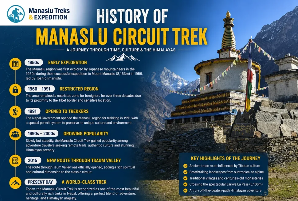
The Manaslu region, specifically the area between Jagat and Dharapani, falls within this second, more restrictive category. It has been a restricted area since Nepal first began formalizing its border zones in the decades following the 1950s, and it was opened to foreign trekkers in 1991 under controlled conditions rather than opened freely. Three decades later, it remains restricted, and the reasons for that status are worth examining in full.
The Manaslu Circuit Trek is a spectacular journey around Mount Manaslu (8,163 m), the eighth-highest mountain in the world. Located…
The Ancient World That Existed Before the Restrictions: Tibet and Nepal’s Trade History
To understand why the Manaslu region became restricted, it is necessary to understand what it was before restrictions existed. For several centuries before the 20th century, the Budhi Gandaki valley was not a trekking route. It was a trade highway, one of the most active corridors connecting the Tibetan plateau to the markets of the Nepal hills and the Gangetic plains of India.
The trade that moved through this valley was structured around a fundamental asymmetry between two ecosystems. The Tibetan plateau, at elevations of 4,000 meters and above, produces salt from evaporated salt lakes in enormous quantities but cannot grow grain at scale. The Nepal hills and lower valleys produce rice, lentils, maize, millet, and spices in abundance but have no salt source. These two deficiencies created a perfect trading relationship that sustained communities on both sides of the Himalayas for generations.
Tibetan traders came south through the Manaslu region carrying rock salt from the great salt lakes of western Tibet, particularly Tso Ngon and Tso Kar. They also carried raw wool from Tibetan sheep, yak hair, dried meat, medicinal herbs found only at high altitude, and occasionally gold dust and turquoise. The Nubri people of the upper Budhi Gandaki valley, whose own settlement at elevations of 3,000 to 4,000 meters meant they could not grow enough food for winter, served as both traders and intermediaries in this exchange.
Moving north, grain traders from the Nepal hills carried rice, millet, barley, lentils, cotton cloth, ironwork including knives and tools, and manufactured goods from the lowland markets. These moved up the Budhi Gandaki valley on the backs of porters and on yak caravans, through the gorge section that modern trekkers walk, and into the high valley to be exchanged with Tibetan and Nubri traders at traditional trading fairs in villages like Samagaun and at the border.
Jagat, the village where trekkers now encounter the first major permit checkpoint, operated for centuries as a customs post on this trade route. The name Jagat itself derives from a word meaning customs or toll point in local usage, indicating that the function of controlling and taxing goods moving through the valley had been institutionalized long before Nepal developed a formal state bureaucracy. Officials in Jagat collected duties on goods moving in both directions, giving the village its economic importance and its role as a gateway to the restricted upper valley.
The Nubri communities of the upper Budhi Gandaki, living in the villages of Lho, Shyala, Samagaun, and Samdo, were central to this trade system. The Nubri are a Tibetan-speaking people whose ancestors migrated southward from Tibet approximately 400 years ago, establishing settlements in the high valleys below the main Himalayan crest. Their language is a Sino-Tibetan dialect, their religion is Vajrayana Tibetan Buddhism, their architecture follows Tibetan patterns, and their cultural calendar follows the Tibetan lunar calendar. Economically, they sat at the intersection of the Tibetan and Nepali trading worlds, able to communicate with both sides and navigate both cultural environments.
The volume of trade through the Manaslu corridor was substantial. Caravans of 50 to 100 or more yaks were not unusual on the main trading season runs, typically in autumn after the harvest when both grain stores and salt stocks were at their peak and mountain passes were still passable before winter snows. The seasonal movement of these caravans shaped the ecological and cultural calendar of the entire valley: grazing patterns, crop timing, and festival dates all organized themselves around the trading cycle.
Beyond salt and grain, the trade corridor also moved more specialized goods. Tibetan medicinal herbs, including high altitude plants used in traditional Tibetan medicine, moved south to markets in Kathmandu and India. Wool moved south for processing in lowland weaving centers. Musk from Himalayan musk deer, a highly valuable trade commodity in Chinese and European markets through most of the 19th and early 20th centuries, moved through the Manaslu corridor as part of the broader trade network. The Tsum Valley, accessible via the Shyar Khola tributary of the Budhi Gandaki, added another branch to this trading network, with the Tsum people maintaining their own trans-Himalayan connections through passes into Tibet north of their valley.
Nepal-Tibet Trade Formalization and the 1856 Treaty
Nepal and Tibet formalized their trading relationship in a series of treaties, the most significant being the Treaty of 1856 that followed the Nepal-Tibet War of 1855 to 1856. Under this treaty, Nepali traders were granted special privileges in Tibet, including the right to trade in Lhasa, reduced customs duties, and extraterritorial legal status. In exchange, Nepal agreed to certain political and economic concessions regarding the relationship between the two territories. These formal arrangements reinforced trading networks that had already been operating informally for centuries and gave the trans-Himalayan trade through the Manaslu and other corridors a legal framework that would persist until the middle of the 20th century.
The 1950s: When the Ancient World Ended
The trans-Himalayan trade that had sustained the Manaslu region’s communities for centuries was destroyed in less than a decade by events that began in 1950 and unfolded through the 1950s and 1960s. The Chinese People’s Liberation Army entered Tibet in October 1950, and by 1951 had signed the Seventeen Point Agreement that formally incorporated Tibet into the People’s Republic of China. This political transformation, which the Tibetan government in exile and many international observers dispute as an annexation, had immediate and catastrophic consequences for the border trade that the Manaslu communities depended on.
Initially, the new Chinese administration allowed some continuation of the traditional border trade. But as Chinese control consolidated and the border between Nepal and Tibet began to function as an international boundary with formal controls on both sides, the ancient informal movement of traders and caravans became increasingly difficult. The 1960 border treaty between Nepal and China, which demarcated the Nepal-China frontier for the first time as a formal international border, introduced passport and visa requirements, customs posts, and movement controls that effectively ended the free flow of traders that had characterized the pre-1950 period.
The Tibetan uprising of 1959 and the Dalai Lama’s flight to India accelerated the deterioration of the border trade environment. China tightened controls on the Tibetan side of the border, limiting the ability of Tibetan traders to move south. The flow of Tibetan refugees through Nepal in the early 1960s introduced a security dimension to the border that had not previously existed. The Manaslu region’s proximity to the Tibetan border made it directly relevant to Nepal’s strategic calculations about its relationship with China.
A further complication arose from the CIA-funded Tibetan resistance, the Chushi Gangdruk army, which used Mustang in northwest Nepal as its base of operations from the early 1960s until 1974. While this was centered in Mustang rather than the Manaslu region, the entire northern border with Tibet became politically sensitive as a result, and Nepal’s government became increasingly concerned about controlling movement in all border-adjacent zones to satisfy Chinese concerns about activities on Nepali soil. The Manaslu region, with its long border with Tibet and its communities with deep cultural and economic ties across that border, was part of the area of heightened sensitivity.
By the late 1960s and through the 1970s, the trans-Himalayan trade through the Budhi Gandaki valley had been reduced to a fraction of its historical volume. The salt trade, the ancient foundation of the entire system, had been additionally disrupted by the Indian government’s subsidized supply of iodized salt to Himalayan communities as part of a public health initiative that eliminated the traditional preference for Tibetan rock salt. Communities that had traded salt for grain for centuries found that iodized salt from India was cheaper, more accessible, and available without the seasonal border crossing that Tibetan salt required. By the 1980s, the salt trade that had defined the Manaslu corridor for centuries was effectively over.
The human consequence for the Nubri and Tsum communities was severe economic disruption. The trading economy that had supplemented their subsistence agriculture collapsed. Communities that had generated income and food security through trade were thrown back on their limited agricultural and pastoral resources alone. Population pressures, resource degradation from overgrazing, and the loss of the cash and goods that trade had provided made the upper Budhi Gandaki valley one of the most economically marginal zones in Nepal by the 1970s and 1980s.
Why the Nepal Government Made Manaslu a Restricted Area: The Full Set of Reasons
When Nepal declared the Manaslu region a restricted area, it was responding to a specific and documented set of concerns. Understanding these concerns separately is essential to understanding why the restrictions have the particular form they do.
Reason 1: Geopolitical Sensitivity and Border Security
The most fundamental reason for the restricted area status is geography. The Manaslu Circuit’s upper section runs within close proximity to the Nepal-China border at multiple points, and the Samdo village area approaches the border at approximately 3,875 meters. The Rui La pass, accessible as a side trip from Samdo, sits directly on the Nepal-China border at approximately 4,998 meters and provides a physical crossing point into Tibet that could theoretically be used for uncontrolled border crossing by foreign nationals.
Nepal’s relationship with China is one of careful balance. Nepal is bordered by India to the south, east, and west, and by China to the north. The maintenance of good relations with China is a cornerstone of Nepal’s foreign policy, and China has consistently expressed concern about any activity in Nepal’s northern border zones that might facilitate Tibetan political organizing, cross-border intelligence activities, or uncontrolled movement between the two countries. The restricted area designation of the Manaslu region, and its permit and guide requirements, give Nepal’s government a mechanism to monitor who enters the border-adjacent zone, for how long, and under whose supervision.
This is not a theoretical concern. In the post-1959 period, Nepal’s northern border zones were used by Tibetan resistance fighters, documented in historical records and subsequently acknowledged publicly. The consequences for Nepal’s relationship with China when such activities became public were diplomatically damaging. The government learned from this experience that controlling access to border zones was not optional if Nepal wanted to maintain the relationship with China that its strategic position requires.
Reason 2: Protection of the Nubri and Tsum Cultural Landscapes
The Nubri communities of the upper Budhi Gandaki valley, and the Tsum people of the Tsum Valley to the east, represent one of the most intact examples of traditional Tibetan Buddhist highland culture that exists anywhere. Their language, which has four regional dialects and is classified as definitely endangered by linguists, is spoken nowhere else in the world. Their monastic traditions, including the active gompa at Samagaun with its approximately 400-year history and the ancient monastery at Lho, represent living Buddhist institutions rather than cultural relics. Their agricultural and pastoral practices, their festival cycles, their architectural traditions, and their social organization have continued with relatively little disruption because of the valley’s geographic isolation.
The Nepal government, advised by conservationists and anthropologists who had observed the rapid cultural disruption that mass tourism had caused in more accessible Himalayan communities, recognized that unrestricted tourist access to the Nubri and Tsum communities could rapidly erode the cultural integrity that made these communities significant. The restricted area designation was intended to limit the pace and scale of outside contact to a level that communities could absorb without the displacement of traditional practices and values that had occurred in places like Namche Bazaar or Lukla, which moved from subsistence village to trekking industry center within two or three decades.
Reason 3: Environmental and Biodiversity Protection
The Manaslu Conservation Area, established formally in 1998 but protected in practice through the restricted area status from 1991, contains one of the most significant biodiversity zones in the central Nepal Himalayas. The vertical range of the conservation area, from approximately 600 meters at the lower Budhi Gandaki valley to above 8,000 meters at the Manaslu summit, spans multiple ecological zones, each with its own distinct plant and animal communities.
The most symbolically important resident of the conservation area is the snow leopard. Estimated populations of 30 to 40 snow leopards inhabit the Manaslu Conservation landscape, making it one of the significant snow leopard zones in Nepal. Snow leopards are classified as Vulnerable by the IUCN and are extraordinarily sensitive to human disturbance, particularly at denning sites and on prey animal movement corridors. The rocky terrain above the tree line throughout the upper Manaslu circuit is core snow leopard habitat, and the restricted visitor numbers that the permit system maintains directly reduces the frequency of disturbance to this population.
Red pandas, classified as Endangered by the IUCN, depend on temperate bamboo forest for food and shelter. The forest zones of the lower and middle Budhi Gandaki gorge provide exactly this habitat. Red pandas are highly sensitive to forest disturbance, overgrazing, and trail-related degradation of bamboo understories. Maintaining controlled visitor numbers and requiring a licensed guide who understands responsible wildlife observation practices are direct conservation tools for red panda habitat.
Other protected species in the Manaslu Conservation Area include the Himalayan black bear, musk deer, Himalayan tahr, ghoral, serow, grey wolf, clouded leopard, and the pangolin. All of these species are sensitive to uncontrolled human access to their habitats. The conservation area also supports diverse bird populations including several pheasant species, the Himalayan monal (Nepal’s national bird), and numerous raptors including the bearded vulture and Himalayan griffon. The gorge section of the Budhi Gandaki is a globally significant zone for river specialist bird species including the ibisbill, which is rarely found elsewhere at accessible elevations.
Reason 4: Preventing the Pattern Seen Elsewhere in Nepal
By the time the Manaslu region opened in 1991, Nepal’s more accessible trekking zones had already demonstrated what unrestricted tourist access could do to mountain communities. The Khumbu region around Everest, opened without restriction from the earliest trekking era, had seen rapid and often disruptive transformation. Forests were cleared for firewood to cook for large trekking groups and expedition support teams. Traditional architecture was replaced with lodges optimized for tourist revenue rather than cultural continuity. Economic inequality between households with trekking income and those without had generated social tensions. Cultural practices were increasingly performed for tourist audiences rather than maintained as living traditions.
The Annapurna region, opened without restriction from the 1970s, had seen the Annapurna Circuit become one of the most heavily used trekking routes in the world by the late 1980s, with all the associated infrastructure pressure, waste management failures, and cultural commodification that high visitor numbers bring. The Annapurna Conservation Area Project was established in 1986 precisely in response to these problems, attempting to retrofit conservation and cultural protection onto a route that was already heavily used.
The Manaslu region benefited from this institutional learning. By designating it restricted from the outset of trekker access, the Nepal government and conservation organizations avoided the retrofitting problem and built a controlled access model into the route from the beginning. The result, thirty years later, is a trekking route where the teahouse culture is genuine rather than performative, where villages are communities rather than service economies, and where the ecological integrity of the conservation area has been maintained to a degree not possible on unrestricted routes.
The Manaslu Circuit Trek is a spectacular journey around Mount Manaslu (8,163 m), the eighth-highest mountain in the world. Located…
The 1991 Opening: Controlled Access, Not Free Access
In 1991, after decades of complete closure to foreign visitors, Nepal opened the Manaslu region to trekking. This opening was not the removal of restriction but the establishment of a managed restricted access system. The government’s decision reflected two simultaneous pressures: the recognition that the region’s isolation had left the Nubri and Tsum communities economically disadvantaged and lacking development support, and the desire to generate the permit revenue and tourism income that could address that disadvantage, while doing so without the uncontrolled access that had damaged other regions.
From the beginning, the 1991 framework required foreign trekkers to obtain a Restricted Area Permit through a registered trekking agency. This agency-based permit system meant that individual travelers could not simply arrive at a trailhead and start walking, as they could in national park areas. The permit requirement created a formal record of every foreign visitor entering the restricted zone, gave the government visibility over visitor numbers and itineraries, and ensured that the economic benefit of trekking would flow partly to registered Nepali businesses and their employees rather than entirely to individual trekkers who might self-supply all their needs.
The mandatory guide requirement, formalized over subsequent years, reflected both security concerns and the practical reality that the trail was poorly mapped, infrastructure was minimal, and trekkers unfamiliar with the terrain and culture would be at genuine risk and would create genuine problems for the communities they passed through without guidance. The licensed guide requirement also created employment for Manaslu-region trained guides and ensured that someone with knowledge of local sensitivities, permit requirements, and trail conditions was present with every foreign visitor group.
The Manaslu Conservation Area: 1998 and the Formal Framework
The restricted area status gave the Manaslu region controlled access but no formal conservation management structure. The National Trust for Nature Conservation (NTNC) began working in the region in early 1997 under the Manaslu Ecotourism Development Project, with funding from the Government of Nepal and the Asian Development Bank. The project’s goal was to develop basic ecotourism infrastructure while building local capacity for sustainable resource management, creating the foundation for a more formal conservation area designation.
On December 28, 1998, the Manaslu Conservation Area was officially declared under Nepal’s National Parks and Wildlife Conservation Act. Covering 1,663 square kilometers in the Gorkha District, it became the second conservation area under NTNC management after the Annapurna Conservation Area. The declaration did not replace the restricted area designation but layered conservation area management onto the existing restricted access framework, creating a dual system that addressed both the geopolitical and conservation dimensions of the region’s protection.
The NTNC manages the conservation area through the Manaslu Conservation Area Project (MCAP), which operates field offices in Philim and Sirdibas, with visitor information centers at Jagat and Samagaun. The MCAP has worked with local communities to establish Conservation Area Management Committees (CAMCs) in villages throughout the zone, giving local people formal roles in managing the resources and governing the impacts of tourism in their areas. Revenue from the Manaslu Conservation Area Permit supports micro hydropower projects in multiple villages, drinking water improvements, healthcare access programs, school construction, and training for local guides and hospitality workers.
The Complete Permit System: Every Document You Need and Why
The Manaslu Circuit Trek requires more permits than any other standard trekking route in Nepal. Each permit exists for a specific legal and administrative reason, and understanding those reasons helps trekkers navigate the permit process without frustration.
| Permit | Issuing Authority | Peak Season Cost (Sep-Nov) | Off-Peak Cost (Dec-Aug) | Purpose |
|---|---|---|---|---|
| Restricted Area Permit (RAP) | Department of Immigration, Kathmandu | USD 100 for first 7 days + USD 15/day after | USD 75 for first 7 days + USD 10/day after | Controls foreign access to the Tibet-border zone; primary security and access document |
| Manaslu Conservation Area Permit (MCAP) | National Trust for Nature Conservation (NTNC) | NPR 3,000 (approx. USD 22 to 30) | Same rate | Funds conservation management, community development, and wildlife protection in the 1,663 sq km conservation area |
| Annapurna Conservation Area Permit (ACAP) | Nepal Tourism Board | NPR 3,000 (approx. USD 22 to 30) | Same rate | Required for the final section of the circuit through Dharapani, which lies in the Annapurna Conservation Area |
| Chumnubri Rural Municipality Permit | Chumnubri Rural Municipality, collected at Jagat | NPR 1,000 (approx. USD 7 to 8) | Same rate | Local government entry fee introduced in 2024; funds village-level infrastructure and services |
| Tsum Valley Permit (if applicable) | Department of Immigration, Kathmandu | USD 40 per person for first 7 days (Sep-Nov) | USD 30 per person for first 7 days | Additional restricted area permit for Tsum Valley extension; covers a separately designated restricted zone |
The RAP is the document that most distinguishes the Manaslu Circuit from other Nepal trekking routes and cannot be obtained independently. A registered trekking agency must apply for it on your behalf, attaching passport copies, photographs, and the agency’s own registration documentation. The permit is issued in Kathmandu before departure; there is no facility to obtain it at the trailhead or in any village along the route. This means that trekkers who attempt the circuit without advance planning and proper agency registration will be turned back at the Jagat checkpoint.
The MCAP and ACAP can, in theory, be obtained at the checkpoint in Jagat for the MCAP and at Besisahar or Dharapani for the ACAP, though it is strongly advised to obtain all permits in Kathmandu before departure to avoid delays and potential complications at checkpoints. The Chumnubri Rural Municipality permit is collected at Jagat checkpoint itself.
How Permit Costs Are Calculated for a 14-Day Trek
For a standard 14-day Manaslu Circuit Trek during the peak autumn season (September to November), the permit cost calculation works as follows: the RAP covers the first 7 days at USD 100 per person, then the remaining 7 days at USD 15 per person per day, giving USD 205 per person for the RAP alone. Adding the MCAP at approximately USD 25, the ACAP at approximately USD 25, and the Chumnubri permit at approximately USD 7, the total permit cost per person for a 14-day autumn trek is approximately USD 260 to USD 270 per person.
For an off-peak trek during December through August, the first 7 days of the RAP cost USD 75, and additional days cost USD 10 per day, so the same 14-day trek carries a RAP cost of USD 145 per person, with total permits at approximately USD 200 per person. This seasonal differential is explicitly designed to encourage trekking in the off-peak months when visitor pressure on the ecological and cultural environment is lower, and to generate more revenue during the peak season when the circuit carries the most visitors.
The Mandatory Guide Rule: History, 2023 Formalization, and the 2026 Solo Change
The requirement to trek with a licensed government guide has been embedded in the Manaslu restricted area system since 1991, though it was not always formalized in the same way as it is today. For most of the period from 1991 to 2023, the practical enforcement of the guide requirement varied and some trekkers, particularly experienced Himalayan trekkers with multiple Nepal visits, found ways to navigate the permit system with minimal formal guide involvement.
On April 1, 2023, the Nepal Tourism Board officially formalized and strengthened the mandatory guide requirement across all trekking routes in Nepal, with particularly strict application in restricted areas. The regulation requires that every foreign trekker in any restricted area, including the Manaslu Circuit, must be accompanied by a licensed guide registered with the Nepal Tourism Board and working through a registered trekking agency. This requirement is enforced at the Jagat checkpoint, where officials verify that a licensed guide is present with the trekking group before allowing entry into the restricted zone.
The reasons behind the 2023 formalization included a documented increase in rescue operations for independent trekkers on Nepal’s trails, the recognition that many solo trekkers were carrying inadequate equipment and knowledge for the conditions they encountered, the desire to direct more of the economic benefit of trekking toward the formal sector of licensed guides and registered agencies, and a commitment made to the trekking industry trade associations that the government would protect their business model from undercutting by informal operators.
Before the 2023 regulation, the Manaslu Circuit also required a minimum group size of two foreign trekkers for the RAP to be issued. This meant that a solo traveler could not obtain the permit independently and either needed to find a second foreign trekker willing to share the permit or join an organized group trek. On March 22, 2026, the Department of Immigration, in coordination with the Trekking Agencies Association of Nepal (TAAN), revised this requirement. The minimum group of two foreign trekkers was eliminated, allowing solo travelers to obtain a RAP provided they are accompanied by a licensed guide. The mandatory guide requirement itself was not changed by the 2026 revision.
| Year | Key Regulation Change | Effect on Trekkers |
|---|---|---|
| 1991 | Manaslu Circuit opened to foreign trekkers for first time | First trekking access possible; agency and permit required from opening day |
| 1998 | Manaslu Conservation Area formally declared | MCAP added to permit requirements; conservation management framework established |
| 2008 | Tsum Valley opened to foreign trekkers | Combined Manaslu-Tsum treks possible; separate Tsum Valley RAP required |
| 2015 | Trekking regulations reinforced after 2015 earthquake disruptions | Checkpoint systems and permit verification tightened |
| 2023 (April 1) | Mandatory guide rule formalized for all restricted areas | No exceptions to licensed guide requirement; enforced at all checkpoints |
| 2024 | Chumnubri Rural Municipality Permit introduced | Additional NPR 1,000 fee collected at Jagat; funds local municipality |
| 2026 (March 22) | Minimum two-trekker group requirement eliminated for RAP | Solo travelers can now obtain RAP independently; guide still mandatory |
The Manaslu Circuit Trek is a spectacular journey around Mount Manaslu (8,163 m), the eighth-highest mountain in the world. Located…
The Checkpoint System: How Enforcement Works on the Ground
The restricted area’s permit requirements are only meaningful if they are enforced on the trail. The Manaslu Circuit has a well-developed checkpoint system that ensures permits are verified at multiple points throughout the route, making it effectively impossible for unpermitted trekkers to complete the circuit without detection.
| Checkpoint Location | Elevation | Permits Checked | Notes |
|---|---|---|---|
| Jagat | 1,340m | RAP, MCAP, ACAP, Chumnubri permit | Primary and most thorough checkpoint; all permits must be present; guide verified here; marks entry into restricted zone |
| Philim | 1,570m | RAP, MCAP | Secondary check; cross-references Jagat entry records |
| Namrung | 2,630m | RAP, MCAP | Mid-route check; monitors trekkers heading into upper circuit |
| Samagaun | 3,530m | RAP | High-altitude check before Larke La approach zone |
| Dharapani | 1,860m | ACAP | Exit checkpoint; logs circuit completion; ACAP first checked here as trekkers enter Annapurna Conservation Area |
From 2026, checkpoints at Jagat and Namrung have transitioned to digital logging. When a licensed guide presents the trekking group’s RAP at these checkpoints, permit numbers and passport details are entered into a national checkpoint database that allows authorities to track which trekkers entered the zone, on which date, and via which route. This digital system closes the gap between checkpoint verifications and makes it much harder for trekkers to attempt sections of the circuit with expired or invalid permits without detection.
The consequence of attempting to trek in the restricted zone without a valid RAP is not merely being turned back. Under Nepal’s Immigration Act, entering a restricted area without the required permit is a legal violation that can result in fines, deportation from Nepal, and a ban on future entry. The checkpoints exist not as an inconvenience but as the enforcement mechanism for a legal regime with genuine consequences for violations.
The Manaslu Circuit Trek is a spectacular journey around Mount Manaslu (8,163 m), the eighth-highest mountain in the world. Located…
What the Restricted Area Rules Require of Trekkers: The Full Code of Conduct
Beyond the permit and guide requirements, the restricted area status and the Manaslu Conservation Area regulations impose a set of behavioral requirements on trekkers that differ from what is required on unrestricted routes. Understanding these requirements before departure prevents inadvertent violations and ensures that trekkers contribute to rather than detract from the conservation and cultural protection the restrictions are designed to achieve.
Stay on Designated Routes
Within the restricted zone, trekkers are required to follow designated trekking routes. Off-trail movement in the restricted zone, particularly in the upper valley and near the Tibetan border, is not permitted for foreign nationals without additional special authorization. The Rui La pass to Tibet from Samdo, for example, is accessible to Nepali citizens under specific conditions but is not an authorized crossing point for foreign trekkers. Any trekker found approaching the Nepal-China border outside of the standard trail would be in violation of both the restricted area regulations and potentially the border management laws of both Nepal and China.
Carry Permits at All Times
All permits must be carried in original form (not photocopies) throughout the trek. At any checkpoint, officials may ask to see the actual documents, not digital photographs or copies. Losing permits mid-trek creates a situation where the trekker cannot pass the next checkpoint legally; the only resolution is for the guide to contact the issuing agency in Kathmandu for documentation of the permit and to negotiate with checkpoint officials, which takes time and may not be possible in remote locations.
Overnight Only in Designated Accommodations
Within the Manaslu Conservation Area, camping is only permitted in designated camping zones. Trekkers staying in teahouses are not affected by this rule in practice, but those on camping treks must use authorized camping areas rather than pitching tents wherever convenient. The purpose of this rule is to concentrate human impact on already-disturbed land rather than allowing it to spread into undisturbed areas, and to prevent the fire risk and resource consumption that random camping in forested areas creates.
No Hunting, No Collecting of Natural Materials
The collection of plants, minerals, fossils, or animals, either live or dead, is prohibited within the Manaslu Conservation Area. This includes wildflowers that might seem ornamental, stones or crystals from riverbeds or cliffs, feathers from birds, and any wildlife product. Hunting of any kind is prohibited for both trekkers and porters within the conservation area. The restriction on natural material collection is particularly relevant to the Manaslu region’s role as a source of traditional medicinal plants, which have historically been collected commercially from the area; the conservation area designation restricts commercial collection and limits personal collection to prevent depletion of wild populations.
Waste Management Requirements
Trekkers and their guides are required to carry out all non-biodegradable waste from the conservation area, including plastic packaging, batteries, empty fuel canisters, and single-use containers. Some villages have established waste management systems where trekkers can pay for waste collection, but these systems vary in coverage and reliability, and the responsibility for waste management ultimately rests with the trekking group. Burning waste is not permitted within the conservation area except in designated fire areas. Burying non-biodegradable waste is not a legal disposal method within the conservation area.
Photography and Cultural Sensitivity
Photography at religious sites, including monasteries, mani walls, and during religious ceremonies, requires explicit permission from the monastery or from the individuals being photographed. Photography of military installations or border infrastructure is prohibited. While there is no specific regulation on commercial photography within the restricted area, trekkers engaged in commercial photography, filming, or media production are expected to obtain additional permissions through the appropriate Nepal government departments before entering the zone.
The Nubri People Today: What Restriction Has Preserved
The practical effect of three decades of controlled access to the Nubri communities of the upper Budhi Gandaki valley is visible in the character of villages like Lho, Shyala, Samagaun, and Samdo. These communities retain a cultural coherence that is rare in Himalayan communities that have had unrestricted tourist access for the same period. The monasteries are functioning spiritual centers, not converted teahouses. The language is still spoken by children, not just elders. The seasonal agricultural and pastoral cycles continue to organize village life around local food production rather than entirely around tourist service. The architectural traditions of stone construction with carved wooden details and the distinctive flat rooflines adapted to snow loads remain the dominant building style, not replaced by the concrete-and-glass lodge architecture that characterizes the most heavily visited trekking zones.
This is not to say that tourism has had no effect on Nubri communities. The teahouse economy has created new income streams, and some household decisions are clearly influenced by the income possibilities of hosting trekkers. Young people have more exposure to outside cultures than their parents and grandparents did. Some traditional practices have declined as economic options have expanded. But the trajectory of change is fundamentally different from what occurred in unrestricted zones, where the speed and scale of tourism development overtook communities before they had time to adapt selectively rather than being transformed wholesale.
The Nubri language is classified as definitely endangered by the UNESCO Atlas of the World’s Languages in Danger, with its approximately 4,000 speakers concentrated entirely in the upper Budhi Gandaki valley. The restricted area status has, arguably, given the language and the culture it carries more time to find a sustainable path through the 21st century than it would have had under the pressure of unrestricted mass tourism.
The Tibet Trade Legacy in the Villages Trekkers Pass Today
The villages of the Manaslu Circuit carry visible evidence of the trade era in their physical structure and in the stories that local guides tell about their communities. Jagat, the first checkpoint and the first village that announces the transition from the ordinary to the restricted, has the physical character of a trading waystation: its flat-roofed stone buildings, its courtyard arrangements, and its position at a natural narrowing of the valley where a checkpoint could control movement in both directions all reflect its centuries-long function as a toll and customs point.
Namrung and Lho, the transition villages where the valley opens from gorge to upper mountain terrain, were historically the points where the trade character of the valley began to shift from lowland-influenced to Tibetan-influenced. The architectural styles, the first appearance of Buddhist prayer flags and mani walls, and the change in the cultural orientation of the communities all mark this transition point. Traders from the hills who came this far south were already in a different world from the one they had left in the Gorkha bazaar.
Samagaun, the largest village in the upper valley and the point from which climbers access Manaslu base camp, was a major trading hub in the traditional system. Its size reflects its historical role as a market town rather than merely an agricultural village. The flat ground around Samagaun, now used as a camping area for trekking groups, was historically the location of trading fairs where Nubri traders met Tibetan counterparts and goods changed hands. The monastery, approximately 400 years old, provided both spiritual services and a neutral space for the trading relationships that crossed cultural and linguistic lines.
Samdo, the last village before the Dharmasala high camp, sits at 3,875 meters at the edge of where year-round habitation is possible without extraordinary hardship. Its position almost at the edge of the Tibetan plateau, looking north into the brown arid landscape of the high border terrain, is a literal representation of where the Nubri world ended and the Tibetan world began. The trails running north from Samdo through the Rui La and other border passes were the paths that the salt caravans used, and they are still visible to trekkers who make the side trip toward the border area, though they are not legally crossable by foreign nationals.
What Restriction Means for Your Experience as a Trekker
For trekkers, the practical effect of the restricted area status manifests in several ways that directly shape the experience of the circuit, almost all of them positive once the administrative process is complete.
The permit requirement and guide mandate mean that every trekker on the Manaslu Circuit has been through a vetting and registration process. Casual drop-in visitors are eliminated. The trekkers you meet on the trail have committed to the logistics, the cost, and the planning that the permit system requires, which creates a self-selected group with a genuine interest in the mountain environment and a degree of preparation for what the route requires. This is markedly different from the experience on unrestricted routes where the full spectrum of visitor motivation and preparation is represented, including those who are not equipped for the conditions they encounter.
The lower visitor numbers that the restricted system produces make the trail quieter than the Everest or Annapurna circuits even in peak season. Teahouses are full in October but not overflowing. Villages feel like villages rather than service strips. You can hear the river in the gorge rather than the conversation of the group ahead of you. Wildlife is more frequently seen because the human pressure on its habitat is lower. These are direct results of the permit system limiting access.
The licensed guide requirement means that every trekking group has access to someone with local knowledge, language skills, and cultural competence. A good Manaslu licensed guide does not just navigate the trail; they interpret the cultural landscape, facilitate genuine interactions with local communities, explain the history and ecology of what you are walking through, and manage the logistics of permits, checkpoints, and accommodation. The guide requirement, which frustrates some trekkers as an unwanted expense, is in practice one of the most significant determinants of the quality of the experience.
How to Obtain Permits: The Step-by-Step Process
All permits for the Manaslu Circuit must be obtained before departure on the trek. There are no permit offices in the trekking villages, and the Jagat checkpoint will not admit trekkers without completed documentation. The following sequence describes the standard permit process for trekkers using a registered agency.
The first step is to book with a registered Nepali trekking agency. The agency applies for the Restricted Area Permit on your behalf at the Department of Immigration in Kathmandu. You will need to provide passport copies and passport-sized photographs to the agency for this application. The RAP processing time is typically one working day, and the agency may ask for the application documents several days in advance during peak season when processing can back up.
The MCAP is obtained from the NTNC or through the same agency, also in Kathmandu. The ACAP is obtained from the Nepal Tourism Board or its affiliated offices. Both the MCAP and ACAP applications require passport photographs and copies. The Chumnubri Rural Municipality permit is collected at the Jagat checkpoint itself, where officials process it upon arrival; payment is in Nepali rupees and must be in cash.
All permits are issued in the name of the specific trekker and are non-transferable. At checkpoints, permits are cross-referenced against passport numbers, and a permit presented by someone other than the named trekker will be rejected. This system eliminates the practice of permit sharing that occurred informally in earlier years.
Frequently Asked Questions About the Manaslu Restricted Area
Can I trek the Manaslu Circuit without a guide?
No. The mandatory guide requirement has been in force since the route opened in 1991 and was formally strengthened under the April 2023 nationwide regulation. A licensed government guide registered with the Nepal Tourism Board and working through a registered trekking agency is required for all foreign nationals entering the Manaslu restricted zone. This requirement is enforced at the Jagat checkpoint and at subsequent checkpoints along the trail. Trekkers who arrive at Jagat without a licensed guide will be denied entry into the restricted zone regardless of what other permits they hold.
Can I trek the Manaslu Circuit solo?
Since March 22, 2026, solo trekkers can obtain a Restricted Area Permit without finding a second foreign trekker to share the permit. The previous minimum group size of two foreign trekkers has been eliminated. However, the mandatory licensed guide requirement applies equally to solo trekkers. A solo trekker who hires a licensed guide through a registered agency can legally complete the circuit, while a solo trekker without a licensed guide cannot enter the restricted zone regardless of their permit status.
Why is the RAP more expensive in autumn than in other seasons?
The seasonal pricing differential is a deliberate policy tool designed to manage visitor distribution across the year. September through November is the most popular trekking season because of post-monsoon clear skies and stable weather. The higher RAP cost during this period generates more conservation revenue when visitor numbers are highest and uses price to moderate growth in peak season demand. The lower off-peak rates incentivize trekking in December through August when weather is less predictable but visitor pressure on the trail, villages, and wildlife is lower. The policy mirrors approaches used in other restricted areas globally where peak-season pricing is used to manage crowding and distribute visitor impact more evenly across the year.
What happens if you enter the restricted zone without a valid permit?
Entering a restricted area without a valid permit is a violation of Nepal’s Immigration Act. Trekkers caught in the restricted zone without proper documentation face fines, deportation from Nepal, and the possibility of being banned from future entry into Nepal. For the trekking agency that allowed or facilitated unpermitted entry, the consequences include loss of operating license. In practice, the Jagat checkpoint is thorough enough that unpermitted entry is very difficult, and trekkers who do slip through an entry point are typically caught at subsequent interior checkpoints. The advice is simple: obtain all permits before departure on the trail.
Did Tibetan traders really come to sell goods in the Manaslu region?
Yes, this is historically documented. For centuries until the mid-20th century, the Budhi Gandaki valley was an active arm of the trans-Himalayan trade network. Tibetan traders came south through the Manaslu region carrying rock salt from the great salt lakes of western Tibet, raw wool, dried meat, medicinal herbs, and other high-altitude goods. They traded these with the Nubri communities of the upper valley and with lowland traders who came north from the Nepal hills carrying grain, rice, lentils, cloth, and manufactured goods. The village of Jagat, whose name means customs post, was a formal toll and inspection point on this route for hundreds of years. The trade ended with the geopolitical disruptions of the 1950s and the economic disruption of Indian iodized salt reaching Himalayan communities, but its legacy is visible in the settlement patterns, cultural connections, and trading fair traditions of the upper valley communities.
Will the restricted area status ever be removed from the Manaslu Circuit?
This is unlikely in the foreseeable future given the continued relevance of the geopolitical factors that originally motivated the designation, the conservation area management framework that depends on the controlled access model, and the demonstrated success of the permit system in maintaining the environmental and cultural integrity that distinguishes the Manaslu Circuit from more accessible trekking routes. The 2026 change relaxing the minimum group size requirement indicates that the system is capable of evolution while maintaining its core framework, and this incremental adjustment is more consistent with how Nepal’s restricted area policy develops than wholesale removal of restricted status would be.
The Restricted Area as the Circuit’s Greatest Asset
The Manaslu Circuit Trek’s restricted area status is not an obstacle to the trekking experience. It is the source of the trekking experience’s most distinctive qualities. The relative quiet of the trail in peak season, the authenticity of the villages, the ecological integrity of the landscapes, the cultural coherence of the Nubri communities, the survival of a language and a monastic tradition that would have faced far greater pressure under unrestricted access: all of these are direct products of three decades of managed, controlled access to a zone that the Nepal government recognized from the beginning was too significant to be simply opened and left to market forces.
The trans-Himalayan trade that once made this corridor one of the economic arteries of the central Himalayas has ended. The political geography that made the Tibetan border the active, contested frontier it was in the 1950s and 1960s has settled, though it remains sensitive. What has not ended is the ecological value of the Manaslu Conservation Area, the cultural significance of the Nubri communities, and the extraordinary landscape that a restricted permit and a licensed guide gives you access to in a way that unrestricted trails, however beautiful, cannot match. The restrictions are not what you pay to get around. They are what you pay for.
To begin planning your Manaslu Circuit Trek, including permit processing, guide arrangement, and itinerary design, contact us at Manaslu Treks. Our team has guided the circuit in every season and can manage the complete permit process, ensuring your documentation is correct before you reach the Jagat checkpoint.
The Manaslu Circuit Trek is a spectacular journey around Mount Manaslu (8,163 m), the eighth-highest mountain in the world. Located…