A Pass That Most Guidebooks Leave Out
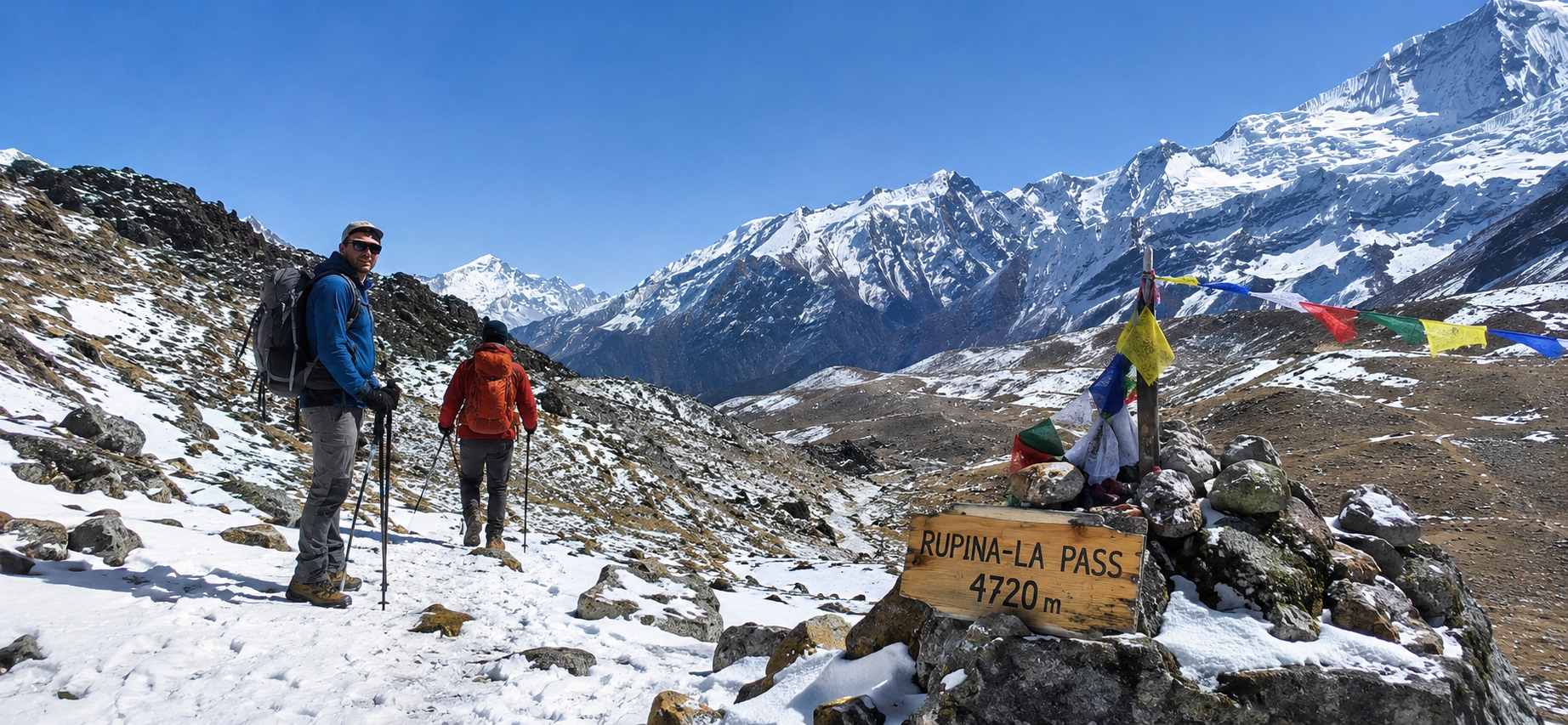
If you search widely enough for the Rupina La Pass, you will notice something before you notice any single fact about the route itself. The sources disagree. One operator lists the pass at 4,610 meters. Another gives 4,643. A third says 4,720, and a fourth, on the same page, contradicts its own itinerary with a completely different number. A handful of older trip accounts, written by people who actually crossed it rather than people writing marketing copy about it, settle somewhere around 4,600 to 4,700 meters without claiming more precision than that.
We are going to be honest about that from the outset, because this is not a trek where false confidence helps anyone. The Rupina La is a real, crossable, infrequently used high pass in the hills west of the Manaslu massif, and it genuinely does link the Gorkha side of the region, in the general direction of the Ganesh Himal, with the Buri Gandaki valley that leads up into Tsum Valley and the Manaslu Circuit. That much is well supported across a wide range of sources, from small specialist trekking agencies to older expedition style trip narratives. Beyond that, published information thins out fast. Exact altitude, exact technical difficulty, how many days a crossing takes, and what a sensible combined itinerary with Tsum Valley actually looks like vary considerably depending on who is writing about it and, we suspect, how much of that writing is a firsthand account versus a template filled in by someone who has never been near Barpak.
This article tries to separate what is reasonably well corroborated from what is extrapolation, informed by comparable remote passes elsewhere in Nepal and by cross checking several independent descriptions of the route. Where sources disagree, we say so rather than picking the number that sounds cleanest. Where nobody has published anything useful, we say that too, rather than inventing a day by day itinerary dressed up as established fact. If you are seriously considering this trek, treat this as a solid orientation and a honest map of what is known, and treat any operator’s exact numbers, including ours, as something to confirm directly before you commit.
What and Where the Rupina La Actually Is
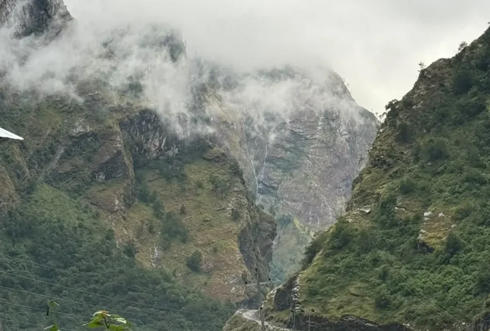
The Rupina La sits in the hill country of Gorkha district, on a ridge system that divides two very different drainages. On one side lies the upper Darondi Khola and the country around Sirandan and the large Gurung village of Barpak, reached by road and trail from Gorkha Bazaar. This is the approach most writers loosely describe as the Ganesh Himal side, since the Ganesh Himal range dominates the skyline to the west and northwest through much of the approach, even though the pass itself does not cross directly onto the Ganesh Himal massif or drop into the Ankhu Khola valley that drains that range. On the other side of the ridge, the trail descends through the Chhuling Valley, beneath the walls of Baudha Peak and Himalchuli, down to the Gurung village of Nyak on the Buri Gandaki river, which is the same river valley that carries trekkers up toward Tsum Valley in one direction and up toward Samagaon, Samdo, and the Manaslu Circuit’s own high point, the Larke La, in the other.
In plain terms, crossing the Rupina La is a way of reaching the lower Manaslu and Tsum Valley trekking area from the west, through genuinely rural Gorkha villages, instead of approaching from the south along the standard Soti Khola and Machha Khola road and trail route that almost everyone else uses. It is a side door into a region that already has only one main door.
The altitude question is where the record gets messy, and it is worth laying out honestly rather than picking a single number and pretending it settles the matter. Figures we found in reasonably serious sources include 4,610 meters, 4,643 meters, 4,650 meters, 4,700 meters, and 4,720 meters. One older, non commercial trip narrative, written in the style of a personal account rather than a sales page, describes an approach col at over 4,000 meters on the way up and does not give a separate figure for the summit of the pass itself, which suggests the final crossing point sits meaningfully higher than that intermediate col. Taken together, the most defensible statement is that the Rupina La lies somewhere in the range of about 4,600 to 4,720 meters, broadly consistent with the 4,500 to 4,720 meter range that shows up when you look across the available literature as a whole. We would not trust any single source that gives you a figure down to the exact meter, because none of the sources we found agree with each other closely enough to justify that kind of precision.
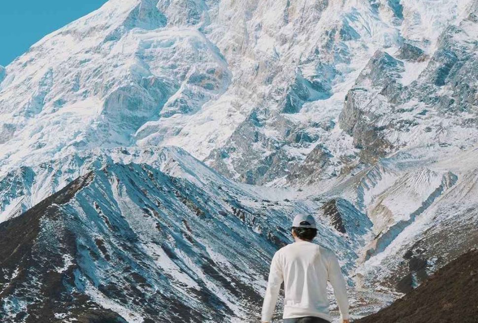
What is more useful than the exact number is the character of the altitude. This is comfortably in the zone where altitude illness is a real possibility, especially for anyone arriving quickly from lower elevations without a few days of acclimatization built in beforehand. It is also well below the altitude of true high passes like the Larke La, which tops out above 5,100 meters on most measurements, or Kang La and Thorong La in the Annapurna region. The Rupina La is a serious hill pass, not a glaciated mountaineering objective, and that distinction matters a great deal for how you should think about preparing for it.
Why So Few People Cross It
There is no single reason the Rupina La stays quiet while the Manaslu Circuit and Tsum Valley a short distance away have grown into established, well guided treks with a real teahouse network. It is a combination of ordinary, practical obstacles that, stacked together, filter out all but a small number of parties each year.
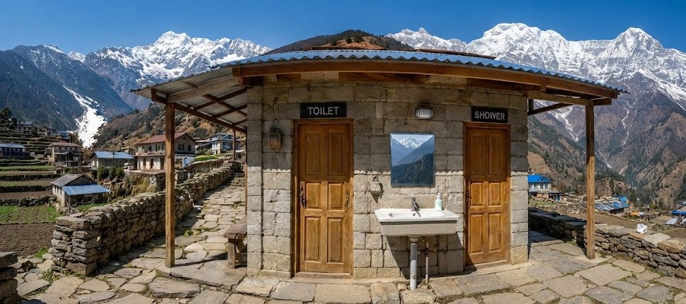
First, there is no teahouse infrastructure on the pass itself or for a meaningful stretch on either side of it. Every serious description of the route agrees on this point even when they disagree on everything else. The villages of Barpak and Laprak on the Gorkha side have lodges and homestays, and the villages along the Buri Gandaki on the Manaslu and Tsum side have a developed teahouse trail, but the connecting stretch over the pass, through camps with names like Rupina La Phedi, Gai Kharka, and Sanrung Kharka, has nothing but open ground, herders’ shelters, and whatever tents your crew carries in. Several sources describe three to six consecutive nights with no permanent settlement at all along parts of this stretch. That means anyone attempting it needs a full camping setup, which immediately raises the cost, the logistics, and the number of staff required, and it rules out the kind of lightweight, lodge to lodge independent trekking that has made nearby routes so accessible to ordinary travelers.
Second, the region is legally restricted. The Manaslu area, which includes the approaches to Tsum Valley and the lower Buri Gandaki, was only opened to foreign trekkers in 1991, and it remains a controlled area today, meaning independent trekking without a licensed guide is not permitted on the standard routes, let alone on a side route like this one that barely appears in official trekking literature at all. That legal structure alone keeps casual trekkers away, since you cannot simply show up and walk it. You need a Nepali trekking agency willing and equipped to run a camping crew over unfamiliar terrain, and only a small number of operators, mostly ones who already run Manaslu and Tsum trips and have staff with personal experience of the Gorkha side villages, seem to offer it at all.
Third, the route finding is genuinely difficult, and this point is corroborated by the only detailed firsthand account we could locate that reads like an actual trip record rather than promotional writing. That account describes faint trails through uninhabited wilderness, a reliance on hiring a local cattle herder as an improvised guide because the route was not obvious even to an experienced trekking party, and porters building improvised shelters from bamboo and reeds on a night when no hut existed at all. This is not a waymarked trail. It is a route that exists because generations of local herders and traders used it, and that kind of route can disappear into grass and scree the moment nobody has walked it in a season or two.
Fourth, snow lingers on this pass in a way that catches people out. The same firsthand account describes waist deep fresh snow on the northern, Chhuling side during a crossing, and mentions a secondhand report of another group failing to cross in the opposite direction because of deep snow on that same northern aspect. A separate, independently written route description recommends carrying rope and ice stakes specifically for conditions where the final snow slopes below the col have hardened into ice, phrased as a conditional requirement rather than a standing one. Put plainly, this is a pass where the weather and the state of the snowpack in the days before your crossing can matter more than anything in your itinerary, and a narrow seasonal window compounds that risk rather than eliminating it.
Fifth, and more mundanely, there is simply very little demand. Most trekkers who come this far into the Manaslu region are already satisfied by Tsum Valley or the Manaslu Circuit on their own, both of which deliver extraordinary scenery, genuine cultural depth in Tsum, and a proper high pass crossing at Larke La, all with a functioning teahouse network and an established permit process. Adding several extra days of camping, extra permit paperwork, and a route finding risk that the standard circuit does not have is a hard sell to all but a specific kind of trekker, so the agencies that do offer it keep small, specialist operations rather than mass market product lines.
Who This Trek Actually Suits
Given all of that, it is worth being direct about who should and should not be looking at the Rupina La as an option. This is not a trek for someone’s first trip to Nepal, and it is not a trek for someone who wants a guaranteed, predictable schedule. It suits a fairly narrow kind of traveler.
- Trekkers who have already completed at least one or two serious high altitude treks in Nepal or a comparable range, so that acclimatization, cold weather camping, and long walking days are familiar rather than new experiences layered on top of each other.
- Groups or individuals genuinely comfortable with camping for several consecutive nights, including nights with no nearby settlement, basic sanitation, and weather that can turn without warning.
- People who are drawn specifically to the idea of a rarely used route for its own sake, rather than people chasing a particular summit, photo, or badge. If what you want is Instagram worthy mountain views with minimum effort, Tsum Valley or the standard Manaslu Circuit will give you that more reliably and far more safely.
- Travelers willing to accept real schedule uncertainty. A route this lightly documented, with route finding this dependent on current conditions and local knowledge, is not one where you can lock in a flight home the morning after a planned pass crossing with much confidence.
- Parties willing to pay for a properly staffed crew, since this is not a route to attempt with a single guide and no porters, and it is certainly not a route for solo trekkers without a support team, both because of the restricted area rules and because of the plain physical risk of getting lost or stranded alone on faint trail with nobody nearby to help.
Conversely, if you are hoping to add “cross Rupina La” to a two week Nepal holiday as a minor detour, or if camping for multiple nights without a proper lodge sounds unpleasant rather than appealing, this is very likely the wrong trek for you, and that is a completely reasonable conclusion to reach. There is no shame in choosing the standard Tsum Valley Trek or Manaslu Circuit Trek instead. Both are superb treks in their own right, and both exist precisely because they solved the infrastructure and access problems that the Rupina La has never had reason to solve.
Difficulty and the Technical Reality
It helps to be precise about what kind of difficulty this actually is, because “difficult” gets used loosely across trekking marketing and it can mean anything from steep stairs to genuine mountaineering. The Rupina La is not a technical climb in the sense that the Larke La, Thorong La, or most named Nepal trekking passes are not technical climbs either. There is no fixed glacier travel on the standard line, and most descriptions do not call for crampons or a rope as a routine requirement.
That said, calling it “non technical” without qualification would be misleading. The clearest and most specific technical details we found, again from that one detailed firsthand trip account, describe an awkward traverse across slabs that sloped the wrong way for comfortable footing, where one party member slipped and was only saved by grabbing a small tree. The same account describes having to kick steps into firm snow on the final slopes below the col, which is a basic snow travel skill but a real one, not something you want to be learning for the first time at 4,600 meters with a loaded pack. A separate, independently written route note recommends rope and ice stakes specifically “if hard snow or ice” are encountered on the final approach, which tells you two things at once: that these conditions occur often enough to be worth mentioning by name, and that they are not universal, since the same note treats them as conditional rather than a fixed requirement of the route.
Route finding as the real hazard
If there is one technical hazard that comes up more consistently than snow or exposure, it is simply losing the trail. Multiple sources, including a commercial operator’s own trip description, specifically attribute the difficulty of the pass to the risk of trekkers losing the route rather than to altitude or steepness on their own. This matches the firsthand account’s description of faint paths through uninhabited terrain and the need to hire a local herder as an impromptu guide. The practical conclusion is straightforward: a crossing of the Rupina La is not something to attempt with a generalist trekking guide who has not personally walked this specific route, or walked it recently. Trail conditions, cairns, and even the preferred line across a given boulder field or snow slope can shift from year to year on a route this lightly used, and local knowledge, ideally from a guide or crew with direct experience of this particular crossing, is doing real safety work here that a map or GPS track cannot fully replace.
Snow, scree, and the descent that bites back
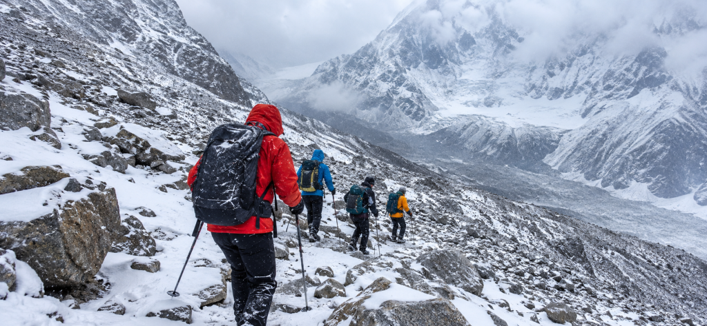
Several independent descriptions single out the descent, rather than the ascent, as the harder or more dangerous half of the crossing. Loose scree and boulder fields below the col require careful footwork, visibility can close in with cloud and wind on the approach ridges, and the northern side of the pass, dropping toward the Chhuling Valley and ultimately Nyak, appears to hold snow longer into the trekking season than the southern, Gorkha facing side. That asymmetry is worth remembering if you are planning direction of travel. Several operators run the trek from Gorkha toward Tsum Valley, climbing the drier southern aspect and descending the snowier northern one, which on balance seems like the more sensible direction, though we did not find a source that stated this preference explicitly as a deliberate safety choice, so take it as our own reasoning from the geography rather than a documented recommendation.
None of this means the Rupina La requires mountaineering certification or specialist equipment as standard. It means it requires fitness, sure footedness on uneven and sometimes icy ground, comfort with genuine exposure to weather and isolation, and above all, a guide and crew who know the specific route, not just the region in general.
Permits You Will Realistically Need
Because the Rupina La sits inside and adjacent to legally restricted trekking areas, permits are not optional paperwork, they are the thing that makes the trek legal at all. We are deliberately not going to quote you exact fee figures here, because permit costs for Nepal’s restricted areas change periodically, sometimes by season and sometimes year to year, and a specific dollar figure given in an article like this one would likely be wrong within a year even if it were accurate today. What we can say with reasonable confidence is which categories of permit you are likely to need, based on consistent agreement across multiple independent sources describing the route.
| Permit or requirement | Why it applies |
|---|---|
| Manaslu restricted area permit | The Buri Gandaki side of the Rupina La, including Nyak and the villages up toward Tsum Valley and Samagaon, falls inside Nepal’s restricted Manaslu area, which requires this special permit in addition to ordinary trekking registration. |
| Manaslu Conservation Area entry | The same corridor lies within the Manaslu Conservation Area, a separate conservation area entry fee from the restricted area permit itself, consistently listed alongside it by operators who run this route. |
| Tsum Valley restricted area permit | If you extend into Tsum Valley proper, which most sensible itineraries combining this pass with the Manaslu region do, Tsum has its own restricted area permit requirement layered on top of the Manaslu permit. |
| Annapurna Conservation Area entry | Only relevant if your route continues over Larke La and down toward Dharapani and Besisahar to finish the Manaslu Circuit, since that final stretch falls inside the Annapurna Conservation Area. |
| Licensed guide requirement | Restricted area rules in this part of Nepal require trekkers to travel with a government licensed guide, and in practice, given the route finding difficulty described above, a guide with specific experience of this crossing matters more than the legal minimum. |
A note on TIMS, the trekkers’ information management system that older sources mention for this and nearby routes. Permit systems and registration requirements in Nepal have shifted more than once in recent years, and we would rather tell you plainly that we are not confident what the current standing requirement is than guess. Confirm the current permit structure, including whether TIMS or an equivalent registration is still required, directly with a licensed Nepali trekking operator before you plan around it. The same goes for every fee figure. A reputable agency that regularly runs Manaslu and Tsum trips will know the current numbers because they pay them every season, and that is a far better source than any article, including this one, that is not updated in real time. If your trip planning touches the standard Manaslu Circuit at any point, it is also worth reading a dedicated Manaslu trekking permit guide for the baseline rules that apply before you layer the Rupina La specific questions on top.
The Best Season, and Why the Window Is Narrow
Across the sources we reviewed, autumn and spring are consistently named as the two viable windows, which is unremarkable on its own since that is true of nearly every high route in Nepal. What is more specific to the Rupina La is the reasoning underneath that general answer. The route depends on crossing a snow prone col without fixed infrastructure, on faint trail that needs to be visually readable rather than buried, and on camp sites that are tolerable rather than storm battered. That combination narrows the realistic window further than it would for a teahouse supported trek like the standard Manaslu Circuit, where lodges give you somewhere warm and dry to wait out bad weather at almost any point.
Autumn, roughly from late September through November, is the window most sources lean toward, and it fits the general pattern across the Nepal Himalaya of a short, clear, stable stretch of weather after the summer monsoon clears and before winter snow begins to build up seriously at this kind of altitude. Given the firsthand reports of significant snow lingering on the northern side of the pass even within the broader autumn to spring range, the earlier part of that autumn window, rather than late November, seems like the more conservative choice, though we are extrapolating that specific preference from the pattern of reports rather than citing a source that states it outright.
Spring, roughly March through May, also appears as a recommended window in several sources, and it has the advantage of rhododendron forest in bloom on the lower approaches through Gorkha, which several route descriptions mention as a genuine highlight of the walk in to the pass. Spring weather in the Nepal hills tends to bring more afternoon cloud and a greater chance of fresh snow at this altitude than deep autumn, so if route finding is your main concern, autumn likely offers a marginally more predictable trail. Both seasons sit either side of the problem, and neither eliminates it. Winter is essentially ruled out by every source that mentions season at all, for the ordinary reason that cold and heavy snow at this altitude would make an unmarked, teahouse free route considerably more dangerous than it already is. Monsoon season, June through August, is ruled out even more firmly, since cloud, rain, leeches, and the risk of landslip on the lower forested sections would make both route finding and basic travel miserable and unsafe.
If we had to compress this into one sentence of practical advice, it would be to aim for the earlier half of the autumn trekking season, treat spring as a reasonable but slightly less certain alternative, and build real flexibility into your schedule either way, because a route this dependent on current snow conditions is not one where you want your flight home to depend on a precise crossing date chosen months in advance.
How Rupina La Compares to Other Remote Nepal Passes
It helps to place the Rupina La against a couple of other high passes that trekkers in Nepal sometimes compare it to, partly because the comparison clarifies what kind of challenge this actually is, and partly because if the Rupina La turns out not to suit you, these are reasonable alternatives that scratch a similar itch for remoteness.
| Pass | Approximate altitude | Infrastructure | Character |
|---|---|---|---|
| Rupina La | About 4,600 to 4,720 meters, sources disagree | No teahouses on the pass stretch, full camping required for several nights | Faint trail, route finding risk, snow prone northern side, no fixed rope needed in normal conditions |
| Larke La, standard Manaslu Circuit | Commonly cited around 5,100 to 5,160 meters | Teahouses close on both approaches, a well established trekking trail over the pass itself | Higher and colder, but a clear, heavily used trail with other trekking groups usually present on the same day |
| Ganja La, Langtang to Helambu link | Commonly cited around 5,100 meters | No permanent teahouses directly on the pass, camping generally required | Similarly prone to snow outside a narrow window, also known for route finding difficulty on the Helambu side descent |
The honest summary is that Rupina La is lower than either of these comparison passes, which sounds like it should make it easier, but the lack of any supporting trail infrastructure and the specific route finding difficulty push its real world difficulty closer to theirs than the altitude alone would suggest. Larke La, despite being considerably higher, is in some ways the less risky crossing today simply because so many trekkers cross it every autumn and spring that the trail stays visible and the camps, now mostly simple lodges rather than tents, are known quantities. Remoteness and altitude are not the same axis of difficulty, and the Rupina La is a useful reminder of that.
Combining Rupina La With Tsum Valley or the Manaslu Circuit
This is the section where we want to be most careful about the line between what sources actually support and what we are reasoning out from geography and general trekking pacing in Nepal, because nearly every operator itinerary we found for this combination disagreed with the others on day counts, even when they agreed closely on the route’s broad shape.
What is well supported, appearing consistently across multiple independent itineraries, is the overall shape of a combined trip: drive from Kathmandu to Gorkha Bazaar, trek up through Gurung villages including Barpak and often Laprak, continue to a high camp below the Rupina La, cross the pass, descend through the Chhuling Valley to Nyak on the Buri Gandaki, and from there join the established Manaslu and Tsum Valley trekking network, either heading up into Tsum Valley toward villages like Chumling, Chhokangparo, and Mu Gompa, or continuing up the main Buri Gandaki toward Samagaon, Samdo, and the Larke La to complete a full Manaslu Circuit, before exiting either back down the Buri Gandaki to Arughat Bazaar or onward over Larke La to Dharapani and Besisahar.
What is not well supported, and where we are extrapolating, is the exact number of days each stage takes. Published itineraries for what sounds like essentially the same route range from fourteen days to twenty four days, and in more than one case the day by day breakdown we could extract did not even match the headline duration quoted elsewhere on the same page. Some of that variation is genuine, since one operator’s nineteen day trip might include extra Kathmandu sightseeing days, a different starting point like Machha Khola instead of Gorkha, or a full Manaslu Circuit extension over Larke La that another operator’s shorter version skips entirely. Some of it, frankly, looks like inconsistent or carelessly maintained marketing content rather than a real reflection of two genuinely different treks.
A reasonable composite outline, clearly flagged as our own extrapolation
With that caveat firmly in place, here is a composite outline of how a Rupina La crossing combined with Tsum Valley plausibly paces out, built from cross checking the stages that multiple sources agree on and filling gaps with reasoning based on typical daily walking times on comparable remote Nepal routes. Treat the broad sequence as reasonably solid and the exact day count as illustrative rather than a fixed promise.
- Arrival in Kathmandu, with time for permit paperwork and gear checks, since restricted area permits generally need to be arranged in advance by your agency.
- A drive of roughly six to ten hours from Kathmandu to Gorkha Bazaar or onward to Barpak, depending on road conditions, which several sources note can add real time variability of its own.
- Two to four days trekking from Barpak through intermediate Gurung settlements and forest camps, gaining altitude gradually toward a base camp or high camp below the pass, generally in the 3,400 to 4,000 meter range based on the camp altitudes multiple sources agree on.
- One long, demanding day crossing the Rupina La itself and descending into the Chhuling Valley to a lower camp, widely described as the hardest single day of the trip, typically seven to eight hours or more depending on snow conditions.
- Two to three further days descending through forest camps to reach Nyak and the Buri Gandaki, where the route joins the established Manaslu and Tsum trekking trail.
- From Nyak, an extension of roughly seven to ten additional days to properly explore Tsum Valley up to Mu Gompa and back, or alternatively a continuation up the Buri Gandaki toward Samagaon and the Larke La to complete a full Manaslu Circuit, which would add a comparable number of days again.
- An exit either back down the Buri Gandaki through Jagat, Machha Khola, and Soti Khola to Arughat Bazaar and a drive to Kathmandu, or, if the Larke La option was taken, onward over that pass to Dharapani and Besisahar.
Depending on which extension you choose and how many rest and acclimatization days you build in, a sensible total for Kathmandu to Kathmandu lands somewhere in the range of eighteen to twenty five days. That is a genuinely long trip by most standards, and it is worth planning your work and travel schedule around that reality rather than the shorter figures some marketing pages quote, since those shorter figures do not obviously account for proper acclimatization, bad weather contingency days, or a full Tsum Valley extension done at a sensible pace.
Gear and Camping Logistics for a Trip Like This
Because teahouses disappear for several consecutive nights on this route, your packing list needs to assume full expedition style camping support rather than the lighter kit that suffices on the standard Tsum Valley Trek or Manaslu Circuit Trek, where a sleeping bag and basic layers are often enough on top of what the lodges provide.
- A four season sleeping bag rated well below freezing, since camp altitudes on this route regularly sit above 3,500 meters and can approach 4,000 meters before the pass itself.
- A sleeping mat with real insulation value, not just cushioning, since you will be sleeping on tent floors and sometimes directly on frozen or damp ground rather than a lodge bed.
- Full waterproof and windproof outer layers, given the consistent mentions of cloud, wind, and sudden weather changes on the approach ridges and at the pass itself.
- Sturdy, broken in trekking boots with good ankle support, suited to loose scree, boulder fields, and potentially icy or snowy ground near the col, rather than lightweight trail shoes.
- Trekking poles, which multiple sources recommend for the steep, loose sections on both approaches to the pass.
- A basic first aid kit including altitude illness medication discussed in advance with a doctor, and a clear personal evacuation plan agreed with your agency before you start, since this route sits well beyond any realistic helicopter staging point for quick response.
- Headlamp with spare batteries, since an early, sometimes predawn start is commonly described for the pass crossing itself to maximize firm snow conditions and clear weather before afternoon cloud builds.
- Gaiters, given the realistic chance of soft or deep snow on the northern descent even outside the depths of winter.
Your agency will typically supply the shared camping equipment itself, meaning tents, kitchen gear, dining shelter, and the staff to carry and run all of it, but you should confirm exactly what is included before booking, since the gap between a well equipped crew and an underprepared one matters far more on a route like this than it would on a teahouse trek where a missing piece of communal gear is merely inconvenient rather than genuinely risky.
Risk, Honest Expectations, and the Case for a Specialist Operator
We want to end the practical part of this article with a direct statement about risk, because the whole point of being honest about thin sourcing is undermined if we then soften the risk picture to make the trek sound more appealing than it is.
The Rupina La is not a dangerous pass in the way a technical mountaineering route is dangerous, with crevasses, serious rockfall exposure, or the need for roped glacier travel as standard. But it combines several smaller risks that add up to something a casual trekker should not underestimate: a faint, easily lost trail through genuinely uninhabited country, a northern aspect that holds snow longer than most itineraries account for, weather that can close in with little warning on exposed ridgelines, camp sites with no backup shelter if conditions turn bad, and a location far enough from any road or regular helicopter staging area that a problem here takes considerably longer to resolve than a similar problem on the main Manaslu Circuit trail, where other trekking groups, phone signal in some villages, and shorter evacuation distances all provide a margin of safety that simply does not exist on this side route.
None of that means the trek should not be attempted. It means it should be attempted with a specific kind of preparation: a trekking agency and guide with genuine, specific experience of this exact crossing rather than general Manaslu region experience alone, a realistic and flexible schedule rather than a tight one, full camping equipment maintained to a standard you have personally verified rather than taken on trust from a glossy brochure, and a clear conversation in advance about what the evacuation plan actually is if something goes wrong at a camp with no settlement and no vehicle access for a day or more in either direction. Ask any operator you are considering directly how many times their own guides have personally crossed this specific pass, in which direction, and in which season. The honest answer to that question will tell you more about whether a given company can run this trek safely than anything in their marketing material, including the exact altitude figure they quote.
Should You Actually Do This Trek
If you have read this far and the narrow season, the camping requirement, the route finding risk, and the general thinness of published information have made you more cautious rather than more excited, that is probably the correct reaction, and the standard Tsum Valley Trek or Manaslu Circuit Trek will reward you just as richly without asking you to accept this level of uncertainty.
If, on the other hand, those same facts have made the idea more appealing rather than less, because what you actually want from a Nepal trek is the feeling of walking somewhere that has not been smoothed into a predictable product, the Rupina La is a real and legitimate option, provided you approach it with a serious, specifically experienced operator, a flexible autumn or spring window, full camping readiness, and realistic expectations about both the physical demands and the gaps in what anyone, including this article, can promise you about the exact conditions you will meet. It will not give you a dramatic glaciated summit or a famous photograph that everyone recognizes. It will give you several days of genuinely quiet trail through Gurung villages, forest, and open ridgeline, a crossing that still depends on local knowledge rather than a worn path and trail signs, and a direct, physical sense of why the Manaslu region’s main trekking routes developed where they did, by walking the alternative that never got the same investment.
That, in the end, is probably the most honest reason to recommend the Rupina La Pass to the right kind of trekker. Not because it is the hardest or the highest or the most photogenic route near Manaslu, but because it is one of the very few left in this part of Nepal that still asks something real of the people who cross it.
Related Manaslu and Tsum Valley Guides
Most trekkers reach the start of this route through the Tsum Valley Trek, covered stop by stop in Tsum Valley Trek: A Village by Village Guide. Before you go anywhere this remote, it is worth reading Money, SIM Cards and Staying Connected on the Manaslu Circuit Trek, since the connectivity situation only gets harder past Mu Gompa. The Manaslu Conservation Area guide and the Manaslu trekking permit guide cover the paperwork that applies to this side of the region as well.