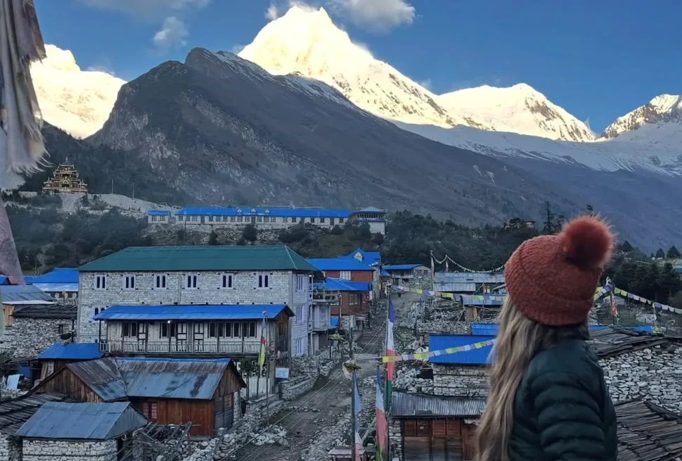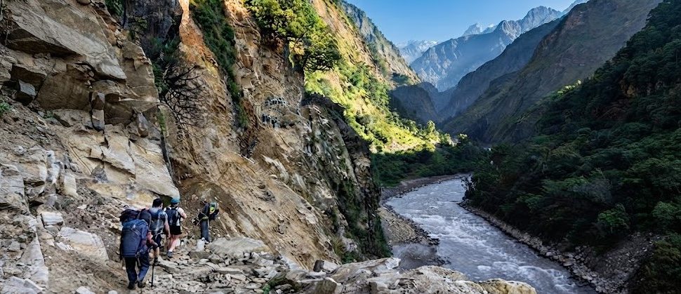
Namrung is the village where the Manaslu Circuit truly changes character. At 2,630 meters in the upper Budhi Gandaki valley, it sits above the gorge terrain that has defined the circuit since the road-end and opens into a broader valley with Tibetan Buddhist architecture, mani walls, chortens, and the first significant mountain views that hint at the scale of the peaks ahead. For most trekkers on the Manaslu Circuit Trek, arriving at Namrung after the long gorge section below feels like surfacing from an enclosed world into one that has suddenly opened. The walls of the gorge have given way to terraced slopes, the forest has diversified into the rhododendron-oak mix of the higher altitude, and the sky above is no longer a narrow strip between cliff faces but a broad canopy that includes, for the first time on the circuit, glimpses of the high peaks that give the route its name.
This guide covers everything a trekker needs to know about Namrung: its location, the approach from Deng, its accommodation and food, its cultural character as a Nubri Tibetan Buddhist village, the mountain views available from its position, the wildlife of the surrounding forest and slopes, and the trail that continues toward Lho, Samagaun, and the high passes above.
Namrung Village: Location and Basic Facts
Namrung sits at 2,630 meters on a terrace on the left bank of the Budhi Gandaki in Gorkha District. The village is substantially larger than the small settlements of the gorge section below, with more teahouses, more permanent houses, and a more established infrastructure. It is the first village on the upper circuit where the Nubri Tibetan Buddhist culture is fully dominant rather than transitional.
| Detail | Information |
|---|---|
| Elevation | 2,630 meters (8,629 feet) |
| District | Gorkha District, Gandaki Province |
| Cultural zone | Nubri Tibetan Buddhist |
| Teahouses | 5 to 8 operating during trekking season |
| Permit checkpoint | Secondary checkpoint — permits checked again here |
| Days from Deng | 1 day (5 to 6 hours walking) |
| Days from Lho | 1 day (3 to 4 hours walking) |
| Mountain views | Ganesh Himal group visible; beginning of high-peak panoramas |
| Cultural features | Mani walls, chortens, gompa above village, prayer flags throughout |
| Position in circuit | Fifth or sixth overnight stop from the road-end |
The administrative position of Namrung within the Manaslu Conservation Area means that permits are checked here a second time, confirming that trekkers entering the higher sections of the valley have the correct documentation. The checkpoint at Namrung is less intensive than the one at Jagat below, usually a brief inspection and registration rather than a full permit review, but all trekkers should have their MCAP and MRAP permits accessible. Above Namrung, another check point is at Lho before the final approach to the Samagaun and the restricted inner zone.
The Trail from Deng to Namrung
The walk from Deng to Namrung is one of the longer days on the lower Manaslu Circuit, covering approximately 14 to 16 kilometers with around 770 meters of net altitude gain. It takes most trekkers five to six hours and passes through several small communities, including the culturally significant village of Ghap, before arriving at Namrung on its broad terrace above the valley.
| Section | Distance | Altitude | Time | Notes |
|---|---|---|---|---|
| Deng to Rana | ~4 km | +200m | 1.5 hours | Forest trail, gorge continues |
| Rana to Bihi Phedi | ~3 km | +130m | 1 hour | River crossing; bridge at Bihi Phedi |
| Bihi Phedi to Ghap | ~3 km | +200m | 1 hour | Tibetan cultural character strengthens; chortens appear |
| Ghap to Namrung | ~4 km | +240m | 1.5 to 2 hours | Forest path; Namrung terrace comes into view |
Ghap: The Cultural Gateway
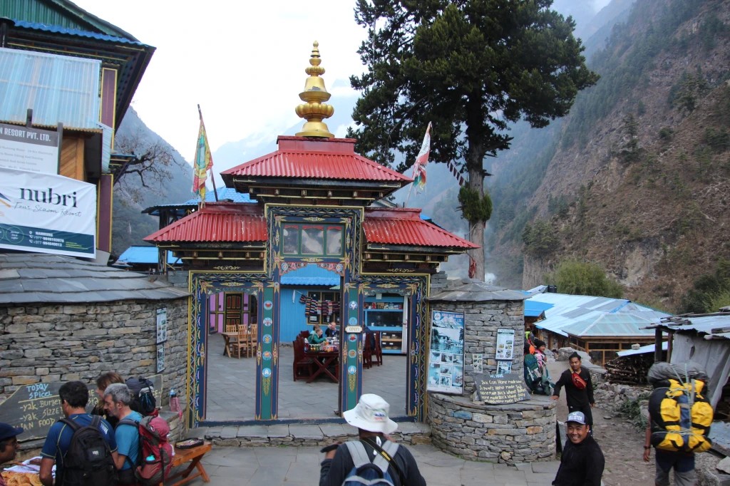
Ghap is the village that trekkers pass through on the way from Deng to Namrung where the Tibetan Buddhist character of the upper valley becomes unmistakable. The village entrance is marked by a traditional stone gate flanked by chortens, and the entry itself passes through a mani wall that requires trekkers to pass on the left side in the clockwise direction that Tibetan Buddhist custom prescribes. The houses at Ghap have the whitewashed exterior walls, flat roofs, and carved wooden window frames that characterize Nubri architecture. A small gompa sits on the slope above the village.
For trekkers who have been walking through the gorge section from the road-end, Ghap represents the first full expression of the cultural landscape that will define the circuit for all the days above. The mani wall at the village entrance is the right moment to pause, turn around on the left side as custom requires, and acknowledge that you are entering a different world from the one you have been walking through. The Nubri people of the upper valley take these cultural markers seriously, and respect for local customs in how trekkers pass through villages and religious sites makes a genuine difference in the quality of the interaction between trekkers and communities.
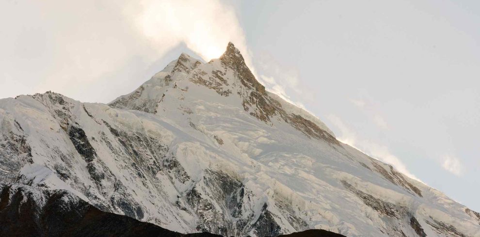
The 9 Days Manaslu Circuit Trek, also known as the Short Manaslu Circuit Trek, is designed for trekkers who want…
Nubri Culture at Namrung
Namrung is a fully Nubri village. The Nubri are an ethnic Tibetan community who have lived in the upper Budhi Gandaki valley for centuries, maintaining a cultural identity rooted in Tibetan Buddhism, the Tibetan language, and the agricultural and pastoral practices of the high Himalayan valleys. They are distinct from the Tamang, Gurung, and other hill communities of the lower valley, and their presence in the upper circuit gives the Manaslu region one of its defining cultural qualities.
Architecture
The architecture of Namrung follows the Nubri pattern: two-story stone houses with flat roofs used for drying grain and firewood, whitewashed exterior walls, and windows with elaborately carved wooden frames painted in dark red and other colors. The upper stories are often used for living and sleeping, while the ground floor houses animals and storage in the winter months. The flat roofs carry prayer flags on tall poles, and the flags create a constant visual animation in the mountain wind that gives Nubri villages their characteristic look from a distance.
The chortens and mani walls that punctuate the village path and the approaches to Namrung are maintained structures with active religious significance. Mani walls are long walls built of flat stones on which the mantra “Om Mani Padme Hum” is carved repeatedly, stone by stone, as an act of merit. The accumulated stones on some mani walls represent decades or centuries of devotional work. These structures should always be passed on the left side, keeping them to your right, in accordance with Tibetan Buddhist practice. This is not an obscure formality but a basic expression of respect for the religious landscape you are walking through.
The Gompa Above Namrung
There is a small gompa (monastery) above Namrung on the slope behind the village. It is not as large or architecturally significant as the gompas at Lho and Samagaun above, but it serves the religious needs of the Namrung community and is the center of the village’s Buddhist life. The gompa is staffed by a small number of monks or a caretaker monk, and trekkers who wish to visit should remove their shoes before entering and dress modestly. Photography inside the gompa is subject to the permission of whoever is present; always ask before photographing religious interiors or objects. A small donation to the gompa’s maintenance fund is appropriate when visiting.
Daily Life in Namrung
The daily rhythm of Namrung is organized around agriculture, livestock, and the requirements of the Buddhist calendar. The main crops at this altitude are buckwheat, barley, potatoes, and some vegetables. Livestock management, particularly of yaks and cattle, is central to household economics: yak dung is collected for fuel, yak milk is processed into butter and cheese, and the animals themselves are used for transport of goods along the routes above the trail that jeeps and horses cannot reach. During the trekking seasons, the teahouse economy adds a significant income stream that supplements and in some years dominates the agricultural income for families with teahouse operations.
Mountain Views from Namrung
Namrung is the first village on the Manaslu Circuit where significant high-mountain views become available. The opening of the valley above the gorge section and the increased elevation provide sightlines that were not possible in the enclosed gorge below. The primary mountain visible from Namrung is not Manaslu itself, which is still screened by intervening ridges, but the Ganesh Himal group to the southeast, a complex of peaks whose highest summit reaches 7,422 meters.
| Peak | Height | Visibility from Namrung | Direction |
|---|---|---|---|
| Ganesh Himal (Tsum) | 7,422m | Good from upper part of village and nearby ridges | Southeast |
| Ganesh Himal II | 7,118m | Visible alongside main Ganesh Himal | Southeast |
| Ngadi Chuli (Peak 29) | 7,871m | Partial views from certain vantage points | North-northeast |
| Manaslu | 8,163m | Not visible from Namrung; appears from Lho above | North |
| Himalchuli | 7,893m | Not visible from Namrung village | Northeast |
The Ganesh Himal group is one of the more visually accessible high-mountain complexes in Nepal, and the views of it from Namrung and the surrounding ridges give trekkers their first prolonged encounter with peaks above 7,000 meters on the Manaslu Circuit. For trekkers who have not previously experienced views of peaks at this scale, the sight of the Ganesh Himal from the terraces of Namrung in the early morning, lit by the first direct sunlight of the day while the village below is still in shadow, is a genuinely memorable experience.
The best views from Namrung are obtained from the upper part of the village and from the slopes above it. A short walk up the hillside behind the village, to the area near the gompa or beyond it, extends the panorama significantly. The views are best in the early morning before haze builds in the valley, and in October and November when the post-monsoon clarity is at its peak.
Accommodation in Namrung
Namrung has five to eight teahouses operating during the main trekking seasons. It is more developed in its accommodation infrastructure than the gorge villages below, reflecting its status as a well-established overnight stop on the standard circuit itinerary. The teahouses range from basic family-run operations to slightly larger establishments that have expanded their capacity in response to growing trekker numbers.
| Facility | Availability at Namrung | Notes |
|---|---|---|
| Room type | Twin-sharing rooms, basic to moderate | Foam mattresses with blankets; some teahouses have attached rooms |
| Hot shower | Available at some teahouses (solar or bucket) | Usually charged extra; not always reliable in cold weather |
| Electricity | Solar power in most teahouses | Device charging available; fee may apply |
| Wi-Fi | Limited — some teahouses have satellite connection | Speeds are low; messaging is possible but streaming is not |
| Phone signal | Ncell coverage reasonable; NT variable | Better than gorge section below; worse than lower valley |
| Common room heating | Wood or yak dung stove | Essential in the evenings; the main gathering space for trekkers |
| Room cost | NPR 300 to 600 per person | Often reduced or free if eating at the teahouse |
| Blanket quality | Adequate but variable | Always use your own sleeping bag from this altitude onward |
At 2,630 meters, the nights at Namrung are genuinely cold throughout the trekking seasons. In October, nighttime temperatures can drop below zero, and in November they regularly reach minus five to minus eight degrees Celsius. A sleeping bag rated to at least minus five degrees Celsius is necessary for comfort, and a sleeping bag liner adds further warmth if needed. The teahouse blankets alone are not adequate for cold nights at this altitude.
Food in Namrung
The food at Namrung is the best of the lower circuit villages in terms of variety and execution, reflecting the larger size of the village and the more competitive teahouse environment. Dal bhat remains the cornerstone of the menu and is served with the usual unlimited refills. Thukpa, the Tibetan noodle soup, is widely available and well-suited to the altitude and temperature. Tibetan bread, which appears more frequently on menus from Namrung northward, is a simple unleavened bread cooked on a griddle and served with butter, jam, or honey for breakfast.
| Food Category | Items Available | Typical Price Range |
|---|---|---|
| Main meals | Dal bhat, thukpa, fried rice, vegetable curry, pasta, noodles | NPR 450 to 700 |
| Tibetan dishes | Tibetan bread, tsampa porridge, butter tea, thukpa | NPR 200 to 500 |
| Breakfast | Porridge, eggs, toast, pancakes, Tibetan bread with jam | NPR 250 to 450 |
| Soups | Garlic soup, tomato soup, vegetable soup, noodle soup | NPR 200 to 350 |
| Snacks | Biscuits, chocolate, nuts, dried fruit, energy bars | NPR 100 to 350 |
| Hot drinks | Milk tea, black tea, ginger tea, butter tea, instant coffee | NPR 100 to 200 |
| Water | Boiled water, mineral water | NPR 100 to 200 per liter |
Butter tea (po cha in Tibetan) is the traditional hot drink of the Tibetan-influenced upper valley. It is made from strongly brewed tea, yak butter, and salt, churned together into a smooth, fatty, slightly salty beverage. For trekkers accustomed to sweet or neutral hot drinks, butter tea is an acquired taste. The fat and salt content is nutritionally appropriate for the cold and the physical demands of the altitude, and many trekkers come to appreciate it by the time they reach Samagaun and Samdo above. Namrung is a good place to try it for the first time, in a teahouse where you can also order something else if you find it genuinely unpalatable.
The 9 Days Manaslu Circuit Trek, also known as the Short Manaslu Circuit Trek, is designed for trekkers who want…
Wildlife and Natural Environment Around Namrung
The forest around Namrung is temperate oak and rhododendron in character, a rich and diverse ecosystem at the mid-altitude range of the Manaslu Conservation Area. The diversity of tree species produces a complex multi-story forest with a well-developed understory that supports a wide range of bird and mammal species. The combination of forest, open terraced slopes, and the rocky ridges above the village creates a varied habitat mosaic that is productive for wildlife observation.
| Species | Type | Habitat | Observation Likelihood |
|---|---|---|---|
| Himalayan monal pheasant | Bird | Forest understory and open slopes | Good — the male’s plumage is unmistakable |
| Blood pheasant | Bird | Rhododendron and mixed forest at higher edges | Moderate — small groups in the forest |
| Satyr tragopan | Bird | Dense forest understory | Uncommon but present; spectacular male |
| Himalayan griffon | Bird | Soaring on thermals above the valley | Very common; large wingspan conspicuous |
| Lammergeier | Bird | Soaring over ridges and valley | Regularly seen; distinctive wedge tail |
| Red panda | Mammal | Bamboo forest above the village | Rare; habitat is present and suitable |
| Himalayan black bear | Mammal | Forest; most active at dusk and dawn | Rarely seen; tracks sometimes visible |
| Himalayan tahr | Mammal | Rocky slopes above the treeline | Begins to appear at this altitude |
| Musk deer | Mammal | Dense forest; mostly nocturnal | Rare but present; no antlers, distinctive tusks |
The Himalayan monal pheasant is the wildlife highlight around Namrung. Nepal’s national bird, the male monal is one of the most spectacular birds on earth: an iridescent combination of green, purple, copper, and blue feathers with a curved metallic-green crest, covering a body the size of a large chicken. The females are brown and cryptically marked. Monals are found in the forest understory and on open slopes, particularly in the early morning when they come down to feed in the open before retreating to the forest. The trail between Deng and Namrung passes through prime monal habitat, and encounters are not uncommon for trekkers who walk quietly and watch the forest edges.
Weather at Namrung Through the Seasons
At 2,630 meters, Namrung has a climate that is cooler and more variable than the gorge villages below. The monsoon season brings heavy rain and cloud from June through September. The spring and autumn seasons are the best for trekking, with clear skies, good visibility, and temperatures that are cold at night but manageable during the day. The winter months bring snow to the ridges above and increasingly cold temperatures that make the teahouses the only practical warm space.
| Season | Months | Daytime Temp | Nighttime Temp | Conditions | Trekking Suitability |
|---|---|---|---|---|---|
| Spring | March to May | 8°C to 18°C | -2°C to 6°C | Rhododendrons in bloom March-April; some afternoon cloud; good visibility | Excellent; April best |
| Monsoon | June to September | 10°C to 18°C | 5°C to 12°C | Heavy rain most days; views obscured; trails wet and slippery; leeches in forest | Not recommended |
| Autumn | October to November | 5°C to 15°C | -5°C to 2°C | Best clarity; dry trail; spectacular mountain views; cold nights | Excellent; peak season |
| Winter | December to February | -2°C to 8°C | -10°C to -3°C | Cold, possible snow on trail above Namrung; pass likely closed | Not recommended; upper circuit inaccessible |
The rhododendron bloom in the forest around Namrung is one of the most celebrated natural events on the lower Manaslu Circuit. The rhododendron forests on the slopes between Deng and Namrung and from Namrung upward to Lho come into full bloom in April, covering the hillsides in pink and red flowers that create a visual contrast with the white peaks visible above the forest line. March and April trekkers who pass through Namrung during this window experience one of the most beautiful natural displays in Nepal, one that the autumn season, for all its superior clarity and mountain views, cannot replicate.
Trail from Namrung to Lho
After Namrung, the circuit continues northward to Lho, the next overnight stop at 3,180 meters. This is a shorter day than the approach from Deng, covering approximately eight to ten kilometers with around 550 meters of net altitude gain and taking most trekkers three to four hours. The trail passes through a diverse section of the valley that includes forest, open pasture sections, and the culturally rich village of Sho before reaching Lho.
| Section | Distance | Altitude Change | Time | Notes |
|---|---|---|---|---|
| Namrung to Lihi | ~3 km | +150m | 1 hour | Mixed forest; some open sections; prayer flags on slopes |
| Lihi to Sho | ~3 km | +200m | 1 hour | Sho is a significant Nubri village with gompa |
| Sho to Lho | ~3 km | +200m | 1 to 1.5 hours | Steady climb through forest; Lho visible on its terrace |
Sho is a village worth pausing at on the Namrung-to-Lho section. It has a significant gompa and a cluster of traditional Nubri houses that, combined with the mountain backdrop that begins to reveal itself as the trail gains altitude, give trekkers an excellent photographic and cultural subject. The short day from Namrung to Lho means that there is time to explore Sho without feeling rushed, making the Namrung-to-Lho day one of the more relaxed and enjoyable stretches of the entire circuit.
Altitude and Acclimatization at Namrung
At 2,630 meters, Namrung is approaching the altitude range where acclimatization becomes relevant. Most healthy adults do not experience significant altitude symptoms at this elevation if they have ascended gradually, which the standard circuit itinerary ensures. However, the body is beginning to work harder to extract oxygen from the thinner air, and some trekkers notice mild symptoms here for the first time: a slight headache in the evening, a night of disrupted sleep, or reduced appetite. These are normal responses to altitude gain and do not require intervention beyond rest, hydration, and avoiding alcohol.
The golden rule of acclimatization is to ascend slowly and to never ascend with symptoms that are worsening rather than improving. The standard circuit itinerary from Namrung ascends to Lho the following day, gaining 550 meters, and then either continues to Shyala and Samagaun over the next one or two days or takes a rest day at Lho. This pace is appropriate for most trekkers. Those who notice significant symptoms at Namrung should consider a rest day at Namrung rather than ascending to Lho until the symptoms resolve.
| Symptom Category | Signs at 2,630m | Appropriate Response |
|---|---|---|
| Normal altitude adjustment | Mild headache, slightly disrupted sleep, mild fatigue | Rest, hydrate well (3+ liters per day), avoid alcohol, monitor |
| Mild AMS | Persistent headache, reduced appetite, notable fatigue | Do not ascend further until symptoms improve; rest at Namrung |
| Moderate AMS | Headache not relieved by ibuprofen, nausea, dizziness | Rest; consider descending to Ghap or Deng if no improvement |
| Severe AMS warning | Confusion, loss of coordination, breathlessness at rest | Descend immediately; medical emergency |
Practical Information for Namrung
Cash
There is no ATM at Namrung. All transactions are in cash Nepali rupees, and the last ATM before the circuit was at Arughat or the road-end below. Trekkers who did not carry sufficient cash should be aware that the options for obtaining more money diminish with each day above the road-end. The standard advice is to carry enough for the entire circuit from Namrung to the exit point on the Annapurna side, plus a 30 percent buffer for unexpected expenses.
Mobile Network
Namrung has reasonable Ncell coverage in most parts of the village. Nepal Telecom coverage is more variable. Above Namrung, connectivity becomes progressively less reliable, with the gorge sections between Lho and the high villages above having the worst reception. Namrung is a good point at which to make calls, send messages, and perform any data-intensive tasks before the connectivity deteriorates in the sections above.
Supplies and Shopping
Namrung has small shops attached to some teahouses where basic trekking supplies can be purchased. Snacks, energy bars, batteries, and basic medications are sometimes available. The range is limited, and prices are higher than in Kathmandu or at the road-end. Trekkers should have all essential equipment and supplies before reaching Namrung, treating this as the last point at which supplementary purchases are plausible rather than the first emergency supply point.
Namrung in the Context of the Full Circuit
Namrung represents the gateway to the Tibetan cultural zone of the Manaslu Circuit. Below it, the valley has been a mix of hill cultures and transitional communities. Above it, the route enters the Nubri heartland: a sequence of villages, Lho, Shyala, Samagaun, Samdo, each more distinctly Tibetan in character and each positioned at a higher altitude than the last, culminating in the acclimatization village of Samagaun and the final teahouse at Dharmasala before the Larke La Pass.
| Village | Elevation | Cultural Character | Key Feature |
|---|---|---|---|
| Deng | 1,860m | Transitional to Tibetan | Deep gorge, waterfalls, dense forest |
| Ghap | 2,160m | Nubri Tibetan Buddhist | Cultural gateway; chorten gate, mani wall |
| Namrung | 2,630m | Nubri Tibetan Buddhist | First major Tibetan village; Ganesh Himal views |
| Lho | 3,180m | Nubri Tibetan Buddhist | Ribung Gompa; first Manaslu views |
| Shyala | 3,500m | Nubri Tibetan Buddhist | Treeline; best mountain views on lower circuit |
| Samagaun | 3,530m | Nubri Tibetan Buddhist | Main acclimatization village; Pungyen Gompa |
| Samdo | 3,875m | Nubri / border Tibetan | Last permanent village; Rui La acclimatization hike |
Frequently Asked Questions About Namrung
What is the elevation of Namrung on the Manaslu Circuit?
Namrung sits at 2,630 meters (8,629 feet) above sea level. It is located in Gorkha District on the left bank of the Budhi Gandaki and is the first major Nubri Tibetan Buddhist village that trekkers encounter on the Manaslu Circuit. It is approximately 770 meters above Deng below and 550 meters below Lho above, and represents a significant step in both altitude and cultural character from the gorge villages of the lower circuit.
Can you see Manaslu from Namrung?
Manaslu itself is not visible from Namrung village due to intervening ridges. The primary high-mountain view from Namrung is of the Ganesh Himal group to the southeast, whose highest peak reaches 7,422 meters. From certain high points above the village, near the gompa or on the ridge above, partial views of peaks further north may be available. Manaslu becomes fully visible from Lho above Namrung, and the views continue to improve dramatically as the circuit ascends to Shyala and Samagaun.
Is there a monastery at Namrung?
Yes, there is a small gompa above Namrung village. It is not as large or architecturally prominent as the monasteries at Lho (Ribung Gompa) or Samagaun (Pungyen Gompa), but it serves as the religious center of the Namrung community and can be visited by trekkers who approach it respectfully. Visitors should remove shoes before entering, dress modestly, and ask permission before photographing. A donation to the gompa is appreciated. The walk up to the gompa also provides improved views over the valley and of the Ganesh Himal group.
What is the best time to visit Namrung?
October is the best month for trekking through Namrung. The post-monsoon clarity gives excellent mountain views, the trail is dry and firm, and the temperatures are cold at night but pleasant during the day. Spring, particularly April, is the second best time and has the added attraction of the rhododendron bloom in the forests below and around Namrung, which creates one of the most visually spectacular natural displays in the Himalayan region. The monsoon season from June through September is not suitable for trekking this section of the circuit.
How many teahouses are at Namrung?
Namrung typically has five to eight teahouses operating during the main trekking seasons. This makes it one of the better-served overnight stops on the lower circuit in terms of accommodation choice. The teahouses range from basic to moderately comfortable, and most offer hot meals, warm common rooms, and basic accommodation. During the peak months of October and November, Namrung can accommodate multiple trekking groups simultaneously, which is not the case for the smaller villages below and above.
What cultural customs should trekkers respect at Namrung?
The primary cultural custom to observe at Namrung and all villages above it on the Manaslu Circuit is to pass mani walls, chortens, and other religious structures on the left side, keeping them to your right as you walk. This corresponds to the clockwise direction of circumambulation in Tibetan Buddhist practice. Entering gompas requires removing shoes and behaving quietly and respectfully inside. Photography of people should always be done with permission. The teahouse families and local community appreciate respectful behavior and genuine curiosity about their culture. Simple greetings in Tibetan, “Tashi Delek” (good luck or auspicious greetings), are appreciated and often elicit a warm response.
The Gateway Opened
Namrung is the point where the Manaslu Circuit becomes the experience that people who have done it remember most vividly. The gorge section below is dramatic and beautiful in its own right, and the physical challenge of the lower valley days is real and worthwhile. But from Namrung northward, the circuit adds cultural depth, mountain scale, and the specifically Tibetan quality of landscape and human settlement that distinguishes the Manaslu route from other Himalayan treks.
The Ganesh Himal from the terraces of Namrung in the early morning, the butter tea from the kitchen of a teahouse that has been feeding trekkers for years, the mani wall at the village edge with its accumulated devotional stone work, and the trail continuing north through the rhododendron forest toward the higher peaks: these are the elements that Namrung contributes to the journey. They are not the climax of the circuit, which is still many days away, but they are the opening of the passage through which the climax becomes possible.
If you are planning a Manaslu Circuit Trek and want to understand how Namrung fits into your itinerary, what the cultural landscape of the upper valley offers, and how to make the most of the transition from the gorge section to the Tibetan highlands above, contact us at Manaslu Treks. We have guided trekkers through this section of the circuit many times and can help you approach the journey in a way that honors both its physical demands and its cultural richness.
The Manaslu Circuit Trek is a spectacular journey around Mount Manaslu (8,163 m), the eighth-highest mountain in the world. Located…