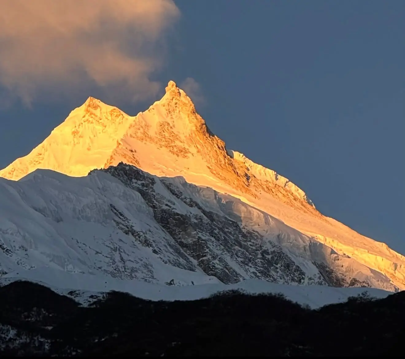
Mount Manaslu rises to 8,163 meters above sea level in the Gorkha district of Nepal, the eighth highest mountain on earth and one of only fourteen peaks anywhere that clear the 8,000 meter mark. For decades it lived in the shadow of Everest and Annapurna, quietly holding its place among the giants of the Himalaya while far fewer outsiders came to see it up close. That is changing. Trekkers who want silence on the trail, villages that still run on yak bells and prayer flags instead of traffic, and a walk that feels like a genuine discovery rather than a queue are now heading straight for Manaslu.
This guide is meant to be the single most complete resource on Mount Manaslu available anywhere online. It goes far beyond a basic overview. We pulled together geology research papers, expedition archives, conservation area records, Guinness World Records data, local ethnography and festival calendars, permit and cost breakdowns, and firsthand route descriptions to build something a serious trekker, a climber, or simply a curious reader can actually use. The Manaslu Circuit Trek is the centerpiece of this region, and we cover its route, permits, cost, difficulty and best season in full detail, along with the mountain’s geology, climbing history, culture, wildlife, environmental challenges and everything else that makes this corner of Nepal worth understanding properly.
Mount Manaslu at a Glance
Before diving into the details, here is a snapshot of the mountain and the region around it.
| Category | Detail |
|---|---|
| Elevation | 8,163 meters or 26,781 feet |
| World ranking | 8th highest mountain on earth |
| Prominence | 3,092 meters, ranked 80th globally, an ultra prominent peak |
| Mountain range | Mansiri Himal, part of the greater Himalaya |
| Location | Gorkha district, Gandaki Province, west central Nepal |
| Coordinates | 28 degrees 32 minutes 58 seconds North, 84 degrees 33 minutes 43 seconds East |
| Meaning of name | From Sanskrit manasa, meaning intellect or soul, often translated as mountain of the spirit |
| Local name | Kutang |
| First ascent | May 9, 1956 by Toshio Imanishi and Gyalzen Norbu |
| First winter ascent | January 12, 1984 by Maciej Berbeka and Ryszard Gajewski |
| Easiest route | Snow and ice climb on the northeast face |
| Rock type | Manaslu leucogranite, part of the High Himalayan leucogranite belt |
| Protected area | Manaslu Conservation Area, 1,663 square kilometers, declared 1998 |
| Trekking route length | Around 177 kilometers for the full Manaslu Circuit |
| Highest point on trek | Larkya La at 5,106 meters |
| Trek opened to foreigners | 1991 |
| Death rate on the mountain | Approximately 2.4 to 2.5 percent of summit attempts |
Where Is Mount Manaslu Located
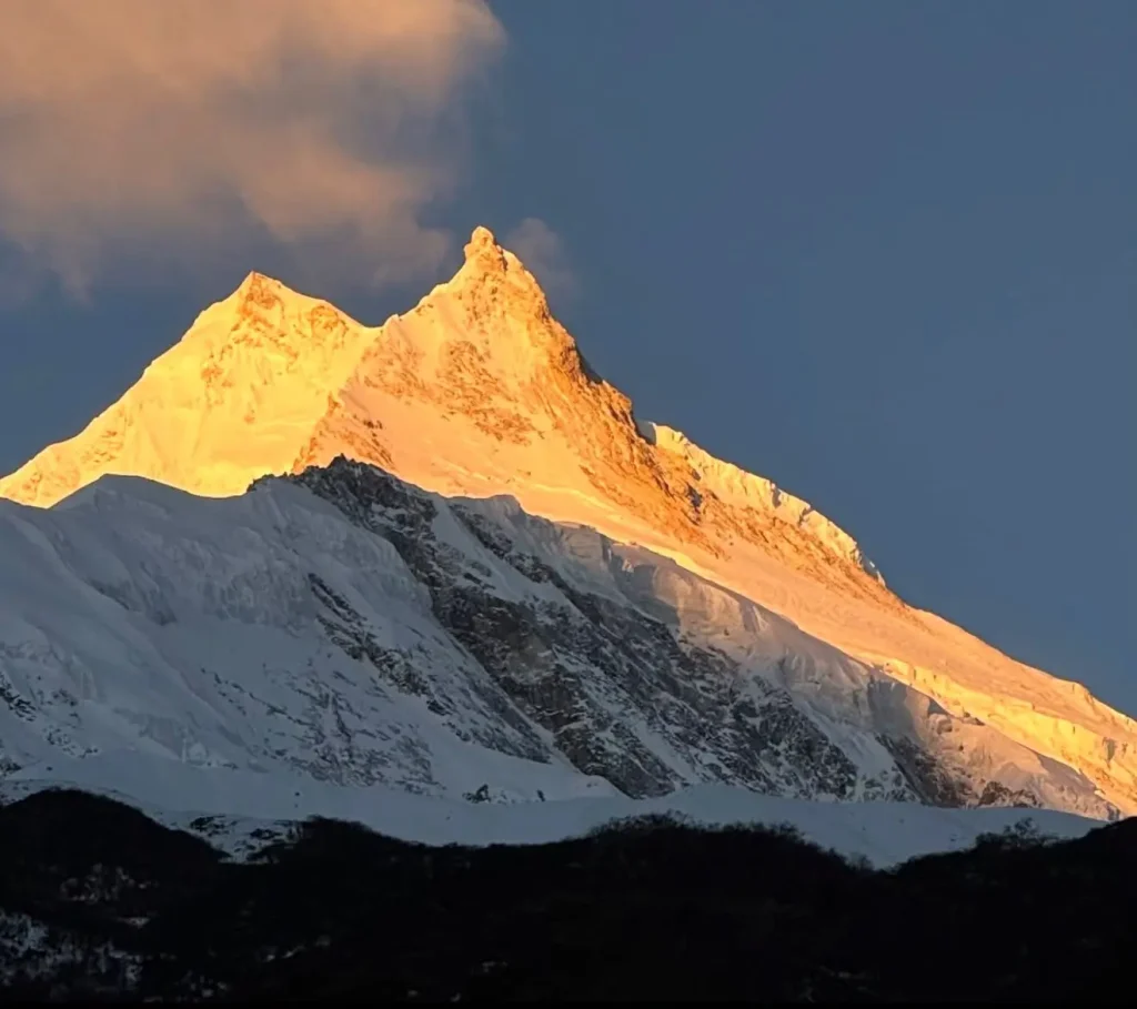
Manaslu sits in the Mansiri Himal, a smaller range within the greater Himalaya, in west central Nepal. It rises inside Gorkha district, roughly 64 kilometers east of Annapurna, the tenth highest mountain on earth, and about 48 kilometers north of Gorkha town as the crow flies. The peak straddles the boundary between the lush middle hills of Nepal and the dry, wind scoured plateau that leads toward Tibet, which is part of why the region feels like two different worlds stitched together along one trail.
Unlike Everest, which sits close to the Tibetan border in the Khumbu region and pulls in huge numbers of visitors every season, Manaslu is tucked further west, reached by driving out of Kathmandu through Gorkha town and into the Budhi Gandaki river valley. The remoteness is part of the appeal. Roads are only slowly creeping into the lower villages, so much of the trekking route still depends on foot trails, suspension bridges and mule trains for supplies. Neighboring high peaks visible from the region include Himalchuli at 7,893 meters, Ngadi Chuli at 7,871 meters, Shringi Himal at 7,187 meters, Ganesh Himal, and across the valley, the long wall of the Annapurna range.
The mountain is bounded to the east by Ganesh Himal and the gorge of the Buri Gandaki river, to the west by the deep valley of the Marsyangdi Khola beneath the Annapurna range, and to the south by the town of Gorkha, historic seat of the Shah dynasty that unified modern Nepal in the eighteenth century.
The Meaning Behind the Name Manaslu
The name Manaslu comes from the Sanskrit word manasa, meaning intellect or soul. Locally the mountain is often called Kutang, and in Tibetan the name breaks down loosely to a flat place, a reference to a shoulder of terrain near the summit where the ridge briefly levels before the final push upward. Nepali script renders the name as मनास्लु. Whichever version you use, the meaning points to something spiritual rather than simply geographic, and that reputation still shapes how the mountain is treated by the communities who live beneath it.
Local Buddhist monasteries consider the peak sacred, and there is a long standing belief that disrespecting the mountain invites disaster, a belief that has shaped relations with foreign expeditions for decades. As you will read further down, this was not just folklore. It played a direct role in how early Japanese expeditions were received in the 1950s, and it still informs how climbing teams and trekking agencies operate in the region today.
How Manaslu Was Formed: The Geology Story
Most trekking articles skip this entirely, but Manaslu happens to be one of the most scientifically important mountains in the Himalaya, not because of its height, but because of what it is made of. The upper mountain is built from what geologists call the Manaslu leucogranite, a pale, mineral rich granite that forms part of what is known as the High Himalayan leucogranite belt, a chain of similar intrusions that runs along the crest of the range from Kashmir to Bhutan. Manaslu is considered the single most studied pluton in that entire belt.
Research using uranium and thorium lead dating of monazite crystals, tiny minerals trapped inside the granite, shows that the rock did not form in one event. It came together in two separate pulses of melting deep in the crust. The first, called the Larkya La phase, dates to about 22.9 million years ago. The second, called the Bimtang phase, followed roughly 4 million years later at about 19.3 million years ago. Both phases are believed to have formed through a process called dehydration melting, where intense heat and pressure squeezed water out of mica bearing rocks deep underground, lowering their melting point enough that they turned to magma and pushed upward into the crust.
What makes this significant is the mechanism behind the heat. Scientists studying the Manaslu granite believe the magma was generated by friction along the Main Himalayan Thrust, the giant fault where the Indian tectonic plate continues to grind beneath the Eurasian plate today. That same collision, still active and still measurable by GPS satellites, is what pushed the entire Himalaya skyward starting around 50 million years ago and continues to lift peaks like Manaslu by a few millimeters most years, offset by erosion, earthquakes and glacial carving.
In plain terms, when you look up at Manaslu, you are looking at a chunk of the earth’s crust that melted, rose, and solidified during two distinct episodes millions of years apart, all driven by the same tectonic collision that is still happening under your feet on the trek today.
The Manaslu Conservation Area
The land around the mountain falls inside the Manaslu Conservation Area, a protected zone covering 1,663 square kilometers that was formally declared on December 28, 1998 under Nepal’s National Parks and Wildlife Conservation Act. It is managed by the National Trust for Nature Conservation, a Nepali non profit that operates under a government mandate that was originally granted for ten years and later extended for a second decade after local communities requested the trust continue its work.
The conservation area covers all seven wards of what is now Tsumnubri Rural Municipality, including the settlements of Sirdibas, Chumchet, Chhekampar, Bihi, Prok, Lho and Samagaun, home to roughly 9,000 people in total. Geographically the area splits into three zones, the Nubri valley in the northwest, Kutang in the middle section, and Tsum valley in the northeast. On the ground, the project runs two field offices, in Philim and Sirdibas, a liaison office in Gorkha bazaar, and tourist check posts at Jagat and Samagaun where permits are checked. Local Conservation Area Management Committees receive ongoing training so that communities themselves play a direct role in managing forests, wildlife and tourism income.
Before this protected status existed, the Nepali government only opened the region to trekkers in 1991, which is notably later than Everest and Annapurna, both of which welcomed foreign visitors decades earlier. That late opening is a large part of why the villages along the route still feel unspoiled. Teahouses exist now, but the pace of development has stayed slow and deliberate compared with the more commercialized trails elsewhere in Nepal.
Climate and the Six Life Zones of the Trail
Few treks in Nepal pack in as much environmental variety as this one. Starting from around 600 to 900 meters near Arughat, the trail climbs through six distinct climatic zones on its way to Larkya La.
- Tropical and subtropical zone, roughly 1,000 to 2,000 meters. River valleys thick with banana trees, rice terraces and subtropical forest.
- Temperate zone, roughly 2,000 to 3,000 meters. Pine and oak forest with a noticeably cooler, milder climate.
- Sub alpine zone, roughly 3,000 to 4,000 meters. Rhododendron and birch forest thinning as elevation increases.
- Alpine zone, roughly 4,000 to 5,000 meters. Open meadows, dwarf shrubs and increasingly bare, rocky ground.
- Arctic zone, above 4,500 to 5,000 meters. Permanent snow line territory where almost nothing grows and the wind carries snow across bare rock.
Annual rainfall across the region averages around 1,900 millimeters, most of it falling during the monsoon between June and September. Here is a fuller month by month picture of what temperatures actually look like along the main trekking corridor.
| Month | Daytime temperature | Nighttime temperature | What to expect |
|---|---|---|---|
| January | Negative 4 to 8 degrees Celsius | Negative 12 to 15 degrees Celsius | Cold, snowy trailhead, quiet season |
| February | 0 to 6 degrees Celsius | Negative 10 to 16 degrees Celsius | Tail end of winter, clear mountain views |
| March | 5 to 14 degrees Celsius | Negative 4 to 12 degrees Celsius | Warming days, longer daylight hours |
| April | 6 to 15 degrees Celsius | Negative 2 to 6 degrees Celsius | Peak spring season, rhododendrons blooming |
| May | 12 to 14 degrees Celsius | 0 to negative 5 degrees Celsius | Good visibility, light precipitation begins late month |
| June | 4 to 6 degrees Celsius | Negative 6 to 12 degrees Celsius | Monsoon onset, slippery trail sections |
| July | 12 to 22 degrees Celsius | 4 to 10 degrees Celsius | Peak monsoon, heavy rain and upper snowfall |
| August | 14 to 24 degrees Celsius | 4 to 9 degrees Celsius | Continuing monsoon, leeches at lower elevation |
| September | 12 to 16 degrees Celsius | 0 to 8 degrees Celsius | Transition toward autumn, improving conditions |
| October | 10 to 14 degrees Celsius | Negative 2 to 6 degrees Celsius | Best trekking month, stable and clear |
| November | 6 to 14 degrees Celsius | Negative 4 to 12 degrees Celsius | Still excellent, early snow possible late month |
| December | 0 to 5 degrees Celsius | Negative 12 to 16 degrees Celsius | Cold, Larkya La can be snowbound |
Flora and Fauna of the Manaslu Conservation Area
The conservation area is one of the richer wildlife habitats in Nepal precisely because it stayed closed to outsiders for so long. Botanically the diversity is remarkable, with researchers recording somewhere between 1,500 and 2,000 plant species across roughly nineteen forest types, dominated by rhododendron in the mid hills and Himalayan blue pine higher up near Ganesh Himal and the Shringi range. Local Buddhist customs have played an unusual role in conservation here, since monasteries in the region have historically enforced hunting bans on their own land, allowing wildlife populations to recover in areas that would otherwise have seen heavy pressure.
| Species | Type | Conservation status | Where you might see it |
|---|---|---|---|
| Snow leopard | Mammal | Vulnerable | High alpine zones above Samdo, rarely seen directly |
| Red panda | Mammal | Endangered | Dense rhododendron and bamboo forest, lower valley |
| Himalayan musk deer | Mammal | Endangered | Forested slopes, sub alpine zone |
| Himalayan tahr | Mammal | Near threatened | Steep rocky slopes near Samagaon and Samdo |
| Blue sheep | Mammal | Least concern | Open alpine terrain near Larkya La |
| Grey wolf | Mammal | Least concern regionally rare | Higher pastures, occasionally seen at dusk |
| Asian black bear | Mammal | Vulnerable | Forested mid hill zones |
| Mainland serow | Mammal | Near threatened | Steep forested terrain, elusive |
| Golden eagle | Bird | Least concern | High ridgelines and passes |
| Himalayan monal (impeyan pheasant) | Bird | Least concern, Nepal’s national bird | Forest edges, mid elevation |
| Himalayan griffon | Bird | Near threatened | Circling high above the valley |
Researchers have documented over 110 bird species, 33 mammal species, 11 butterfly species and 3 reptile species within the conservation area boundaries, making it one of the more biologically significant protected zones in the Nepal Himalaya despite its relatively modest size.
The People of Nubri and Tsum
Two main ethnic groups call this valley home, the Nubri and the Tsum, separated by the point where the river branches near Chhikur. Nubri has seen visitors since Nepal first opened to tourism in 1950, so its culture has adapted somewhat to outside contact. Tsum, on the other hand, remained closed to foreigners far longer and still holds onto older traditions, art and language more tightly than almost anywhere else in Nepal.
Lower down the valley, Gurung communities dominate the middle hills, a group well known across Nepal and internationally for serving in the Brigade of Gurkhas. As the trail climbs closer to the Tibetan border, Bhotia communities take over, identifiable by flat roofed stone houses built to handle heavy snow and a strong Buddhist devotion expressed through mani walls, chortens and monasteries that line the trail. Walking this route is as much a cultural experience as a mountain one, and trekkers who take time to sit with a cup of butter tea in a village kitchen often remember those conversations as much as the scenery.
Tsum valley in particular carries a special spiritual identity. Local tradition holds that the valley is Beyul Kyimolung, a hidden valley of happiness blessed by the eighth century Buddhist master Guru Rinpoche, and treated by local Buddhists as one of several sacred hidden lands scattered across the Himalaya.
The Shyagya Tradition: A Valley Where Nothing Is Killed
One of the most remarkable cultural facts about this region, and one that rarely appears in standard trekking guides, is the Shyagya tradition of Tsum valley. Rooted in Tibetan Buddhist principles of ahimsa, or non violence, Shyagya designates the entire valley as a sacred no killing zone where harming any living creature is strictly prohibited. The tradition blends religious belief with practical environmental stewardship, treating every life form as equally deserving of protection.
While its roots trace back to older Buddhist mythology tied to the valley’s sacred status, Shyagya was formally written down in 1921 when the religious teacher Drukpa Rinpoche, Ngawang Palzang, drafted a signed agreement banning killing throughout Tsum. Local leaders reinforced the rules again in 1939, and the valley marked its centennial in 2021. The tradition sets out seven specific prohibitions still respected today.
- No hunting of wild animals
- No trapping of animals or birds
- No honey hunting
- No selling of domestic animals for slaughter
- No killing of animal calves
- No transporting animals through the valley for slaughter elsewhere
- No lighting fires in pasturelands or forests
For trekkers, this means Tsum valley is not only culturally distinct but also one of the more intact wildlife corridors in the entire Manaslu region, a direct result of a century old community commitment rather than government regulation alone.
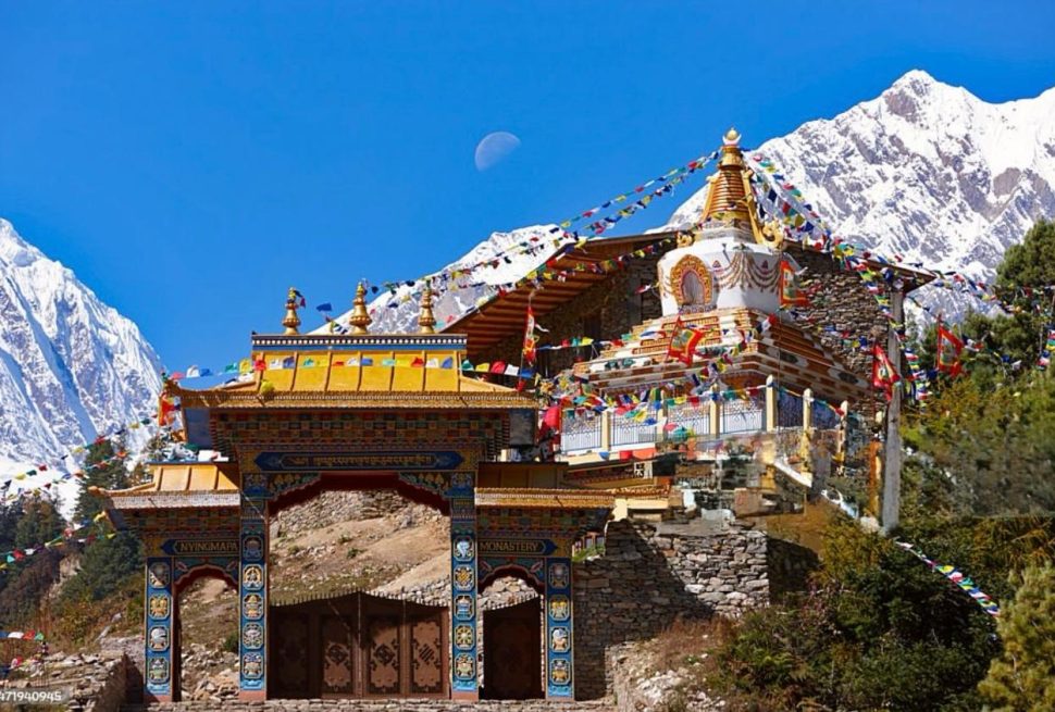
Monasteries and Sacred Sites of the Manaslu Region
Buddhist monasteries and nunneries are scattered along the entire trekking corridor, many of them centuries old and still active as centers of religious life rather than tourist attractions. Here are the major ones you are likely to see or hear about along the way.
| Monastery | Location | Approximate elevation | Notes |
|---|---|---|---|
| Gumba Lungdang | Nubri valley, Gorkha district | 3,200 meters | Tibetan Buddhist monastery known for detailed wood carving and murals |
| Mu Gompa | Northern Tsum valley | 3,700 meters | Among the oldest and largest in the region, Nyingma school, built in the late seventeenth century |
| Pungyen Gompa | Near Samagaon, at the base of Manaslu | 4,050 meters | Sacred meditation retreat, site of the 1954 tragedy that shaped early expedition relations |
| Rachen Gompa | Tsum valley | 3,240 meters | One of the region’s largest nunneries, home to 200 to 300 nuns since 1905 |
| Serang Gompa (Shringi Gompa) | Near Bihi village | 3,100 meters | Remote retreat center for meditation and study |
| Ribung Gompa | Near Lho village | 3,400 meters | Known for traditional Cham masked dance ceremonies |
| Naksa Chhyoling Gompa | Philim village | 2,400 meters | A common early stopover on the standard circuit |
| Hinang Gompa | Near Lamagaon | Not specified | Popular side trip with views of Himalchuli and Manaslu |
| Namla Gompa | Near Namrung | Not specified | Holds ancient murals, texts and religious artifacts |
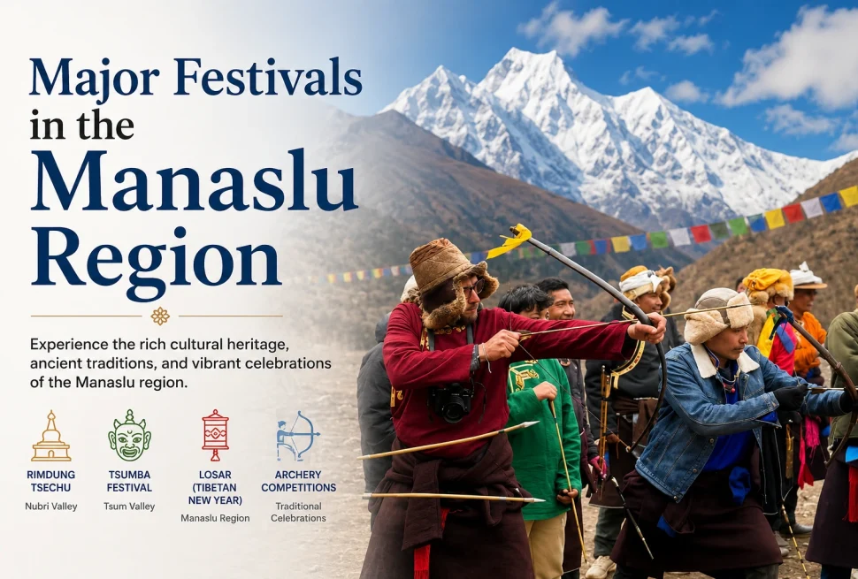
Festivals and Living Traditions Along the Trail
Trekking through Nubri and Tsum at the right time of year means a real chance of walking straight into a living festival rather than a staged performance for tourists.
| Festival | Region | Approximate timing | What happens |
|---|---|---|---|
| Gyalpo Lhosar | Nubri valley | February or March | Tibetan New Year with monastic prayers, masked cham dances, family feasts and butter lamp lighting |
| Tsampa Lhosar | Tsum valley | February or March | New year celebration centered on roasted barley flour offerings and village feasts |
| Dhachyang Festival | Tsum valley | December or January | Traditional archery competition combined with folk dance and mountain deity rituals |
| Dumji Festival | Manaslu region monasteries | June or July | Multi day festival honoring Guru Rinpoche with cham dances and sand mandalas |
| Saga Dawa | Region wide | Late May or June | Commemorates the Buddha’s birth and enlightenment with pilgrimage and butter lamp offerings |
| Yartung Festival | Nubri valley | Late August or September | Horse racing and cham dance honoring mountain deities |
| Harvest Festival | Tsum valley | September or October | Agricultural celebration with communal meals and field blessings |
| Mani Rimdu | Lho monastery | October or November | Major masked dance festival with sacred pill ceremonies and fire rituals |
| Nara Festival | Nubri and Tsum | October or November | Purification ritual with exorcism dances to banish negative forces before winter |
A Complete Climbing History of Manaslu
The mountain first drew serious attention from mountaineers in 1950, when the British climber H. W. Tilman spotted it during an Annapurna reconnaissance and judged there might be a workable route to the summit. Japanese teams took over the exploration through the early 1950s, and it was not without conflict.
- 1952. A Japanese reconnaissance team surveys the area after the monsoon.
- 1953. A fifteen member Japanese team led by Yukio Mita attempts the northeast face from a base camp at Samagaon, reaching 7,750 meters before turning back.
- 1954. Villagers at Samagaon turn a Japanese team away, blaming earlier expeditions for angering local deities after an avalanche destroyed Pungyen monastery and killed eighteen people. A large donation eventually helps rebuild the monastery, though distrust lingers for years.
- 1956. On May 9, Toshio Imanishi and Sherpa climber Gyalzen Norbu reach the summit, the first successful ascent, as part of a Japanese expedition led by Aritsune Maki. Because of lingering sensitivity, Japan does not send another expedition for fifteen years.
- 1971. Kazuharu Kohara and a partner summit via the northwest spur, the second successful ascent.
- 1972. Reinhold Messner climbs the southwest face during an Austrian expedition. The same year, an avalanche kills fifteen climbers, including ten Sherpas, at a Korean camp at 6,500 meters, still the mountain’s deadliest single incident.
- 1974. A Japanese women’s team becomes the first all female group to summit any peak above 8,000 meters.
- 1984. On January 12, Polish climbers Maciej Berbeka and Ryszard Gajewski complete the first winter ascent.
- 1986. Jerzy Kukuczka, Artur Hajzer and Carlos Carsolio make the first ascent of the mountain’s east summit.
- 1996. Carlos Carsolio summits Manaslu as his fourteenth and final 8,000 meter peak, becoming the youngest person at the time to complete all fourteen.
- 2012. An avalanche on September 23 kills eleven climbers, one of the deadliest incidents in the mountain’s history.
- 2014. Polish ski mountaineer Andrzej Bargiel sets a speed record from base camp to summit of 14 hours 5 minutes.
- 2019. Italian climber Francois Cazzanelli breaks that record with a base camp to summit ascent of exactly 13 hours, done without supplemental oxygen.
- 2021. An American Alpine Journal investigation finds that a large share of climbers who believed they had summited Manaslu had actually stopped at the mountain’s false summit.
- 2022. On September 26, an avalanche near Camp IV injures thirteen climbers and kills Nepali guide Anup Rai. The same week, American ski mountaineer Hilaree Nelson dies after falling from the summit area while descending.
- 2023. On January 6, Spanish alpinist Alex Txikon leads a team including six Sherpa climbers to the first winter summit of the mountain in more than twenty years.
Notable Records Set on Manaslu
| Record | Holder | Year | Detail |
|---|---|---|---|
| First ascent | Toshio Imanishi and Gyalzen Norbu | 1956 | Japanese led expedition, northeast face |
| First winter ascent | Maciej Berbeka and Ryszard Gajewski | 1984 | Polish expedition, normal route |
| First all female 8,000 meter summit | Japanese women’s expedition | 1974 | First time any all women team summited an 8,000 meter peak anywhere |
| Fastest base camp to summit, without oxygen | Francois Cazzanelli | 2019 | 13 hours flat, beating the previous 14 hour 5 minute record |
| First winter summit in over twenty years | Alex Txikon and team | 2023 | First successful winter ascent since the 1984 first winter ascent era |
| Fourteenth and final 8,000 meter peak for a legendary climber | Carlos Carsolio | 1996 | Youngest person at the time to complete all fourteen 8,000 meter peaks |
How Dangerous Is Manaslu Compared to Other 8000 Meter Peaks
Manaslu carries a reputation as one of the more hazardous 8,000 meter peaks, though it is far from the deadliest. Current estimates put its overall death rate around 2.4 to 2.5 percent of summit attempts, with roughly 90 fatalities recorded against close to 3,750 successful summits through 2025.
| Peak | Approximate death rate |
|---|---|
| Nanga Parbat | 20.1 percent |
| Annapurna I | 13.4 percent |
| K2 | 11.8 percent |
| Everest | 2.5 percent |
| Manaslu | 2.4 percent |
| Gasherbrum II | 2.3 percent |
| Lhotse | 1.7 percent |
| Cho Oyu | 1.3 percent |
Avalanches are the leading cause of death on the mountain, particularly on the slopes between camps two and three, followed by altitude related illness in the death zone above 7,000 meters, extreme weather exposure, and falls or technical errors on steep sections near the summit ridge. These numbers are worth knowing not to discourage anyone but because they explain why climbing Manaslu is treated with real caution by professional operators, and why hiring experienced guides is essential if you plan to attempt the summit rather than just trek around it.
The False Summit Controversy
Manaslu has become known in mountaineering circles as one of the trickier 8,000 meter peaks to verify. It has a false summit separated from the true top by a narrow, dangerous, corniced ridge that many climbers choose not to cross given the exposure involved. A 2021 investigation published in the American Alpine Journal, drawing on photographic and GPS evidence, concluded that a large share of climbers who believed they had reached the summit had actually stopped at the false one, sometimes just a few meters short in elevation but a genuinely different and more exposed location. This has become a significant issue for record keeping among climbers pursuing all fourteen 8,000 meter peaks, and reputable expedition operators today push clients to continue to the verified true summit whenever conditions allow.
Climbing Route and Camps: Base Camp to Summit
For climbers attempting the summit rather than trekking the circuit, the standard route follows the northeast face, the same line used in the first ascent. Most expeditions fly by helicopter to Samagaon, acclimatize, then move into a series of camps on the mountain itself.
| Stage | Elevation | Terrain and notes |
|---|---|---|
| Base Camp | 4,800 meters | Set up near Samagaon after acclimatization trekking |
| Camp 1 | 5,600 to 5,700 meters | Moraine and crevassed glacier terrain, 5 to 7 hours from base camp |
| Camp 2 | 6,300 to 6,400 meters | Moderate snow slopes with one short steep section, 5 to 7 hours from Camp 1 |
| Camp 3 | 6,900 meters | Snowy slopes with a short steep pitch, 4 to 5 hours from Camp 2 |
| Camp 4 | 7,300 meters | Steep terrain requiring fixed ropes and crampons, 6 to 7 hours from Camp 3 |
| Summit | 8,163 meters | Flowing snow and ice slopes, 6 to 8 hours from Camp 4, with careful navigation around the false summit ridge |
Expedition teams typically make several rotations between the lower and higher camps before the final summit push, both to stock camps with supplies and to acclimatize gradually. The autumn and spring windows remain the preferred seasons for expeditions for the same reasons they suit trekkers, namely more stable weather and lower avalanche risk than the monsoon or deep winter months.
The Manaslu Circuit Trek Explained
For the vast majority of visitors, the goal is not the summit but the trek that loops around the entire massif. The Manaslu Circuit Trek follows an old salt trading route along the Budhi Gandaki river, climbing gradually from subtropical farmland into high alpine terrain before crossing Larkya La and descending toward the Annapurna region. The full route covers around 177 kilometers and typically takes twelve to sixteen days of actual walking, with most operators recommending fourteen to sixteen days total once acclimatization and buffer days are included.
Along the way you will pass beneath ten peaks that rise above 6,500 meters, several of them over 7,000 meters, all visible from the trail without needing to leave it. The circuit only opened to independent trekking in 1991, and even now it remains a restricted area, meaning every trekker needs a licensed guide and a minimum group size of two people to obtain the required permits. If you want a shorter version of this journey, a 10 day Manaslu Circuit Trek itinerary is also available for travelers with less time, though it moves faster and gives less room for acclimatization.
Manaslu Circuit Trek Itinerary Day by Day
Itineraries vary by operator, but here is a typical fourteen day plan with approximate walking time and elevation for each stage.
| Day | Route | Altitude | Approximate walking time |
|---|---|---|---|
| 1 | Arrival in Kathmandu | 1,350 meters | Not applicable |
| 2 | Drive to Machha Khola | 930 meters | 7 to 8 hours by road |
| 3 | Machha Khola to Jagat | 1,410 meters | 6 to 7 hours |
| 4 | Jagat to Deng | 2,095 meters | 6 to 7 hours |
| 5 | Deng to Namrung | 2,900 meters | 5 to 6 hours |
| 6 | Namrung to Samagaon via Lho | 3,500 meters | 5 to 6 hours |
| 7 | Acclimatization day at Samagaon | 3,500 meters | Optional side hike, 3 to 4 hours |
| 8 | Samagaon to Samdo | 3,785 meters | 3 to 4 hours |
| 9 | Samdo to Dharamsala (Larkya Phedi) | 4,450 meters | 3 to 4 hours |
| 10 | Dharamsala over Larkya La to Bimthang | 5,106 meters at the pass, descending to 3,700 meters | 8 to 10 hours |
| 11 | Bimthang to Tilije | 2,300 meters | 5 to 6 hours |
| 12 | Drive from Dharapani to Kathmandu | 1,350 meters | 7 to 8 hours by road |
| 13 | Free day or buffer day in Kathmandu | 1,350 meters | Not applicable |
| 14 | Departure | Not applicable | Not applicable |
For a full stage by stage breakdown with distances and elevation gain, our detailed Manaslu Circuit Trek route guide goes deeper into each section of the trail.
Extended and Alternative Itineraries
Several longer or alternative itineraries let you combine the standard circuit with neighboring regions.
- Manaslu with Tsum Valley, roughly 18 to 23 days. Adds a detour into Tsum before rejoining the main circuit, taking in Mu Gompa and Rachen Gompa along the way. Our Tsum Valley and Manaslu Circuit combination trek covers the full extended route.
- Manaslu with Nar Phu Valley, roughly 20 to 22 days. Crosses both Larkya La at 5,106 meters and Kang La at around 5,306 meters, linking Manaslu with the remote Nar and Phu villages, which only opened to foreign trekkers in 2002.
- Around Manaslu with Annapurna Circuit, roughly 24 to 28 days. Instead of exiting at Dharapani, trekkers continue on toward Manang, cross Thorong La, and descend through Muktinath and the Kali Gandaki valley, effectively linking two of Nepal’s classic circuits into one extended journey.
- Manaslu Base Camp side trip. An optional add on from Samagaon that brings trekkers close to the mountain’s actual base camp for closer views without joining a climbing expedition.
Best Time to Trek and Climb Manaslu
Two windows work best for this region, matching the pattern used across most of Nepal’s high mountain trails. Autumn, running from September through November, is generally considered the top choice, with stable weather, clear skies and comfortable daytime temperatures following the end of the monsoon. October in particular tends to deliver the most reliable conditions, as shown in the monthly weather table earlier in this guide.
Spring, from March through May, is the second strong option, bringing warmer days, blooming rhododendron forests lower down the valley, and good visibility before the pre monsoon haze builds up in late May. Winter trekking, from December through February, is possible but demands serious cold weather gear and carries real risk of snow blocking Larkya La entirely. Monsoon season, June through August, is best avoided due to leeches, landslides, and clouds that hide the mountain views you came for. Climbing expeditions almost always target the pre monsoon spring window, since that period offers the calmest weather on the upper mountain, though a small number of experienced teams also attempt winter ascents.
Permits and Rules You Need to Know
Because Manaslu sits in a restricted area, the permit process is more involved than treks like Annapurna Base Camp or Poon Hill. You will need three separate permits arranged through a registered trekking agency, since independent applications are not accepted here.
| Permit | Cost, September to November | Cost, December to August |
|---|---|---|
| Manaslu Restricted Area Permit, first 7 days | 100 US dollars per person | 75 US dollars per person |
| Manaslu Restricted Area Permit, each additional day | 15 US dollars per person per day | 10 US dollars per person per day |
| Manaslu Conservation Area Permit | 3,000 Nepali rupees, flat rate | 3,000 Nepali rupees, flat rate |
| Annapurna Conservation Area Permit | 3,000 Nepali rupees, flat rate | 3,000 Nepali rupees, flat rate |
| Tsum Valley Restricted Area Permit, optional extension, per week | 40 US dollars per person | 30 US dollars per person |
A licensed guide is mandatory for this trek, and the minimum group size for permit purposes is two trekkers, not counting the guide. Solo trekking is not permitted in this region under current rules, so if you are traveling alone your agency will typically pair you with another traveler or provide the required numbers on paper. For a complete rundown of every rule, document and fee involved, our Manaslu Circuit Trek complete guide answers the most common questions trekkers ask before booking.
Complete Cost Breakdown for the Trek
Here is a fuller itemized picture of where your money actually goes on a standard fourteen day trip.
| Expense category | Typical cost |
|---|---|
| All three permits combined | Approximately 140 US dollars per person |
| Licensed English speaking guide | 20 to 30 US dollars per day |
| Porter, optional, carries up to 20 kilograms | 18 to 19 US dollars per day |
| Teahouse accommodation and three daily meals | 30 to 40 US dollars per day |
| Kathmandu to Machha Khola transport | 10 to 15 US dollars by public bus, 200 to 250 US dollars for a private jeep |
| Dharapani to Besisahar or Kathmandu return transport | 20 to 25 US dollars |
| Hot shower along the trail | 2.50 to 4 US dollars each time |
| Wifi access at teahouses | 5 to 8 US dollars per day where available |
| Device charging | 1 to 2 US dollars per device per charge |
| Guide and porter tips | 5 to 30 US dollars per day, informal but expected |
Put together, a standard twin share package with a guide but no personal porter typically starts around 986 US dollars per person, and rises toward 1,300 US dollars or more once a personal porter, a private vehicle, and comfort extras are added. Full service packages that bundle everything, including all permits, transport, guide, porter, meals and Kathmandu hotel nights, generally run from around 1,150 to 1,900 US dollars for a fourteen to sixteen day trip, with the price shifting based on group size, season and comfort level. Before locking in a date, it is worth reading through what you should know about the trek before booking so your expectations on cost, comfort and pacing all line up with reality.
How Difficult Is the Manaslu Circuit Trek
This trek sits in the strenuous category rather than the easy or moderate ones. You should expect daily walks of five to seven hours on most days, stretching to eight or ten hours on the day you cross Larkya La. Trails alternate between gentle river paths and steep switchbacks cut into hillsides, with several suspension bridges that sway more than nervous trekkers might like.
Altitude is the biggest factor. You climb from under 1,000 meters to over 5,100 meters over the course of little more than a week, which is a serious gain even with acclimatization days built in. Fit, active hikers with no serious health issues can generally manage this trek even as first time trekkers in the Himalaya, provided they choose an itinerary of fourteen to sixteen days rather than rushing it, listen to their guide, and stay honest about symptoms of altitude sickness rather than pushing through them. Teahouses along the route are basic, especially compared with the more developed lodges on the Everest or Annapurna trails, so travelers should arrive with realistic expectations about hot showers, electricity and menu variety.
Larkya La Pass, the High Point of the Journey
Larkya La sits at 5,106 meters and marks both the physical high point of the trek and its emotional centerpiece. The crossing typically starts before dawn, often around 4 or 5 in the morning, so that trekkers can cross the pass and begin descending before afternoon winds pick up. From the top, on a clear day, you can see Cheo Himal, Himlung Himal and Kang Guru, with occasional glimpses of the Annapurna range far to the west.
The descent from the pass toward Bimthang is long and can be hard on the knees, dropping well over a thousand meters in a single push. Cold, wind and altitude combine to make this the day most trekkers remember most vividly once they are home, both for the difficulty and for the sense of achievement once you reach the meadows of Bimthang and Manaslu comes into view from an entirely new angle.
Tsum Valley, the Hidden Valley Beside Manaslu
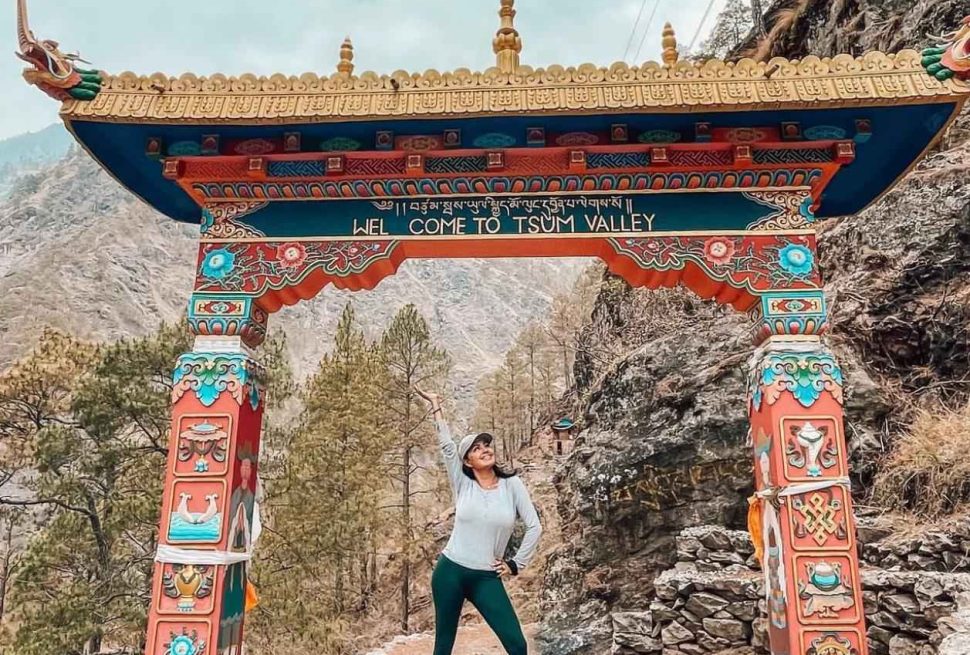
Just north of the main circuit lies Tsum Valley, a side valley that stayed closed to foreigners even longer than the rest of the region. Tsum only opened to organized group tourism relatively recently, and its Buddhist culture remains some of the most intact in Nepal, reinforced by the Shyagya no killing tradition covered earlier and by ongoing work from the local Tsum Welfare Committee to keep tourism respectful and sustainable.
Many trekkers now combine both regions into one longer trip, adding Tsum Valley onto the standard Manaslu Circuit for a deeper look at monasteries, nunneries and villages that see a fraction of the foot traffic found even on the main circuit. If that appeals to you, our Tsum Valley and Manaslu Circuit combination trek covers the extended route, permits and extra days required to fit both areas into a single itinerary.
What to Pack for the Manaslu Circuit
Because this trek moves through six climate zones, your packing list needs to cover both warm weather and genuinely cold, high altitude conditions.
| Category | Items to bring |
|---|---|
| Upper body layers | Moisture wicking base layers, fleece or light down mid layer, waterproof and windproof outer shell |
| Lower body layers | Quick drying trekking pants, thermal leggings, insulated pants for the pass crossing |
| Footwear | Broken in trekking boots, camp shoes for evenings, wool trekking socks, gaiters for snow sections |
| Head and hands | Warm hat, sun hat, gloves rated for freezing temperatures, sunglasses with strong UV protection, headlamp with spare batteries |
| Sleep system | Sleeping bag rated to at least negative 15 degrees Celsius, sleeping bag liner for extra warmth |
| Trekking gear | Trekking poles, daypack, duffel bag for porter, water bottle or bladder, water purification tablets or filter |
| Health and safety | High factor sunscreen, lip balm with sun protection, basic first aid kit, altitude medication approved by your doctor, blister treatment |
| Electronics | Solar charger or spare power banks, universal adapter, fully charged phone or camera |
| Documents | Passport with spare photocopies, passport photos for permits, travel insurance details, cash in Nepali rupees for the trail |
Altitude Sickness and Safety Tips
Because the trek gains so much elevation in a short time, altitude sickness is the single biggest safety concern on this route, more than weather or terrain. Acute mountain sickness can appear at altitudes as low as 2,500 meters and typically shows up as headache, nausea, dizziness or trouble sleeping. Left unaddressed, it can progress into two far more dangerous conditions.
| Condition | What it is | Common symptoms | What to do |
|---|---|---|---|
| Acute mountain sickness (AMS) | Mild altitude illness, common and usually manageable | Headache, nausea, fatigue, dizziness, poor sleep | Rest at the same altitude, hydrate, avoid climbing higher until symptoms improve |
| High altitude pulmonary edema (HAPE) | Fluid buildup in the lungs, serious and potentially fatal | Breathlessness at rest, persistent cough, chest tightness, blue tinged lips | Immediate descent, supplemental oxygen if available, emergency evacuation |
| High altitude cerebral edema (HACE) | Fluid buildup in the brain, a medical emergency | Confusion, loss of coordination, severe headache, hallucination | Immediate descent, emergency evacuation, treat as life threatening |
The rule that saves lives here is simple: never ignore symptoms and never continue climbing higher while they are getting worse. Build acclimatization days into your itinerary rather than skipping them to save time, drink far more water than feels necessary, avoid alcohol at altitude, and walk at a pace slow enough that you can hold a conversation without gasping. Your guide should be trained to recognize the early signs of HAPE and HACE, both of which can turn dangerous quickly and sometimes require immediate descent or helicopter evacuation. This is exactly why travel insurance covering trekking above 5,000 meters and emergency evacuation is not optional for this trip, it is a basic requirement before you even book your flight to Kathmandu.
Manaslu Circuit Trek Compared with Everest and Annapurna
People often ask how this trek stacks up against Nepal’s two most famous routes, and the honest answer is that each offers something different.
| Factor | Manaslu Circuit | Everest Base Camp | Annapurna Circuit |
|---|---|---|---|
| Typical duration | 12 to 16 days | 12 to 14 days | 15 to 20 days |
| Highest point | 5,106 meters, Larkya La | 5,364 meters, Kala Patthar viewpoint | 5,416 meters, Thorong La |
| Guide requirement | Mandatory, restricted area | Not legally required, but recommended | Not legally required on most sections |
| Crowd level | Low, restricted permits limit numbers | Very high in peak season | Moderate to high, roads have changed parts of the trail |
| Teahouse comfort | Basic, improving slowly | Well developed, more amenities | Well developed, some road access |
| Permit cost | Higher, due to restricted area fees | Lower, standard national park fees | Lower, standard conservation fees |
| Overall character | Remote, culturally rich, quiet trail | Iconic views, busy trail, strong infrastructure | Diverse landscapes, increasingly road accessible |
Manaslu gives you a version of the same high Himalayan experience minus most of the crowd. Because it only opened relatively recently and remains a restricted area requiring a guide, the villages have kept more of their original rhythm, and you are far more likely to have a teahouse dining room mostly to yourself in the evening. The tradeoff is a higher permit cost and mandatory guide requirement, but for many trekkers that trade is well worth it for the sense of discovery the trail still offers.
Accommodation and Food Along the Trail
Lodging on this trek is entirely teahouse based once you leave Kathmandu. These are simple family run guesthouses offering a bed, usually two per room, and shared bathroom facilities that get more basic the higher you climb. Hot showers are available in the lower villages, sometimes for a small extra fee, and become rare above Samagaon, where you may only have a bucket of hot water or none at all.
Food is straightforward and carb heavy, built around the needs of people burning huge amounts of energy each day. Dal bhat, Nepal’s staple of lentil soup, rice and vegetable curry, is the most reliable option throughout the trek and usually comes with a free refill. You will also find noodle soups, fried rice, momos, porridge and basic pasta dishes, with menu options narrowing and prices rising the further you get from road access. Many experienced trekkers stick to vegetarian meals at higher elevations, since meat has often traveled a long way without proper refrigeration by the time it reaches your plate.
Environmental Challenges: Climate Change and Glacier Retreat
Like the rest of the high Himalaya, the glaciers around Manaslu are retreating as global and regional temperatures rise. Scientific research across the central Himalaya has increasingly pointed to black carbon, essentially soot from cooking fires, vehicle exhaust and open burning across the Indo Gangetic plains, as a major accelerant of glacier melt. When black carbon particles settle on snow and ice, they darken the surface and reduce its ability to reflect sunlight, a property scientists call albedo, which speeds up melting well beyond what warmer air temperatures alone would cause.
For a region whose entire water system, from Samagaon’s fields to the Budhi Gandaki river that trekkers follow for days, depends on glacial and snowmelt, this is not an abstract concern. Reduced and less predictable meltwater affects agriculture, drinking water and the hydropower potential of rivers draining the range. Trekkers walking through the sub alpine and alpine zones today are, in a very direct sense, walking through a landscape that is visibly changing within a single human lifetime, with older guides in villages like Samagaon and Samdo often describing glaciers that sat noticeably closer to the trail decades ago.
Waste Management and the Mountain Cleanup Effort
Nepal’s high mountains, most famously Everest, have long struggled with waste left behind by decades of expeditions, and Manaslu is not immune to the same pressures given its growing popularity as an 8,000 meter objective. The Nepali Army has run organized mountain cleanup campaigns since 2019, working with international partners to remove accumulated trash from high camps across several peaks. Between 2019 and 2023 alone, these campaigns collected around 110 tons of waste from Everest, and similar seasonal efforts extend to other major peaks including Manaslu during active climbing seasons.
As glaciers melt and retreat, they are also revealing decades of previously buried waste and, at times, the remains of climbers who never made it home, a grim but increasingly visible reminder of how climate change is reshaping the high mountain environment. Trekking and expedition operators across the region, including on Manaslu, are under growing pressure to enforce strict pack it out policies, and conservation area fees collected from every trekker who enters the Manaslu Conservation Area go in part toward funding cleanup and waste management infrastructure at lower elevations along the route.
Local Economy and Sustainable Tourism
Tourism is one of the most important sources of cash income for the roughly 9,000 residents of the Manaslu Conservation Area, alongside subsistence farming and animal herding. A licensed English speaking trekking guide typically earns in the range of 20 to 30 US dollars per day on this route, while porters, who carry loads up to 20 kilograms, typically earn around 18 to 19 US dollars per day, figures that represent meaningful income in the rural Nepali economy even though they may look modest by international standards. Teahouse owners, mule and yak train operators, and small shopkeepers along the route depend heavily on the trekking season for annual income.
Because the region only opened to tourism in 1991 and remains a restricted area today, growth has stayed more controlled than in heavily trafficked regions like the Everest or lower Annapurna trails. Community based management through the Conservation Area Management Committees, along with the Tsum Welfare Committee in Tsum valley specifically, aims to keep a larger share of tourism revenue circulating locally rather than flowing entirely to outside operators, while also limiting the kind of rapid, unplanned development that has changed the character of some other Nepali trekking regions over the past two decades.
Why Trek Manaslu with Local Experts
Given the permit requirements, the restricted area rules and the genuine altitude risk involved, choosing the right operator matters more here than on almost any other trek in Nepal. A team with real experience on this specific route understands exactly how to pace the itinerary, when to push through Larkya La and when to build in an extra acclimatization day, and how to handle problems if the weather turns or someone in the group develops symptoms of altitude sickness.
Working with a locally based, Gorkha region focused team, rather than a generic operator who mainly runs Everest or Annapurna trips, tends to mean stronger relationships with teahouse owners, better contingency planning around the pass crossing, and guides who genuinely know the trail rather than following a map. You can read more about our approach and background on our about, or see what past trekkers have said about their experience on the reviews before deciding who to trust with a trip like this.
Frequently Asked Questions About Mount Manaslu
Is Mount Manaslu open for solo trekkers
No. Because the route runs through a restricted area, every trekker needs a licensed guide, and permits require a minimum of two trekkers per group. Solo applications are not accepted, though most agencies can place a single traveler into an existing small group.
Do I need previous trekking experience
Prior high altitude experience helps but is not required. What matters more is a reasonable level of fitness, a willingness to walk slowly and rest when your guide advises it, and a realistic understanding that this trek is physically demanding, especially on the day you cross Larkya La.
Can the Manaslu Circuit Trek be combined with other routes
Yes. Many trekkers extend the standard circuit with the Tsum Valley detour, others add Nar Phu valley, and some continue past Dharapani into the Annapurna region toward Manang and Thorong La, effectively linking two of Nepal’s classic circuits into one extended trip.
How much walking is involved each day
Most days run five to seven hours at a steady, unhurried pace, with the crossing of Larkya La stretching to eight or ten hours depending on weather and snow conditions on the pass itself.
Is there mobile signal or wifi along the trail
Coverage is patchy. Lower villages often have decent mobile signal and some teahouses sell wifi cards, but service becomes unreliable or disappears entirely above Samagaon, so it is worth telling family back home to expect quiet days near the end of the trek.
Is Manaslu a dangerous mountain to climb
It carries real risk, with a historical death rate around 2.4 to 2.5 percent of summit attempts, similar to Everest and considerably safer than Nanga Parbat, Annapurna or K2. Avalanches are the leading cause of death, which is why season selection and an experienced expedition operator matter enormously for anyone attempting the summit rather than the trekking circuit.
What makes Tsum Valley different from the rest of the Manaslu region
Tsum stayed closed to outside visitors even longer than the surrounding Nubri valley, and it operates under the centuries old Shyagya tradition, a formally documented no killing rule that has protected wildlife and shaped daily life throughout the valley since it was written down in 1921.
Final Thoughts on Mount Manaslu
Mount Manaslu is not just the eighth highest point on earth, it is a full ecosystem of ancient granite, retreating glaciers, endangered wildlife and centuries old Buddhist culture wrapped around one dramatic peak. Whether you come for the summit as a mountaineer, for the full loop as a trekker, or for a shorter taste of the region on a ten day itinerary, this is one of the last corners of Nepal’s Himalaya where the trail still feels like a genuine discovery rather than a well trodden tourist circuit.
If Larkya La, the villages of Samagaon and Samdo, the monasteries of Tsum valley, and views of the eighth highest mountain on the planet are calling you, now is a good time to start planning. Booking is already open for the coming seasons, and with limited permits and a mandatory guide requirement, early planning makes a real difference in securing the dates and team you want. Check our current Manaslu Circuit Trek booking availability to start mapping out your own trip around this remarkable mountain.