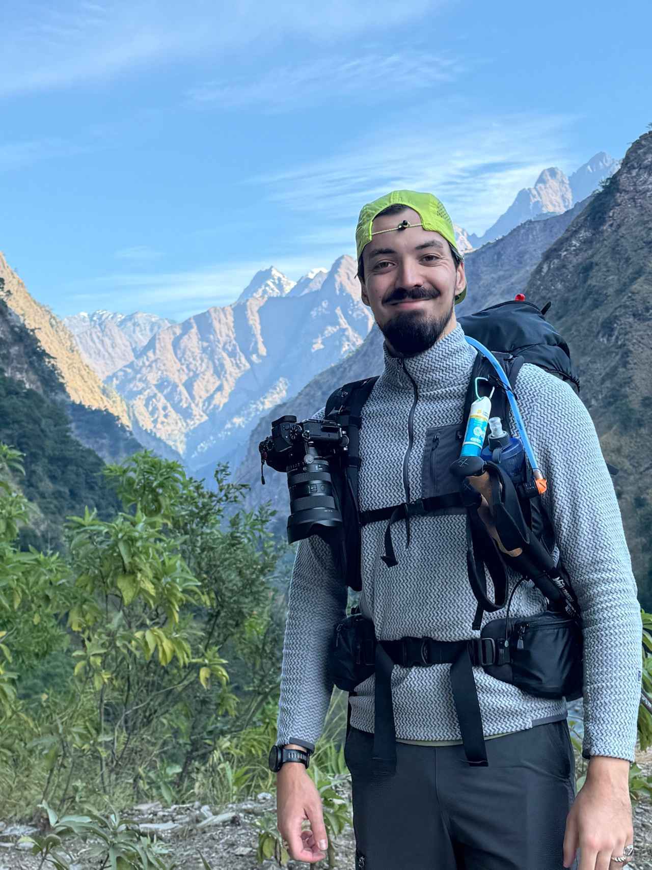
Written by Kiran Basnet, Founder and Licensed Trekking Guide at Manaslu Treks and Expedition. Twenty plus completions of the Manaslu Circuit since 2018. Updated for the 2026 and 2027 trekking seasons.
People write to me almost every week asking the same question in different words. Is the Manaslu Circuit actually worth it. Is it too hard. Is it too remote. Should they do Everest Base Camp or Annapurna instead. I have crossed Larkya La more than twenty times now, and I still do not have a short answer, because the honest answer depends on who is asking. So instead of giving you a short answer, I am going to give you the long one. Everything I tell a trekker sitting across from me in our Thamel office before they book, written down in one place.
This guide covers what the trek actually involves, what it costs in 2026, the permit rules that changed this year, the best months to go, a full breakdown of the thirteen day itinerary, the food and teahouses you will experience, the culture and wildlife along the route, how Manaslu compares with Everest Base Camp and the Annapurna Circuit, and the honest answer to who should and should not attempt this trek. If you read all the way through, you will know more about this route than most people who have already booked it somewhere else.
What Is the Manaslu Circuit Trek
The Manaslu Circuit is a thirteen day trek that loops around Mount Manaslu, the eighth highest mountain on earth at 8,163 meters, in the Gorkha district of northern Nepal. The name Manaslu comes from the Sanskrit word Manasa, usually translated as mountain of the spirit, and once you have spent a morning watching the sunrise hit that summit from Samagaon, the name makes sense in a way no photograph quite captures.
The route follows the Budhi Gandaki river north from the lower hills near Machha Khola, climbs steadily through forest and gorge country to the Tibetan influenced villages of the upper Nubri valley, and crosses Larkya La Pass at 5,106 meters before descending into the Marsyangdi valley near Dharapani. Unlike Everest Base Camp or the main Annapurna Circuit, Manaslu sits inside a restricted trekking area. That single fact shapes almost everything about the experience. You need a licensed guide, you need government permits, and because of that extra friction, far fewer people ever walk this trail. In 2024, roughly 12,500 trekkers completed the Manaslu Circuit, compared with about 250,000 on the Annapurna Circuit and around 50,000 on the Everest Base Camp route. That difference is something you feel every single day you are out here.
I grew up in Tripura Sundari municipality in Dhading district, which sits right at the entrance to this route. These were not mountains I discovered as a guide. They were the mountains I grew up looking at, so when I tell you what this trek is really like, it comes from the mountain up, not a brochure down.
The Manaslu Circuit Trek is a spectacular journey around Mount Manaslu (8,163 m), the eighth-highest mountain in the world. Located…
How Difficult Is the Manaslu Circuit Trek Really
The Manaslu Circuit is graded challenging, and that grading is fair. It is not a technical climb. You will not use a rope, an ice axe, or crampons on the standard route. What makes it hard is the combination of sustained walking days, a large altitude gain, and one very demanding pass crossing near the end.
The standard itinerary covers somewhere between 177 and 200 kilometers depending on the exact route and side trips you add, spread across thirteen days from Kathmandu back to Kathmandu. Most walking days run five to seven hours, though a few, especially the drive days and the pass crossing itself, run longer. You gain altitude gradually at first, from around 930 meters at Machha Khola up to 3,530 meters at Samagaon over five walking days, which is a sensible rate. Then the terrain above Samagaon gets more serious quickly, climbing to Samdo, then Dharamsala at roughly 4,450 meters, before the crossing itself.
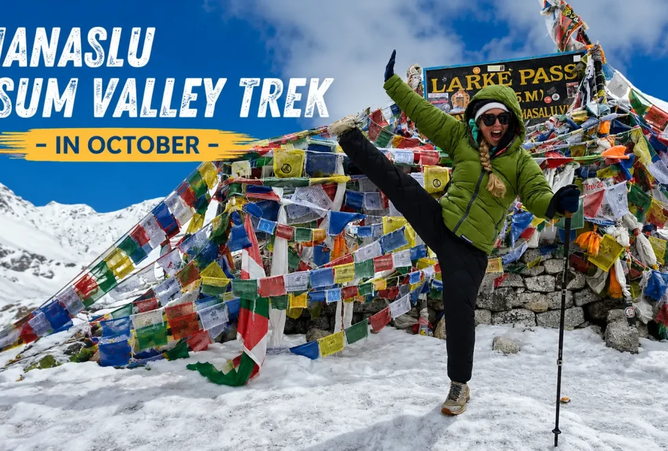
Larkya La is the day that defines this trek. You leave Dharamsala at four in the morning, often after only four or five hours of sleep because altitude and nerves make deep sleep difficult that high up. The walk to the pass and down the other side to Bimthang typically takes eight to ten hours, crossing a gain of roughly 650 meters to the summit of the pass followed by a long, rocky, uneven descent that tests your knees after nine days of accumulated fatigue. It is not technical. It is simply long, cold, and high, and it comes at the point in the trek when your body has the least reserve left.
What tends to catch people off guard is not the pass itself but the lower gorge section in the first few days. The trail between Machha Khola and Deng crosses the Budhi Gandaki on a series of suspension bridges, climbs and drops repeatedly through narrow gorge terrain, and can be humid and warm even while you are gaining altitude underneath. It does not feel like a Himalayan trek yet. Trekkers often walk too fast through this section simply because it feels easy, and that pace catches up with them once the air thins out above Namrung.
My honest advice after twenty plus crossings of this pass is that fitness is not the biggest predictor of who has a good trek. Pace is. The trekkers who walk slowly enough to hold a conversation, who respect the acclimatization day at Samagaon, and who eat properly even when their appetite drops, consistently do better than trekkers who arrive fitter but rush the lower sections.
What It Actually Costs to Trek Manaslu in 2026
Manaslu is more expensive than Annapurna and generally comparable to or a little above Everest Base Camp, mostly because of the restricted area permit fee and the added logistics of operating in a remote valley where every kilogram of rice has to be carried or flown in.
Our package price with Manaslu Treks and Expedition depends on your group size, since a guide, permits, and ground transport cost the same whether one person books or ten people book.
| Group Size | Price Per Person |
|---|---|
| Solo traveler | USD 1,350 |
| 2 to 5 travelers | USD 1,250 |
| 6 to 8 travelers | USD 1,200 |
| 9 to 10 travelers | USD 1,150 |
This price includes your Kathmandu hotel nights before and after the trek, ground transport to Machha Khola and back from Dharapani, all three restricted area and conservation permits, a licensed English speaking guide, porter support, full board meals on the trail, teahouse accommodation, and a loaned sleeping bag and down jacket that you return at the end. It does not include your international flights, Nepal visa fee, travel insurance, or personal spending on the trail such as hot showers, wifi, and bottled drinks.
People sometimes ask why Manaslu costs more than a similar length Annapurna trek. The honest answer is the restricted area permit itself, which runs close to 175 US dollars per person once you include the conservation fees and the municipality charge, compared with around 40 dollars for the Annapurna Conservation Area Permit alone. Add the cost of carrying supplies into a valley with far less road access, and the extra 300 to 400 dollars compared with a standard Annapurna package reflects real operating costs rather than a markup. You can see current departure dates and live pricing on our Manaslu Circuit Trek booking.
Permits You Need for Manaslu in 2026
Something genuinely changed this year, so if you read an older article about Manaslu permits, some of it is now out of date.
On March 22, 2026, Nepal’s Department of Immigration updated the rules around the Manaslu Restricted Area Permit. Previously, the permit could only be issued to a group of at least two foreign trekkers, which meant solo travelers often had to find a stranger to pair up with just to satisfy the paperwork. That requirement has been removed. A single trekker can now apply for the Restricted Area Permit individually.
What has not changed is the guide requirement. A licensed guide from a registered trekking agency is still mandatory to enter the Manaslu restricted area, and independent trekking without one is still prohibited. The new rule simply means you no longer need a second trekker on your application. You can book as one person and trek with your own dedicated guide, or you can still join a group departure if you prefer the company and the lower shared cost.
You need three permits for this route in total. The Manaslu Restricted Area Permit, the Manaslu Conservation Area Permit, and the Annapurna Conservation Area Permit, since the trail exits through Annapurna Conservation Area territory near Dharapani. There is also a small entry fee collected by the Chumnubri Rural Municipality at the Jagat checkpoint. One detail that surprises a lot of trekkers coming from Everest or Annapurna is that Manaslu does not require a TIMS card. If an agency tells you that you need one for this specific route, they are working from outdated information.
| Permit | Approximate Cost |
|---|---|
| Restricted Area Permit, autumn season | USD 100 for the first week, then USD 15 per extra day |
| Restricted Area Permit, other seasons | USD 75 for the first week, then USD 10 per extra day |
| Manaslu Conservation Area Permit | NPR 3,000 per person |
| Annapurna Conservation Area Permit | NPR 3,000 per person |
| Chumnubri Rural Municipality entry fee | NPR 1,000 per person |
We process all of this in Kathmandu on your behalf. We need your original passport and it normally takes one to two working days, though we allow three to four days in October when the immigration office handles its highest volume of the year. Checkpoints at Jagat and Namrung now use digital verification, so keep a photo of your permits on your phone as a backup. Every permit fee is already included in your package price with us, so there is nothing extra to arrange once you have booked.
The Manaslu Circuit Trek is a spectacular journey around Mount Manaslu (8,163 m), the eighth-highest mountain in the world. Located…
The Best Time to Trek the Manaslu Circuit
Spring and autumn are the two windows that give you the best combination of dry trails and clear mountain views, though each has its own personality.
Autumn, running from late September through November, is generally my first recommendation. The monsoon clears out of the sky by late September, trails dry out fast, and October in particular tends to deliver the most reliable mix of clear skies and stable weather all year. It is also the busiest month, so teahouses near Samagaon and above can fill up, which is one reason we recommend booking three to four months ahead if you want an October date. Early November is nearly as good and slightly quieter, though nights at Dharamsala and on the approach to Larkya La turn seriously cold by then. Late November starts sliding into winter conditions, with real risk of snow at the pass.
Spring, from March through May, is the other strong option. April is the standout month, with comfortable daytime temperatures, rhododendron forests blooming through the lower and middle sections of the trail, and generally good visibility toward Manaslu. Late March can work well too, though the high sections around Larkya La can still be holding winter snow early in the month, so we build in some flexibility. May is fine early on but the pre monsoon cloud builds through the month, so we prefer trekkers choose the first half if they are set on May.
Monsoon, from June through August, is not something we recommend for a standard Manaslu itinerary. The lower Budhi Gandaki valley takes the worst of the rain, with muddy trails, landslide risk, and unreliable road conditions before you even reach the higher, drier section of the route. Winter, from December through February, is possible for experienced trekkers with the right gear, but snow and freezing temperatures around Samdo, Dharamsala, and Larkya La make it a serious undertaking that we generally advise against for a first Manaslu trip.
| Season | Our Take |
|---|---|
| October | Best overall, clear skies, busiest month |
| April | Excellent, rhododendrons, comfortable days |
| Early November | Excellent but noticeably colder at altitude |
| Late September, late March | Good transition periods, worth considering |
| June to August | Generally avoid, heavy rain in the lower valley |
| December to February | Possible but demanding, for experienced trekkers only |
If you want to read a deeper month by month breakdown of what April specifically looks like on this route, we have a full guide on trekking the Manaslu Circuit in April.
The Full Itinerary, Day by Day
Our standard itinerary runs thirteen days from Kathmandu back to Kathmandu, with a single acclimatization day built in at Samagaon, exactly where the altitude gain starts to matter.
| Day | Route and Altitude |
|---|---|
| 1 | Arrival in Kathmandu, 1,300 meters |
| 2 | Drive to Machha Khola, 930 meters |
| 3 | Trek to Jagat, 1,410 meters |
| 4 | Trek to Deng, 1,860 meters |
| 5 | Trek to Namrung, 2,900 meters |
| 6 | Trek to Samagaon, 3,530 meters |
| 7 | Acclimatization day in Samagaon |
| 8 | Trek to Samdo, 3,860 meters |
| 9 | Trek to Dharamsala, 4,450 meters |
| 10 | Cross Larkya La, 5,106 meters, to Bimthang, 3,720 meters |
| 11 | Trek to Tilije, 2,300 meters |
| 12 | Drive to Kathmandu |
| 13 | Final departure |
The first two days are about getting to the trailhead. You land in Kathmandu, meet your guide for a briefing, and the next morning you drive eight to nine hours through the hills toward Machha Khola, following the same river valley you will be walking beside for the next week.
Days three through six take you deeper into the gorge and then out of it. The trail from Machha Khola to Jagat and on to Deng runs through some of the most dramatic terrain on the whole route, narrow river gorges, forest, and a string of suspension bridges that cross the Budhi Gandaki again and again. By the time you reach Namrung on day five, the landscape has opened up and the Tibetan Buddhist character of the upper valley starts to show in the architecture and the prayer flags on every ridge. Day six brings you into Samagaon at 3,530 meters, the main village of the upper Manaslu valley and the point where Manaslu itself fills the eastern sky.
Day seven is the rest day, and it is genuinely not optional in my opinion. Most groups spend the morning hiking toward Birendra Lake or Pungyen Gompa, both close enough to manage easily while still gaining a bit of altitude exposure during the day before sleeping back down at Samagaon that night. This is the single day in the itinerary that determines how comfortable the next four days feel.
Days eight and nine push you higher, first to Samdo at 3,860 meters, a village with a strong Tibetan character close to the old trade route into Tibet, then on to Dharamsala at 4,450 meters, which exists for one reason only, to shelter trekkers the night before the pass. Day ten is the pass crossing itself, an early start well before sunrise, a long climb to 5,106 meters, and then a demanding descent to Bimthang. Days eleven through thirteen bring you back down through Tilije toward the Marsyangdi valley and then by road back to Kathmandu, with day thirteen reserved for your onward flight home.
If your schedule does not fit thirteen days exactly, we also run nine, ten, eleven, and longer variants including combinations with Tsum Valley, and we are happy to adjust the standard plan around your available time. You can see all the current itinerary options on our Manaslu Circuit Trek.
The Manaslu Circuit Trek is a spectacular journey around Mount Manaslu (8,163 m), the eighth-highest mountain in the world. Located…
Acclimatization and Altitude Safety on the Manaslu Circuit
After more than twenty trips on this route, the thing I have learned most clearly is that the biggest factor in how someone handles Larkya La is not their fitness level. It is how well they acclimatized in the days before it.
The rest day at Samagaon, 3,530 meters, is the most important day of the entire itinerary. It gives your body time to adjust before you continue up to Samdo and then Dharamsala, both meaningfully higher. Skipping or shortening this day to save time is the single most common mistake I see in other companies’ itineraries, and it is the mistake most likely to cause real trouble on the pass.
Common symptoms above 3,500 meters include a mild headache, some breathlessness on climbs that would not normally bother you, lighter sleep, and a reduced appetite. These are normal signs that your body is adjusting and are not, on their own, a reason to panic. What matters is that they do not get worse. Warning signs that require immediate descent include a headache that does not respond to rest and basic pain relief, confusion or loss of coordination, or breathlessness that continues even while resting. Our guides are trained to watch for these signs every day, not just when someone mentions feeling unwell.
The practical advice I give every group the night before Larkya La is simple. Drink water before you sleep even if you are not thirsty. Keep your batteries inside your sleeping bag overnight so the cold does not drain them. Set your alarm for three thirty in the morning and be ready to walk by four. Groups that leave on time get the calm morning conditions on the pass. Groups that leave late walk into the wind that tends to pick up after nine in the morning, and that wind at 5,000 meters in the cold turns a hard day into a genuinely difficult one.
Travel insurance with helicopter evacuation cover is not optional on this route. The nearest hospital capable of treating serious altitude illness is in Kathmandu, and the only realistic way out of the upper valley in a genuine emergency is by helicopter, which can cost several thousand dollars without insurance. Check that your policy specifically covers high altitude trekking and helicopter rescue up to at least 6,000 meters before you travel, not just the headline coverage amount.
Teahouses and Daily Life on the Trail
You will sleep in teahouses for the entire trek, family run lodges that combine simple guest rooms with a shared dining area, usually the warmest room in the building once the stove is lit in the evening. For a closer look at teahouse menus, vegetarian options, and safe drinking water, our food and water safety guide goes through it in detail.
The lower and middle sections of the route, Machha Khola through Namrung and Lho, have improved noticeably over the past few years. Most of the main stops now have at least some rooms with attached bathrooms and hot showers, something that was rare here even five years ago. Above Samagaon, conditions get simpler. Rooms are smaller, the nights are colder, and hot water becomes less reliable. Dharamsala, the stop just before Larkya La, is the most basic of the whole route, and it is meant to be. Nobody stays there for comfort. They stay there because the pass is four hours away in the dark.
Electricity above Samagaon runs on solar power and is not something you should plan your charging schedule around. A power bank kept warm inside your jacket at night, alongside your camera batteries, solves most of this problem. Mobile signal follows a similar pattern, reasonably reliable from Machha Khola through Samagaon on the Ncell network, then increasingly patchy above that. If you need to stay reachable for work or family, the practical move is to send a message from Samagaon before you head up toward Samdo and Dharamsala, and let people know you will be out of contact for two or three days around the pass.
Food changes with the altitude and the culture of the valley you are walking through. In the lower sections you will find a wide menu, dal bhat, noodle soup, fried rice, eggs, and chapati, made with produce that is still reasonably fresh because these villages have market access. From Namrung upward the menu simplifies and the Tibetan influence becomes stronger. Tsampa, roasted barley flour mixed with butter tea, is a Nubri valley staple worth trying even if the taste takes some getting used to. Butter tea itself, made from strong tea, yak butter, and salt, appears on every table from Deng onward, and I recommend drinking it rather than skipping it, since the fat content genuinely helps at altitude.
My honest advice on food, the same advice I give every group before we start walking, is to eat dal bhat above Deng rather than pizza or pasta whenever it is available. It is what the local families actually cook for themselves, it is usually refillable without extra charge, and the balance of rice, lentils, and vegetables is close to exactly what your body needs on a long trekking day. Above Samagaon, eat more than you feel like eating. Altitude suppresses appetite while your body is burning more calories than usual, and trekkers who under eat in the two days before Larkya La feel that deficit on the pass.
The Culture Along the Manaslu Circuit
One of the things that surprises trekkers most on this route is how sharply the culture changes partway through the trek.
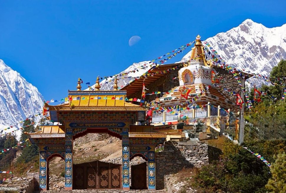
From Machha Khola through Deng, you are walking through hill communities that are culturally close to Gorkha and Dhading, predominantly Hindu and animist, with terraced fields, roadside shrines, and a version of Nepal that feels familiar if you have already spent time in Kathmandu. Everything shifts at Deng. From there into the Nubri valley, you enter a Tibetan Buddhist world that stayed almost entirely closed to outsiders until 1991. The architecture changes, prayer flags line every ridge, mani walls grow longer and more elaborate, and the monasteries you pass are active places of daily practice rather than sites preserved for visitors.
Samagaon, at 3,530 meters, has a monastery at its center that has been in continuous use for generations. If your schedule allows it, spend part of your acclimatization morning there while the monks are doing their prayers. The sound of chanting and the smell of juniper incense carrying across the village is not a performance arranged for trekkers. It is simply what a Tuesday morning looks like in Samagaon. Pungyen Gompa, a short walk above the village, is smaller and older and sees far fewer visitors. If you extend your trip into Tsum Valley, Rachen Gompa there is a functioning nunnery built directly into a cliff face, one of the most striking religious sites in this part of Nepal. You can read more about the history and culture of this wider region on our Manaslu and Tsum Valley culture guide.
Samdo, higher again and closer to the old trade route into Tibet, has an even stronger Tibetan character, with stone houses built into the hillside and livestock kept just below the living quarters for warmth through winter. Walking through these villages is genuinely different from visiting a cultural site set up for tourism. You are moving through a community that has organized its entire way of life around this valley and this altitude for centuries, and that comes through in small details, the way people greet you, the rhythm of daily chores, the fact that nobody seems to be performing anything for your benefit.
Wildlife and Mountains You Will See
The Manaslu Conservation Area covers 1,663 square kilometers and protects one of the more complete high altitude ecosystems left in Nepal, with real chances of meaningful wildlife sightings, especially above 3,500 meters.
Blue sheep, known locally as bharal, are the animal you are most likely to see in number, particularly on the rocky slopes above Samdo and on the approach to Larkya La. I have seen herds of thirty to fifty animals on a single slope up there. Himalayan tahr and musk deer show up more often in the forested sections between Jagat and Deng, usually early in the morning. Bird life is genuinely excellent along this route. The Himalayan Monal, Nepal’s national bird, appears regularly in the forest between about 2,500 and 4,000 meters, and lammergeier vultures with enormous wingspans circle the high ridges above the upper valley.
The Manaslu Conservation Area is also estimated to hold around fifty snow leopards, though I want to be straightforward about this. In more than twenty trips on this route I have seen fresh tracks twice and the animal itself once, at a distance, above Samdo. It is a real possibility, not something to expect or plan a trip around, but knowing the habitat is intact enough to support them adds something to how you look at the terrain you are walking through.
As for the mountains themselves, you do not just see one peak on this trek, you see a changing relationship with several. The first clear view of Manaslu’s north face appears above Lho at around 3,180 meters, closer and larger than most trekkers expect. From Samagaon, Manaslu fills the eastern sky, and at sunrise the summit catches the first light while the valley below stays in shadow for another twenty five minutes or so. From the top of Larkya La itself, Himlung Himal, Cheo Himal, Kang Guru, and Manaslu are all visible together with open sky between them, a view that does not repeat anywhere else on the circuit.
| Peak | Height |
|---|---|
| Mount Manaslu | 8,163 meters |
| Himalchuli | 7,893 meters |
| Ngadi Chuli | 7,871 meters |
| Himlung Himal | 7,126 meters |
| Kang Guru | 6,981 meters |
| Cheo Himal | 6,820 meters |
| Ganesh Himal | 5,203 meters |
Manaslu Circuit Compared With Everest Base Camp and Annapurna Circuit
I get asked to compare these three routes more than almost anything else, usually from someone with two or three weeks in Nepal trying to decide where to spend them.
All three are serious treks. Everest Base Camp takes you to 5,364 meters with Kala Patthar at 5,555 meters as an optional add on, without crossing a high pass. The Annapurna Circuit crosses Thorong La at 5,416 meters, higher than Larkya La, on a route that has been significantly reshaped by road construction over the past fifteen years, with much of the lower section now driven rather than walked by most operators. Manaslu crosses Larkya La at 5,106 meters and, in my experience, feels more remote than either of the other two, mostly because of the sheer difference in trekker numbers.
| Route | Highest Point | Approx Trekkers Per Year |
|---|---|---|
| Manaslu Circuit | 5,106 meters | 12,500 |
| Everest Base Camp | 5,555 meters, Kala Patthar | 50,000 |
| Annapurna Circuit | 5,416 meters, Thorong La | 250,000 |
Cost follows a similar pattern. A standard Annapurna Circuit package tends to start from around 850 dollars per person, Everest Base Camp packages commonly start in the 1,400 to 1,900 dollar range because of the cost of Lukla flights, and Manaslu sits from around 1,150 to 1,350 dollars per person with us depending on group size, mostly because of the restricted area permit fee.
Culturally, Everest Base Camp moves you through Sherpa communities that have been shaped by decades of mountaineering tourism, which is not a criticism, simply a different atmosphere. The Annapurna Circuit crosses Gurung, Manangi, and Thakali territory with a genuinely wide range of culture across one trek. Manaslu’s Nubri valley, closed to outsiders until 1991, still feels the least touched by tourism of the three, and if that is specifically what you are looking for, Manaslu is the strongest choice.
My honest recommendation, and I guide all three of these routes, is this. If you have never done a high altitude trek in Nepal before and want strong infrastructure and flexibility, Annapurna is the more forgiving starting point. If Everest itself is the draw, nothing replaces standing at Base Camp. If you already have a trek or two behind you and want the quietest, most culturally intact experience of the three, Manaslu is the one I recommend without hesitation.
Who Should Trek Manaslu, and Who Should Choose Something Else
Manaslu rewards a particular kind of trekker more than it rewards raw fitness. People who do well here tend to be patient, comfortable with basic accommodation, and genuinely interested in walking through a culture rather than past it. If you want fewer crowds, a licensed guide who actually knows the route rather than a generalist covering every trail in Nepal the same way, and villages that have not been reshaped around tourism, this is very likely the right trek for you.
There is no strict age cutoff. I have guided trekkers from their twenties into their sixties across Larkya La, and age has mattered far less than pace and preparation. What matters more is whether you can comfortably walk five to seven hours on uneven terrain across consecutive days, since that is the daily reality here more than any single technical difficulty.
Manaslu is probably not the right choice if you have serious heart or lung conditions that have not been cleared by a doctor, if you have no experience with multi day walking at all, or if the idea of several days without reliable hot water or electricity sounds unbearable rather than simply part of the deal. If you are unsure whether you can manage sustained daily walking, a shorter route like Langtang Valley or Annapurna Base Camp is a reasonable way to test your comfort with multi day trekking before committing to something at this altitude and remoteness.
Common Worries First Time Trekkers Have
Let me address the questions people are usually too polite to ask directly.
What if I fall behind the group. With a private guide, which is how most of our trips run, there is no group pace to fall behind. Your guide walks at your pace. Even on group departures, guides are trained to keep the slowest walker in sight and adjust accordingly. This is not a race, and nobody on this trail is timing you.
What if I get sick at altitude. Mild symptoms above 3,500 meters are common and usually resolve with rest, water, and food. Our guides check on every trekker daily, not just when someone says something. If symptoms are serious, descent is the treatment, and helicopter evacuation is available if genuinely needed, which is why insurance with evacuation cover matters so much.
Are the teahouses really that basic. Lower down, no, many now have attached bathrooms and hot showers. Higher up, yes, rooms are simple, walls are thin, and heating exists mainly in the dining room. It is not luxury, but it is warm enough, fed well enough, and honestly, part of what makes the trek feel real rather than staged.
Will I be the oldest or slowest person there. Almost certainly not, and even if you are, nobody notices in the way you might expect. The Himalayas do not care about your pace. What people remember afterward is that they made it, not how quickly.
Training and Packing, What Actually Matters
You do not need to be an athlete for this trek, but a bit of structured preparation makes a real difference to how much you enjoy it rather than just survive it.
Eight to twelve weeks of consistent walking, ideally on hills or stairs with a loaded daypack, builds the specific kind of endurance this trek demands far better than gym machines do. Two or three sessions a week of thirty to sixty minutes of cardio, plus some basic leg strength work like squats and step ups for the long descent from Larkya La, covers most of what matters physically. If you can hold a conversation while walking uphill, you are moving at roughly the right pace for altitude.
For packing, the short version is that you need clothing for both warm valley walking and freezing nights near the pass, since temperatures on this route swing from comfortable daytime hiking weather in the lower gorge to well below freezing at Dharamsala. A proper layering system, a down jacket, a sleeping bag rated to at least minus ten degrees Celsius, broken in trekking boots, and a headlamp for the predawn start on pass day cover the essentials. We provide a sleeping bag and down jacket as part of every package if you would rather not carry or buy your own, and our team can walk you through the full packing list and arrange any gear rental in Kathmandu before you set off.
Why Trek Manaslu With Manaslu Treks and Expedition
We are a Nepal based company built specifically around the Manaslu and Tsum Valley region, not a general trekking operator that treats every route the same way. I come from Dhading, the district this trek begins in, and our guide team, including Amar Khand, Susam Suyal, and the rest of our guides, has real, repeated, on the ground experience with this exact route rather than a generic understanding of Himalayan trekking.
We do not ask for advance payment to hold your booking. You confirm your date, and payment is settled after you arrive in Nepal. Every price we quote is transparent, with no hidden charges added once you are already committed. We handle every permit, every checkpoint, and every logistical detail so you can focus on the trek itself rather than paperwork. Our team is registered under Nepal’s Tourism and Antiquities Act, we are a TAAN member, and we are affiliated with the Nepal Mountaineering Association, which matters if you want to know that the company arranging your permits is properly recognized rather than operating informally.
If it helps to see the region through the eyes of someone who has walked it more than twenty times, I have written a longer, more personal account of why I recommend this specific route over others, including an honest comparison with Annapurna, on our best Manaslu Circuit Trek. You can also read more about our team and our approach on the our team and the about Manaslu Treks and Expedition.
How to Book Your Manaslu Circuit Trek
- Visit our Manaslu Circuit Trek and check the availability section for confirmed departure dates
- Decide between a private trek on your own schedule or a group departure for a lower shared cost
- Message us directly on WhatsApp at plus 977 9869225929 or email info@manaslutreks.com with any questions before you commit
- Confirm your date. No advance payment is required to hold your booking
- Send us your passport details so we can begin processing your permits ahead of your arrival
- Arrive in Kathmandu a day or two before departure for your gear check and trek briefing
- Pay for your trek after arrival in Nepal, then start the drive toward Machha Khola and the trail beyond it
Frequently Asked Questions
How hard is the Manaslu Circuit Trek compared with Everest Base Camp
Manaslu involves a genuine high pass crossing at 5,106 meters and generally rougher trail conditions in the lower gorge, while Everest Base Camp involves more total altitude gain to 5,364 meters without a technical pass. Most guides, myself included, consider them comparably demanding for different reasons.
Can I trek Manaslu solo now
As of March 2026, a single trekker can be issued a Restricted Area Permit individually without needing a second trekker on the application. A licensed guide from a registered agency is still mandatory either way.
Do I need a TIMS card for Manaslu
No. The Manaslu Circuit does not require a TIMS card, unlike Everest Base Camp or the Annapurna Circuit. You need the Restricted Area Permit, the Manaslu Conservation Area Permit, and the Annapurna Conservation Area Permit instead.
What is the highest point on the Manaslu Circuit
Larkya La Pass at 5,106 meters is the highest point most trekkers reach on the standard route.
How many days do I need for the Manaslu Circuit
Our standard itinerary is thirteen days from Kathmandu back to Kathmandu, including one acclimatization day at Samagaon. Shorter and longer variants are available depending on your schedule.
Is the Manaslu Circuit safe for solo travelers
Yes, when arranged through a registered agency with a licensed guide, which is a legal requirement for this route regardless of whether you are traveling alone or with others.
What is the coldest part of the trek
Dharamsala, at around 4,450 meters, the overnight stop just before Larkya La, is consistently the coldest and most basic stop on the route.
Do I need previous trekking experience for Manaslu
Previous multi day trekking experience helps but is not strictly required if you arrive reasonably fit and follow a sensible training plan for eight to twelve weeks before departure.
What permits are included in the package price
All three required permits, the Restricted Area Permit, the Manaslu Conservation Area Permit, and the Annapurna Conservation Area Permit, along with the municipality entry fee, are included in every package we offer.
Is travel insurance required
Yes. Insurance covering high altitude trekking and helicopter evacuation up to at least 6,000 meters is essential given the remoteness of the upper valley and the cost of emergency evacuation without it.
Final Thoughts
After twenty plus trips on this exact route, the thing I would want you to know before you book is simple. Manaslu is not the easiest trek in Nepal and it is not trying to be. It rewards patience over speed, and it gives back a version of the Himalayas that the busier routes cannot offer anymore, quiet trails, villages that still run on their own rhythm rather than a tourist schedule, and a pass crossing that feels genuinely earned by the time you reach the top. If that sounds like the kind of trek you want, we would be glad to plan it with you. Reach us on WhatsApp at plus 977 9869225929, by email at info@manaslutreks.com, or check current departure dates directly on our Manaslu Circuit Trek.