Shyala is a small village at 3,500 meters on the Manaslu Circuit Trek, sitting at the precise point where the forest ends and the alpine begins. It is not a famous name on the circuit. It does not appear on most trekkers’ highlight lists. Many itineraries list it only as a lunch stop on the longer day from Lho to Samagaun. But Shyala marks one of the most significant landscape transitions on the entire route: the moment when the Budhi Gandaki gorge finally releases its grip on the trail, the tree canopy opens, and the mountains that have been hiding behind ridges and forest suddenly step forward into full view.
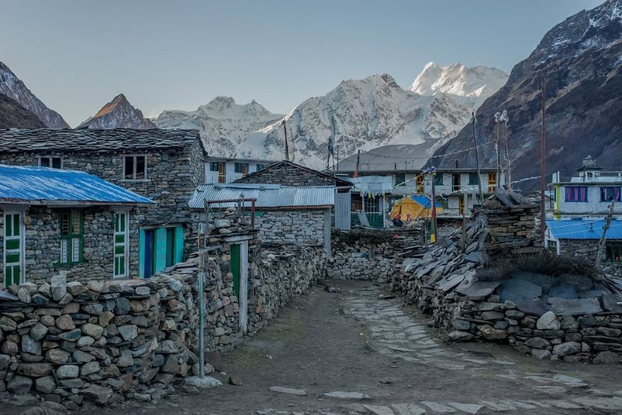
The village itself is tiny, a handful of stone houses with flat Tibetan-style roofs, one or two teahouses, prayer flags on every rooftop, and a mani wall running along the trail through the settlement. The permanent population is small enough to count in families rather than hundreds. In winter, even those families may move to lower ground, and Shyala becomes an empty cluster of stone buildings sitting in the deep quiet of a Himalayan valley at 3,500 meters with snow on the ground and no trekkers passing through. But during the spring and autumn trekking seasons, the teahouses open, smoke rises from the kitchen chimneys, and Shyala functions as it has functioned for generations: a place of rest at the edge of two worlds, where the last trees meet the first high pastures and where the mountains finally show themselves.
This guide covers everything you need to know about Shyala on the Manaslu Circuit Trek: its location and cultural character, the trail from Lho, the treeline transition that defines the landscape around it, the mountain views, the wildlife, the teahouse accommodation, the food, the weather, and why some trekkers choose to spend a night here rather than push through to Samagaun in a single day. Whether you are planning a Manaslu Circuit Trek and researching each stage in detail, or simply want to understand what Shyala offers beyond its status as a named point on the map, this guide gives you the full picture.
The Manaslu Circuit Trek is a spectacular journey around Mount Manaslu (8,163 m), the eighth-highest mountain in the world. Located…
Where Is Shyala Located
Shyala lies in the Manaslu Conservation Area in Gorkha District, Gandaki Province of Nepal, in the upper section of the Budhi Gandaki valley. The village is part of the Tsum Nubri Rural Municipality and sits within the Nubri cultural zone, the Tibetan-heritage region of the upper Budhi Gandaki that begins around Namrung and extends northward through Lho, Shyala, Samagaun, and Samdo. On the Manaslu Circuit trekking route, Shyala comes between Lho (3,180m) to the south and Samagaun (3,530m) to the north, making it the smallest and quietest of the three main overnight options in this section of the circuit.
The village sits on a terrace above the Budhi Gandaki River, which runs below and to the west of the settlement. The terrace position gives Shyala a slightly more open feel than the heavily forested sections of trail below. The terrain above the village, looking northward up the valley, shifts from the scrubby vegetation of the high treeline to the open alpine meadows that characterize the landscape from here all the way to the Larke La Pass. To the south, the forest closes in again within a short walk, the blue pines and rhododendrons that have accompanied the trail since the middle valley growing denser as the elevation drops toward Lho.
| Detail | Information |
|---|---|
| Elevation | Approximately 3,500 meters (11,480 feet) |
| Also spelled | Shyaula, Syala, Syaula |
| District | Gorkha District |
| Province | Gandaki Province |
| Rural Municipality | Tsum Nubri Rural Municipality |
| Conservation Area | Manaslu Conservation Area |
| Cultural zone | Nubri (Tibetan Buddhist) |
| Village below on circuit | Lho (3,180m) — 2 to 2.5 hours south |
| Village above on circuit | Samagaun (3,530m) — 2 to 3 hours north |
| Settlement size | 5 to 6 stone houses, 1 to 2 teahouses |
| Landscape character | Sits precisely at the forest-to-alpine treeline transition |
One geographical detail about Shyala surprises many trekkers when they first notice it on the elevation profile: at approximately 3,500 meters, Shyala is actually at a similar elevation to Samagaun (3,530m), and depending on the exact measurement used, can appear on some maps as marginally higher than the larger village to its north. This means the walk from Shyala to Samagaun is nearly flat, tracing the broad valley floor rather than climbing steeply. The perceived difficulty of this section comes not from altitude gain but from the open exposure and the cumulative effect of altitude on legs that have been walking for a week or more.
The Trail from Lho to Shyala
The walk from Lho to Shyala is one of the most beautiful sections of the entire Manaslu Circuit, a two to two and a half hour journey that climbs 320 meters through some of the finest high-altitude forest on the route. The trail begins in Lho, where the monastery on the hilltop behind the village and the partial views of Manaslu’s summit ridge mark a clear spiritual and visual arrival in the upper valley. From Lho, the trail heads north and climbs steadily through blue pine and Himalayan fir, the canopy filtering the light and the forest floor soft with accumulated needles.
As the trail climbs, the forest shifts in character. The rhododendrons, which grow as tall trees in the middle altitudes, begin to shrink. At Lho they were still proper trees with thick trunks and wide canopies. By the time the trail approaches Shyala, the rhododendrons have become dense bushes, their leaves smaller and tougher, their growth habit more low and spreading than upright. The blue pines thin out, standing further apart, shorter, with less of the towering presence they have lower on the route. Between the thinning trees, the trail begins to offer glimpses of open sky and, on clear mornings, the first hints of the mountain terrain that dominates the landscape above.
| Trail Stage | From | To | Distance | Elevation Change | Walking Time |
|---|---|---|---|---|---|
| To Shyala | Lho (3,180m) | Shyala (3,500m) | ~5 to 7 km | +320m | 2 to 2.5 hours |
| Onward to Samagaun | Shyala (3,500m) | Samagaun (3,530m) | ~5 to 6 km | +30m (nearly flat) | 2 to 3 hours |
| Lho to Samagaun (full day) | Lho (3,180m) | Samagaun (3,530m) | ~11 to 13 km | +350m total | 4 to 5 hours with lunch stop |
The trail crosses several small streams along this section, side tributaries of the Budhi Gandaki that tumble down from the ridges on either side. In early autumn, these streams run clear and fast with the last of the monsoon water. By November, they slow to a quieter flow. Wooden bridges and stepping stones provide the crossings. Prayer flags are strung between trees along this section of trail, increasing in frequency as the trail approaches Shyala, a visible marker of the deepening Tibetan Buddhist cultural influence of the upper valley.
The mani walls begin appearing at intervals from Lho onward, running alongside the trail in the familiar long stacks of carved prayer stones. The convention of passing these walls with the wall on your right, moving in the clockwise direction of circumambulation, is the respectful practice here as it is throughout the Tibetan Buddhist Himalaya. The walls at this altitude are older and more weathered than those in the lower valley, their carved surfaces worn smooth by wind and rain, the red ochre paint that once filled the carved letters now faded to a pale terracotta.
Approaching Shyala: When the Trees Open
The moment of arrival at Shyala is one of those moments on the Manaslu Circuit that trekkers often describe afterward as a threshold experience. Walking through the forest, enclosed in the tree canopy, you are still in the lower world of the circuit, the world of shade and bird calls and filtered light. And then the trees thin rapidly, the rhododendron scrub falls away, and the sky expands above you from a narrow strip between canopy edges to a wide open arc that includes, somewhere in the middle of it, the great white mass of Manaslu’s summit ridge looking directly north up the valley.
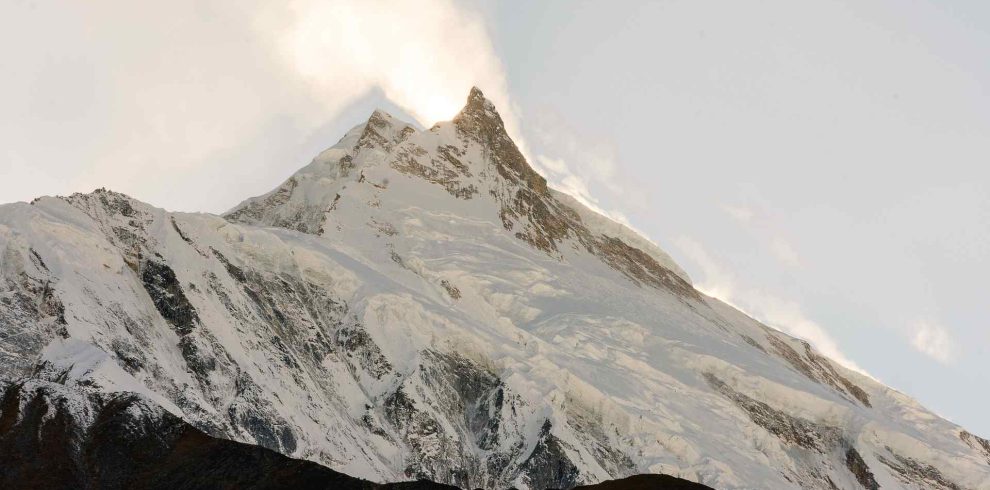
This is the first unobstructed view of Manaslu for most trekkers on the circuit, or at least the first view that communicates its true scale. At Namrung and Lho, the mountain was visible but still partially screened by ridges and by the tree-covered slopes of the valley. At Shyala, the valley opens sufficiently and the elevation is sufficient that Manaslu’s glaciated flanks are visible in their full height above the intervening terrain. The glaciers catch the light differently at different times of day. The summit ridge, often trailing a plume of wind-driven snow, marks a height above you that feels both impossibly distant and newly present in a way it was not an hour ago on the forested trail below.
Shyala and the Treeline: Understanding the Landscape Transition
The defining geographical fact about Shyala is its position at the treeline, the altitude above which trees cannot survive. The treeline on the south-facing slopes of the Manaslu Conservation Area is not a sharp line but a transition zone, several hundred meters of altitude where the trees shrink progressively from their full growth form to stunted scrub to isolated individuals clinging to sheltered microhabitats to nothing. Shyala sits in the middle of this transition zone, with proper forest below and open alpine above, and the settlement itself occupying a position where both worlds are present simultaneously.
Below Shyala, the slopes carry blue pine and Himalayan fir in their full height. The rhododendrons grow as trees, their trunks reaching head height and above. The undergrowth is dense: bamboo in the lower sections, alpine shrubs and wild roses higher up, and through all of it the medicinal herbs that Himalayan traditional medicine has catalogued for centuries. The forest floor is soft with accumulated needles and leaf litter. The air in the lower forest smells of resin and damp earth. Birdsong fills the canopy.
At Shyala, the rhododendrons have become bushes growing no taller than chest height. The blue pines are spaced widely apart, shorter, with thinner trunks. Between them, juniper scrub appears as a new element, low-growing and tough, adapted to the harsher conditions of the high alpine zone that begins a short distance above. Lichen covers the exposed rock surfaces in shades of orange, grey, and pale green. The undergrowth has simplified to hardy grasses, dwarf shrubs, and the scattered flowering plants that can complete their growth cycle in the short alpine summer.
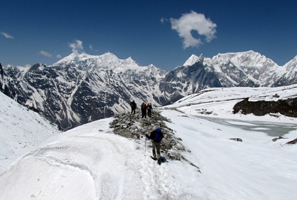
Above Shyala, within half an hour to an hour of walking northward, the trees disappear entirely. The landscape opens to the vast brown and gold of the high alpine meadows, the terrain that will accompany the circuit all the way to the pass. Scattered boulders, left by retreating glaciers, dot the valley floor. Yak pastures spread across the broad flat sections of the valley. The Budhi Gandaki runs clear between gravel banks. The open sky above feels enormous after the enclosed forest of the lower route. And looking up the valley, the mountains are no longer a background detail but the entire foreground, middle ground, and background of the view.
The Ecological Significance of the Treeline
For trekkers interested in the natural world, the treeline at Shyala is not just a visual boundary but an ecological one with real significance for the distribution of plants, animals, and habitats along the circuit. The trees that grow below Shyala provide shelter, nesting sites, and food resources for species that cannot survive in the open alpine above. The birds that fill the Lho forest, the laughingthrushes, the warblers, the Himalayan monal pheasants, are concentrated in this forest zone precisely because it provides what the alpine above cannot: dense cover and a diverse food supply from insects, berries, and seeds.
Above the treeline, the species change. The open rocky terrain above Shyala supports Himalayan tahr and blue sheep, large ungulates that are adapted to steep, exposed ground and that need the sight lines the open terrain provides to watch for predators. The raptors that soar above the valley, the Himalayan griffon and the lammergeier, use the thermals that rise from the open alpine slopes rather than hunting through the forest canopy. The treeline at Shyala is where you transition from one set of wildlife encounters to another, and paying attention to that transition adds a layer of ecological interest to a walk that is already spectacular for its scenery alone.
Mountain Views from Shyala
The mountain views from Shyala and its surrounding area are among the most dramatic on the Manaslu Circuit before reaching Samagaun, and for a particular reason: Shyala is the first point on the route where Manaslu (8,163m) is fully visible as a mountain of consequence rather than a distant summit peek above the forest canopy. The experience of walking out of the trees at Shyala and seeing the eighth highest mountain on earth standing in the open ahead of you is one of those moments that justifies everything that came before it on the circuit, the days in the gorge, the forest climbs, the river crossings, the permit checkpoints.
| Peak | Elevation | Visibility from Shyala | Notes |
|---|---|---|---|
| Manaslu | 8,163m | Excellent — northern and western faces visible | First proper unobstructed view on the circuit; grows more impressive on the approach to Samagaun |
| Himalchuli | 7,893m | Good — visible to the east | A wall of rock and ice filling the eastern skyline; most dramatic in afternoon light |
| Ngadi Chuli (Peak 29) | 7,871m | Partial — visible from open terrain above the settlement | Best seen from slightly above Shyala where the eastern ridges no longer block the view |
| Manaslu North | 7,157m | Good — visible as a distinct subsidiary peak | Often confused with Manaslu itself; the main summit is further right |
| Ganesh Himal range | Various peaks 6,000m to 7,400m | Partial — visible in southern views from the trail | Looking back south from above Shyala on a clear day |
The view of Manaslu from Shyala is not the definitive view that Samagaun provides, where the mountain fills the northern horizon and its glaciated flanks stretch across the entire width of the valley. At Shyala, there is still distance between the trekker and the summit, and the angle of view means that the full mass of the mountain’s lower flanks is still partially obscured by the intervening valley walls. But it is the view that reveals Manaslu as a presence rather than a backdrop, and for trekkers who have been looking forward to this moment since leaving Kathmandu, the first clear sighting from above the treeline at Shyala is deeply satisfying.
The quality of the view varies by time of day and season. Morning is generally clearer than afternoon, as high-altitude wind and cloud tend to build during the day and can obscure summits by early afternoon. In October, the post-monsoon clarity produces views of extraordinary sharpness: the ice and rock details on Manaslu’s flanks are visible without binoculars, and the colour contrast between the blue-white of the glacier ice and the deep blue of the sky at this altitude is a blue that does not exist at lower elevations. In May, the spring haze softens the colours but the views are still excellent, and the rhododendrons in bloom below add a foreground of red and pink that autumn cannot offer.
Cultural Character of Shyala
Shyala is part of the Nubri cultural zone, the Tibetan Buddhist community that occupies the upper Budhi Gandaki valley from approximately Namrung northward to the Tibetan border. The Nubri people, whose name comes from the Tibetan term for this valley, speak a Tibetan dialect called Nubri that is closely related to but distinct from Central Tibetan. Their religion is Nyingma Buddhism, the oldest of the four main schools of Tibetan Buddhism, associated with the legendary Guru Rinpoche (Padmasambhava) who is credited with bringing Buddhism to Tibet in the eighth century.
The physical evidence of this culture is visible throughout Shyala even in the settlement’s current small size. The houses are built in the Tibetan style: thick stone walls for insulation against the cold, flat roofs for drying food and materials during summer, small windows to minimize heat loss in winter. The prayer flags on the rooftops and poles are not decoration but devotional objects, their five colors representing the five elements (sky blue for space, white for water, red for fire, green for air, yellow for earth) and their printed prayers and mantras carried to the world on every breath of wind.
The mani walls and chortens that line the trail through and around Shyala are characteristic features of Tibetan Buddhist communities throughout the Himalaya. The chortens at Shyala are simple whitewashed structures, smaller and less ornate than those at Samagaun or Samdo, but they serve the same religious function: marking sacred space, housing relics or sacred texts, and guiding practitioners along the correct path of circumambulation. Walking through Shyala in a clockwise direction, passing the chortens on your right, is the respectful practice that local tradition requires and that costs the visiting trekker nothing.
Traditional Economy and Livelihood
The traditional economy of Shyala, like that of the other upper valley villages, rested on a combination of subsistence agriculture, yak herding, and cross-border trade. Barley and potatoes are the crops that grow at this altitude during the brief summer season, hardy enough to complete their growth cycle between the snowmelt of spring and the first snows of autumn. Yaks graze the alpine pastures above the settlement in summer and are brought to lower ground in winter, providing milk, fiber, meat, and transport through the year.
The trans-Himalayan trade that once sustained communities throughout the Nubri valley brought salt, wool, and other goods from the Tibetan plateau south through these villages in exchange for grain, manufactured goods, and lower-altitude products. This trade, which had operated for centuries along the high passes above Samdo and Samagaun, was progressively disrupted by the tightening of the Nepal-Tibet border following the political changes in Tibet in the mid-twentieth century. By the late twentieth century, organized trekking tourism had arrived in the Manaslu region (which opened to foreign trekkers in 1992), and the teahouse economy that now sustains Shyala is the partial replacement for the trade economy that came before it.
Today, the families at Shyala who run the teahouses carry all the supplies needed for the trekking season up from lower villages or from the road-end at Arughat, a task that requires either porters or yaks and represents a significant logistical effort for each season’s operation. Understanding this supply chain helps trekkers understand why food prices at Shyala are higher than in Kathmandu, and why wasting food or complaining about limited menu options is particularly poor form in a settlement this small and this remote.
Where to Stay in Shyala
Shyala has one or two teahouses, with the exact number varying by season and year. The settlement is not designed as a primary overnight stop on most itineraries, which means the teahouse capacity is limited and the range of facilities is basic even by Manaslu Circuit standards. The teahouses that do operate here are run by local families who also manage the kitchen, the rooms, and any other services, often with a small staff or family members helping during the busy trekking seasons.
The rooms at Shyala are twin-sharing with foam mattresses, pillows, and blankets. The blankets are adequate for mild conditions but should be supplemented with your sleeping bag on cold nights, which at 3,500 meters means most nights in October, November, and the spring months. Private single rooms are not typical here. The bathrooms are shared and may be outside the main building. Hot showers are not available at Shyala. The common room, heated by a wood or yak-dung burning stove, is the social center of the teahouse and the only consistently warm space in the building after dark.
| Facility | Availability at Shyala | Notes |
|---|---|---|
| Room type | Twin-sharing rooms, basic | No private singles; limited total capacity |
| Bedding | Foam mattress, pillow, blankets | Always use your sleeping bag at this altitude |
| Bathroom | Shared, basic | May be outside the main building |
| Hot shower | Not available | Next hot shower opportunity is Samagaun |
| Electricity | Solar, limited and variable | Charging possible but not guaranteed; carry a power bank |
| Wi-Fi | Possibly available, very limited | Do not rely on it; connectivity is far below Lho quality |
| Phone signal | Ncell and Nepal Telecom, variable | May work in parts of the settlement; not reliable |
| Heating | Wood or yak-dung stove in common room only | Rooms are not heated; the common room is where you warm up |
| Room cost | NPR 300 to 600 per person | Some agencies include Shyala as a lunch stop, not overnight |
The limited capacity of Shyala’s teahouses means that trekking groups intending to stay overnight should inform their agency in advance so that arrangements can be made. During the peak season months of October and November, even the limited number of beds at Shyala can fill up if multiple groups arrive on the same day. Because Shyala is often listed as a lunch stop rather than an overnight destination on standard itineraries, the teahouse owners may not expect overnight guests and may need advance notice to prepare rooms and sufficient food supplies.
The experience of a night at Shyala is qualitatively different from a night at Samagaun or even Lho. The settlement is quieter, the number of trekkers present is smaller, and the evening in the common room around the stove has an intimacy that the larger teahouses at the more established overnight stops cannot replicate. If you have the flexibility to spend a night here and your acclimatization schedule permits it, the experience is worth seeking out.
The 9 Days Manaslu Circuit Trek, also known as the Short Manaslu Circuit Trek, is designed for trekkers who want…
Food in Shyala
The food at Shyala follows the standard Manaslu Circuit teahouse menu, a selection shaped by what can be carried to 3,500 meters at the end of a long supply chain from the road-end far below. Dal bhat, the universal Nepali meal of rice with lentil soup and seasonal vegetables, is the most reliable and nutritious option and comes with unlimited refills. Thukpa, the Tibetan noodle soup with vegetables that appears on menus throughout the upper valley, is a warming and substantial meal that suits the cold evenings at this altitude particularly well. Fried rice, Tibetan bread with yak butter or jam, chapati, and pancakes are also typical menu items.
The food at Shyala is cooked in a small kitchen by the teahouse family, using ingredients that have been carried up from below. The vegetable selection is limited by what survives the journey and the storage conditions. Fresh vegetables are available in some form even at this altitude, but variety decreases as the season progresses and supply runs low toward the end of November. The kitchen does what it can with what it has, and the results are consistently better than the limited resources might suggest. Teahouse cooks on the Manaslu Circuit have long practice in producing satisfying meals from simple ingredients at altitude.
| Food Category | Items Available at Shyala | Typical Price Range |
|---|---|---|
| Main meals | Dal bhat (with refills), thukpa, fried rice, vegetable curry | NPR 450 to 750 |
| Bread and light meals | Tibetan bread with butter, chapati, egg dishes, pancakes | NPR 250 to 500 |
| Soups | Garlic soup, vegetable soup, noodle soup, tomato soup | NPR 200 to 350 |
| Breakfast | Porridge, oats, fried egg, Tibetan bread, instant noodles | NPR 200 to 400 |
| Snacks | Biscuits, chocolate, instant noodles, packaged nuts | NPR 100 to 300 |
| Hot drinks | Black tea, milk tea, ginger tea, hot lemon, instant coffee, hot chocolate | NPR 100 to 200 |
| Water | Boiled water, mineral water | NPR 100 to 200 per liter |
Garlic soup is worth ordering at Shyala. At 3,500 meters, the body is working harder than usual to supply oxygen to its tissues and to maintain core temperature in the cold air. Garlic contains compounds that support circulation, and a hot bowl of garlic soup warms you from the inside in a way that a cup of tea alone does not. The practical effects may be modest, but the warmth and the sense of doing something useful for your altitude adjustment make garlic soup a circuit tradition with real appeal.
Budget approximately NPR 1,500 to 2,500 per day for all food at Shyala if you are paying independently. Package trek arrangements typically include meals, but the same economics apply: everything costs more here than at lower altitudes because of the supply chain. Treat the pricing not as a complaint but as an accurate reflection of the effort required to put food on your plate at this altitude and this level of remoteness.
Wildlife Around Shyala
The terrain around Shyala, spanning the treeline transition from forest to alpine, is one of the most ecologically productive zones on the Manaslu Circuit for wildlife observation. The edge between two distinct ecosystems, which ecologists call an ecotone, supports more species than either ecosystem alone, because animals can exploit the resources of both while moving between them. Trekkers who pay attention to the landscape around Shyala, and who walk quietly and carry binoculars, have a reasonable chance of encountering some of the most remarkable wildlife in the Himalayan region.
| Species | Type | Habitat at Shyala | Observation Likelihood |
|---|---|---|---|
| Himalayan tahr | Mammal | Steep rocky slopes above the treeline, east-facing morning slopes | Good — commonly seen in small herds in early morning |
| Blue sheep (bharal) | Mammal | Open rocky terrain above and around the settlement | Moderate — more common above 3,800m; possible at Shyala |
| Himalayan monal pheasant | Bird | Forest understory below and around the settlement | Good in the forest section; the brilliant male is unmistakable |
| Himalayan griffon | Bird | Soaring on thermals above the valley | Common — large wingspan and conspicuous in flight |
| Lammergeier (bearded vulture) | Bird | Soaring over ridges and the valley floor | Regularly seen — distinctive wedge-shaped tail in flight |
| Snow pigeon | Bird | Rocky cliffs and open terrain above the treeline | Common in flocks on cliff faces |
| White-capped redstart | Bird | Stream edges and scrub throughout the zone | Very common — active and visible along streams |
| Raven | Bird | Throughout the valley at all altitudes | Very common — vocal and conspicuous |
| Pika | Mammal | Rock piles and boulder fields above the treeline | Common — listen for sharp whistle alarm calls |
| Snow leopard | Mammal | Rocky ridges above the treeline; dawn and dusk | Very rare — habitat is present, sightings are exceptional |
Himalayan tahr are the most reliably observed large mammals around Shyala. These stocky wild goats, with their curved horns and thick brown coats, inhabit the steep slopes above the treeline and are most active in the early morning before the sun warms the open slopes. They are not particularly shy of humans when observed from a distance and the observer does not approach too quickly. A herd of tahr on a steep rock face, picking their way across ground that would terrify most humans, is a genuinely impressive sight and one that gives some practical context to the predator-prey relationships of this landscape.
The Himalayan monal pheasant, Nepal’s national bird, is best seen in the forest section of the Lho-to-Shyala trail. The male monal is one of the most spectacular birds in the world: iridescent green, purple, copper, and blue feathers covering a body the size of a large chicken, with a distinctive curved crest and a copper-coloured tail. The females are brown and streaked, well camouflaged, and far less conspicuous. Monals move through the forest understory in pairs or small groups, scratching for bulbs, seeds, and insects in the leaf litter. They are more often heard before they are seen, their loud whistling call carrying through the forest before the bird itself becomes visible.
Why Spend a Night in Shyala
The standard Manaslu Circuit itinerary treats the distance from Lho to Samagaun as a single walking day, with Shyala as a lunch stop in the middle. This is a perfectly reasonable arrangement for trekkers who are managing the altitude well and whose itinerary does not include an extra rest day. But there are specific circumstances and personal preferences that make an overnight stop at Shyala worthwhile, and understanding them helps trekkers and their guides make better decisions at this point in the circuit.
Acclimatization Benefit
The most practical argument for spending a night at Shyala is acclimatization. By the time most trekkers reach this section of the circuit, they have been walking for six to eight days and have been above 2,000 meters for several of them. But the altitude gains from Lho (3,180m) to Samagaun (3,530m) and then to Samdo (3,875m) and Dharmasala (4,460m) represent a rapid ascent into serious altitude territory, and the standard itinerary’s pace can feel rushed for some trekkers whose bodies are slower to adjust.
Spending a night at Shyala adds a night at a lower altitude than Samagaun before ascending to Samagaun, which gives the body additional time to adjust before the demanding days above. This is particularly valuable for trekkers who experienced any symptoms at Lho, who are making their first high-altitude trek, or who are on a conservative acclimatization schedule. An extra night at Shyala delays the arrival at Samagaun by one day but improves the quality of the acclimatization and the performance on the days above Samagaun, which are the days that matter most.
The Setting and the Quiet
The second argument for staying at Shyala is less practical and more experiential. Shyala is quieter than any of the larger villages on the circuit. At Samagaun, there may be ten or fifteen trekking groups in residence at any given peak-season evening, with multiple teahouses running and the village having a comparative bustle. At Shyala, you may be the only trekking group. The evening in the common room is just you, your guide, and the teahouse family. The conversation that happens around a stove in those circumstances, without the distraction of a room full of other trekkers, has a different quality.
The silence outside the teahouse after dinner is the silence of a small settlement at 3,500 meters with no road access, no generator, and no artificial light beyond the solar-powered bulbs in the common room and kitchen. The stars at this altitude, with no light pollution for fifty kilometers in any direction, are extraordinary. The Milky Way is visible as a physical band across the sky, not just a suggestion of increased star density. On clear nights, the snow on the upper ridges catches the starlight and glows faintly. If you are awake early in the morning, which altitude often ensures, the silence before dawn at Shyala is one of the deepest you will experience on the entire circuit.
Sunrise Light
Sunrise at Shyala illuminates the valley above in gold while the forest below remains in shadow. The light climbs the slopes from the summit downward, touching the highest snow fields first, then the rock bands, then the upper pastures, then the prayer flags on the rooftops of the settlement, then the trail that disappears northward. For photographers, this directional morning light on the mountain terrain above Shyala creates conditions that the flat midday light cannot replicate. And for any trekker who is awake to see it, the experience of watching Manaslu catch the first light of day from a quiet teahouse terrace in a village of five houses is one that the larger, busier overnight stops on the circuit simply cannot offer.
Altitude and Acclimatization at Shyala
At 3,500 meters, Shyala is above the altitude threshold where acute mountain sickness (AMS) becomes a genuine concern for trekkers who have not acclimatized adequately. The standard circuit itinerary manages this risk through a gradual ascent profile, gaining altitude slowly over the first week of the trek and including rest days at higher altitudes. Trekkers who have followed the itinerary correctly and have been responding well to the altitude typically arrive at Shyala without significant symptoms. But the altitude is high enough that mild symptoms, a slight headache, reduced appetite, disrupted sleep, are common and expected on the first night at or above 3,500 meters.
The key principle at this altitude is monitoring and honest communication. Mild symptoms that improve with rest and hydration are normal. Symptoms that worsen over 12 to 24 hours, or that include vomiting, breathlessness at rest, or confusion, are warning signs that require a response. Your guide is trained to assess and respond to altitude sickness, and the most important thing you can do is tell them honestly how you are feeling rather than minimizing symptoms because you do not want to slow the group or extend the itinerary.
| Symptom Category | Signs | Appropriate Response |
|---|---|---|
| Mild AMS | Headache relieved by ibuprofen, mild fatigue, slightly reduced appetite, disturbed sleep | Rest, drink 3 to 4 liters of water per day, avoid alcohol, monitor for worsening |
| Moderate AMS | Persistent headache not relieved by medication, nausea, dizziness, significant fatigue | Do not ascend further; rest at Shyala or descend to Lho; consult guide; consider medication |
| Severe AMS / HAPE warning signs | Breathlessness at rest, dry cough, reduced SpO2, pink frothy sputum | Emergency descent immediately; do not wait for symptoms to resolve at altitude |
| Severe AMS / HACE warning signs | Confusion, loss of coordination, severe fatigue, inability to walk straight | Emergency descent immediately; medical emergency requiring urgent action |
Drinking adequate water is the most effective and accessible intervention for altitude adjustment. The cold, dry air at 3,500 meters causes significant fluid loss through respiration, and most trekkers breathe more rapidly at altitude than they do at sea level, increasing this fluid loss. Aim for at least three to four liters of fluid per day including water, tea, and soup. The teahouses at Shyala provide boiled water for a fee, which is the safest source. Treat any other water with purification tablets or a UV sterilizer before drinking.
The 9 Days Manaslu Circuit Trek, also known as the Short Manaslu Circuit Trek, is designed for trekkers who want…
Weather at Shyala Through the Seasons
Shyala’s position at the treeline means it experiences more wind exposure than the forest villages below. The trees that provide shelter and reduce wind speed in the forest zone are absent at Shyala, and the valley channels wind from the passes above during both day and night. Daytime temperatures during the main trekking seasons are pleasant in sunshine but can drop rapidly with cloud cover or wind. Nights are cold throughout the trekking season and become very cold by late November as the winter approaches.
| Season | Months | Daytime Temp | Nighttime Temp | Trail and Weather Conditions | Trekking Suitability |
|---|---|---|---|---|---|
| Spring | March to May | 8°C to 18°C | -5°C to 3°C | Rhododendrons bloom below Shyala; some afternoon cloud; snow possible on ridges above | Excellent, especially April and May |
| Monsoon | June to September | 8°C to 15°C | 0°C to 5°C | Rain most days, cloud obscures mountain views, trails wet and slippery, leeches in forest | Not recommended; views poor, conditions difficult |
| Autumn | October to November | 5°C to 15°C | -8°C to 0°C | Clear skies, best mountain views, stable weather, cold nights; October best month | Excellent; peak season with optimal conditions |
| Winter | December to February | -5°C to 5°C | -15°C to -5°C | Snow on the trail above Shyala, pass may be closed, most teahouses closed | Not feasible without specialist equipment |
October is the single best month to visit Shyala and the entire upper Manaslu Circuit. The sky after the monsoon is clear with extraordinary visibility, and the views from the treeline at Shyala take in Manaslu and the surrounding peaks with a sharpness that is not available in any other season. The snowfall on the upper peaks from the late monsoon creates fresh white summits against the deep blue of the post-monsoon sky. Temperatures are cold at night but manageable during the day, and the trail conditions are at their best: dry, firm, and free of the ice and snow that complicate travel in November and later.
The spring rhododendron bloom transforms the forest below Shyala in April and May. Walking up from Lho through the blooming rhododendrons to arrive at Shyala’s open treeline position is one of the most visually spectacular transitions on the circuit. The pink and red of the flowers below contrasts with the white and grey of the mountain terrain above, and the village sits precisely at the point where these two landscapes meet. If you have any flexibility in your trekking season, a late April or early May visit to Shyala catches this bloom at its peak.
Permits and Practical Information
By the time trekkers reach Shyala, the permit requirements for the Manaslu Circuit have already been arranged and checked at multiple points along the route. The Manaslu Restricted Area Permit and the Manaslu Conservation Area Permit should both be in your possession and should have been checked at the checkpoints at Jagat, Namrung, and Lho. No new permits are required specifically at Shyala, but all existing permits remain valid and should be accessible for any further checks on the route above.
The guide requirement that applies throughout the Manaslu restricted area is unchanged at Shyala. All legal trekkers in the Manaslu restricted zone are traveling with a licensed guide, and the guide’s role at this point in the circuit includes monitoring altitude adjustment, deciding whether the group should push on to Samagaun or stop at Shyala, and ensuring the group has adequate food and rest before the harder days above Samagaun.
There is no ATM or money exchange in Shyala. Cash in Nepali rupees is the only payment method accepted anywhere on the Manaslu Circuit above Arughat. By Shyala, trekkers on package arrangements should not need to pay for meals directly, but independent trekkers need to ensure they are carrying enough rupees for accommodation, food, and extras through the entire upper circuit to the Annapurna side. Bhimtang, the first village after the Larke La Pass, also operates on a cash-only basis.
Shyala in the Context of the Full Manaslu Circuit
Understanding where Shyala fits in the overall flow of the Manaslu Circuit helps trekkers appreciate its significance. The circuit is not simply a sequence of overnight stops but a journey through changing landscapes, cultures, and altitude zones, each stage of which prepares the trekker physically and mentally for what comes next. Shyala’s position at the treeline means it marks the transition from the circuit’s lower phase, characterized by forest, gorge, and the lush vegetation of the lower valley, to its upper phase, characterized by open alpine terrain, Tibetan culture, and the altitude that defines the hardest days of the route.
| Village | Elevation | Cultural Character | Landscape Character | Role in Circuit |
|---|---|---|---|---|
| Machhakhola | 869m | Gurung, Magar | Subtropical gorge | Trailhead, first night |
| Jagat | 1,340m | Mixed hill communities | Deep gorge, river crossings | First permit checkpoint |
| Deng | 1,860m | Transition | Gorge narrows, forest begins | Mid-lower valley stop |
| Namrung | 2,630m | Beginning of Tibetan influence | Temperate forest | Entry to upper valley character |
| Lho | 3,180m | Nubri Tibetan Buddhist | High forest, first mountain views | Last village before treeline |
| Shyala | 3,500m | Nubri Tibetan Buddhist | Treeline transition; forest meets alpine | First mountain view milestone; optional overnight |
| Samagaun | 3,530m | Nubri Tibetan Buddhist | Open alpine, Manaslu close | Primary acclimatization village |
| Samdo | 3,875m | Tibetan Buddhist, border village | High alpine, Tibet border proximity | Second acclimatization stop, last permanent village |
| Dharmasala | 4,460m | No permanent residents | Glaciated, very high alpine | Last overnight before pass |
| Larke La Pass | 5,106m | No habitation | High mountain pass, glaciated | Highest point; circuit’s defining challenge |
The progression from Machhakhola at 869 meters to Shyala at 3,500 meters takes most trekkers six to seven days of walking and represents a gain of nearly 2,700 meters in altitude over that period. This gradual gain is exactly what the acclimatization process requires, and trekkers who arrive at Shyala feeling strong and well adjusted are in a much better position for the harder days above than those who have pushed too hard in the lower valley or ignored early altitude symptoms.
From Shyala to Samagaun: The Final Approach
The walk from Shyala to Samagaun takes two to three hours and is the most straightforward section of the circuit in terms of difficulty. The elevation gain is minimal, only about 30 meters of net ascent over a distance of five to six kilometers, and the trail traces the broad Budhi Gandaki valley floor through open alpine terrain. After the forested climb from Lho to Shyala, this section feels expansive and easy. The views up the valley improve steadily as the trail progresses north, with Manaslu growing visually larger and more detailed with each kilometer.
The trail crosses yak pastures where large herds may be grazing, their yak bells providing a sound that has accompanied Himalayan trekkers for generations. The pastures are managed communally by the villages of the upper valley, with grazing rights and seasonal movement patterns that have been established over centuries. The yaks in the pastures between Shyala and Samagaun are generally indifferent to trekkers, but the size of the animals and the width of their loads when carrying supplies means that passing a yak caravan requires stepping off the trail on the uphill side and waiting for the animals to pass.
Samagaun appears around a broad curve in the valley: a substantial village by the standards of the upper circuit, with perhaps two hundred houses spread across a terrace above the Budhi Gandaki, prayer flags on every rooftop, and the Pungyen Gompa monastery visible on the hillside above. After the quiet of Shyala, Samagaun can feel almost busy: multiple teahouses operating, other trekking groups in residence, and the wider range of facilities that a larger village with a more established tourism infrastructure can provide. The contrast with Shyala’s intimacy is immediate and stark.
Frequently Asked Questions About Shyala
What is the elevation of Shyala village on the Manaslu Circuit?
Shyala sits at approximately 3,500 meters (11,480 feet) above sea level. Some maps and permit documents record the elevation as slightly higher, in the range of 3,510 to 3,575 meters, as precise measurements of small Himalayan settlements vary between sources. What is consistent across all sources is that Shyala sits at or just above 3,500 meters, making it the highest point on the trail between Lho (3,180m) and Samagaun (3,530m), despite Samagaun being the larger and more established of the two settlements. This means trekkers actually descend slightly from Shyala to Samagaun rather than continuing to climb.
Is Shyala an overnight stop or just a lunch stop on the Manaslu Circuit?
Most standard Manaslu Circuit itineraries treat Shyala as a lunch stop on the Lho to Samagaun day, which is a four to five hour walk from Lho with a rest and food break at Shyala in the middle. However, Shyala does have one or two functioning teahouses that offer overnight accommodation, and some trekking itineraries, particularly those designed for slower acclimatization or for trekkers who want a more intimate experience of the upper valley, include Shyala as a dedicated overnight stop. If you want to stay at Shyala, inform your trekking agency in advance so the teahouse can be notified and accommodation prepared.
What is special about Shyala compared to other villages on the circuit?
Shyala’s primary distinction is its position at the treeline, the altitude boundary between the forested lower valley and the open alpine upper valley. It is the point where the forest that has accompanied the circuit since the lower gorge gives way to alpine meadow, where the rhododendrons shrink from trees to bushes, and where Manaslu suddenly becomes fully visible after being partially or completely screened by forest and ridges throughout the lower valley. Shyala is also the quietest and most intimate overnight stop available on the upper circuit, offering a teahouse experience with very few other trekkers and a sense of genuine remoteness that the larger villages cannot replicate.
How many teahouses are at Shyala?
Shyala typically has one or two functioning teahouses during the main trekking seasons. The exact number varies by year and season, as the small scale of the settlement and the limited trekker traffic through it makes commercial viability marginal for multiple teahouses. The total sleeping capacity at Shyala is small, probably no more than ten to twenty beds across all available teahouses. Advance booking through your trekking agency is important if you intend to stay overnight, particularly during the peak months of October and November when even the limited capacity of Shyala can fill with one or two groups stopping simultaneously.
Can I see Manaslu from Shyala?
Yes, and this is one of the most significant things about Shyala. The mountain is visible from the settlement and from the trail above the settlement, and Shyala is the first point on the Manaslu Circuit where Manaslu (8,163m) is visible without the forest canopy or intervening ridges partially blocking the view. The view from Shyala is not the definitive close panorama that Samagaun provides, but it is the first view that communicates the mountain’s true scale and presence. For trekkers who have been working toward this view since leaving Kathmandu, Shyala is where the circuit’s name first becomes something you can see rather than just a label on a map.
What wildlife is most likely to be seen near Shyala?
The most reliably seen large mammal near Shyala is the Himalayan tahr, a wild goat with curved horns and a thick brown coat that inhabits the rocky slopes above the treeline. Tahr are commonly seen in small herds on the east-facing slopes above the settlement in the early morning. The Himalayan monal pheasant, Nepal’s national bird and one of the world’s most colorful birds, is frequently encountered in the forest section of the trail between Lho and Shyala. Himalayan griffons and lammergeiers soar above the valley on most days. Pikas, small relatives of rabbits, live in the rock piles above the treeline and are heard more often than seen, announcing your presence with sharp whistle calls.
Is altitude sickness a risk at Shyala?
At 3,500 meters, altitude sickness is a real possibility for trekkers who have not adequately acclimatized. The standard circuit itinerary manages this risk through a gradual ascent from lower altitudes over the preceding days, and most trekkers who have followed their itinerary correctly arrive at Shyala with mild or no symptoms. However, the altitude is above the threshold where individual susceptibility becomes a significant factor, and some people respond to 3,500 meters with headaches, nausea, or poor sleep regardless of how slowly they have ascended. Report any symptoms to your guide. At Shyala, the response options include resting at this altitude or descending to Lho, which is only two to two and a half hours below.
What is the best season to pass through or stay at Shyala?
October is the best month for the views, the trail conditions, and the overall quality of the experience. The post-monsoon clarity gives extraordinary mountain views, the trail is dry and firm, and the temperatures, while cold at night, are manageable during the day. Spring, specifically late April and early May, offers the added spectacle of the rhododendron bloom in the forest below Shyala: the walk up through blooming rhododendrons to the treeline at Shyala is one of the most beautiful single sections of trail on the entire circuit. November is also good but temperatures fall significantly by late in the month. Monsoon season from June through September is not suitable for the upper Manaslu Circuit.
Does Shyala have a monastery or gompa?
No, Shyala does not have a monastery. The settlement is too small to support one. The religious infrastructure visible at Shyala is limited to the mani walls, chortens, and prayer flags that characterize all the upper valley settlements, but there is no resident monk or monastery building in the village itself. The nearest monasteries are at Lho, about two hours south, and at Samagaun, about two to three hours north. Both are worth visiting if your itinerary includes rest days at those villages. The monastery above Samagaun, Pungyen Gompa, is one of the most significant religious sites on the entire circuit.
Should I carry cash to Shyala?
Yes. There is no ATM at Shyala and no way to access cash above Arughat on the Manaslu Circuit. If you are on a package trek where meals and accommodation are prepaid by your agency, your cash needs at Shyala are limited to personal extras: additional drinks, snacks, charging fees, and any small purchases from the teahouse. If you are trekking independently or on a semi-guided arrangement, you need to carry enough rupees to cover all meals, accommodation, and extras from this point through the pass and down the Annapurna side to Dharapani or Besisahar, where road access and ATMs return. Estimate your costs per person per day and carry a meaningful buffer beyond your calculation.
The Village Between Two Worlds
The Manaslu Circuit has its celebrated moments: the deep gorge below Jagat, the monastery views at Samagaun, the early morning start from Dharmasala, the crossing of the Larke La. These are the experiences that trekkers name when they tell people about the route, and they deserve their reputations. But the circuit’s character is made of transitions as much as destinations, and Shyala occupies one of the most significant transitions on the entire route.
The forest that has accompanied the trail since the lower valley ends at Shyala. The rhododendrons that put on their famous display in spring, the blue pines that have filtered the light and the bird calls for days of walking, the enclosed feeling of the gorge world: all of these things diminish and then disappear as the trail climbs above Shyala into the open alpine of the upper circuit. What replaces them is the world that defines the Manaslu Circuit’s most intense days: open sky, open valley, the mountains standing in their full height with no forest to hide behind, and the air growing thinner with each northward kilometer toward the pass.
Shyala stands at the line between these two worlds. It is too small to be a destination in the way that Samagaun or Samdo are destinations. But it is not too small to matter. The trekkers who stop here, whether for lunch or for a night, and who pay attention to the transition happening around them, see something that the trekkers who only look at the highlights miss: the moment when the circuit changes character, the moment when the mountains step forward and the forest steps back, the moment when everything that comes next becomes imaginable in a way it was not an hour before.
If you are planning a Manaslu Circuit Trek and want guidance on how to build Shyala into your itinerary, whether as a lunch stop on the standard schedule or as an overnight acclimatization option, contact us at Manaslu Treks. We have guided trekkers through this section of the circuit across many seasons and can help you make the most of what Shyala offers, on its own terms and as part of the full circuit journey.
The Manaslu Circuit Trek is a spectacular journey around Mount Manaslu (8,163 m), the eighth-highest mountain in the world. Located…