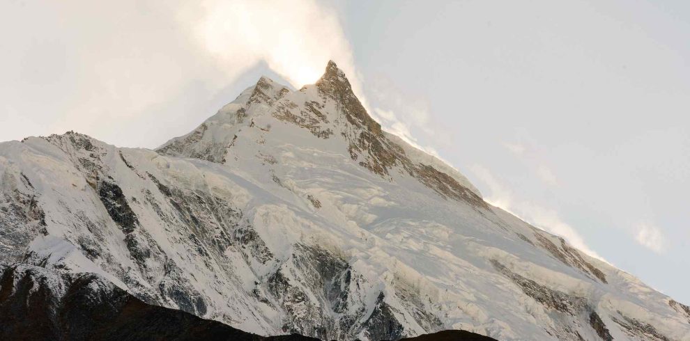
The 14-Day Manaslu Circuit Trek takes you around Mount Manaslu at 8,163 meters, the eighth-highest mountain on earth, through one of the most remote and culturally authentic trekking routes in Nepal. The entire route passes through the Manaslu Conservation Area, a protected zone of 1,663 square kilometers established in 1998 in the Gorkha District of Gandaki Province. As this is a restricted area, a licensed Nepali guide is mandatory by law for all trekkers on the route.
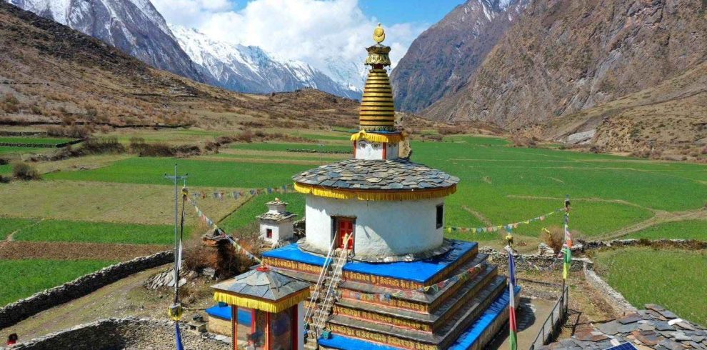
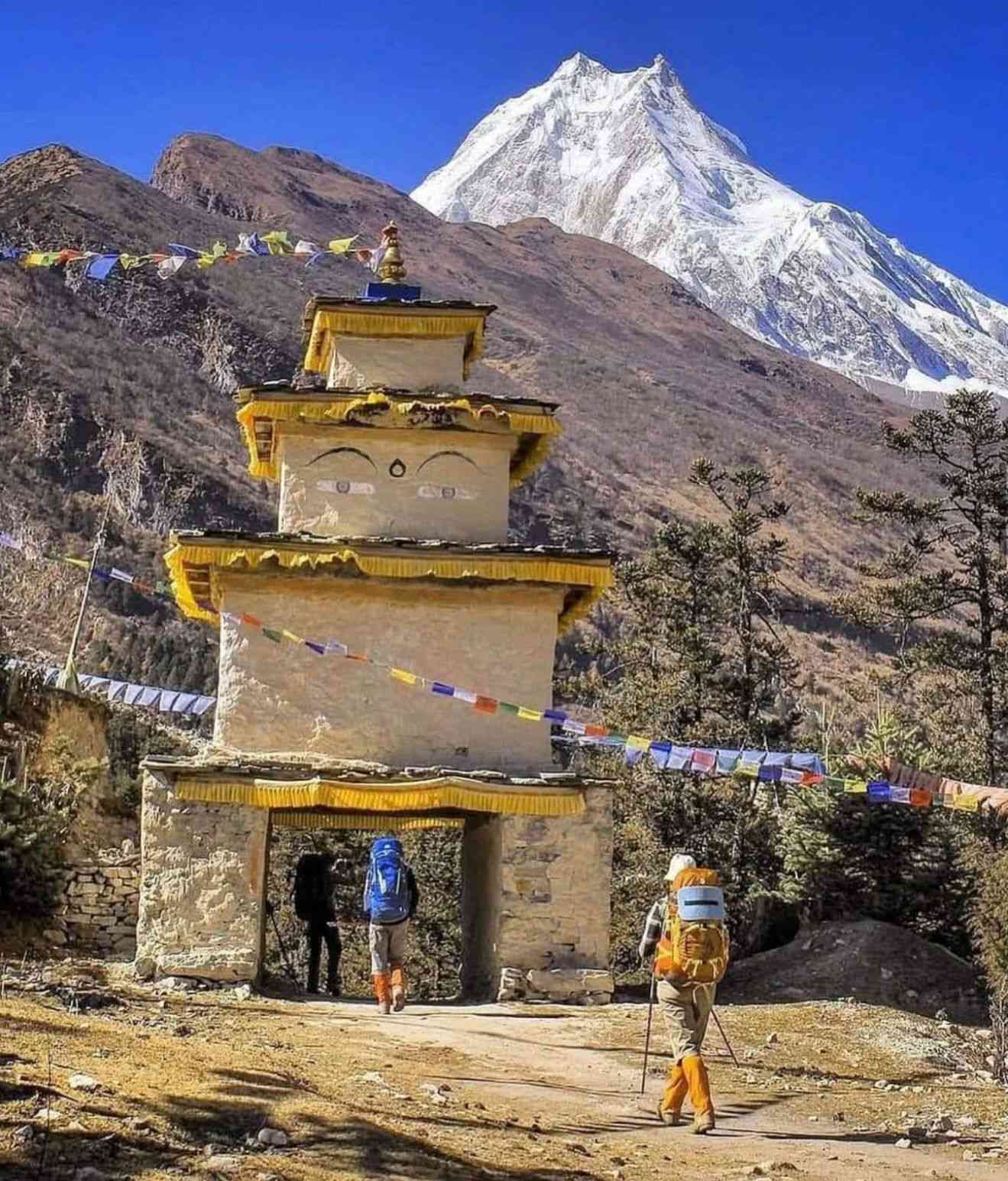
Starting from Machha Khola at 930 meters, the trail follows the Budhi Gandaki River upstream through subtropical forest, river gorges, and rhododendron hills before rising into the high Tibetan influenced villages of the Nubri Valley. The Nubri people who inhabit the upper valley from Lho through Sama Gaon and Samdo follow Tibetan Buddhist traditions that have remained largely unchanged for centuries. Their monasteries are active religious centers, not heritage sites. Monks conduct daily prayers, rituals, and education in the same buildings that have served the community for generations. Mani walls, prayer wheels, and chortens line every trail section through the upper valley. Yak herding, barley farming, and butter tea are still the daily rhythm of life here.
The crossing of Larkya La Pass at 5,106 meters is the defining moment of the trek. Starting before dawn from Dharamsala at 4,460 meters, you cross the pass in the early morning before winds rise and descend through a glacial cirque where Himlung Himal at 7,126 meters, Cheo Himal at 6,820 meters, Kang Guru at 6,981 meters, and Annapurna II at 7,937 meters form an unbroken panorama. Compared to Everest Base Camp and the Annapurna Circuit, the Manaslu Circuit Treks remains significantly quieter, more culturally intact, and more genuinely remote.
We are Manaslu Treks and Expedition Pvt. Ltd., a licensed local operator based in Kathmandu specializing exclusively in this region. We arrange all permits, handle all logistics, and provide licensed guides local to Gorkha district who have walked this specific circuit across multiple seasons. Pay after arriving in Nepal. No advance payment required.
14 Days Manaslu Circuit Trek Updated Cost 2026 & 2027
The 14-day Manaslu Circuit Trek cost for 2026 and 2027 starts from USD 1,150 per person and goes up to USD 1,350 per person. Our pricing is 100% All-Inclusive, meaning there are absolutely no hidden costs or surprise fees after you arrive.
The 14-day Manaslu Circuit Trek is available for both private solo travellers and groups, with flexible pricing based on group size. The itinerary and services can be adjusted to suit your travel style, while experienced local guides take care of your safety, logistics, and overall trekking experience from start to finish.
| No. of Pax | Starting Price (per person) | Inquiry |
|---|---|---|
| 1 Pax | USD 1,350 | |
| 2–5 Pax | USD 1,250 | |
| 6–8 Pax | USD 1,200 | |
| 9–10 Pax | USD 1,150 |
Note: If your group has more than 10 trekkers, please contact us for a special group discount on WhatsApp or Email.
Manaslu Circuit Trek video reviews of Manaslu Treks and Expeditions
Why 14 Days Is the Right Length for the Manaslu Circuit Trek
The Manaslu Circuit is 177 kilometres of trail that gains over 4,000 metres in altitude before you even reach the pass. You could rush it in 10 days, but you would be sacrificing the acclimatization days that make the Larkya La crossing safe and the cultural stops that make the journey worth doing at all. The standard 14 days Manaslu Circuit Trek is the most widely recommended duration because it gives you one proper rest day at Samagaon, which sits at 3,500 metres, before you push to Dharamsala and then over the pass. Without that day your body does not have enough time to adjust, and the crossing at 5,106 metres becomes significantly harder and riskier.
The 14 day schedule also lets you walk at a pace that matches how the trail actually feels. The lower sections from Machha Khola to Namrung are lush, warm, and full of villages worth spending time in. The upper sections from Samagaon to Dharamsala are high, cold, and require your lungs to be working properly. The 14 day itinerary is built around this reality rather than a fixed departure schedule.
Trekkers who have done both the 9 day Manaslu Circuit Trek and the 14 day version consistently say the 14 day experience feels complete. The shorter versions skip the acclimatization day and move faster through the cultural villages. If you have the time, 14 days is the version to do.
The Larkya La Pass: What the Crossing Actually Involves
The Larkya La Pass at 5,106 metres is the highest point of the 14 days Manaslu Circuit Trek and the moment that defines the entire journey. Most trekking companies describe it as a scenic highlight. It is that, but it is also a serious mountain crossing that requires preparation, a pre-dawn start, and a guide who knows the route in the dark.
You leave Dharamsala at around 4 or 5 in the morning. The path begins in the dark, crossing glacial moraine with a headlamp. As the light comes up, the landscape around you opens into one of the most dramatic high-altitude environments in Nepal. The pass itself is marked with prayer flags, and the views from the top stretch across Himlung Himal at 7,126 metres, Cheo Himal at 6,820 metres, Kang Guru at 6,981 metres, and Annapurna II at 7,937 metres. On a clear morning, the panorama runs the full length of the horizon with no interruption.
The descent to Bimthang at 3,720 metres is long and steep. The entire day runs 8 to 10 hours depending on conditions and your pace. Snow on the pass is common from November through March and can make the trail harder to follow. Our guides know the route across multiple seasons and make the call on timing based on the actual conditions each morning, not a fixed schedule.
The reason the 14 days Manaslu Circuit Trek builds in the acclimatization day at Samagaon before the pass is specifically so your body can handle this day. Trekkers who skip the rest day report the crossing as brutal. Trekkers who take it properly describe it as the best day of their trekking life.
Villages and Culture Along the 14 Day Manaslu Circuit Route
One of the things that separates the 14 days Manaslu Circuit Trek from almost every other route in Nepal is how intact the culture along the trail still is. The restricted area permit limits the number of trekkers each year, which means the villages have not been transformed into tourism infrastructure the way Namche Bazaar or Lukla have. What you find instead are communities living the same way they have for generations, who happen to allow trekkers to pass through.
Jagat at 1,410 metres is where the restricted area officially begins. All permits are checked here by the army. The village itself is stone-paved and sits above a dramatic gorge.
Namrung at 2,900 metres is the first place where you feel the Tibetan Buddhist influence clearly. The stone buildings, the prayer walls lining the trail, and the monastery just above the village give the place a stillness that is noticeably different from the lower sections.
Lho sits above the valley with one of the most spectacular viewpoints on the entire circuit. Ribung Gompa sits on a ridge above the village, and from there you get your first unobstructed view of the full Manaslu massif. Most groups stop here for lunch and a monastery visit.
Samagaon at 3,500 metres is the largest village in the upper valley and the cultural heart of the trek. The Nubri people here speak a Tibetan dialect, and the monastery at the edge of the village is an active religious site. The acclimatization day here gives you time to visit the monastery, take the side hike to Birendra Lake at around 3,900 metres, or walk the village and spend time with the people who live there.
Samdo at 3,785 metres is the last real village before Dharamsala and the pass. It sits close to the old Tibetan trade route, and the handful of stone buildings feel genuinely remote. Most trekkers arrive early in the afternoon and spend the rest of the day resting before the pass crossing.
14 Day Manaslu Circuit Trek Permit Costs for 2026
The Manaslu region is a government-designated restricted area, which is the main reason it stays as quiet and unspoiled as it does. Three separate permits are required to trek the route, and all three must be arranged through a registered trekking agency. You cannot walk into an immigration office and get the Manaslu Restricted Area Permit yourself.
| Permit Type | Peak Season (Sep to Nov) | Off Season (Dec to Aug) |
|---|---|---|
| Manaslu Restricted Area Permit (per week) | USD 100 per person | USD 75 per person |
| Manaslu Conservation Area Permit (MCAP) | USD 30 per person | USD 30 per person |
| Annapurna Conservation Area Permit (ACAP) | USD 30 per person | USD 30 per person |
| Local Municipality Entry Fee | NPR 1,000 per person | NPR 1,000 per person |
For a standard 14 day trek in October, the RAP costs USD 200 per person (two weeks), plus the two conservation permits at USD 30 each. Total permit cost in peak season is approximately USD 260 per person. We include all permits in our package pricing, so there are no additional permit fees when you book with us.
Solo trekking update for 2026: As of March 2026, Nepal updated the rules for the Manaslu restricted area. Solo trekkers can now obtain the Restricted Area Permit without the previous requirement of being part of a group of at least two people. A licensed guide is still mandatory throughout the trek. Our team handles the solo permit process in full.
How Difficult Is the 14 Day Manaslu Circuit Trek?
The 14 days Manaslu Circuit Trek is rated moderate to challenging. The trail itself is not a technical climb. There is no fixed rope, no crampon requirement, and no climbing experience needed. What makes it challenging is the combination of sustained altitude, long walking days, and the Larkya La crossing.
On most days you will walk between 5 and 7 hours. The pass crossing day runs 8 to 10 hours. The terrain is a mix of rocky trails, stone paths, suspension bridges, and steep switchbacks. The altitude is the real variable. You sleep above 3,500 metres for five consecutive nights, with one night at 4,450 metres immediately before the pass.
Who can do this trek: Regular hikers who can walk 6 hours on uneven ground, people who exercise consistently, and first-time Himalayan trekkers with proper preparation. You do not need prior high-altitude experience. What you need is the willingness to go slowly, listen to your body, and not fight the altitude.
Recommended preparation: Build cardio fitness so you can walk uphill for 2 to 3 hours without stopping. Running, cycling, stair climbing, and day hikes in the months before your trip all help. Strength in your knees matters on the long descent from the pass.
14 Day Manaslu Circuit Trek vs Everest Base Camp vs Annapurna Circuit
| 14 Day Manaslu Circuit | Everest Base Camp (14 days) | Annapurna Circuit (14 days) | |
|---|---|---|---|
| Maximum altitude | 5,106 m (Larkya La) | 5,364 m (Base Camp) | 5,416 m (Thorong La) |
| Daily trekker numbers | Very low (restricted area) | Very high | High |
| Solo trekking | Allowed with licensed guide | Allowed independently | Allowed independently |
| Cultural authenticity | Very high (Nubri, Tibetan) | Moderate (commercialised) | Moderate |
| Crowd level | Low to very low | Very high in season | High in season |
| Cost estimate 2026 | From USD 1,150 | From USD 1,200 | From USD 900 |
The main reason trekkers choose the 14 days Manaslu Circuit Trek over Everest Base Camp is the experience of actually being in the mountains rather than walking a crowded highway to a famous base camp. The Manaslu route circles a living mountain through communities that still function as they always have. If you have done Everest Base Camp or Annapurna and want to remember what Nepal trekking felt like before it became a bucket list industry, the Manaslu Circuit is the right choice.
What is included in the 14 day Manaslu Circuit Trek package?
Our package includes all three required permits, a licensed English-speaking local guide, porter service (one porter per two trekkers), all teahouse accommodation on the trail, all meals on the trail (breakfast, lunch, and dinner), airport transfers, ground transportation to and from the trailhead, and a first aid kit. Not included: international flights, travel insurance, personal trekking gear, tips, and personal expenses.
Can I do the 14 day Manaslu Circuit Trek as a solo trekker?
Yes. As of March 2026, Nepal updated the Manaslu restricted area rules to allow solo trekkers to obtain permits without joining a group. You still need a licensed guide throughout the trek. We handle the solo permit process and arrange private treks with dedicated guides for solo travellers, starting from USD 1,350 per person.
How much does the 14 day Manaslu Circuit Trek cost in 2026?
Package pricing starts at USD 1,350 per person for solo trekkers and goes down to USD 1,150 per person for groups of 9 to 10 people. All packages are fully inclusive with no hidden fees. You pay on arrival in Nepal with no upfront deposit required.
What permits do I need for the 14 day Manaslu Circuit Trek?
Three permits are required: the Manaslu Restricted Area Permit (USD 100 per person per week in peak season, USD 75 off-peak), the Manaslu Conservation Area Permit (NPR3000), and the Annapurna Conservation Area Permit (NPR3000). A local municipality entry fee of NPR 1,000 is collected at Jagat checkpoint. We arrange all permits as part of every package.
Is the 14 day Manaslu Circuit Trek suitable for beginners?
It is suitable for fit beginners who are honest about their preparation. You do not need technical climbing skills or prior high-altitude experience, but you do need to be able to walk 5 to 7 hours a day on uneven terrain. If you exercise regularly and can handle sustained uphill walking, you can complete this trek. Our guides set a pace suited to your fitness level.
What is the best time to do the 14 day Manaslu Circuit Trek?
October and November are the most popular months, offering stable weather, clear mountain views, and dry trails. March through May is the best spring window with warmer temperatures. The Larkya La Pass can have heavy snow in December, January, and February, making crossing harder. The route is not recommended during the June to August monsoon, though the Tsum Valley branch can be done in monsoon due to its rain shadow location.
How hard is the Larkya La Pass crossing?
It is the most demanding day of the trek. You start before dawn from Dharamsala at 4,450 metres, gain 650 metres to the pass at 5,106 metres, then descend around 1,400 metres to Bimthang. The full day takes 8 to 10 hours. The ascent is steady and non-technical. The descent is long and steep on rocky trail. Having a licensed guide who knows the route is essential for the pre-dawn crossing of the moraine.
What are teahouses like on the Manaslu Circuit?
Teahouses on the Manaslu Circuit are simpler than those on Everest or Annapurna, which is part of what makes the experience feel genuine. In the lower sections, rooms are basic but comfortable with separate bathrooms. In the upper valley from Samagaon to Dharamsala, facilities become more basic with shared bathrooms and limited hot water. There is no Wi-Fi above Samdo. We work with trusted teahouse owners along the full route to ensure room availability even during busy season.
Do I need travel insurance for the 14 day Manaslu Circuit Trek?
Yes, and it is not optional in any practical sense. Helicopter rescue from the Manaslu region costs USD 3,000 to USD 6,000 without insurance. Your policy must explicitly cover high-altitude trekking above 4,000 metres and emergency evacuation. Arrange cover before leaving your home country.
Can I extend the 14 day trek to include Tsum Valley?
Yes. Our 19 day Manaslu Circuit with Tsum Valley Trek and 23 day Tsum Valley and Manaslu Circuit Trek combine both routes into one extended journey. Tsum Valley can also be visited during monsoon due to its rain shadow location and has a distinct cultural feel from the main circuit villages.
How do I book the 14 day Manaslu Circuit Trek?
Contact our team by email or WhatsApp to share your preferred travel dates, group size, and any customization requests. We confirm availability, finalize the itinerary, and arrange all permits and logistics before your arrival. No payment is required until you arrive in Nepal. Read what past trekkers say about their experience on our reviews page, or contact us directly to start planning.
14 Days Manaslu Circuit Trek Overview
The Manaslu Circuit Trek is a challenging yet deeply rewarding 14 days journey that circles Mt. Manaslu (8,163 m), the world’s eighth-highest peak. Starting from Machha Khola, the trail follows the Budhi Gandaki River through lush subtropical forests, rhododendron-covered hills, and alpine meadows, eventually reaching the high-altitude landscapes around Larkya La Pass at 5,106 m. Along the way, trekkers pass glaciers, rugged moraines, and enjoy sweeping views of Manaslu, Himalchuli, Ngadi Chuli, and Annapurna II.
The route leads through traditional Gurung and Tibetan-influenced villages such as Jagat, Namrung, Lho, Sama Gaon, and Samdo, where ancient monasteries and Buddhist traditions are still part of daily life. Compared to the busier Annapurna or Everest trails, the Manaslu Circuit offers a quieter, more authentic experience, with pristine nature and fewer trekkers on the path.
The 14-day Manaslu Circuit Trek covers a remarkable range of landscapes from lowland rice paddies to high glacial valleys and culminates with the crossing of Larkya La, one of the longest and most dramatic passes in the Himalayas. A licensed guide is required for the journey, and we handle all permits, logistics, and acclimatisation planning so you can focus on the adventure and fully experience Nepal’s mountain culture.
14 Days Manaslu Circuit Trek Outline Itinerary 2026
| Day | Destination | Altitude | Activity Highlight |
| Day 01 | Kathmandu | 1,350 m | Arrival and Trek Briefing |
| Day 02 | Machha Khola | 930 m | Scenic drive from Kathmandu |
| Day 03 | Jagat | 1,410 m | First day of trekking; entry to Restricted Area |
| Day 04 | Deng | 2,095 m | Lush forests and river crossings |
| Day 05 | Namrung | 2,900 m | Tibetan culture and mountain views |
| Day 06 | Samagaun | 3,500 m | Arrival at the foot of Mt. Manaslu Via Pungen Gompa |
| Day 07 | Samagaun | 3,500 m | Acclimatization: Base Camp or Birendra Lake |
| Day 08 | Samdo | 3,785 m | Easy walk to the last village before the pass |
| Day 09 | Dharmasala | 4,450 m | Final stop before the big climb (No Wi-Fi) |
| Day 10 | Bimthang | 5,106 m | Cross Larkya La Pass; descend to Bimthang |
| Day 11 | Tilije | 2,300 m | Scenic descent through rhododendron forests |
| Day 12 | Kathmandu | 1,350 m | Drive back to the city |
| Day 13 | Kathmandu | 1,350 m | Leisure day / Buffer day for delays |
| Day 14 | Departure | — | Fly home with memories |
How to Book the 14 Day Manaslu Circuit Trek
14 Days Manaslu Circuit Trek Highlights
- Circle the world's eighth highest peak Mount Manaslu at 8,163 meters on one of Nepal's most pristine and least crowded trekking circuits
- Cross the magnificent Larkya La Pass at 5,106 meters, one of the highest and most rewarding mountain passes on any Nepal trekking route, with unobstructed views of Manaslu, Himlung, Cheo Himal, and Annapurna II
- Experience genuine Himalayan culture in the ancient Tibetan Buddhist villages of the Nubri Valley including Lho, Sama Gaon, and Samdo, where centuries old traditions remain completely intact
- Trek through the Manaslu Conservation Area, a UNESCO recognized protected zone covering 1,663 square kilometers of the Gorkha district with extraordinary biodiversity
- Walk through landscapes that transition from subtropical river gorges at 900 meters to high Himalayan glacial terrain above 5,000 meters within 14 days
- Visit active Buddhist monasteries at Bihi, Lho, Pungyen, and Sama Gaon where monks conduct daily religious ceremonies that have continued for hundreds of years
- Enjoy an authentic and uncrowded trekking experience with a fraction of the trail traffic found on the Annapurna Circuit or Everest Base Camp route
- All three required permits for the Manaslu restricted area (RAP, MCAP, ACAP) fully included and arranged by our licensed Nepali guide team
- Flexible group departures throughout spring and autumn season with private and fixed departure options to match any travel schedule and budget
- Trek with a certified guide who averages over 30 Manaslu circuit completions and knows every teahouse, trail condition, and weather pattern on the route
14 days Manaslu Circuit Trek Detail Itinerary
14 Days Manaslu Circuit Trek is a breathtaking journey around Mt. Manaslu, combining stunning Himalayan scenery with rich Tibetan-influenced culture. From lush valleys to the high Larkya La Pass, each day offers new landscapes, authentic villages, and beautiful mountain views.
Welcome to Nepal! When you arrive at Tribhuvan International Airport, our team will be waiting to greet you and take you to your hotel in Thamel, the colorful heart of Kathmandu. After you settle in, you’ll meet your guide for a friendly chat about the trek ahead, the route, the daily plan, what to expect with altitude, and a quick gear check. If you’re missing anything, there’s time to browse the trekking shops nearby. In the evening, enjoy your first taste of Nepali cuisine or just relax before the adventure begins.
We set off early for a full day’s drive to the trailhead. The road first winds through green hills and fertile valleys, following the Trishuli and Marsyangdi rivers. You’ll pass small towns, tea houses, and endless terraced farms. After reaching Arughat, the pavement gives way to a rougher mountain road, taking us deeper into rural Nepal. The Budhi Gandaki River appears beside us, flowing through a steep gorge. By late afternoon, we reach the quiet riverside village of Machha Khola, where we’ll stay in a cozy teahouse for the night.
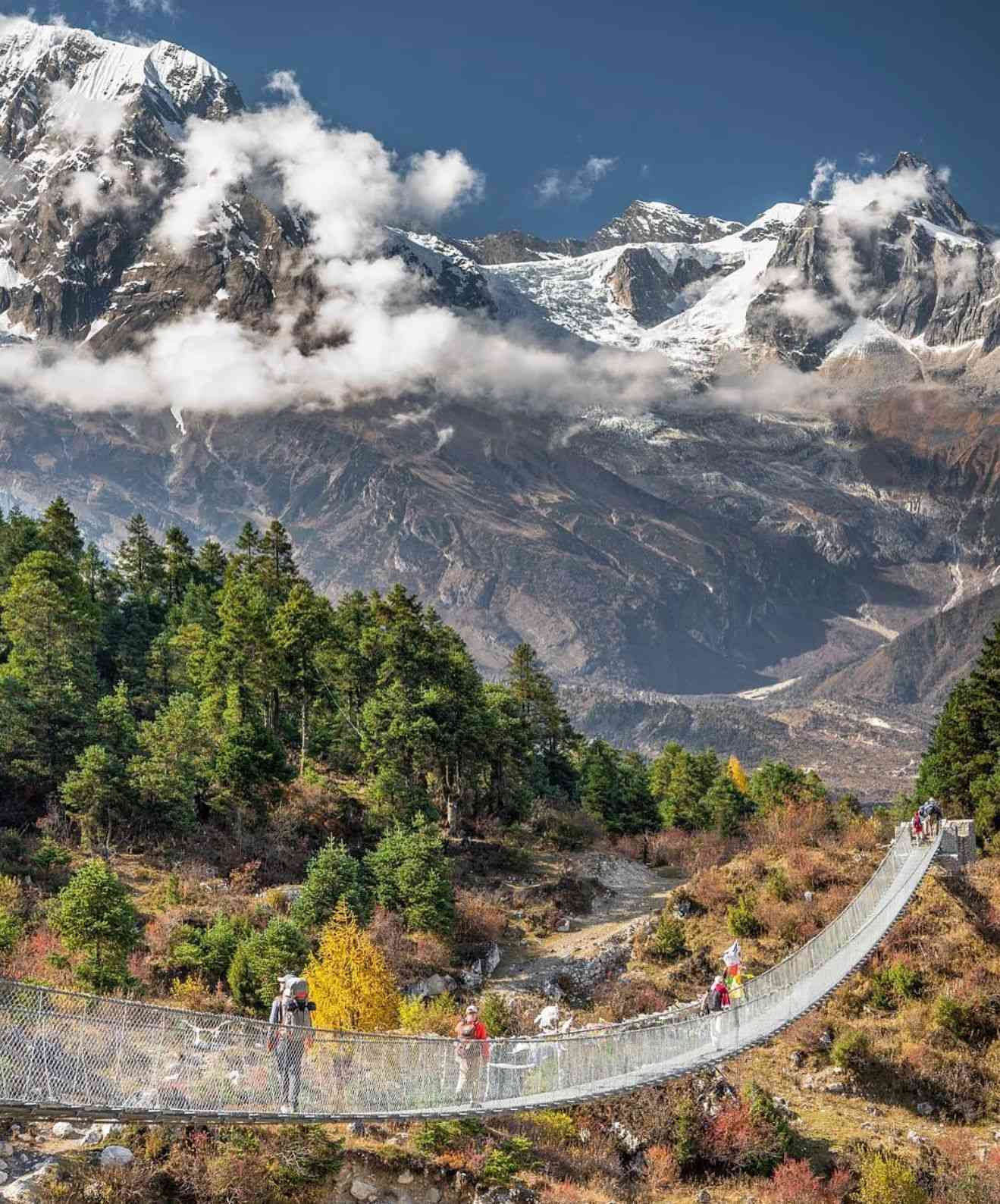
Our first day of trekking follows the Budhi Gandaki upstream through narrow paths and subtropical forest. We cross suspension bridges, pass the natural hot springs at Tatopani, and make our way through small villages. The trail is a mix of gentle climbs and riverside walks, with the sound of rushing water always nearby. By evening, we arrive in Jagat, a beautiful stone-paved village where the Manaslu Restricted Area officially begins. This is where our permits are checked before we settle in for the night.
The trail today is full of variety. We pass through villages like Salleri and Philim, where Tibetan influence is clear in the architecture and prayer flags. The path takes us through bamboo groves, terraced hillsides, and cliffside trails high above the Budhi Gandaki. You’ll feel the remoteness of the valley as the number of trekkers thins out. After 6 to 7 hours of walking, we reach Deng, a quiet mountain village surrounded by forests and farmland.
We head deeper into the mountains, walking through pine and rhododendron forests and crossing small wooden bridges over clear streams. Villages like Bihi and Ghap greet us with mani walls, prayer wheels, and smiling locals. As we climb higher, the air turns cooler and the views open up. By the time we reach Namrung, we can see the impressive Siringi Himal, and the stone houses here feel like something from another era.
This is one of the most scenic days of the trek. We pass through Lihi and Sho, with their barley fields and apple orchards, and then on to Lho, home to the striking Ribung Monastery. From here, Mt. Manaslu dominates the skyline. We continue to Shyala, surrounded by snow-covered peaks on all sides, before reaching Samagaon. This large village, sitting right below Manaslu, is rich in Tibetan culture and will be our base for the next two nights.
We spend the day in Samagaon to help our bodies adjust to the altitude. There are several optional hikes, including the challenging trek to Manaslu Base Camp at 4,800 meters, which passes by the turquoise waters of Birendra Lake. For a gentler option, you can visit Pungyen Gompa, a peaceful monastery on a ridge with panoramic views. These side trips not only aid acclimatization but also offer unforgettable scenery. The evening is spent relaxing in the village, enjoying the quiet mountain atmosphere.
We have a short but beautiful walk today. The trail crosses open yak pastures and follows a wide valley with views of surrounding peaks. A wooden bridge takes us into Samdo, a small and very traditional village near the Tibetan border. The rest of the day can be spent exploring the village or taking a short acclimatization hike up the ridge for more mountain views.
Samdo to Dharamsala (4,4Today is an important day as you make your way to the final staging point before crossing the high mountain pass. The walk from Samdo to Dharmasala takes around 3 to 4 hours at a steady pace. The trail has recently been improved by local people, making it wider and more comfortable than it used to be. Although the elevation increases, the trail is more gradual than you might expect and not very steep.
The path climbs gently along a rocky trail, offering wide-open views of the valley and the surrounding snow-covered peaks. Along the way, you’ll see old ruins of a traditional Tibetan trade post—a subtle reminder of the region’s history as a trading route to Tibet.
Dharmasala is a very basic overnight stop with a few simple teahouses that offer shared dormitory rooms. Facilities are extremely limited due to the remoteness and altitude, but the views of the surrounding mountains are absolutely impressive.
Because tomorrow involves crossing the Larkya La Pass, you’ll want to rest early, stay warm, and be prepared for a pre-dawn start. This stop is all about getting your body and mind ready for the most demanding and rewarding day of the trek.50 m)
Dharamsala to Bimthang is going to be the most challenging and exciting day of our entire trek. It’s a long, tough day that demands an early start and a steady pace, but the rewards are incredible.
We’ll be trekking for about 8 to 10 hours in total. We start at Dharmasala around 4,460 meters, climb all the way up to the Larkya La Pass at 5,106 meters, and then have a long descent to Bimthang at about 3,720 meters. The total distance will be somewhere between 16 and 24 kilometers.
Our Journey
We’ll be getting up before dawn, probably around 3 or 4 AM. That early start is essential so we can get to the pass before the winds pick up and have plenty of time for the long descent.
The path starts with a steady climb over a rocky moraine. As we ascend, the air gets thinner and the cold intensifies, so we’ll need to go slowly and steadily.
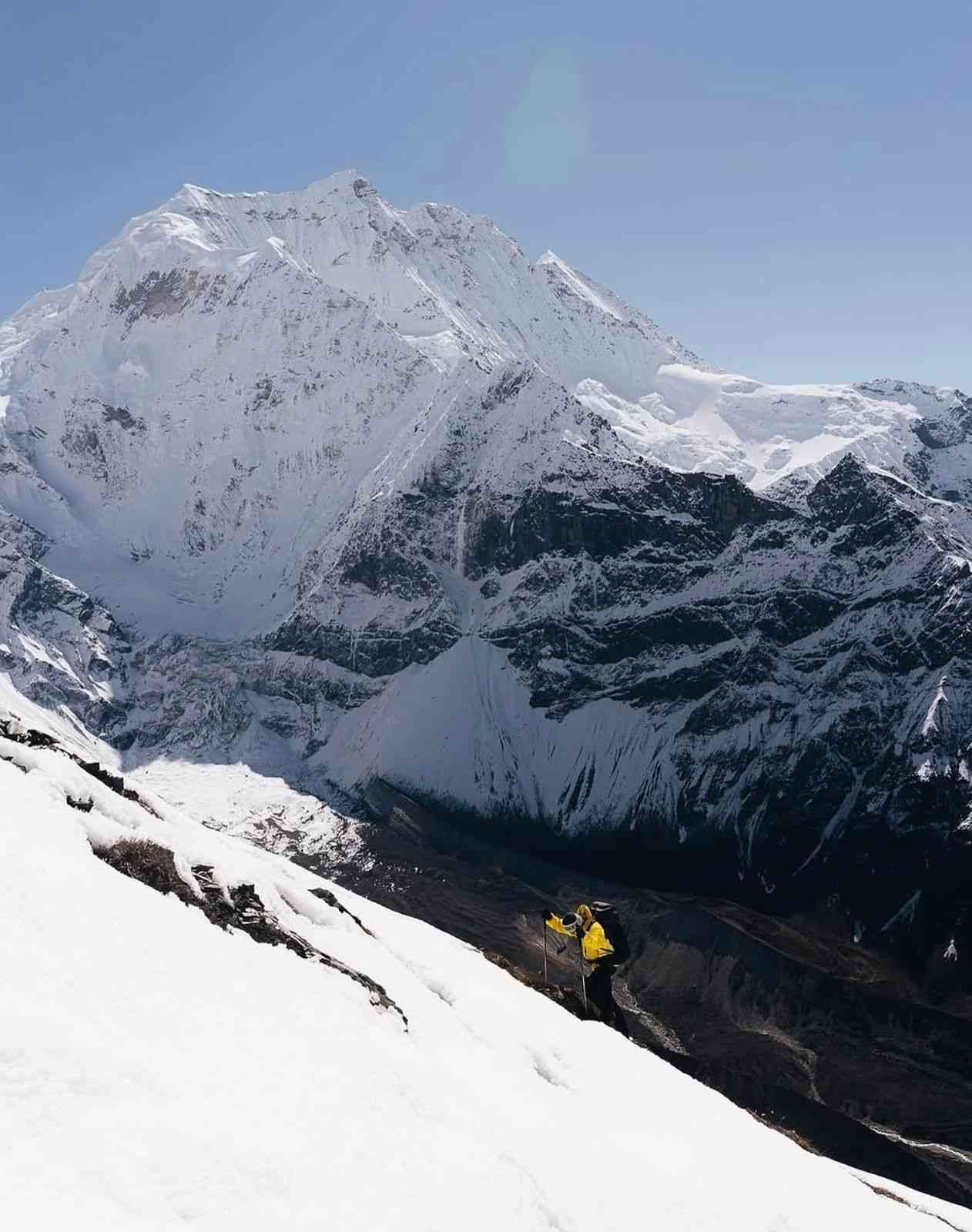
Reaching the top of the Larkya La Pass will be a huge milestone. The pass is marked by colorful prayer flags and offers a breathtaking 360-degree panoramic view of the Himalayas. We’ll be able to see majestic peaks like Manaslu, Himlung Himal, and Annapurna II. It’s the perfect spot for photos before we start our descent.
The trek down to Bimthang is long and steep, over rocky and sometimes snowy terrain. Our trekking poles will be a big help here to keep our balance and protect our knees. As we lose altitude, the landscape will change, and we’ll eventually find ourselves in a beautiful, forested valley.
Finally, we’ll arrive in Bimthang, a lovely village surrounded by towering peaks. The teahouse facilities here are much better than in Dharmasala, so we can get a well-deserved rest. This is the end of the high-altitude challenges and the beginning of our journey to lower elevations.
Important Things to Remember
This is a physically demanding day due to the altitude, distance, and difficult terrain. Let’s make sure we’re prepared with good trekking boots, warm layers, a windproof jacket, and our trekking poles. Let’s also keep an eye on each other for any signs of altitude sickness and stay hydrated throughout the day.
The day begins with incredible morning views of the mountains before we descend through alpine meadows and rhododendron forests. The trail passes streams and small villages as we return to warmer, greener terrain. We arrive in Tilije, a lively Gurung village known for its apple orchards, in the late afternoon.
After breakfast in Tilije, we begin our journey back to the capital. A scenic jeep ride takes us through beautiful mid-hill landscapes, small villages, and riverside valleys before connecting to the highway at Besisahar. From here, we continue toward Kathmandu, arriving in the evening. Tonight, Manaslu Treks and Expedition will host a special farewell dinner to celebrate your incredible journey in the Himalayas. You will also receive your Achievement Award as a token of recognition for completing the Manaslu adventure, a memory to cherish for years to come.
This day is a safety buffer in case of delays on the trek. If everything runs on time, you can explore Kathmandu’s UNESCO World Heritage sites like Pashupatinath, Boudhanath Stupa, or Patan Durbar Square. Or simply relax, shop for souvenirs, and enjoy the city’s cafes.
Your journey on the 14 Days Manaslu Circuit Trek ends today. We’ll transfer you to the airport for your flight home, leaving you with unforgettable memories of remote valleys, high passes, and the warm smiles of the people you met along the way.
What’s Included & Excluded in Manaslu Circuit Trek
Manaslu Trek Package Inclusions
- Airport pick-up and drop-off in Kathmandu
- 3 nights hotel accommodation in Kathmandu with breakfast (1 night before and 1 after the trek)
- Ground transportation: Kathmandu to Machha Khola and Dharapani to Kathmandu by public bus
- All necessary permits: Manaslu Restricted Area Permit, Manaslu Conservation Area Permit (MCAP), and Annapurna Conservation Area Permit (ACAP)
- Licensed, English-speaking local trekking guide
- Porter service (1 porter for every 2 trekkers, carrying up to 20 kg total – 10 kg per trekker)
- Three meals a day (breakfast, lunch, dinner) during the trek
- Morning tea or coffee every trekking day
- Lodge/teahouse accommodation during the trek
- Sleeping bag and down jacket (to be returned after the trek)
- Trekking map of the Manaslu Circuit
- Trekking completion certificate from Manaslu Treks & Expedition
- Farewell dinner in Kathmandu hosted by Manaslu Treks & Expedition
- First-aid kit carried by the guide
- All government taxes and local charges
Cost Not Included in the Package
- Nepal visa fee (available on arrival at Tribhuvan International Airport)
- International airfare to and from Kathmandu
- Travel insurance (must include emergency evacuation coverage)
- Meals in Kathmandu (lunch and dinner)
- Personal expenses like snacks, bottled water, soft drinks, alcohol, Wi-Fi, battery charging, and hot showers during the trek
- Tips for guide and porter
- Any services not mentioned in the “Included” section
14 Days Manaslu Circuit Trek Map
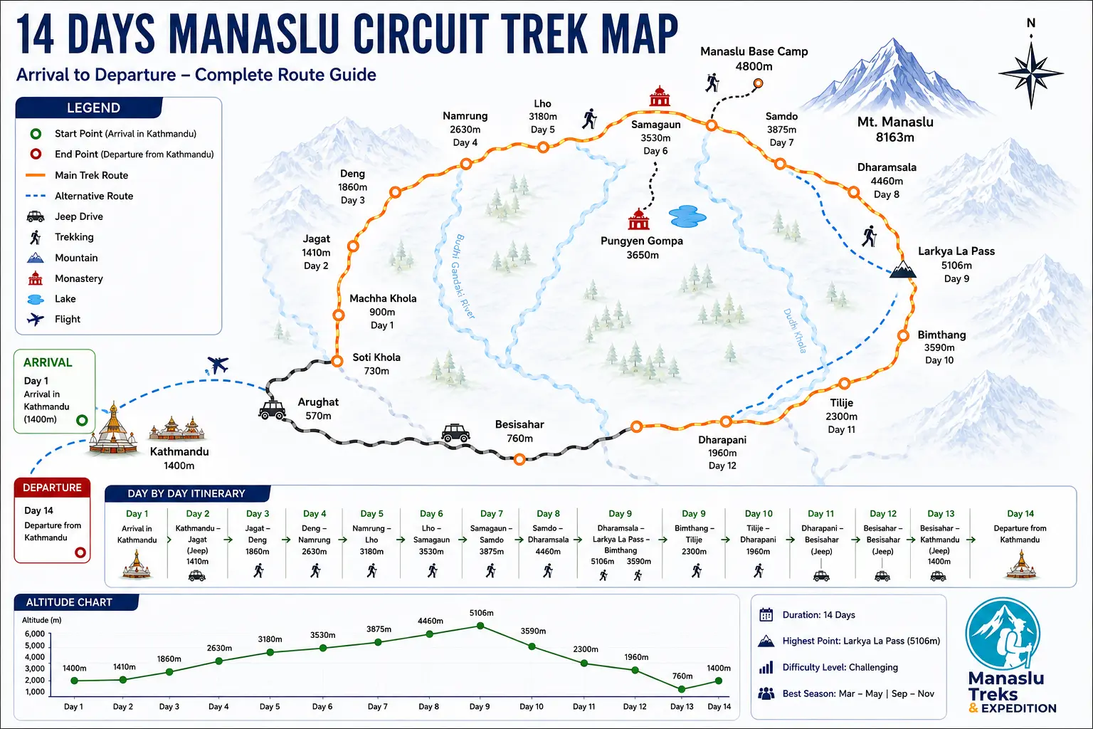
Important Information
2026 Manaslu Circuit Trek Permit and Important Information
As of March 22 2026 the Government of Nepal and the Department of Immigration have officially updated the regulations for the Manaslu region. Individual travelers can now apply for trekking permits without the previous requirement of a two person group. This update makes it easier to plan a 14 days Manaslu Circuit Trek while still following all official rules.
Official Solo Trekking Permit Rules for 2026
Trekkers can now obtain a Manaslu Restricted Area Permit as an individual. There is no longer a requirement to join another traveler to meet permit rules for the 14 days Manaslu Circuit Trek. This change provides more flexibility for solo travelers.
However a licensed trekking guide is still mandatory. Every trekker must be accompanied by a government licensed guide throughout the restricted region. This is required for safety, navigation, and compliance with local regulations.
All permits must be processed through a registered trekking agency in Nepal. Individual applications are not accepted directly by immigration offices. A local agency ensures proper documentation and legal entry into the restricted Manaslu region.
Travel Insurance Requirements for 14 Days Manaslu Circuit Trek
Travel insurance is mandatory for the 14 days Manaslu Circuit Trek. Your policy must cover high altitude trekking up to 6000 meters, as Larkya La Pass reaches 5106 meters. Insurance must include emergency helicopter evacuation and full medical coverage.
In addition, our company provides full insurance coverage for guides and porters. This includes medical treatment and emergency rescue services. This ensures that both trekkers and local staff are protected during the journey.
Local Municipality Fee at Jagat Checkpoint
In addition to conservation permits, trekkers must pay a local government entry fee in the Manaslu region.
- Location: Jagat checkpoint
- Cost: 1000 NPR per person
- Payment: One time fee collected at the entry point
All Inclusive Permit and Service Support
Planning permits and regulations for the 14 days Manaslu Circuit Trek can be complex for international travelers. Our team manages the entire process to ensure a smooth and legal trekking experience.
- We arrange the 1000 NPR local municipality fee at Jagat
- We verify your insurance for high altitude trekking
- We provide insured guides and porters
- We process Restricted Area Permit, Manaslu Conservation Area Permit, and Annapurna Conservation Area Permit
With proper permit handling and local expertise, you avoid delays and unexpected costs during your trek. This allows you to focus fully on the experience and landscapes of the Manaslu region.
Manaslu vs Annapurna vs Everest Comparison
When planning a trek in Nepal many travelers compare Everest Base Camp, Annapurna Circuit, and Manaslu Circuit to decide which route is the best fit. While Everest is well known and Annapurna offers variety, the 14 days Manaslu Circuit Trek has become a strong choice for those looking for a quieter and more authentic experience in 2026.
1. Crowds and Trail Experience
Everest Base Camp is one of the busiest trekking routes in Nepal, especially during peak seasons. Tea houses and trails can feel crowded. Annapurna Circuit is still popular, but many sections now follow motor roads, which changes the trekking experience.
The 14 days Manaslu Circuit Trek is different. As a restricted area, the number of trekkers is limited. The trail feels quieter, more remote, and closer to a traditional mountain journey.
2. Cultural Experience
The Manaslu region has strong Tibetan cultural influence. Villages such as Lho and Sama Gaun still follow traditional lifestyles, and monasteries remain active parts of daily life. Compared to Everest and Annapurna, Manaslu feels less commercial and more connected to local culture.
3. High Pass Experience
Larkya La Pass at 5106 meters is one of the main highlights of the 14 days Manaslu Circuit Trek. The crossing is challenging but rewarding, with wide views of Manaslu and surrounding peaks. It offers a similar level of challenge to Thorong La in Annapurna, but with fewer trekkers on the trail.
4. Cost and Overall Value
Everest trekking often includes expensive flights to Lukla, which increases total cost. Annapurna is generally more accessible but has become more developed. The 14 days Manaslu Circuit Trek offers a balance of cost and experience, especially with overland access and fewer commercial elements.
Why Choose 14 Days Manaslu Circuit Trek
The 14 days Manaslu Circuit Trek combines remote trails, strong cultural experience, and high altitude adventure in one journey. It is suitable for trekkers who want a quieter route without losing the scale and challenge of the Himalayas.
Our team specializes in the Manaslu region and manages all required permits, logistics, and safety planning. With experienced local guides and proper support, the journey becomes well organized and reliable from start to finish.
Manaslu Teahouse Facilities 2026
The accommodation standards along the 14 days Manaslu Circuit Trek have improved steadily in recent years. Even though the region remains remote, many teahouses now provide reliable basic comfort for trekkers. Understanding what to expect helps you prepare properly and enjoy the journey without unnecessary concern.
Room Facilities on the Route
Most teahouses on the 14 days Manaslu Circuit Trek offer twin sharing rooms with wooden beds, foam mattresses, and blankets. In lower villages such as Machha Khola and Jagat, some lodges provide attached bathrooms. As you move higher to Samagaun and Samdo, rooms become more basic due to altitude and limited resources.
At higher elevations, insulation is minimal, so a proper sleeping bag is important for warmth. Despite the remote setting, it is often surprising to find comfortable rooms even in high altitude villages.
WiFi and Internet Access
Internet access is available along most parts of the 14 days Manaslu Circuit Trek, although the quality varies depending on location and weather.
- Lower regions like Jagat and Namrung provide stable WiFi for a small fee, usually between 300 to 500 NPR
- Higher villages such as Lho and Samagaun offer satellite based internet, suitable for messaging and basic use
- Mobile networks work intermittently, with NTC generally providing better coverage than Ncell in this region
Electricity and Charging
Electricity on the 14 days Manaslu Circuit Trek is supplied through solar systems and small hydro sources. Charging is available in most lodges, especially in dining areas.
- Charging fees typically range from 200 to 500 NPR per device
- Power availability may be limited during cloudy or cold conditions
- Carrying a power bank with at least 20,000 mAh capacity is strongly recommended
Hot Showers and Hygiene
Maintaining hygiene is manageable throughout the trek, though facilities vary by altitude.
- Gas powered hot showers are available in lower and mid altitude villages for around 400 to 600 NPR
- In higher areas, hot water is usually provided in buckets due to freezing conditions
- Boiled water is widely available and recommended instead of plastic bottled water
Real Experience on the Route
While the Manaslu region is still considered remote, the level of comfort on the 14 days Manaslu Circuit Trek is better than many trekkers expect. In several locations, it can feel surprising to find functional lodges and basic services at such altitude.
Our Local Advantage
Our team works closely with trusted teahouse owners along the Manaslu route. This allows us to secure reliable rooms even during busy seasons. Guides also assist with arrangements for charging, hot water, and meals, making the overall experience more comfortable and organized.
Manaslu Trek Packing List 2026
Choosing the right season and preparing proper gear is essential for a safe and comfortable journey on the 14 days Manaslu Circuit Trek. Weather conditions vary from warm lower valleys to cold high altitude sections near Larkya La Pass, so preparation must be practical and realistic.
Best Time for 14 Days Manaslu Circuit Trek
The most reliable seasons for the 14 days Manaslu Circuit Trek are spring and autumn, when weather conditions are stable and visibility is clear.
- Spring season from March to May offers moderate temperatures and clear mornings. Trails are greener, and rhododendron forests are in bloom in lower sections.
- Autumn season from September to November provides the best mountain visibility. Skies are clear, and conditions are more stable for crossing Larkya La Pass.
Winter brings heavy snow at higher elevations, while monsoon months lead to rain and limited visibility. These seasons are less suitable for the 14 days Manaslu Circuit Trek.
Detailed Packing List for 2026
Upper Body Clothing
- Moisture wicking base layer tops
- Thermal inner wear for cold conditions
- Fleece or insulated mid layer
- Down jacket for high altitude warmth
- Waterproof and windproof outer shell jacket
Lower Body Clothing
- Trekking pants for daily hiking
- Thermal base layer for cold nights
- Waterproof outer pants for rain or snow
Footwear
- Sturdy waterproof trekking boots with ankle support
- Comfortable camp shoes or sandals for lodges
- Warm trekking socks and spare pairs
Headwear and Accessories
- Warm wool hat or beanie
- Sun hat for lower altitude
- UV protection sunglasses
- Gloves for cold conditions
Trekking Gear
- Trekking poles for stability and knee support
- Daypack with rain cover
- Water bottles or hydration system
- Headlamp with extra batteries
- Power bank for charging devices
Personal and Health Items
- Basic first aid kit and altitude medication
- High SPF sunscreen and lip balm
- Personal toiletries and hygiene items
Why Preparation Matters
The 14 days Manaslu Circuit Trek is a demanding route with rapid altitude gain and changing weather. Conditions can shift quickly, especially near Larkya La Pass, so having the right gear directly affects safety and comfort.
Our guides check equipment regularly during the trek to ensure you are properly prepared for each section of the route.
Equipment Support
We provide all necessary trekking equipment for the 14 days Manaslu Circuit Trek, including a high quality down jacket, sleeping bag, trekking poles, and a waterproof duffel bag for porter use. This helps reduce your packing load and ensures you are fully prepared for high altitude conditions.
If you prefer not to carry all equipment from home, we arrange everything in Kathmandu before starting the trek, making your preparation simple and efficient.
For a complete and updated equipment checklist, you can also read our detailed Manaslu Circuit Trek Packing List guide.
How to Prepare for Manaslu Circuit Trek 2026
Preparing your body properly is essential for completing the 14 days Manaslu Circuit Trek safely. This route involves long walking days, steep ascents, and high altitude conditions, especially near Larkya La Pass at 5106 meters. We recommend starting your physical preparation at least 8 to 12 weeks before arrival in Nepal.
Cardiovascular and Strength Training
The 14 days Manaslu Circuit Trek requires consistent stamina, as most trekking days involve 6 to 8 hours of walking on varied terrain.
- Aerobic training such as long distance walking, cycling, or swimming to improve endurance
- Leg strength exercises including squats, lunges, and step training for uphill sections
- Practice hikes with a light backpack of 5 to 7 kg to simulate real trekking conditions
Acclimatization and Altitude Safety
Altitude is the main challenge during the 14 days Manaslu Circuit Trek. Proper acclimatization reduces the risk of Acute Mountain Sickness and improves overall performance.
- Gradual ascent with a dedicated acclimatization day in Samagaun
- Maintain steady walking pace and avoid rushing at higher altitude
- Drink at least 3 to 4 liters of water daily to support acclimatization
- Daily monitoring of oxygen level and heart rate using pulse oximeter
Health and Medication
- Consult your doctor about altitude medication such as Diamox before the trek
- Maintain proper nutrition with energy rich meals during the trek
- Listen to your body and communicate any symptoms to your guide immediately
Our guides are trained to recognize early signs of altitude sickness. If necessary, we prioritize immediate descent to ensure safety.
Emergency Support and Evacuation
While prevention is always the priority, we are fully prepared for emergencies. Our team is connected with reliable helicopter rescue services in key locations such as Samagaun, Samdo, and Bimthang.
During the 14 days Manaslu Circuit Trek, there is continuous coordination between your guide and our Kathmandu office to ensure quick response in case of any issue.
Guide’s Field Note
Every morning before starting the trek, we check weather conditions, trail status, and altitude factors carefully. Based on this, we adjust the daily plan if needed to ensure safe crossing of sections like Larkya La Pass.
Our team, including experienced guides like Susam and Kiran, focuses on safety, pacing, and real mountain conditions rather than fixed schedules. This approach makes a significant difference in high altitude trekking.
For more detailed fitness training, altitude preparation, and expert recommendations, you can also read our complete Manaslu Circuit Trek Preparation Guide.
How to Plan the 14 Days Manaslu Circuit Trek from USA and Europe 2026
Planning the 14 days Manaslu Circuit Trek from the USA and Europe requires proper preparation and clear understanding of travel logistics. We support international travelers from countries such as the United States, United Kingdom, Germany, and France to ensure a smooth journey from arrival to the mountains.
International Flights to Kathmandu
There are no direct flights from the USA or most European countries to Nepal, so travelers usually connect through major international hubs.
- From USA: Common routes include connections via Doha, Dubai, or Istanbul. Total travel time is usually between 20 to 24 hours depending on departure city
- From Europe: Flights commonly connect through Istanbul or Doha with reliable airlines and shorter travel times compared to USA routes
Visa on Arrival in Nepal
Travelers from the USA and most European countries can obtain a visa on arrival at Tribhuvan International Airport in Kathmandu.
- Visa process is simple and can be completed at the airport or online before arrival
- 30 day tourist visa is recommended for the 14 days Manaslu Circuit Trek to allow buffer time
- Visa fee is 50 USD for 30 days
- Carrying US dollars in cash is recommended for smooth payment
Gear and Equipment in Kathmandu
Many trekkers prefer to travel light and arrange equipment in Kathmandu. We assist you in selecting reliable gear before starting the 14 days Manaslu Circuit Trek.
- Down jackets and sleeping bags rated for cold conditions are available for rent
- Equipment rental cost is usually around 1 to 2 USD per day
- Thamel offers a wide range of trekking gear, from local products to international brands
Money and Currency
The official currency in Nepal is Nepalese Rupee. Proper cash planning is important before starting the trek.
- ATMs are available in Kathmandu and accept international cards
- No reliable ATMs are available during the 14 days Manaslu Circuit Trek
- We assist you in exchanging enough cash for personal expenses such as hot showers, WiFi, and tips
Why Travelers Choose Our Team
We understand the expectations of international trekkers in terms of safety, communication, and organization. Our services are designed to make the 14 days Manaslu Circuit Trek simple and reliable.
- Airport pickup and drop in private vehicle
- Experienced English speaking guides
- Full support with permits and trek logistics
- 24 hour support during the trek
- No advance payment required and flexible booking system
- We accept both cash and card payment options
With proper planning and local support, your journey from international departure to the Manaslu region becomes straightforward and stress free.
14 Days Private Manaslu Circuit Trek vs Group Manaslu Circuit Trek
The 14 Days Manaslu Circuit Trek can be organized as a fully customized and private trekking experience instead of following a fixed group departure. If you prefer more flexibility, comfort, and personal support throughout the journey, you can make this your own 14 Days Private Manaslu Circuit Trek with a dedicated local team.
A private trek allows you to travel at your own pace and customize the journey according to your preferences. Whether you are a couple, family, group of friends, photographer, or simply looking for a quieter experience, a private trek offers greater flexibility and comfort from beginning to end.
Customize Your 14 Days Private Manaslu Circuit Trek
- Private licensed local trekking guide
- Personal porter support
- Flexible travel dates
- Private airport pickup and drop-off
- Private jeep transportation options
- Better room and lodge preferences where available
- Extra acclimatization or rest days if needed
- Flexible walking pace based on your comfort
- Customized itinerary according to your travel style
Many trekkers choose a 14 Days Private Manaslu Circuit Trek because the route itself is already less crowded than Everest Base Camp or Annapurna Circuit. Traveling with your own guide creates a more personal experience from Machha Khola to Larke Pass.
Private Manaslu Circuit Trek vs Group Manaslu Circuit Trek
| Features | Private Trek | Group Trek |
|---|---|---|
| Departure Dates | Choose your own dates | Fixed departures |
| Trekking Pace | Flexible | Group pace |
| Guide Support | Dedicated guide | Shared guide |
| Privacy | High | Shared experience |
Advantages and Disadvantages of Private vs Group Manaslu Circuit Trek
Private Manaslu Circuit Trek Advantages
- Flexible travel dates
- Trek at your own pace
- Dedicated guide support
- Custom acclimatization and itinerary
- Greater privacy and comfort
Private Trek Disadvantages
- Usually costs more
- Smaller groups share fewer expenses
- Less social interaction
Group Manaslu Circuit Trek Advantages
- Lower cost
- Meet other trekkers
- Great for solo travelers
- Fixed departures simplify planning
Group Trek Disadvantages
- Less flexibility
- Shared guide attention
- Walking pace depends on group
- Limited room preferences
Trekkers looking for flexibility, privacy, and a more personalized experience often prefer a 14 Days Private Manaslu Circuit Trek, while budget-conscious travelers may enjoy the social experience of joining a group departure.
Culture, Local Life and Festivals During the 14 Days Manaslu Circuit Trek
The 14 Days Manaslu Circuit Trek is not only a journey through Himalayan landscapes and high mountain passes but also a cultural experience through some of Nepal’s most remote and traditional villages. One of the reasons many trekkers consider Manaslu special is that the region still feels authentic and less commercialized compared to Everest Base Camp and Annapurna.
As the trail follows the Budhi Gandaki Valley toward higher elevations, trekkers pass through different communities, landscapes, and lifestyles. Lower sections of the trail include villages influenced by Gurung culture, while upper villages such as Namrung, Lho, Samagaon, and Samdo are heavily influenced by Tibetan Buddhist traditions because of the region’s proximity to the Tibetan border.
Traditional Villages and Tibetan Buddhist Influence
- Traditional stone-built Himalayan villages
- Ancient mani walls and prayer wheels
- Colorful Buddhist prayer flags
- Chortens and sacred monuments
- Yak caravans transporting goods
- Terraced farming and local agriculture
- Traditional mountain lifestyles
- Active monasteries and spiritual sites
Dashain Festival and Autumn Trekking Experience
If you join the 14 Days Manaslu Circuit Trek during autumn, especially in October, you may experience Nepal’s biggest festival season. October is one of the best months for trekking in Manaslu because of stable weather, clear mountain views, and cultural celebrations across Nepal.
The most important festival in Nepal is Dashain, celebrated throughout the country. During this period, many trekking guides, porters, and local staff also celebrate with their families before returning to work. Trekkers often enjoy hearing stories from guides and porters about local traditions and village celebrations.
- Family gatherings and blessings from elders
- Traditional Nepali food and celebrations
- Village festivities and local customs
- Seasonal holiday atmosphere
- Authentic local cultural experiences
Many trekkers arrive for the mountains but leave remembering the people, traditions, and village life. The 14 Days Manaslu Circuit Trek is not only about crossing Larke Pass but also about experiencing living Himalayan culture.
Best Time and Weather Conditions for the 14 Days Manaslu Circuit Trek
Choosing the right season is one of the most important parts of planning the 14 Days Manaslu Circuit Trek. Weather conditions directly affect mountain visibility, trail conditions, road access, temperatures, and the overall trekking experience. Since the route gradually climbs from warm lower valleys to high mountain environments above 5,100 meters at Larke Pass, weather can change noticeably throughout the journey.
The Manaslu region receives approximately 1,900 mm of annual rainfall, with most rain occurring during Nepal’s monsoon season from June through September. Lower elevations around Machha Khola and Jagat remain much warmer and more humid, while higher areas such as Samagaon, Dharamsala, and Larke Pass experience colder mountain conditions throughout the year.
Although trekking is possible during multiple seasons, most experienced local guides and trekkers consider spring (March–May) and autumn (September–November) the best periods for the Manaslu Circuit Trek because of more stable weather, clearer skies, and safer trail conditions.
Autumn Season (September to November) — Best Overall Time for Manaslu Trek
Autumn is generally considered the best season for the 14 Days Manaslu Circuit Trek. After monsoon rain clears dust and moisture from the atmosphere, the mountains often become exceptionally clear. Visibility improves significantly and the Himalayan views around Lho, Samagaon, Manaslu Base Camp, and Larke Pass can be spectacular.
October and November are usually the busiest trekking months because weather patterns become more stable and rainfall decreases considerably. Daytime temperatures remain comfortable while mornings often provide very clear mountain views.
- Clear mountain visibility
- Stable weather conditions
- Dry trekking trails
- Excellent photography opportunities
- Comfortable daytime temperatures
- Ideal season for crossing Larke Pass
- Dashain and Tihar festival atmosphere in Nepal
October is especially popular because trekkers can experience not only ideal trekking weather but also Nepal’s major festival season. During Dashain and Tihar, villages and cities across Nepal become more festive. Guides and porters sometimes share stories about local celebrations, traditions, and village customs.
Many trekking guides and porters also celebrate Dashain with their families before returning to work. During major holiday periods, guide and porter availability can occasionally become limited, so booking early during autumn is often recommended.
Spring Season (March to May)
Spring is another excellent season for trekking in Manaslu. Temperatures gradually become warmer and hillsides at lower elevations begin blooming with rhododendron forests. Daylight hours are longer and trekking conditions usually remain favorable.
During spring, daytime temperatures in lower sections become comfortable and higher elevations remain manageable. Mountain visibility is often good during mornings, although occasional afternoon clouds can develop.
- Blooming rhododendron forests
- Longer daylight hours
- Comfortable temperatures
- Good visibility during mornings
- Excellent season for photography
Monsoon Season (June to September)
Monsoon trekking creates a very different experience compared to autumn and spring. Rainfall increases significantly and the lower sections of the trail become warmer, wetter, and more humid. Afternoon showers become much more common and road conditions may occasionally become difficult because of landslides or muddy sections.
The probability of rain becomes much higher during monsoon months, especially during afternoons and evenings. Morning conditions can sometimes remain surprisingly clear before clouds gradually build later in the day.
One interesting detail many first-time trekkers do not expect is that the first few trekking days often feel much warmer than anticipated. Areas around Machha Khola, Jagat, and Deng remain at lower elevations and frequently experience warm temperatures, sunny weather, and humid conditions.
Because temperatures remain relatively warm during the first three trekking days, many experienced local guides carry both rain gear and a lightweight umbrella. In lower sections, a compact trekking umbrella can actually feel more comfortable than continuously wearing a waterproof jacket.
What to Bring for Monsoon Trekking in Manaslu
If trekking during monsoon season, proper equipment becomes very important. Conditions can shift quickly and keeping gear dry can make a major difference in overall comfort.
- Lightweight trekking umbrella
- Waterproof rain jacket
- Rain pants
- Backpack rain cover
- Quick-dry trekking shirts
- Extra hiking socks
- Waterproof hiking shoes
- Dry bags for electronics and important documents
- Trekking poles for muddy and slippery sections
- Power bank and waterproof pouch
Winter Season (December to February)
Winter trekking in Manaslu can still be beautiful but conditions become more challenging at higher elevations. Snowfall occasionally affects Dharamsala and Larke Pass, and temperatures during mornings and nights can drop well below freezing.
- Cold temperatures at higher elevations
- Possible snow around Larke Pass
- Fewer trekkers on the trail
- Peaceful trekking experience
- Clear skies during stable weather periods
For most trekkers planning the 14 Days Manaslu Circuit Trek, October, November, March, and April remain the preferred months because they offer a balance of stable weather, clear mountain views, comfortable trekking conditions, and a more enjoyable overall experience.
Geographic Context of the 14 Day Manaslu Circuit Trek
The 14 day Manaslu Circuit Trek forms a complete loop around Mount Manaslu at 8,163 meters, the eighth highest mountain on earth, located in the Gorkha District of Gandaki Province in Nepal. The word Manaslu comes from the Sanskrit word Manasa meaning intellect or soul, giving the mountain its local name — the Mountain of the Spirit. The entire route passes through the Manaslu Conservation Area, a protected zone of 1,663 square kilometers established in 1998 by the Ministry of Forest and Soil Conservation under Nepal’s National Parks and Wildlife Conservation Act. It is the third conservation area established in Nepal and is jointly managed by the National Trust for Nature Conservation and local communities.
Manaslu Conservation Area: Key Facts
| Established | 1998 |
| Total Area | 1,663 square kilometers |
| Elevation Range | 600 meters to 8,163 meters at the summit of Mount Manaslu |
| District | Gorkha District, Gandaki Province, Nepal |
| Borders | Annapurna Conservation Area to the west, Tibetan Plateau to the north and east |
| Mammal Species | 33 confirmed species including Snow Leopard, Himalayan Tahr, and Musk Deer |
| Bird Species | 110 confirmed species including Impeyan Pheasant and Himalayan Griffon |
| Butterfly Species | 11 confirmed species |
| Reptile Species | 3 confirmed species |
| Plant Species | Approximately 2,000 flowering plant species, 11 forest types |
The Budhi Gandaki River and Gorge
The 14 day Manaslu Circuit Trek follows the Budhi Gandaki River upstream from Machha Khola at 930 meters for most of its northward journey. The Budhi Gandaki has carved one of the deepest river gorges in Nepal through the Mansiri Himal range. In the lower sections between Machha Khola and Jagat, the gorge is so narrow and sheer that sunlight reaches the river for only a few hours each day. The trail frequently crosses the river on suspension bridges and traverses cliffside paths cut into vertical rock walls. The route crosses over 35 suspension bridges along the full circuit, making it one of the most bridge intensive trekking routes in Nepal. Above Namrung the valley opens dramatically into wider Tibetan style terrain, and the confined gorge character of the lower route gives way entirely to open high altitude landscapes.
Larkya La Pass
Larkya La Pass at 5,106 meters and 16,752 feet is the highest point of the 14 day Manaslu Circuit Trek and serves as the geographic dividing line between the Manaslu Conservation Area and the Annapurna Conservation Area. It also marks the boundary between Gorkha District and Manang District. The pass is classified as one of the longest high altitude passes in the entire Himalayan range of Nepal. The crossing begins from Dharamsala at 4,460 meters, passes over glacial moraine and four frozen lakes on the approach, and reaches the pass summit before descending steeply to Bimthang at 3,720 meters. The total crossing takes 8 to 10 hours.
Peaks Visible from Larkya La Pass at 5,106m
| Himlung Himal | 7,126m — visible to the north from the pass summit |
| Cheo Himal | 6,820m — part of the glacial cirque visible from the pass |
| Kang Guru | 6,981m — visible to the west from the pass |
| Annapurna II | 7,937m — visible ahead on the descent toward Bimthang |
| Manaslu | 8,163m — visible to the northeast from the pass |
| Ngadi Chuli | 7,871m — also known as Peak 29, visible from the descent side |
Birendra Lake
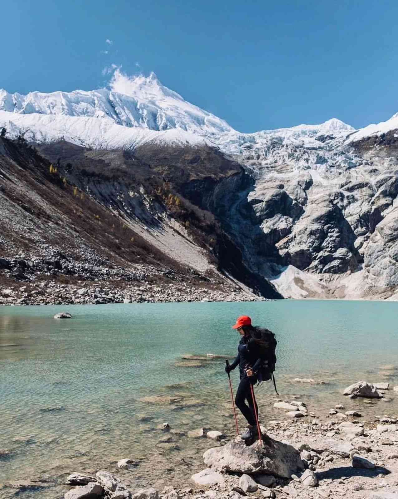
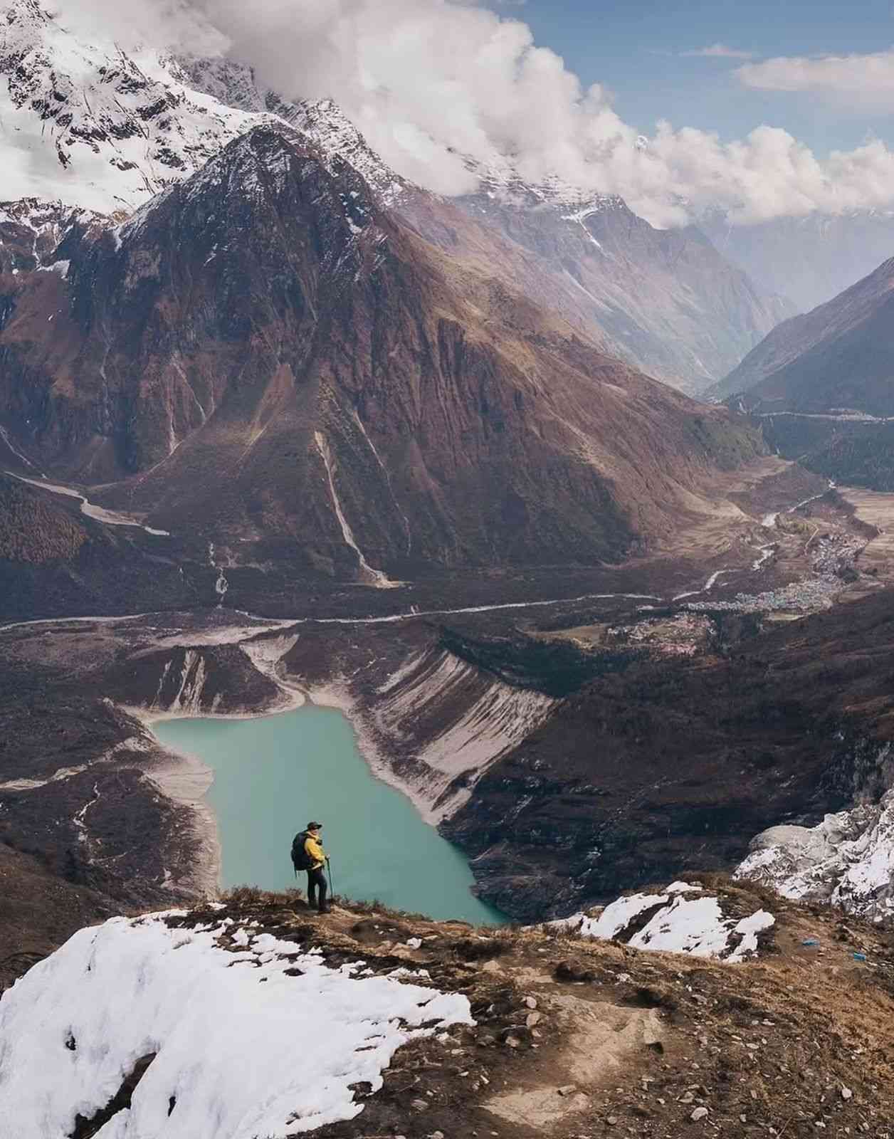
Birendra Lake, known locally as Birendra Tal, sits at approximately 3,451 meters directly below the southwestern glacier face of Manaslu. It is accessible from Samagaon on Day 7 of the 14 day itinerary during the acclimatization day. The lake is fed by glacial meltwater from the Manaslu glacier above it. Walking time from Samagaon to Birendra Lake is approximately 45 minutes. The lake is named after the late King Birendra of Nepal. Trekkers who continue beyond the lake toward Manaslu Base Camp at 4,800 meters gain significant additional altitude, which supports acclimatization for the Larkya La crossing three days later.
Ecological Zones on the 14 Day Manaslu Circuit Trek
The 14 day Manaslu Circuit Trek passes through four distinct ecological zones as it ascends from 930 meters at Machha Khola to 5,106 meters at Larkya La Pass. Each zone has its own vegetation, wildlife, and climate character.
Subtropical Zone — 930m to 1,800m
Days 2 to 3 — Machha Khola to Jagat
Dense riverine forest, bamboo groves, and subtropical vegetation. The Budhi Gandaki gorge is narrow and sheer here. Rice terraces cover hillsides above the river. Warm and humid, especially during and after monsoon season. Langur and Rhesus Macaque common.
Temperate Zone — 1,800m to 3,000m
Days 4 to 5 — Jagat to Namrung
Oak, maple, pine, and rhododendron forest. Rhododendrons bloom from February through April. Red Panda habitat in this zone. Temperatures moderate with cool mornings above 2,500 meters. Tibetan cultural influence begins to appear in village architecture and religious objects from Ghap onward.
Subalpine Zone — 3,000m to 4,000m
Days 6 to 8 — Namrung to Samdo
Pine and juniper scrub giving way to open alpine meadow. Blue Sheep and Himalayan Tahr visible on open slopes. Yak herding becomes the dominant land use. Frost occurs above 3,500 meters even in October. The valley opens significantly and Tibetan style flat roofed villages replace the stone roofed lodges of the lower sections.
Alpine Zone — 4,000m to 5,106m
Days 9 to 10 — Dharamsala to Larkya La Pass
Exposed rocky moraine with permanent snow and glacial ice above 4,800 meters. The approach to Larkya La crosses four frozen lakes. Virtually no vegetation. Himalayan Marmot and Pika present in rocky sections below the snowline. Temperatures consistently below zero from late October onward. Wind exposure on the pass is significant and is the primary reason for the pre dawn departure time.
Wildlife on the 14 Day Manaslu Circuit Trek
The Manaslu Conservation Area is confirmed to be home to 33 species of mammals, 110 species of birds, 11 species of butterflies, and 3 species of reptiles according to the Nepal Tourism Board and the Department of National Parks and Wildlife Conservation. Because the region is a restricted area with controlled trekker numbers, wildlife encounters here are less disturbed than on more heavily visited routes. The following species are confirmed residents of the conservation area and are realistic sighting possibilities during the 14 day Manaslu Circuit Trek.
Mammals — 33 Species Confirmed in the Conservation Area
Snow Leopard (Panthera uncia)
| IUCN Status | Vulnerable |
| Sighting Reality | Extremely rare to see directly. Tracks occasionally found in snow above Samagaon |
| Habitat on Route | Upper valley above Samagaon, rocky terrain toward Manaslu Base Camp, slopes above Samdo |
| Trek Days | Days 7 to 9 |
Himalayan Tahr (Hemitragus jemlahicus)
| IUCN Status | Near Threatened |
| Sighting Reality | Commonly spotted on rocky slopes near Larkya La Pass area and above Namrung |
| Habitat on Route | Rocky slopes from Namrung upward, confirmed common on slopes near Larkya La |
| Trek Days | Days 5 to 10 |
Blue Sheep — Bharal (Pseudois nayaur)
| IUCN Status | Least Concern |
| Sighting Reality | Commonly seen in open high altitude terrain. Primary prey species of the Snow Leopard |
| Habitat on Route | Open slopes above Samagaon and between Samagaon and Samdo |
| Trek Days | Days 6 to 9 |
Himalayan Musk Deer (Moschus leucogaster)
| IUCN Status | Endangered |
| Sighting Reality | Shy and largely nocturnal. Rare daytime sighting but confirmed present in the conservation area |
| Habitat on Route | Forest sections between Jagat and Namrung, subalpine areas |
| Trek Days | Days 3 to 5 |
| Note | Historically hunted for its musk gland, which is used in traditional medicine and perfume. Strictly protected under Nepal law. A recent study published in 2025 in the International Journal for Parasitology confirmed the Musk Deer as an active research subject in the Manaslu Conservation Area, indicating ongoing scientific monitoring of this species in the region. |
Red Panda (Ailurus fulgens)
| IUCN Status | Endangered |
| Sighting Reality | Rare but confirmed in the temperate bamboo and rhododendron forest zones of the route |
| Habitat on Route | Confirmed sightings reported near Namrung, Lho, and Samdo according to biodiversity research on the Manaslu region |
| Trek Days | Days 4 to 6 |
| Note | The Manaslu Conservation Area is recognized as a significant conservation corridor connecting Manaslu and Annapurna ranges for the Red Panda population. Relies on undisturbed bamboo understory for food and shelter. Primarily active at dawn and dusk. |
Himalayan Black Bear (Ursus thibetanus)
| IUCN Status | Vulnerable |
| Sighting Reality | Present in lower forest zones. Avoids humans and retreats when people are detected |
| Habitat on Route | Dense forest sections in the lower and middle valley |
| Trek Days | Days 3 and 4 |
Himalayan Marmot (Marmota himalayana)
| IUCN Status | Least Concern |
| Sighting Reality | Very commonly seen basking on sunny alpine slopes in the upper valley |
| Habitat on Route | Open grassland and rocky slopes between Samagaon and Samdo, yak pastures above Samdo |
| Trek Days | Days 7 to 9 |
Pika (Ochotona species)
| IUCN Status | Varies by species, generally Least Concern |
| Sighting Reality | Commonly heard calling from rock crevices at high altitude. Small and fast but regularly visible |
| Habitat on Route | Rocky slopes above Samdo, moraine terrain near Dharamsala |
| Trek Days | Days 9 and 10 |
Grey Wolf (Canis lupus)
| IUCN Status | Least Concern globally, vulnerable in Nepal context |
| Sighting Reality | Rare. Confirmed present in the Manaslu Conservation Area |
| Habitat on Route | High alpine zones in the upper valley |
| Trek Days | Days 7 to 10 |
Langur and Rhesus Macaque
| IUCN Status | Least Concern |
| Sighting Reality | Very commonly seen. Both species habituated to trail presence |
| Habitat on Route | Subtropical and lower temperate forest from Machha Khola to Deng |
| Trek Days | Days 3 and 4 |
Birds — 110 Species Confirmed in the Conservation Area
The Manaslu Conservation Area has 110 confirmed bird species across its full altitude range. The following are the most frequently observed and most notable species along the 14 day Manaslu Circuit Trek route.
Impeyan Pheasant — Danphe (Lophophorus impejanus) — National Bird of Nepal
| IUCN Status | Least Concern |
| Sighting Reality | Moderate to good. Most active early morning on forest edges |
| Habitat on Route | Temperate and subalpine forest, forest edges between Deng and Namrung |
| Trek Days | Days 4 and 5 |
Himalayan Griffon Vulture (Gyps himalayensis)
| IUCN Status | Least Concern |
| Sighting Reality | Very commonly seen overhead throughout the full route |
| Habitat on Route | Thermal currents above open valley sections at all altitudes |
| Trek Days | All days of the trek |
Lammergeier — Bearded Vulture (Gypaetus barbatus)
| IUCN Status | Near Threatened |
| Sighting Reality | Regularly seen soaring above cliffs and ridgelines, particularly in the upper valley |
| Habitat on Route | Cliff faces and open ridgelines throughout the route |
| Trek Days | Days 5 to 10 |
Blood Pheasant (Ithaginis cruentus)
| IUCN Status | Least Concern |
| Sighting Reality | Moderate. Found in subalpine scrub zones |
| Habitat on Route | Subalpine scrub and forest edges between Namrung and Lho |
| Trek Days | Days 5 and 6 |
Snow Partridge (Lerwa lerwa)
| IUCN Status | Least Concern |
| Sighting Reality | Possible at high altitude, found in alpine and subalpine zones |
| Habitat on Route | Rocky alpine terrain above 3,500 meters |
| Trek Days | Days 7 to 9 |
Alpine Accentor and Yellow Throated Marten
| Note | Alpine Accentors are small sparrow like birds found at high altitude throughout the upper valley sections. Yellow Throated Martens are slender weasel family predators confirmed present in the Manaslu Conservation Area, active in temperate and subalpine forest zones on the middle sections of the route. |
Altitude Profile: 14 Day Manaslu Circuit Trek
Understanding the altitude profile of the 14 day Manaslu Circuit Trek helps you prepare your body correctly, identify the days that carry the highest altitude sickness risk, and understand why the itinerary is structured the way it is. The route climbs from 930 meters at Machha Khola to 5,106 meters at Larkya La Pass over 9 walking days before descending back to low altitude over 2 days. The acclimatization day at Samagaon on Day 7 is the single most important day in the entire profile from a safety perspective.
Key Altitude Numbers at a Glance
| Trek Start | Machha Khola — 930m |
| Trek Highest Point | Larkya La Pass — 5,106m / 16,752ft |
| Trek End Point | Tilije — 2,300m before drive to Kathmandu |
| Total Elevation Gain | Approximately 4,176m from trailhead to pass |
| Acclimatization Day | Day 7 — Samagaon at 3,500m |
| AMS Risk Begins | Day 6 above 3,000m, increases significantly from Day 8 |
| Longest Single Day | Day 10 — Larkya La crossing, 8 to 10 hours, 18 to 24km |
Day by Day Altitude Profile
Day 1 — Arrive Kathmandu
| Overnight Altitude | 1,350m |
| Gain or Loss | No trekking. Arrival day |
| Activity | Airport transfer, trek briefing, gear check, hotel in Thamel |
| AMS Risk | None at this altitude |
| Accommodation | 3 star hotel Kathmandu |
Day 2 — Drive Kathmandu to Machha Khola
| Overnight Altitude | 930m |
| Change from Previous | Descent of 420m from Kathmandu by road |
| Drive Time | 7 to 9 hours by bus, 5 to 6 hours by private jeep |
| AMS Risk | None |
| Note | Road is paved to Arughat, rough mountain road beyond. Motion sickness medication recommended |
| Accommodation | Teahouse Machha Khola |
Day 3 — Machha Khola to Jagat
| Start Altitude | 930m |
| Overnight Altitude | 1,410m |
| Net Gain | +480m |
| Distance | Approximately 22km |
| Walking Time | 6 to 7 hours |
| Terrain | Riverside trail, subtropical forest, suspension bridges, gentle ascent with some steeper sections |
| AMS Risk | None at this altitude |
| Key Point | Restricted Area checkpoint at Jagat. All permits verified here. Local municipality fee of NPR 1,000 collected |
| Accommodation | Teahouse Jagat |
Day 4 — Jagat to Deng
| Start Altitude | 1,410m |
| Overnight Altitude | 2,095m |
| Net Gain | +685m |
| Distance | Approximately 23km |
| Walking Time | 6 to 7 hours |
| Terrain | Bamboo groves, cliffside paths, river crossings, Philim village permit check |
| AMS Risk | None |
| Note | This is the largest single net gain day in the lower valley. The route involves more ascent and descent within the day than the net figure suggests |
| Accommodation | Teahouse Deng |
Day 5 — Deng to Namrung
| Start Altitude | 2,095m |
| Overnight Altitude | 2,900m |
| Net Gain | +805m |
| Distance | Approximately 20km |
| Walking Time | 6 to 7 hours |
| Terrain | Pine and rhododendron forest, Bihi and Ghap villages, mani walls and chortens begin appearing, Ghap permit check |
| AMS Risk | Low. Begin monitoring for mild symptoms from this altitude onward |
| Note | Largest single net gain day of the entire trek. Pace should be slower than lower days. Drink more water from today onward |
| Accommodation | Teahouse Namrung |
Day 6 — Namrung to Samagaon via Lho
| Start Altitude | 2,900m |
| Overnight Altitude | 3,500m |
| Net Gain | +600m |
| Distance | Approximately 18km |
| Walking Time | 6 to 7 hours |
| Key Stop | Lho village at approximately 3,180m with Ribung Monastery and first full view of Mount Manaslu |
| Terrain | Open Nubri valley landscape, barley fields, Tibetan style villages, Samagaon permit check |
| AMS Risk | Moderate. Headache and reduced appetite possible on arrival. Normal early symptoms at this altitude |
| Note | Samagaon at 3,500m is the first altitude where acclimatization symptoms commonly begin. Rest immediately on arrival. Do not attempt side trips on arrival day |
| Accommodation | Teahouse Samagaon |
Day 7 — Acclimatization Day at Samagaon
| Overnight Altitude | 3,500m — same as Day 6 |
| Net Gain or Loss | Zero overnight altitude change. This is the purpose of the day |
| Option 1 | Birendra Lake at 3,451m — 45 minute walk from Samagaon. Suitable for all fitness levels |
| Option 2 | Manaslu Base Camp at 4,800m — 3 to 4 additional hours above Birendra Lake. Suitable for fit trekkers wanting maximum acclimatization benefit |
| Option 3 | Pungyen Gompa at approximately 3,900m — 45 to 60 minute walk from Samagaon. Active monastery with views of Manaslu, Ngadi Chuli, and Himalchuli |
| AMS Risk | Moderate. The acclimatization day itself reduces risk on subsequent days significantly |
| Why This Day Matters | This is the most critical day in the entire altitude profile. The Larkya La Pass crossing on Day 10 reaches 5,106m. Without proper acclimatization at 3,500m, the rapid altitude gain over the following three days significantly increases AMS risk. This day is not optional rest. It is active acclimatization through light hiking at altitude |
| Accommodation | Teahouse Samagaon — second night |
Day 8 — Samagaon to Samdo
| Start Altitude | 3,500m |
| Overnight Altitude | 3,785m |
| Net Gain | +285m |
| Distance | Approximately 10km |
| Walking Time | 3 to 4 hours |
| Terrain | Open yak pasture valley, wide and flat sections, wooden bridge crossing, Samdo near Nepal Tibet border |
| AMS Risk | Moderate. Controlled gain designed to prepare the body for Day 9 altitude jump |
| Afternoon Option | Short acclimatization hike up the ridge above Samdo for additional altitude exposure and views toward Tibet |
| Samdo Permit Check | Restricted Area Permit verified at Samdo checkpoint |
| Accommodation | Teahouse Samdo — last comfortable teahouse before the pass |
Day 9 — Samdo to Dharamsala
| Start Altitude | 3,785m |
| Overnight Altitude | 4,460m |
| Net Gain | +675m — significant single day gain at high altitude |
| Distance | Approximately 6km |
| Walking Time | 3 to 4 hours |
| Terrain | Rocky alpine trail, gradual but sustained ascent, wide valley views, ruins of old Tibetan trade post on route, Larkya Glacier visible |
| AMS Risk | High. This is the second highest overnight altitude of the entire trek. Report any symptoms to your guide immediately on arrival |
| Dharamsala Conditions | Dormitory rooms only, no WiFi, no private showers, minimal menu. Temperature can drop below minus 10 degrees Celsius overnight in October and November |
| Critical Advice | Eat a full meal even if appetite is reduced. Hydrate well throughout the afternoon. Sleep fully clothed and in your sleeping bag. Set alarm for 3am. Do not consume alcohol this evening |
| Accommodation | Basic teahouse Dharamsala — dormitory |
Day 10 — Dharamsala to Bimthang via Larkya La Pass — The Crossing Day
| Start Altitude | 4,460m |
| Highest Point | Larkya La Pass — 5,106m / 16,752ft |
| Overnight Altitude | 3,720m Bimthang |
| Total Ascent | +646m from Dharamsala to pass |
| Total Descent | 1,386m from pass to Bimthang |
| Net Change | 740m net descent from Dharamsala to Bimthang overnight altitude |
| Distance | 18 to 24km total |
| Walking Time | 8 to 10 hours total |
| Departure Time | 3am to 4am from Dharamsala. Pre dawn start is essential to reach pass before winds rise |
| Terrain Ascent | Rocky moraine, four frozen lakes on approach, snow and ice in final section above 4,800m |
| Terrain Descent | Steep rocky descent, loose scree in sections, glacial valley terrain, long and hard on knees. Trekking poles essential |
| AMS Risk | Highest of the entire trek at the pass. Descent to Bimthang resolves most acute risk rapidly |
| What You See | Himlung Himal 7,126m, Cheo Himal 6,820m, Kang Guru 6,981m, Annapurna II 7,937m, Manaslu 8,163m, Ngadi Chuli 7,871m |
| Accommodation | Teahouse Bimthang — significantly more comfortable than Dharamsala |
Day 11 — Bimthang to Tilije
| Start Altitude | 3,720m |
| Overnight Altitude | 2,300m |
| Net Descent | 1,420m — largest single day descent of the trek |
| Distance | Approximately 16km |
| Walking Time | 5 to 6 hours |
| Terrain | Alpine meadow, conifer forest, rhododendron forest, small streams, Gurung villages, apple orchards at Tilije |
| AMS Risk | Minimal and decreasing rapidly with descent. Most altitude symptoms resolve by the time Tilije is reached |
| Note | Knees feel the 1,420m descent significantly. Use trekking poles. Take the descent at a measured pace. This is the most physically demanding day for knees of the entire descent |
| Accommodation | Teahouse Tilije |
Day 12 — Drive Tilije to Kathmandu
| Start Altitude | 2,300m |
| End Altitude | 1,350m Kathmandu |
| Drive Time | 7 to 9 hours via Besisahar |
| AMS Risk | None |
| Note | Farewell dinner in Kathmandu hosted by Manaslu Treks and Expedition. Trekking completion certificate presented |
| Accommodation | 3 star hotel Kathmandu |
Day 13 — Free Day in Kathmandu
| Altitude | 1,350m Kathmandu |
| Purpose | Buffer day for any weather or logistics delay on the trek. If trek ran on schedule, this is a free day for sightseeing, shopping, or rest |
| Optional Sightseeing | Boudhanath Stupa, Patan Durbar Square, Swayambhunath, Pashupatinath Temple, Thamel market |
| AMS Risk | None |
| Accommodation | 3 star hotel Kathmandu |
Day 14 — Departure from Kathmandu
| Altitude | 1,350m Kathmandu |
| Activity | Airport transfer at appropriate time for your international flight |
| Note | We recommend booking international flights with at least one full buffer day after Day 14 in case of any trek delay on the Larkya La crossing day |
Complete Altitude Summary
| Day | Destination | Altitude | Change |
| Day 1 | Kathmandu | 1,350m | Arrival |
| Day 2 | Machha Khola | 930m | Drive, 420m lower |
| Day 3 | Jagat | 1,410m | +480m |
| Day 4 | Deng | 2,095m | +685m |
| Day 5 | Namrung | 2,900m | +805m — largest lower valley gain |
| Day 6 | Samagaon via Lho | 3,500m | +600m |
| Day 7 | Samagaon — Rest Day | 3,500m | 0m — acclimatization |
| Day 8 | Samdo | 3,785m | +285m — controlled gain |
| Day 9 | Dharamsala | 4,460m | +675m — high risk day |
| Day 10 | Larkya La Pass then Bimthang | 5,106m pass then 3,720m | +646m to pass, 1,386m descent |
| Day 11 | Tilije | 2,300m | 1,420m descent |
| Day 12 | Kathmandu | 1,350m | Drive back |
| Day 13 | Kathmandu | 1,350m | Buffer or free day |
| Day 14 | Departure | 1,350m | International flight home |
Altitude Sickness Risk by Section
| Days 1 to 5 | Low risk. Below 3,000m throughout |
| Day 6 | Moderate. First night above 3,500m. Mild headache and reduced appetite possible and normal |
| Day 7 | Acclimatization. Risk managed by resting at the same altitude |
| Day 8 | Moderate. Controlled +285m gain keeps risk manageable |
| Day 9 | High. 4,460m overnight altitude. Report all symptoms to guide immediately |
| Day 10 at pass | Highest risk point of the entire trek at 5,106m. Rapid descent to Bimthang resolves acute risk |
| Days 11 to 14 | Risk eliminated by descent. Recovery begins immediately from Day 11 morning |
Trail and Road Conditions: 14 Day Manaslu Circuit Trek 2026
This section gives you the honest, current picture of road and trail conditions on the 14 day Manaslu Circuit Trek. Conditions change every season. What you read on older websites or generic travel blogs may no longer reflect what is actually on the ground. This information is based on our direct operational experience running departures in this region combined with current road project data from Nepal’s Department of Roads and the Nepal Army Infrastructure Development Project.
Important Notice for 2026 Departures
The Nepal Army is currently constructing a strategic north south road from Benighat in Dhading District to Larkya Pass in Gorkha District. This road passes through sections of the Manaslu Circuit Trek trail between Jagat and the upper valley. As of May 2026, 40.28 kilometers of the assigned 92 kilometer section has been opened with completion targeted for fiscal year 2029/30. Active road construction directly affects several trail sections between Jagat and Namrung. Your guide manages all routing decisions in these sections in real time based on current conditions on the day of trekking.
Section 1: Kathmandu to Machha Khola — The Drive
By Public Bus — 7 to 8 Hours Including Lunch and Breaks
| Departure Point | Gongabu Bus Park, Kathmandu. Early morning departure between 6am and 7am |
| First 3 Hours | Prithvi Highway toward Mugling. Good road quality with paved dual carriageway for most of this section. However traffic can be heavy, particularly around Naubise and through the gorge sections before Mugling. Allow extra time in peak season |
| Next 1 Hour | Turn off the Prithvi Highway onto the Kalu Pandey Highway, also called the Dhading Highway. This shortcut reduces the journey by approximately one hour compared to continuing on the main highway. The road is narrower but paved and in reasonable condition |
| Dhading Besi | Headquarters of Dhading District. Reached approximately 1.5 hours after the Kalu Pandey Highway junction. A natural rest and lunch stop. Good facilities, restaurants, and fuel available here. Many buses make a 20 to 30 minute stop |
| Dhading Besi to Arughat | Approximately 1.5 hours from Dhading Besi to Arughat. The road is paved and in good condition throughout this section. Arughat is the last town with reliable banking facilities, shops, and services before the trek begins |
| Arughat to Machha Khola | This final section takes 1.5 to 2 hours and the road character changes completely beyond Arughat. The surface is unpaved dirt and gravel. Active road construction is ongoing in sections. The road is rough, narrow in places, and follows the Budhi Gandaki gorge with steep drops on one side. A 4WD vehicle handles this section significantly better than a standard bus |
| Motion Sickness | Common on this drive, particularly beyond Arughat. Carry medication if you are sensitive to winding mountain roads. Eat lightly before and during the journey |
By Private Jeep — 5 Hours
| Journey Time | Approximately 5 hours direct without long stops |
| Advantage | Departs when you are ready, no fixed bus schedule, more comfortable seating, stops where you want, significantly better on the rough Arughat to Machha Khola section |
| Cost | USD 120 to 180 for the full vehicle depending on group size. We arrange private jeep on request |
| Our Recommendation | For groups of 3 or more, private jeep is worth the additional cost. It reduces fatigue before the trek begins and is significantly more comfortable on the rough final section |
Drive Route Summary: Kathmandu to Machha Khola
| Section | Time | Road Condition |
| Kathmandu to Prithvi Highway junction | 30 min | Good, paved, city traffic |
| Prithvi Highway toward Mugling | 2.5 to 3 hours | Good paved road, heavy traffic possible |
| Kalu Pandey Highway shortcut | 1 hour | Paved, narrower, saves 1 hour versus main highway |
| Kalu Pandey to Dhading Besi | 1 hour | Good paved road. Dhading Besi — lunch and rest stop |
| Dhading Besi to Arughat | 1.5 hours | Good paved road. Arughat — last reliable ATM and services |
| Arughat to Machha Khola | 1.5 to 2 hours | Unpaved, rough, narrow, under construction in sections. 4WD essential |
Section 2: Machha Khola to Jagat — Trail Conditions
Two Route Options — Guide Decides on the Day
| Option 1: Full Road | Walk the entire Machha Khola to Jagat section along the road. Safe, wide, and clear of landslide risk. Less scenic than the old trail but reliable in all seasons and weather conditions |
| Option 2: Old Trail after Doban | From Machha Khola follow the road to Doban, then switch to the original trekking trail. This section of old trail is scenic and passes through the classic Budhi Gandaki gorge terrain with suspension bridges and riverbank walking |
| Old Trail Risk | The old trail section between Doban and Jagat is prone to both wet landslides during and after rain and dry landslides caused by loose rock and soil on steep slopes. Dry landslides can occur without warning even in good weather. Your guide assesses current conditions and makes the routing decision based on what they find on the day. Do not question this decision |
| Our Approach | We always take the old trail when conditions allow because the experience is superior to walking on a construction road. When landslide risk is present we use the road without hesitation |
Section 3: Jagat to Deng — Road Construction Impact
Nepal Army Road Construction — What You Need to Know
The Nepal Army is currently constructing a strategic north south road from Benighat in Dhading District through the Budhi Gandaki valley toward Larkya Pass and the Tibetan border. This is part of Nepal’s national strategic road network linking Nepal with China. The road construction is funded under Nepal’s national infrastructure development budget. As of November 2025, the Army has opened 40.28 kilometers of the 92 kilometer section assigned to them. The remaining 51.72 kilometers must be completed by fiscal year 2029/30. The road aims to eventually connect the Manaslu valley to the Tibetan border at Larkya area, with connectivity to the Chinese road network on the Tibet side.
What This Means on the Trail: Jagat to Philim
| Jagat to Philim | From Jagat you walk approximately 2 hours along the road. This road section is the construction road built for the strategic highway project. It is not a trekking trail. It is a working road with vehicles, construction machinery, and dust |
| Philim Village | At Philim village the original trekking trail resumes. From Philim you leave the road behind and enter the genuine trekking route toward Deng, Bihi, and the upper valley. The permit checkpoint at Philim is active |
| Road Walking Character | The 2 hour road section between Jagat and Philim is the least scenic part of the entire 14 day itinerary. This is the honest reality of road construction in the region. It cannot currently be avoided |
| Why the Road Is Being Built | The strategic highway is a national infrastructure priority. It will eventually provide year round road connectivity to the Nubri valley communities and a trade route toward Tibet. The road is not built for trekkers but its construction directly affects several trail sections in the lower and middle valley |
Deng to Namrung — Trail Status
| Trail Character | From Philim and Deng onward the route returns to genuine mountain trekking trail through forest, alongside the river, and through the traditional Tibetan influenced villages of the middle valley |
| Road Construction Presence | Road construction is progressing gradually northward. Sections between Deng and Ghap may have road construction activity in the 2026 season depending on progress rate. Your guide is updated on current construction status before each departure |
| Our Position | Where road construction is active we route trekkers on the original trail wherever it remains passable. Where the original trail has been disrupted by construction we use the safest available alternative. Trail routing decisions are made by your guide using current field knowledge, not fixed itinerary rules |
Section 4: Namrung to Dharamsala — Upper Valley Trail
Namrung to Samagaon
| Trail Status | Well established trekking trail. Road construction has not yet significantly impacted this section as of 2026 season. Classic high altitude Manaslu trekking terrain |
| Key Stop | Lho village at approximately 3,180m with Ribung Monastery and the first panoramic view of Mount Manaslu directly across the valley |
| Surface | Stone paved in village sections, dirt and rock trail between villages. Requires standard trekking footwear throughout |
Samagaon to Dharamsala
| Trail Status | Good trekking trail. Trail from Samdo to Dharamsala has been improved by local communities and is now wider and more gradual than it was previously in some sections |
| Surface Samdo to Dharamsala | Rocky mountain path. A wooden bridge crosses the Budhi Gandaki river on this section. Good views of the Larkya Glacier on the approach to Dharamsala |
| Dharamsala Facilities | Three basic teahouses only. Dormitory rooms. No WiFi. No hot shower. Minimal menu. Coldest overnight point of the trek |
Section 5: Larkya La Pass Crossing Conditions
Larkya La Pass — 5,106m
| Departure Time | 3am to 4am from Dharamsala. Must reach pass before winds rise mid morning |
| Autumn Conditions | October and November generally clear and cold. Snow on the pass is common from late November. October is most reliable for clear conditions and firm ground surface |
| Spring Conditions | March and early April may have significant snow and ice on the approach and summit. Late April and May generally have better conditions. Snow can fall at any time in spring without much warning |
| Approach to Pass | Rocky moraine, four frozen lakes on the approach, snow and ice in the final 300 to 400 vertical meters. Trekking poles essential. Microspikes or traction devices useful in icy conditions, especially in spring |
| Descent to Bimthang | Steep, loose rock, and scree in the upper section. Long and hard on the knees. Trekking poles are more important on the descent than the ascent. Take a measured pace. Do not rush the descent |
| Weather Window | If overnight snowfall blocks the pass our team delays departure by one day. The buffer day on Day 13 in Kathmandu exists specifically for this scenario. Do not book international flights departing less than two full days after your planned Kathmandu return date |
Section 6: Bimthang to Goa and Exit — Post Pass Trail and Transport
Bimthang to Tilije
| Trail Status | Standard trekking trail descending through alpine meadow and rhododendron and conifer forest. Good trail quality on this western descent |
| Descent | 1,420m net descent from Bimthang at 3,720m to Tilije at 2,300m. The largest single day descent of the 14 day itinerary. Knees feel this descent significantly after the Larkya La crossing the previous day |
| Walking Time | 5 to 6 hours |
Tilije to Goa — Road Section
| Tilije to Dharapani | Short walk or jeep ride from Tilije connects to Dharapani and the road toward Besisahar |
| Goa Village | Goa is the vehicle access point for the western exit of the Manaslu Circuit. Jeeps can reach Goa. Standard buses cannot access Goa due to the road condition and the terrain on this section |
| Goa to Besisahar Road | The road from Goa toward Besisahar is currently under construction. Road surface is rough, unpaved in sections, and under active work. A 4WD jeep is the only reliable vehicle for this section. Do not expect a smooth or comfortable road ride on this exit. Journey time from Goa to Besisahar is approximately 1.5 to 2 hours by jeep depending on conditions |
| Our Arrangement | We arrange a private jeep at Goa for all our departures. This vehicle is pre arranged before the trek begins so there is no waiting at Goa. The jeep takes you from Goa to Besisahar where the road quality improves significantly and the drive to Kathmandu continues |
Besisahar to Kathmandu
| Road Quality | Good paved highway from Besisahar to Kathmandu via the Prithvi Highway. Noticeably better than the entry road through Dhading |
| Journey Time | Approximately 5 to 6 hours from Besisahar to Kathmandu depending on traffic |
| Arrival in Kathmandu | Typically late afternoon or early evening. Farewell dinner hosted by Manaslu Treks and Expedition follows that evening |
Complete Trail and Road Conditions Summary
| Section | Trek Days | Current Status 2026 |
| Kathmandu to Arughat | Day 2 drive | Good paved road throughout |
| Arughat to Machha Khola | Day 2 drive | Unpaved, rough, 4WD required |
| Machha Khola to Doban | Day 3 | Road or old trail. Guide decides |
| Doban to Jagat | Day 3 | Old trail preferred, landslide risk. Guide decides |
| Jagat to Philim | Day 4 | 2 hour road walk. Army construction road. Unavoidable |
| Philim to Namrung | Days 4 to 5 | Original trail. Some construction activity possible in sections |
| Namrung to Dharamsala | Days 5 to 9 | Good established trekking trail throughout upper valley |
| Larkya La Pass crossing | Day 10 | Snow and ice possible. Pre dawn start required. Guide manages |
| Bimthang to Tilije | Day 11 | Good trekking trail. Long steep descent |
| Tilije to Goa | Day 12 | Jeep only. No buses reach Goa |
| Goa to Besisahar | Day 12 | Road under construction, rough, 4WD jeep only |
| Besisahar to Kathmandu | Day 12 | Good paved highway |
A Note on Trail Conditions and Our Approach
Trail conditions on the Manaslu Circuit change every season. Road construction is progressing. Landslide patterns shift. New sections of trail open and old sections are disrupted. No published website, including this one, can give you a perfectly accurate picture of conditions on the specific days of your departure. What we can give you is experienced local guides who know these trails in real time, who walk them every season, and who make routing decisions based on what they find on the ground rather than what is written on a map. That local knowledge is the most important thing we provide on every departure.
For the most current conditions on specific dates contact us directly on WhatsApp at +977 9869225929 before your departure. Our team is in the field every season and will give you the current picture.
14 Days Manaslu Circuit Trek FAQs
The Manaslu Circuit Trek typically takes 13 to 15 days. A 14-day itinerary is the most balanced option, allowing proper acclimatization in Samagaon, safe crossing of Larkya La Pass, and comfortable daily walking hours.
The highest point is Larkya La Pass (5,160 meters / 16,929 ft).
Larkya La Pass is 5,160 m, making it one of the highest trekking passes in Nepal.
Manaslu is physically harder than Everest Base Camp due to fewer facilities and a higher pass, though Everest has more altitude exposure.
Yes. Manaslu is physically and logistically more demanding due to:
- Longer remote sections
- Fewer facilities
- Mandatory guide requirement
- Higher pass with less infrastructure
Manaslu is moderate to challenging, mainly due to:
- High altitude
- Long walking days
- Remote terrain
- Cold conditions at Larkya La
If you want less crowd, more Tibetan culture, and wilderness, Manaslu is better.
If you prefer comfort, road access, and more lodge options, Annapurna suits better.
Yes. Restricted Area Permit, Manaslu Conservation Area Permit, and Annapurna Conservation Area Permit are included.
Aspect Manaslu Circuit Annapurna Circuit Crowd Very low Very high Permit Restricted Normal Guide Mandatory Optional Culture Tibetan Buddhist Mixed Difficulty Moderate–Hard Moderate
A 14-day Manaslu Circuit Trek package costs USD 1,250 – 1,700 per person, depending on:
- Group size
- Private vs group trek
- Jeep vs bus
- Hotel standard in Kathmandu
Typically included:
- All permits (RAP, MCAP, ACAP)
- Licensed guide
- Porter (1 porter for 2 trekkers)
- Transportation (private jeep or bus)
- Tea house accommodation
- Three meals during trek
- Government taxes and insurance for staff
No. Manaslu is a restricted area and a licensed guide is mandatory by law.
Yes, if the beginner is fit, follows a 14-day itinerary, and treks with a professional guide.
RAP: USD 100 (first 7 days, Sep–Nov)
MCAP: NPR 3,000
ACAP: NPR 3,000
Yes. Permits cannot be issued without a registered trekking agency and licensed guide.
Yes, legally mandatory.
Guide: USD 30–40 per day
Porter: USD 25–30 per day
A porter carries up to 20–22 kg maximum.
Yes. Tipping is customary:
- Guide: USD 150–200
- Porter: USD 100–150 (for 14 days)
Yes, you will get Wi-Fi in the Manaslu Circuit trek, but in the Dharmasala, it is not available.
NTC (Nepal Telecom) works better than Ncell in Manaslu.
Yes. 10,000–20,000 mAh recommended.
Yes, you can charge your phone in the Manalsu Circuit Trek only in the Dharmasala, not available.
No. Drone use is illegal without special government permission, especially in restricted areas.
Dal Bhat
Noodles
Pasta
Fried rice
Pizza & local burger
Tibetan bread
Soup and porridge
Yes. Vegetarian food is available everywhere.
Yes, a hot shower is available in the Manaslu Circuit Trek
Spring (March–May) – best views, stable weather
Autumn (Sept–Nov) – clearest skies, busiest season
Possible but very cold, and Larkya La may close due to snow.
Yes, especially above 4,100 m.
One full rest day in Samagaon
Slow ascent
Hydration
Guided pace
Basic health posts in Samagaon, none near Larkya La.
Start: Machha Khola / Soti Khola
End: Dharapani
7–9 hours by bus
5-6 hours by jeep
Yes. Rated at least –10°C.
Highly recommended for Larkya La descent.
Yes. Insurance must cover:
- Trekking up to 5,500 m
- Emergency helicopter evacuation
Yes. Most nationalities can get Visa on Arrival at Kathmandu Airport.
Physically, Manaslu is harder due to the high pass and fewer facilities. Everest Base Camp has better infrastructure.
You walk 5–7 hours per day, with one long day (Larkya La crossing) of 8–9 hours.
Yes.
- Autumn & Spring: Normal difficulty
- Winter: Much harder due to snow
- Monsoon: Slippery trails, landslides
Plan at least 2–3 months ahead, including:
- Fitness training
- Permit processing
- Insurance
- Gear preparation
You should be comfortable:
- Walking 6–7 hours/day
- Carrying a light daypack
- Walking uphill at altitude
Recommended:
- Cardio (hiking, stairs, cycling)
- Leg strength (squats, lunges)
- Backpack training
Yes. Cardio is more important than strength for Manaslu.
No special altitude training is required if you follow a proper acclimatization itinerary.
Average 5–7 hours, depending on altitude and terrain.
Yes. Weather changes, cold mornings, and simple lodges require mental flexibility.
River gorges
Pine and rhododendron forests
Tibetan villages
Glaciers and high mountain passes
Serang Gompa is not included in this standard 14-day Manaslu Circuit Trek itinerary. The monastery is located off the main trail near Bihi village and requires a separate side trip with a steep ascent and usually an extra overnight stay for proper acclimatization.
If you would like to visit this remote monastery and explore the cultural side of the Nubri Valley, you can choose our dedicated Serang Gompa Trek, which is designed with enough time to reach the monastery comfortably and experience the local Buddhist culture.
Book at least 4 to 6 weeks in advance for the peak autumn season (September to November). Manaslu Treks and Expedition offers 365 guaranteed daily departures year-round with no advance payment required.
Yes. The Manaslu Circuit is generally safe for solo female trekkers. Nepal law requires a licensed guide on the Manaslu Circuit, which adds an extra layer of safety. Many solo female trekkers complete the route every season.
There is no official minimum age, but most operators recommend a minimum age of 12 to 15 years. Children must be accompanied by a parent or guardian and in good physical health.
The Manaslu Conservation Area is home to snow leopards, red pandas, Himalayan tahr, musk deer, blue sheep, and langur monkeys. Over 110 bird species have been recorded on the route.
Excellent. October and November offer the clearest skies and best light. The route provides dramatic views of Manaslu (8,163 m), ancient monasteries, Tibetan villages, and alpine landscapes.
Bring Nepalese Rupees (NPR). There are no ATMs beyond Machha Khola and teahouses do not accept credit cards. Budget approximately NPR 2,000 to 4,000 per day for trail expenses.
Yes. Manaslu Treks and Expedition runs 365 guaranteed departures every year. Group sizes are typically 2 to 10 trekkers. Contact us to check availability for your preferred dates.
The Manaslu Circuit sees a fraction of the foot traffic of the Everest Base Camp trek. Even in peak October, the trail is significantly quieter, making it ideal for those seeking an authentic experience.
Recommended vaccinations include Hepatitis A, Typhoid, Tetanus-Diphtheria, and Rabies. Consult your doctor 4 to 6 weeks before departure. Some trekkers take Diamox for altitude sickness prevention.
With a porter, carry a daypack of 5 to 8 kg. The porter handles your main bag up to 25 kg. Without a porter, keep total pack weight under 12 to 15 kg to reduce fatigue and altitude sickness risk.
The best stops with private rooms and hot showers are Jagat, Namrung, Lho, Samagaon, and Samdo. The Himalayan Hotel in Samagaon is consistently recommended. Bring a sleeping bag liner for hygiene.
Never drink untreated water. Use purification tablets, a SteriPen UV purifier, or a Sawyer Squeeze filter. Teahouses sell boiled water for a small fee. Avoid single-use plastic water bottles.
The trek starts at Machha Khola (930 m), approximately 6 to 8 hours by private jeep or 8 to 10 hours by local bus from Kathmandu. A private jeep (USD 180 to 200) is more comfortable and reliable.
Most days involve 300 to 700 metres of elevation gain over 5 to 7 hours. The Larkya La Pass day gains 650 m of ascent then descends 1,600 m to Bimthang — the longest and most demanding day of the trek.
Yes. Trekkers in their 60s and 70s complete the Manaslu Circuit successfully every season with proper preparation. Good cardiovascular fitness and a well-paced itinerary with acclimatization are key.
Your guide is trained in wilderness first aid. Helicopter rescue is available from most points on the route and typically arrives within 2 to 4 hours. Travel insurance with evacuation cover up to 5,000 m is essential.
Microspikes or Yaktrax are useful for the Larkya La Pass crossing, especially outside peak season. Full mountaineering crampons are not required. Good ankle-support boots with firm rubber soles are sufficient.
Most nationalities get a Nepal visa on arrival at Tribhuvan International Airport. A 30-day visa costs USD 50. Bring one passport photo and USD cash. Indian nationals do not require a visa.
Single-use plastic bags are banned in the Manaslu Conservation Area. Trekkers must carry out all non-biodegradable waste. Open fires above 3,000 m are prohibited. Manaslu Treks and Expedition follows Leave No Trace principles.
Yes. Manaslu Treks and Expedition has a flexible booking policy with no advance deposit required. You confirm your trek on arrival in Kathmandu. Comprehensive travel insurance covering cancellation is recommended.
-
I Almost Did Not Come and I Am So Grateful That I DidBy Diane Morton June 7, 2026I almost did not come on this trek. At the last minute, about two weeks before departure, a small panic set in about whether I was fit enough, whether the altitude would be too much, whether at 54 I was too old for this kind of thing. I emailed Kiran at Manaslu Treks and Expedition in something close to anxiety and he called me back on WhatsApp within an hour. He spoke to me for nearly forty minutes. He asked about my fitness, my experience, my medical history. He told me about trekkers in their sixties and seventies who had successfully crossed the Larkya La. He told me the things that would be genuinely hard and the things that were less intimidating than they looked on paper. He did not tell me it would be easy. He told me it would be worth it. I booked the trek the next day. Our guide was Praldah and he was perfect. For someone who needed reassurance alongside competence, he provided both in exactly the right measure. He never made me feel old or slow or out of place. When I had a nosebleed on the second high altitude day he was calm and efficient and matter-of-fact about it. The hardest moment was the pre-dawn start for the Larkya La crossing. I lay in my bunk at Dharamsala listening to the wind and thinking I cannot do this. Then I thought about Kiran's voice on the phone saying it will be worth it and I got up. The summit of Larkya La at 5160 meters as the sun was rising over the Himalayan chain was worth every single difficult moment. Porter Bikash was wonderful throughout. Manaslu Treks and Expedition is the best trekking company I have ever used.Date of Experience: December 23, 2025
-
Twenty Years of Trekking and This Is the Best Route I Have DoneBy Kevin Walsh June 7, 2026I have been trekking seriously for twenty years. Annapurna Circuit twice, Everest Base Camp, Langtang, Kanchenjunga base camp. I say this not to boast but to establish that I have a reasonable basis for comparison when I say the 14 Day Manaslu Circuit Trek is the finest trek I have ever done. The combination of wilderness quality, cultural richness, and the crowning achievement of the Larkya La Pass puts it in a category of its own. I reached out to Manaslu Treks and Expedition after a recommendation and had an email exchange with Kiran that confirmed they were the right agency. He treated me as an experienced trekker who did not need to be talked through the basics while still making sure I understood the specific demands of this particular route. Our guide was Dhana Sherpa and he was absolutely exceptional. His knowledge of the Manaslu region is comprehensive and his care for the people in his charge is genuine. When I had a rough twenty-four hours around Samdo, a day where altitude fatigue and a headache combined to make me feel considerably less heroic than I had planned, he managed the situation with calm professionalism. I also had a brief nosebleed at around 4200 meters on the approach to Dharamsala. Dhana barely paused, dealt with it quickly and practically, and we kept going. His matter-of-fact competence in those moments is deeply reassuring when you are at altitude and far from anywhere. The Larkya La at 5160 meters was, as it always is for everyone who crosses it, one of the greatest physical and visual experiences of my trekking life. Porter Pasang was excellent throughout. Manaslu Treks and Expedition run this trek with outstanding professionalism.Date of Experience: September 19, 2024
-
A Trek That Demands Everything and Gives Back Even MoreBy Lucy Porter June 7, 2026The 14 Day Manaslu Circuit is not a trek for everyone and I think it is important to say that clearly. The altitude, the duration, and the remoteness combine to create a physical and psychological challenge that is genuinely significant. I say this as someone who completed it, loved it absolutely, and would do it again without hesitation. I had my hardest moment on day ten, the second day at high altitude before the pass. I had a nosebleed in the morning, which I had learned by this point was an altitude response and not a cause for concern, but it was followed by a headache that stayed through the afternoon. Our guide Sunil monitored me throughout without making me feel anxious about it. He has a gift for calibrating his concern precisely to the situation, enough to take it seriously, not so much as to alarm anyone unnecessarily. He also told me that evening that the next morning would likely be better, and he was right. The acclimatization day at Samdo had done more work than I realized and by the morning of the Dharamsala approach I was moving well. The Larkya La crossing was everything. Five hours in darkness and growing light, the air thin enough that every step required conscious management, and then the top, and the panorama, and the feeling of having genuinely earned something. Porter Tenzin was wonderful throughout the fourteen days. Kiran from Manaslu Treks and Expedition had called me before booking to make sure I understood what I was getting into. He prepared me well. Everything about this company is excellent.Date of Experience: May 09, 2025
-
The Guide Who Kept Me Going When I Wanted to StopBy Chris Steele June 7, 2026I want to specifically and emphatically recommend Susam, the guide I had for the 14 Day Manaslu Circuit Trek with Manaslu Treks and Expedition, because he saved my pass crossing in a way I do not think I could have managed without him. It was day eleven. The night at Dharamsala had been brutal. The altitude at 4450 meters meant broken sleep, a headache that had arrived around midnight and not left by morning, and a complete absence of appetite. When Susam knocked at 3:50am I lay in my sleeping bag for longer than I should have. Susam sat next to me and spoke quietly. He said he had seen this many times. He said the headache and the lost appetite were the altitude doing what altitude does and that they would not stop me from crossing the pass. He said the crossing would be hard but that I had already done the harder work of getting to this point. He said that most people who turn back one day before the pass regret it for years. He said to eat a little. I ate a little. The crossing was hard. I will not pretend otherwise. There are sections above 5000 meters where walking slowly with full concentration and deliberate breathing is the only way to proceed. Susam stayed just behind me the entire way, steady and quiet, and when I reached the top I turned around and he was right there. Porter Karma carried everything without complaint. Kiran at Manaslu Treks and Expedition had prepared me well for this trip. The Larkya La is magnificent. This company is excellent.Date of Experience: March 07, 2025
-
Raw Honest Beautiful: The Manaslu Circuit in Fourteen DaysBy Rebecca Quinn June 7, 2026I am going to write this review the way I wish travel reviews were always written, honestly about the hard bits and specifically about the wonderful bits. Hard bits first. Day seven was one of the most physically uncomfortable days I have spent in years. The combination of altitude, a persistent headache that had been building since Samagaun, and a long uphill section left me feeling wrung out by mid-afternoon. I sat in the teahouse that evening genuinely questioning whether I had been too optimistic about my fitness. Our guide Ramsharan appeared at my table with a cup of ginger tea I had not asked for, sat down, and asked me specific questions about my symptoms. He checked my coordination, had me walk a straight line, and concluded that I was not dangerously altitude sick but that I was underfueled and dehydrated. He gave me a rehydration sachet, told me to eat more than I thought I needed, and said we would check again in the morning. The next morning I felt almost completely normal. The ginger tea and food and extra sleep had done their work and when we climbed toward the Birendra Lake viewpoint I was moving well and in good spirits. That lake reflecting Manaslu above it in the early morning light is one of the most beautiful things I have ever seen. The Larkya La crossing six days later was the summit of the whole experience in every sense. Porter Dawa was brilliant throughout. Kiran at Manaslu Treks and Expedition had set this trip up perfectly from the first email. I cannot recommend this trek and this company strongly enough.Date of Experience: September 13, 2025
-
Manaslu at Full Depth: A Fourteen Day AccountBy Tom Harding June 7, 2026I have now completed both the Everest Base Camp trek and the 14 Day Manaslu Circuit and I will tell you without hesitation that the Manaslu is the more complete and more moving experience. The reasons are multiple: the lower number of trekkers on the trail, the greater cultural depth of the Nubri region, the more varied terrain, and most significantly the Larkya La Pass, which is a crossing that the Everest trail simply does not have an equivalent of. I booked with Manaslu Treks and Expedition after reading through their materials and then having a conversation with Kiran on WhatsApp. He was knowledgeable and practical and direct about the demands of the trek, particularly about the pass crossing and the altitude involved. Our guide was Nakul and he was superb in every way. Technically excellent, culturally knowledgeable, personally warm. He managed our group of four with quiet skill and had a way of framing the harder sections of the trek as investment rather than ordeal. I struggled on the morning of the pass. I am not too proud to say it. I had been at high altitude for three days and the 4am wake-up at Dharamsala hit me at a low point. I sat at the breakfast table unable to eat and with a dull headache that had been my companion since Samdo. Nakul looked at me across the table and said eat something even if you do not want to. I ate half a bowl of porridge and drank two cups of tea and we walked out into the cold together. Four hours later I was at the top of Larkya La in the early morning sun with Manaslu and the entire Himalayan chain laid out around me. I thought about that bowl of porridge and felt grateful for the guide who made me eat it. Porter Mingma was excellent. Manaslu Treks and Expedition delivered a flawless experience.Date of Experience: May 24, 2026
-
Everything They Promise and More Across Fourteen DaysBy Diana Shaw June 7, 2026When I tell people I did the 14 Day Manaslu Circuit Trek they usually ask two things: was it hard and was it worth it. The answers are yes and yes, and the second yes is much larger than the first. I found Manaslu Treks and Expedition through a combination of research and a recommendation from someone I met on a previous trek in Nepal. I emailed Kiran and he replied the same day with more useful information than I had gathered in a week of independent research. We then spoke by WhatsApp and he answered questions I had not even thought to ask. His preparation of clients is exceptional. Our guide was Praldah and he was an outstanding companion for fourteen days. He has a quality that is very hard to find in a guide, which is the ability to make each trekker feel individually attended to even in a group context. He remembered small things, the kind of tea you preferred, the pace you needed on steep uphills, the subjects you found interesting. I had my first ever altitude nosebleed on day ten and it frightened me more than it should have. Praldah was completely calm about it and walked me through the standard management technique and told me plainly what it did and did not indicate about my condition. His calm was contagious. There was also a moment on the final climb to the Larkya La where I thought about stopping. I was at around 4900 meters, the wind had come up, my legs were very tired, and the pass still looked impossibly far above. Praldah stopped beside me and said something I will not forget. He said the mountain does not care if you make it today. But you will care, for a long time, whether you did or did not. I made it. Porter Bikash was excellent throughout. Manaslu Treks and Expedition is everything they say they are.Date of Experience: April 10, 2025
-
A Solo Trekker's Account of the Complete Manaslu CircuitBy Ian Blackwood June 7, 2026I do most of my trekking alone, which means the quality of a guide matters even more than it does for group travelers, because when there are only two of you the relationship has nowhere to hide. You spend fourteen days in close proximity and everything about the person becomes apparent. Our guide Dhana Sherpa became, over those fourteen days, one of the most interesting people I have met in years of travel. He is a Manaslu specialist who has been guiding this particular route for a long time and his connection to the landscape and communities is deep and genuine. He spoke of the Nubri villages not as attractions but as places he knew and respected, greeted the guesthouse owners by name, checked in on an elderly man in Samagaun whom he had known for years. I had a rough night at Samdo on day nine. Something I ate was not sitting right and I was up several times and arrived at breakfast looking the way you would expect. Dhana assessed the situation quickly and made a practical decision to slow the pace to Dharamsala and give me time to recover. By evening I was eating normally again. The nosebleed I had on the morning of the pass crossing at around 4600 meters was, in retrospect, a minor thing, but at 4am in the dark and cold it felt alarming. Dhana dealt with it in about four minutes and we kept moving. He said the altitude causes it sometimes and not to give it more significance than it deserved. The Larkya La at dawn was extraordinary beyond any description I can offer. Porter Pasang was wonderful. Manaslu Treks and Expedition is genuinely one of the best companies I have used anywhere in the world.Date of Experience: February 25, 2026
-
From the Gorge to the Pass: The Complete Manaslu ExperienceBy Natalie Cruz June 7, 2026I want to explain why the 14 day version of the Manaslu Circuit is worth the extra time if you have it. The shorter itineraries get you to the high points but this one gives you the complete arc of the journey, from the subtropical gorge country of the lower Budhi Gandaki through the oak and rhododendron forests of the middle elevations into the high Buddhist plateau of the Nubri region and finally over the Larkya La and down into the fertile valley of Bimthang. It is a complete world in fourteen days. Our guide was Sunil and he was extraordinary. He has been guiding the Manaslu Circuit for many years and his understanding of the route is total. He also has this wonderful ability to make the cultural dimension of the trek come alive. When we visited the gompa at Lho he did not just show us the building, he told us its history, explained the iconography of the paintings on the interior walls, introduced us to one of the monks who had been there for decades. I had one incident worth mentioning. On day eight I slipped on a section of trail above the river and sat down hard, more surprised than hurt but badly shaken for about twenty minutes. Sunil checked me over with calm efficiency, gave me a few minutes to collect myself, and then we continued. He walked just behind me for the next hour without saying why, just close enough that I felt the reassurance of his presence without feeling supervised. The Larkya La crossing was the pass I had been building toward since day one and it delivered completely. The altitude, the distance, the effort, the panorama at the top, all of it was exactly as formidable and magnificent as every experienced trekker had told me it would be. Porter Tenzin was brilliant. Manaslu Treks and Expedition is an outstanding company.Date of Experience: January 16, 2026
-
My Worst Morning and My Best View on the Same DayBy George Walton June 7, 2026On day eleven I had the worst morning of the entire trek. I had barely slept at Dharamsala, the altitude teahouse at around 4450 meters that serves as the last stop before the Larkya La crossing. My head was heavy, my appetite was gone, I had been up twice in the night, and when the guide knocked at 3:45am I genuinely lay in my sleeping bag for a full minute wondering if I could skip the pass entirely. Susam, our guide, appeared at the door when I was still sitting on my bunk and he looked at me with this calm assessing expression and said are you ready. Not are you okay, not do you want to rest, just are you ready. Something about the directness of it cut through the fog of altitude and fatigue and I said yes and pulled on my down jacket. The crossing of Larkya La four hours later was the best view I have ever had in my life. I do not use superlatives carelessly. The panorama from that pass at 5160 meters is genuinely unlike anything else accessible to a non-technical trekker. The entire Himalayan chain is visible, Manaslu behind you, the Annapurnas ahead of you, peaks in every direction that most people on earth will never see from closer than a photograph. Susam stood beside me at the cairn and we both just looked for a while without speaking. That morning and that view are the two things I tell people about when they ask about the trek. The difficulty and the reward are inseparable from each other. You need the hard night to earn the view. Porter Karma was excellent throughout. Kiran from Manaslu Treks and Expedition had set up the entire trip with impressive efficiency. The 14 day circuit is the full experience. Do not settle for less.Date of Experience: November 03, 2025
-
Tears Nosebleeds and the Most Spectacular Trek on EarthBy Amanda Foster June 7, 2026I want to write the kind of review that would have helped me when I was researching this trek, which means I am going to be genuinely honest about the difficult parts as well as the beautiful ones. The difficult parts: altitude is real and it affects everyone differently. I had nosebleeds on days eight and eleven, not severe, but disconcerting the first time. Our guide Ramsharan was completely unfazed and handled both with calm efficiency. I also had a day on the climb toward Dharamsala where I was moving so slowly and breathing so hard that I genuinely wondered if I had overestimated my own ability. The beautiful parts: essentially everything. The gorge of the Budhi Gandaki in the lower section with its hanging bridges and thundering water and vertical rock walls. The village of Serang with its prayer flags and its views back down the valley. The first sight of Manaslu above Lho that literally stopped me walking. Birendra Lake reflecting the mountain above it in perfect stillness on a clear morning. Pungen Glacier with the west face of Manaslu directly overhead. The crossing of Larkya La at 5160 meters in pre-dawn darkness and emerging into full sunlight and full panoramic Himalayan glory at the top. Ramsharan was the perfect guide for this journey. He understood when to talk and when to let the landscape speak. He kept the group together without making it feel managed. He cared about every person in his charge with what felt like genuine personal warmth. Porter Dawa was exceptional. I booked through Kiran at Manaslu Treks and Expedition who had been brilliant from the first WhatsApp call. Everything about this trip was excellent.Date of Experience: March 10, 2026
-
The 14 Day Circuit Is the Only Way to Truly Experience ManasluBy Peter Hartley June 7, 2026I did my research before choosing an agency for the 14 Day Manaslu Circuit Trek and it pointed clearly toward Manaslu Treks and Expedition. After initial email contact, Kiran called me on WhatsApp and spent nearly an hour walking me through the itinerary, the altitude profile, the permit requirements, and the kind of day-to-day experience I should expect. He was measured and honest rather than promotional and that gave me confidence. Our guide was Nakul and he was quite simply one of the finest people I have met in years of travel. His technical knowledge of the Manaslu region is excellent but what sets him apart is a quality of genuine human care for the people in his charge. He noticed on day four that I was moving oddly and asked about it. I had a small blister developing on my left heel that I had not mentioned because I did not want to make a fuss. He had me stop, looked at it, treated it properly, and told me that small problems become big problems on a long trek and that I should always tell him. The first view of Manaslu from above Lho on around day six stopped me completely in my tracks. I have seen photographs of this view but nothing prepared me for the reality of it. The mountain is simply enormous and the fact that you are standing in its actual presence rather than viewing it from miles away changes everything. The Larkya La crossing on day twelve was the climax. Fourteen days of walking and climbing all converging on one four-hour ascent in the dark and cold and then that extraordinary panorama at the top. Nakul had timed the crossing perfectly and we had clear skies throughout. Porter Mingma was wonderful. The descent to Bimthang and the final days walking out were beautiful. Manaslu Treks and Expedition is exceptional.Date of Experience: July 25, 2024
-
Hard Days Beautiful Places and a Guide Who Never Let Me Give UpBy Jenny Caldwell June 7, 2026There were two moments on the 14 Day Manaslu Circuit Trek where I seriously thought about stopping. Once on the long uphill grind from Namrung to Samagaun when the altitude caught me on a particularly steep section and I sat down on a rock and thought I cannot go further. And once on the morning of the Larkya La crossing when I was so cold and so tired and the darkness before 4am was so complete that the gap between where I was and where I needed to go felt impossibly large. Both times our guide Praldah was there in exactly the way a good guide should be. Not pressuring, not dismissive, just steady. He has been doing this for a long time and he knows the difference between a body that genuinely cannot go on and a mind that is looking for permission to stop. Both times he sat with me, did not suggest going back, and somehow communicated through his calmness that the difficulty was temporary and manageable. Both times he was right. I had a mild nosebleed on day nine in Samdo that was briefly alarming. Praldah dealt with it quickly and reassured me that it was a normal altitude response. By day eleven I had almost forgotten about it. The Larkya La crossing remains the single greatest physical achievement of my life. Standing at 5160 meters with the sun coming up and the Himalayan range visible from Manaslu to Annapurna is not something any review can fully capture. You have to stand there yourself. Porter Bikash was brilliant throughout the fourteen days. I had booked with Manaslu Treks and Expedition after speaking with Kiran by phone, who had been so thorough and honest about the trek that I felt completely prepared.Date of Experience: April 07, 2026
-
A Complete and Total Himalayan ExperienceBy Robert Nash June 7, 2026I have been on treks where something went unexpectedly wrong and the guide turned out not to be up to the challenge. That is a frightening experience when you are in a remote mountain environment. The reason I am writing this review for Manaslu Treks and Expedition specifically is that their guide Dhana Sherpa is the most competent and reassuring mountain professional I have ever worked with. He demonstrated this most clearly on day ten when I developed what felt like a real altitude headache around Samdo. Not just the normal dull heaviness you get at 3600 meters but a sharp throbbing pain behind my eyes that made me genuinely concerned. Dhana assessed me calmly and methodically, checked my coordination and mental clarity, asked specific questions about my symptoms, and made the call to do an extra acclimatization half day in Samdo rather than pushing to Dharamsala as originally planned. He also messaged Kiran back in Kathmandu to let him know about the change in schedule. By the next morning I was dramatically better. That decision by Dhana almost certainly made the difference between me successfully crossing Larkya La and being evacuated from the route. I cannot overstate how grateful I am for his judgment. The pass crossing itself two days later was everything I had hoped it would be and more. The 5160 meter summit of Larkya La with its tattered prayer flags and its vast panorama of Himalayan peaks in every direction is one of the great physical and spiritual experiences available to a trekker. Porter Pasang was exceptional throughout. The lower gorge sections, the Nubri villages, the Pungen Glacier approach, Birendra Lake, all of it is extraordinary. Manaslu Treks and Expedition is simply excellent.Date of Experience: October 29, 2025
-
Fourteen Days in the Shadow of ManasluBy Carolyn Moss June 7, 2026The 14 Day Manaslu Circuit Trek is not a casual holiday. I want to be very clear about that because I think some people might read reviews that focus only on the beautiful parts and think it will be easier than it is. It is genuinely demanding. The altitude, the distance, the terrain, the cold nights at elevation, all of it requires real physical and mental commitment. I am telling you this as someone who completed it and absolutely loved every day of it. I reached out to Manaslu Treks and Expedition initially via their website and Kiran emailed me back the same afternoon. We then spoke on WhatsApp and he was extremely clear about the physical requirements of the trek. He did not oversell it or undersell it. He gave me a realistic picture and then gave me excellent advice on how to prepare. Our guide was Sunil and he was outstanding from the first day to the last. He had the particular skill of making a group of different people with different abilities feel like they were on the same team. On day thirteen on the descent toward Bimthang I slipped on a wet section of trail and went down hard on my knee. It was not a serious fall but it was enough to knock the confidence out of me for an hour. Sunil cleaned the cut, applied a bandage from the first aid kit, and then spent the next section of trail walking just behind me. By lunch I was moving normally again. Porter Karma was a wonderful presence throughout the trek. The Larkya La crossing was magnificent, Birendra Lake below Samagaun was one of the most beautiful things I have ever seen, and the entire route from Soti Khola to the pass and down to Bimthang is a genuine masterpiece of trekking. Fully recommended.Date of Experience: August 15, 2024
-
The Trek That Reminded Me What I Am Made OfBy Sam Fletcher June 7, 2026I am a reasonably fit person. I run, I cycle, I have done a number of multi-day hikes in Europe and the UK. None of that fully prepared me for fourteen days on the Manaslu Circuit. Not because the trek is beyond the reach of a normally fit person, it absolutely is not, but because the combination of altitude, duration, and the raw scale of the environment operates on you in ways that no amount of training can simulate. Our guide was Susam and I will be recommending him to every person I know who asks about Nepal. He has this quality of absolute presence on the trail, always aware, always engaged, but never intrusive. He knew when I needed encouragement and when I needed to work through something myself. On day nine when the cumulative fatigue was getting to me and the headache that had been flickering for two days turned into something more persistent, he reduced the pace without making it obvious. There was a moment on day eleven around midday when we were crossing a river on a log bridge that had seen better days and I genuinely froze. The water below was moving fast and the log was slick with moisture and I just stopped moving halfway across. Susam came back across the bridge from the other side, took my hand, and walked me across. He did not make it into anything. We just kept walking. The Larkya La crossing on day twelve was the culmination of everything. We started in darkness and reached the top as the sun was coming up and the light on the surrounding peaks was something I would need a poet to describe properly. I am not a poet. I can only say that it was one of the most beautiful things I have ever seen and that getting there felt completely and utterly worth every hard day. Porter Tenzin carried our bags throughout. Kiran from Manaslu Treks and Expedition had set up the whole trip perfectly. Genuinely outstanding.Date of Experience: June 20, 2025
-
I Cried at the Top of Larkya La and I Am Not EmbarrassedBy Leah Carpenter June 7, 2026I am going to tell you exactly what happened at the top of Larkya La Pass at 5160 meters on day twelve of my 14 Day Manaslu Circuit Trek. I reached the prayer flags, our guide Ramsharan put his hand on my shoulder and said good job in this very quiet sincere way, and I burst into tears. Not gentle emotional tears but full ugly crying. Fourteen days of effort, fourteen days of early mornings and tired legs and cold nights and altitude headaches, and it all came out at that cairn with the prayer flags snapping in the wind and the Himalayan panorama stretching in every direction. Ramsharan said nothing. He just stood next to me while it happened, which was exactly the right thing to do. The trek to that point had been extraordinary. I had started in Gorkha and the first glimpse of the Budhi Gandaki gorge on day two was a real signal that this route was going to be different from anything I had done before. The gorge is deep and dramatic and the trail clings to its sides through sections that genuinely require concentration. Ramsharan was always aware of where everyone was. I had a nosebleed at Samdo on day ten. It was my first ever altitude-related nosebleed and it scared me more than it should have because I had not experienced it before. Ramsharan explained that it was common above 3500 meters, that it did not indicate anything serious, and that staying well hydrated would help. He was calm and informative and by the time the bleeding stopped I felt reassured. The Pungen Glacier viewpoint above Samagaun was another unforgettable section. The walk up to the glacier moraine with Manaslu's north face directly above you is one of those experiences where the landscape is so extreme that it recalibrates your sense of what is normal. Porter Dawa was with us every day and his cheerfulness was contagious. Manaslu Treks and Expedition earned every single one of these five stars.Date of Experience: December 11, 2024
-
My Nose Bled at 5000 Meters and I Have Never Felt More AliveBy Jonathan Webb June 7, 2026Fourteen days in the Manaslu region with Manaslu Treks and Expedition. I can tell you now that it was the hardest thing I have ever done voluntarily and also the thing I am most proud of in my adult life. Day twelve. We set off from Dharamsala at four in the morning, headlamps cutting through darkness so complete and cold that every breath produced a visible cloud. I had been struggling with altitude since Samagaun, nothing incapacitating, but a persistent low pressure in my sinuses that had produced three or four nosebleeds over the previous four days. That morning as we climbed the first steep section above the teahouse my nose started bleeding again. Our guide Praldah paused the group on a flat section of trail, dealt with it practically and quickly, made sure I was comfortable continuing, and then we kept moving. He said the altitude was doing exactly what altitude does and that it would ease once we were over the pass and descending. He was right. The climb to Larkya La is relentless. There is no other word for it. You gain enormous altitude over a sustained period with almost no level sections and the air at 5000 meters and above is thin enough that ordinary walking becomes a real physical effort. Praldah set the pace from the front, stopping every half hour for a rest and a drink, and his steadiness was everything. When we reached the top the sun was just coming over the eastern ridges and the entire Himalayan chain was visible in both directions. Porter Bikash carried everything without complaint for fourteen days. The lower gorge sections, the cultural villages of Nubri, Birendra Lake below Samagaun, the entire sweep of this route is extraordinary. Manaslu Treks and Expedition delivered everything they promised.Date of Experience: January 31, 2025
-
The Guide Who Made This Trek What It WasBy Fiona Campbell June 7, 2026I need to talk about our guide Dhana Sherpa because I am not sure the 14 Day Manaslu Circuit Trek would have been the experience it was without him specifically. I have hired guides on treks before and the quality varies enormously. Dhana was in a completely different category. He has been guiding in the Manaslu region for many years and his knowledge of the area is encyclopedic. Not just the trail and the logistics but the geology, the ecology, the Buddhist history of the Nubri communities, the names of the peaks that surround you at every stage of the route. I had a rough day on day ten when a mild stomach upset combined with the altitude around Samdo left me feeling genuinely terrible. I was not sure I was going to make the dinner table that evening. Dhana checked on me three times during the afternoon rest period, made sure I was drinking rehydration salts, and in the morning when I was still not quite right he made the call to take the day at reduced pace, which turned out to be exactly the right decision. By the time we reached Dharamsala I was back to normal. The Larkya La crossing on day twelve was absolutely magnificent. I had been building toward it for eleven days and the physical and psychological weight of that preparation made standing at the top of the pass at 5160 meters feel earned in a way that very few things in life do. The panorama from that pass is one of the great views on earth. Porter Pasang was wonderful every day of the trek. I booked with Manaslu Treks and Expedition after a thorough email exchange with Kiran and the follow through on every promise he made was perfect.Date of Experience: September 06, 2024
-
Fourteen Days in Nepal Changed My Life CompletelyBy Michael Dunne June 7, 2026I am not usually someone who uses phrases like life changing but I genuinely do not have another way to describe what the 14 Day Manaslu Circuit Trek with Manaslu Treks and Expedition did to me. I came home a different person and I mean that in the most practical and specific sense. Kiran, the owner, called me on WhatsApp before I booked and we talked for about forty minutes. He asked me about my fitness level, my previous trekking experience, my altitude history, and what I was hoping to get from the trek. He then gave me a genuinely honest assessment of the challenge involved, including the fact that Larkya La at 5160 meters is a serious undertaking and that there is no guarantee of being able to cross it on the scheduled day if weather turns. I appreciated that honesty enormously. Our guide was Sudip and he was a remarkable human being. Patient, skilled, funny, deeply knowledgeable about both the mountain environment and the Buddhist culture of the Nubri region. He had been guiding in the Manaslu area for over fifteen years and it showed in everything he did. I had one genuinely frightening moment on a suspension bridge above the Budhi Gandaki gorge around day five. The bridge swayed more than I expected and I froze in the middle of it, which is the worst thing you can do because standing still makes the swaying worse. Sudip was behind me and spoke to me in a low steady voice, told me to look at my feet not the river below, told me to breathe, and walked me across one step at a time. When we got to the other side I sat on a rock and my legs were shaking. He sat next to me and said nothing for a while and then said this happens to more people than you think and handed me a biscuit. Porter Karma was a constant source of cheerful energy throughout the fourteen days. The Larkya La crossing was the hardest and most rewarding thing I have ever done. Fully and completely recommended.Date of Experience: May 17, 2025
-
A Journey That Tests Everything You Have and Gives Back MoreBy Kate Sinclair June 7, 2026Day eleven of the 14 Day Manaslu Circuit and I was genuinely considering calling it quits. Not because I was injured or seriously ill, but because the cumulative weight of the altitude, the distance, the cold nights, and a persistent low-grade headache had ground me down to a point where I just wanted it to stop. I sat outside the teahouse at Dharamsala in the freezing pre-evening air and stared at the dark wall of the pass above me and thought about how I could plausibly tell my guide Sunil that I was done. I did not tell him, partly because I knew what the answer would be, and partly because some stubborn part of me knew that the pass was the whole point and that turning back one day before the summit of the trek would be something I could never forgive myself for. Sunil noticed my mood at dinner and sat beside me without making it a big deal. He talked quietly about the mountain, about the families who have crossed this pass for centuries carrying trade goods between Nepal and Tibet, about the monks who walk it in winter without modern gear. By the time I went to sleep I had decided I was crossing that pass. The Larkya La crossing the next morning remains one of the defining experiences of my life. We started at 4am with headlamps and the stars above were so bright and numerous that the darkness seemed almost incandescent. The climb took about four hours and every step above 5000 meters required real conscious effort, breathing deliberately, placing feet carefully, resting often. But Sunil was right there, steady and calm, and when we reached the cairns and prayer flags at the top he smiled and said we made it. Porter Tenzin was incredible throughout the trek. The whole experience with Manaslu Treks and Expedition was exactly what proper adventure travel should be.Date of Experience: March 22, 2025
-
Nosebleeds Suspension Bridges and the Most Beautiful Place on EarthBy Andrew Pearce June 7, 2026Before I booked this trek I sent about a dozen questions to Manaslu Treks and Expedition over email. Kiran himself replied to every single one, often within hours, and his responses were detailed and genuinely informative rather than the generic copy-paste answers you get from a lot of agencies. That alone told me I was in the right hands. Our guide was Susam and from the first day on the trail he set a tone that I can only describe as deeply competent warmth. He was clearly an expert in the technical and logistical demands of the route but he was also just a lovely person to spend fourteen days in the mountains with. He had a quiet sense of humor, a genuine love for the landscape, and a sixth sense for when someone in the group needed encouragement or just to be left alone. I am going to be honest about the nosebleed incident on day nine. We were climbing toward Samdo and I had been feeling the altitude since Samagaun. My nose just started bleeding without warning, a proper bleed that took about fifteen minutes to stop, and I was embarrassed about it but Susam was completely matter of fact. He had me sit down, tilt my head forward, and apply pressure, and when it stopped he handed me a cup of water and said the altitude does this to almost everyone and that it meant nothing about my ability to continue. He was right. I made the pass crossing two days later and it was the proudest physical moment of my life. The 14 day itinerary gives you the full experience of this route. The gorge walking in the lower section through Machha Khola and Jagat is dramatic and beautiful in a completely different way from the high mountain terrain above Samagaun. The rhododendron forests in the middle elevations are extraordinary in autumn when the leaves are turning. The Larkya La crossing at 5160 meters is the culmination and the views from the top are simply indescribable. Porter Pemba was with our group every day and was wonderful. This trek and this company get my strongest possible recommendation.Date of Experience: November 09, 2024
-
Fourteen Days That Were Hard and Beautiful in Equal MeasureBy Helen Griffiths June 7, 2026I have been trekking for twenty years across four continents and the 14 Day Manaslu Circuit Trek with Manaslu Treks and Expedition is comfortably in the top three experiences of my life. It is also the one where I came closest to genuinely struggling and that is part of what makes it stick. I had a bad blister develop on my right heel on day four between Deng and Namrung. I had done everything right with socks and boot fitting but the particular combination of rocky trail and steep descent caught me out and by the time we stopped for the night I could barely put weight on my foot. Our guide Ramsharan sat me down after dinner, looked at it without flinching, and proceeded to dress it with calm practiced efficiency. He had a proper medical kit and used it well. He also quietly adjusted the next day's pace to give me time to recover without making me feel like a burden to the group. By day six I was moving normally again and by the time we reached Samagaun and got our first full unobstructed view of Manaslu the blister was forgotten entirely. The mountain is incomprehensible from that valley. It just fills the sky above you and there is nothing in the frame except ice and rock and that endless blue high altitude sky. The section from Samdo up to the Larkya La base camp at Dharamsala is where the trek becomes truly serious. The altitude at that teahouse is around 4450 meters and you feel it. Sleep is patchy, appetite disappears, and every small physical task requires conscious effort. Ramsharan was excellent at monitoring everyone and making sure we were hydrating and acclimatizing properly. The pass itself on day twelve was extraordinary. The descent to Bimthang through moraine fields and then into the lush lower valley on the other side is one of the great trekking days on earth. I would not have missed a single day of this fourteen day journey. Porter Dawa was brilliant throughout. Manaslu Treks and Expedition run a first class operation.Date of Experience: April 02, 2025
-
I Almost Turned Back on Day Ten But I Am So Glad I Did NotBy David Marsh June 7, 2026I need to start this review by being honest about something. On the morning we were supposed to cross Larkya La Pass I woke up at 3am in the Dharamsala teahouse with a pounding headache that felt like someone was pressing their thumbs into my temples from the inside. My nose had been bleeding on and off since we arrived at Samdo two days earlier, nothing dramatic, just a slow persistent trickle every time the altitude got to me, and that morning it started again just as I was lacing my boots. I sat on the edge of my bunk and thought seriously about telling our guide Nakul that I was done. Nakul saw my face when I came down for breakfast and he sat across from me with a cup of black tea and said nothing for about two minutes. Then he said that the pass would be one of the hardest things I had ever done and also one of the best, and that if I was truly unwell he would get me down safely, but that if it was just fear and exhaustion then the mountain was waiting. I drank my tea and put on my down jacket and we walked out into the dark together. The crossing of Larkya La at 5160 meters in the pre-dawn cold was genuinely one of the most physically demanding things I have done in my life. My legs were burning, my breathing was labored, and there were two sections of the ascent where I had to stop every twenty steps and just stand with my hands on my knees. But Nakul stayed behind me the entire time, never rushing, never impatient, just steady and present. When we reached the prayer flags at the top of the pass and the Himalayan panorama opened up in every direction I sat down on a rock and actually cried. Not from pain but from something else entirely. The 14 day itinerary is the complete Manaslu experience. The first several days through the Budhi Gandaki gorge are incredible even before you reach the high terrain. Our porter Bikash carried my bag every day with quiet professionalism. Kiran from Manaslu Treks and Expedition had set the whole trip up and had been so thorough in his pre-trip WhatsApp communication that I arrived prepared for almost everything. Nothing fully prepares you for Larkya La. Book this trek. Do the 14 days. Cross the pass. It will change you.Date of Experience: October 26, 2024
-
Fourteen Days That I Will Spend the Rest of My Life Being Grateful ForBy Sarah Thornton June 7, 2026I almost did not come on this trek. At the last minute, about two weeks before departure, a small panic set in about whether I was fit enough, whether the altitude would be too much, whether at 54 I was too old for this kind of thing. I emailed Kiran at Manaslu Treks and Expedition in something close to anxiety and he called me back on WhatsApp within an hour. He spoke to me for nearly forty minutes. He asked about my fitness, my experience, my medical history. He told me about trekkers in their sixties and seventies who had successfully crossed the Larkya La. He told me the things that would be genuinely hard and the things that were less intimidating than they looked on paper. He did not tell me it would be easy. He told me it would be worth it. I booked the trek the next day and I will be grateful to him for that conversation for the rest of my life. Our guide was Praldah and he was perfect. For someone who needed reassurance alongside competence, he provided both in exactly the right measure. He never made me feel old or slow or out of place. He set a pace that worked for me without making me feel like the group was waiting. He monitored my altitude acclimatization with careful attention and when I had a nosebleed on the second high altitude day he was calm and efficient and matter-of-fact about it. The hardest moment was the pre-dawn start for the Larkya La crossing. I lay in my bunk at Dharamsala listening to the wind and thinking I cannot do this. Then I thought about Kiran's voice on the phone saying it will be worth it and I got up. The summit of Larkya La at 5160 meters as the sun was rising over the Himalayan chain was worth every single difficult moment. Porter Bikash was wonderful throughout. Manaslu Treks and Expedition is the best trekking company I have ever used.Date of Experience: December 18, 2025
-
Twenty Years of Trekking and This Is the Best Route I Have DoneBy kiran basnet June 7, 2026I have been trekking seriously for twenty years. Annapurna Circuit twice, Everest Base Camp, Langtang, Kanchenjunga base camp, Dolpo. I say this not to boast but to establish that I have a reasonable basis for comparison when I say the 14 Day Manaslu Circuit Trek is the finest trek I have ever done. The combination of wilderness quality, cultural richness, and the crowning achievement of the Larkya La Pass puts it in a category of its own. I reached out to Manaslu Treks and Expedition after a recommendation and had an email exchange with Kiran that confirmed they were the right agency. He treated me as an experienced trekker who did not need to be talked through the basics while still making sure I understood the specific demands of this particular route, especially the altitude profile around the pass. Our guide was Dhana Sherpa and he was absolutely exceptional. His knowledge of the Manaslu region is comprehensive and his care for the people in his charge is genuine. When I had a rough twenty-four hours around Samdo, a day where altitude fatigue and a headache combined to make me feel considerably less heroic than I had planned, he managed the situation with calm professionalism and made exactly the right calls about pace and acclimatization time. I also had a brief nosebleed at around 4200 meters on the approach to Dharamsala. Dhana barely paused, dealt with it quickly and practically, and we kept going. His matter-of-fact competence in those moments is deeply reassuring when you are at altitude and far from anywhere. The Larkya La at 5160 meters was, as it always is for everyone who crosses it, one of the greatest physical and visual experiences of my trekking life. Porter Pasang was excellent throughout. Manaslu Treks and Expedition run this trek with outstanding professionalism.Date of Experience: September 04, 2025
-
A Trek That Demands Everything and Gives Back Even MoreBy kiran basnet June 7, 2026The 14 Day Manaslu Circuit is not a trek for everyone. I think it is important to say that clearly. The altitude, the duration, and the remoteness combine to create a physical and psychological challenge that is genuinely significant, and anyone who books it thinking it will be a comfortable mountain walk is in for a surprise. I say this as someone who completed it, loved it absolutely, and would do it again without hesitation. But I want to be honest about what it actually asks of you. I had my hardest moment on day ten, the second day at high altitude before the pass. I had a nosebleed in the morning, which I had learned by this point was an altitude response and not a cause for concern, but it was followed by a headache that stayed through the afternoon despite staying hydrated and resting. Our guide Sunil monitored me throughout without making me feel anxious about it. He has a gift for calibrating his concern precisely to the situation, enough to take it seriously, not so much as to alarm anyone unnecessarily. He also told me that evening that the next morning would likely be better, and he was right. The acclimatization day at Samdo had done more work than I realized and by the morning of the Dharamsala approach I was moving well. The Larkya La crossing was everything. Five hours in darkness and growing light, the air thin enough that every step required conscious management, and then the top, and the panorama, and the feeling of having genuinely earned something. Porter Tenzin was wonderful throughout the fourteen days. Kiran from Manaslu Treks and Expedition had called me before booking to make sure I understood what I was getting into. He prepared me well. Everything about this company is excellent.Date of Experience: July 14, 2025
-
The Guide Who Kept Me Going When I Wanted to StopBy kiran basnet June 7, 2026I want to specifically and emphatically recommend Susam, the guide I had for the 14 Day Manaslu Circuit Trek with Manaslu Treks and Expedition, because he saved my pass crossing in a way that I do not think I could have managed without him. It was day eleven. The night at Dharamsala had been brutal. The altitude at 4450 meters meant broken sleep, a headache that had arrived around midnight and not left by morning, and a complete absence of appetite. When Susam knocked at 3:50am I lay in my sleeping bag for longer than I should have. By the time I got to the small dining room the other three members of the group were already eating and I sat down and could not face the food. Susam sat next to me and spoke quietly. He said he had seen this many times. He said the headache and the lost appetite were the altitude doing what altitude does and that they would not stop me from crossing the pass. He said the crossing would be hard but that I had already done the harder work of getting to this point. He said that most people who turn back one day before the pass regret it for years. He said to eat a little. I ate a little. The crossing was hard. I will not pretend otherwise. There are sections above 5000 meters where walking slowly with full concentration and deliberate breathing is the only way to proceed. Susam stayed just behind me the entire way, steady and quiet, and when I reached the top I turned around and he was right there and he said something in Nepali that I did not understand but the tone told me everything. Porter Karma carried everything without complaint. Kiran at Manaslu Treks and Expedition had prepared me well for this trip. The Larkya La is magnificent. This company is excellent.Date of Experience: March 30, 2025
-
Raw Honest Beautiful: The Manaslu Circuit in Fourteen DaysBy kiran basnet June 7, 2026I am going to write this review the way I wish travel reviews were always written, honestly about the hard bits and specifically about the wonderful bits, because I think the vague superlatives of most trekking reviews do a disservice to what these places actually are. Hard bits first. Day seven was one of the most physically uncomfortable days I have spent in years. The combination of altitude, a persistent headache that had been building since Samagaun, and a long uphill section between Samagaun and the optional Pungen Glacier excursion left me feeling wrung out by mid-afternoon. I sat in the teahouse that evening genuinely questioning whether I had been too optimistic about my fitness. Our guide Ramsharan appeared at my table with a cup of ginger tea I had not asked for, sat down, and asked me specific questions about my symptoms. He checked my coordination, had me walk a straight line, shone a light in my eyes, and concluded that I was not dangerously altitude sick but that I was underfueled and dehydrated and possibly pushing too hard. He gave me a rehydration sachet, told me to eat more than I thought I needed that evening, and said we would check again in the morning. The next morning I felt almost completely normal. The ginger tea and the food and the night of extra sleep had done their work and when we climbed toward the Birendra Lake viewpoint I was moving well and in good spirits. That lake reflecting Manaslu above it in the early morning light is one of the most beautiful things I have ever seen. The Larkya La crossing six days later was the summit of the whole experience in every sense. Porter Dawa was brilliant throughout. Kiran at Manaslu Treks and Expedition had set this trip up perfectly from the first email. I cannot recommend this trek and this company strongly enough.Date of Experience: May 08, 2026
-
Manaslu at Full Depth: A Fourteen Day AccountBy kiran basnet June 7, 2026I have now completed both the Everest Base Camp trek and the 14 Day Manaslu Circuit and I will tell you without hesitation that the Manaslu is the more complete and more moving experience. The reasons are multiple: the lower number of trekkers on the trail, the greater cultural depth of the Nubri region, the more varied terrain, and most significantly the Larkya La Pass, which is a crossing that the Everest trail simply does not have an equivalent of. I booked with Manaslu Treks and Expedition after reading through their materials and then having a conversation with Kiran on WhatsApp. He was knowledgeable and practical and direct about the demands of the trek, particularly about the pass crossing and the altitude involved. I respected his honesty. Our guide was Nakul and he was superb in every way. Technically excellent, culturally knowledgeable, personally warm. He managed our group of four with quiet skill, kept the pace right for the slowest member without making the faster ones feel constrained, and had a way of framing the harder sections of the trek as investment rather than ordeal. I struggled on the morning of the pass. I am not too proud to say it. I had been at high altitude for three days and the 4am wake-up at Dharamsala hit me at a low point. I sat at the breakfast table unable to eat and with a dull headache that had been my companion since Samdo. Nakul looked at me across the table and said eat something even if you don't want to. I ate half a bowl of porridge and drank two cups of tea and we walked out into the cold together. Four hours later I was at the top of Larkya La in the early morning sun with Manaslu and the entire Himalayan chain laid out around me. I thought about that bowl of porridge and felt grateful for the guide who made me eat it. Porter Mingma was excellent. Manaslu Treks and Expedition delivered a flawless experience.Date of Experience: August 21, 2025
-
Everything They Promise and More Across Fourteen Incredible DaysBy kiran basnet June 7, 2026When I tell people I did the 14 Day Manaslu Circuit Trek they usually ask two things: was it hard and was it worth it. The answers are yes and yes, and the second yes is much larger than the first. I found Manaslu Treks and Expedition through a combination of research and a recommendation from someone I met on a previous trek in Nepal. I emailed Kiran and he replied the same day with more useful information than I had gathered in a week of independent research. We then spoke by WhatsApp and he answered questions I had not even thought to ask. His preparation of clients is exceptional. Our guide was Praldah and he was an outstanding companion for fourteen days. He has a quality that is very hard to find in a guide, which is the ability to make each trekker feel individually attended to even in a group context. He remembered small things, the kind of tea you preferred, the pace you needed on steep uphills, the subjects you found interesting, and he used that awareness to make the trek feel personally tailored. I had my first ever altitude nosebleed on day ten and it frightened me more than it should have. Praldah was completely calm about it and walked me through the standard management technique and told me plainly what it did and did not indicate about my condition. His calm was contagious and by the time the bleeding stopped I was already matter of fact about it. There was also a moment on the final climb to the Larkya La where I thought about stopping. I was at around 4900 meters, the wind had come up, my legs were very tired, and the pass still looked impossibly far above. Praldah stopped beside me and said something I will not forget. He said the mountain does not care if you make it today. But you will care, for a long time, whether you did or did not. I made it. Porter Bikash was excellent throughout. This trek is everything.Date of Experience: February 13, 2026
-
A Solo Trekker's Account of the Complete Manaslu CircuitBy kiran basnet June 7, 2026I do most of my trekking alone, which means the quality of a guide matters even more than it does for group travelers, because when there are only two of you the relationship has nowhere to hide. You spend fourteen days in close proximity and everything about the person becomes apparent. Our guide Dhana Sherpa became, over those fourteen days, one of the most interesting people I have met in years of travel. He is a Manaslu specialist who has been guiding this particular route for a long time and his connection to the landscape and communities is deep and genuine. He spoke of the Nubri villages not as attractions but as places he knew and respected, greeted the guesthouse owners by name, checked in on an elderly man in Samagaun whom he had known for years. These small moments of genuine connection transformed the trek from a physical journey into something more meaningful. I had a rough night at Samdo on day nine. Something I ate was not sitting right and I was up several times and arrived at breakfast looking the way you would expect. Dhana assessed the situation quickly and made a practical decision to slow the pace to Dharamsala and give me time to recover. He said nothing dramatic about it, just adjusted the plan and checked on me throughout the day. By evening I was eating normally again. The nosebleed I had on the morning of the pass crossing at around 4600 meters was, in retrospect, a minor thing, but at 4am in the dark and cold it felt alarming. Dhana dealt with it in about four minutes and we kept moving. He said the altitude causes it sometimes and not to give it more significance than it deserved. The Larkya La at dawn was extraordinary beyond any description I can offer. Porter Pasang was wonderful. Manaslu Treks and Expedition is genuinely one of the best companies I have used anywhere in the world.Date of Experience: October 05, 2024
-
From the Gorge to the Pass: The Complete Manaslu ExperienceBy kiran basnet June 7, 2026I want to explain why the 14 day version of the Manaslu Circuit is worth the extra time if you have it. The shorter itineraries get you to the high points but this one gives you the complete arc of the journey, from the subtropical gorge country of the lower Budhi Gandaki through the oak and rhododendron forests of the middle elevations into the high Buddhist plateau of the Nubri region and finally over the Larkya La and down into the fertile valley of Bimthang. It is a complete world in fourteen days. Our guide was Sunil and he was extraordinary. He has been guiding the Manaslu Circuit for many years and his understanding of the route is total. He also has this wonderful ability to make the cultural dimension of the trek come alive. When we visited the gompa at Lho he did not just show us the building, he told us its history, explained the iconography of the paintings on the interior walls, introduced us to one of the monks who had been there for decades. The place became a real and living thing rather than a stop on an itinerary. I had one incident worth mentioning. On day eight I slipped on a section of trail above the river and sat down hard, more surprised than hurt but badly shaken for about twenty minutes. Sunil checked me over with calm efficiency, gave me a few minutes to collect myself, and then we continued. He walked just behind me for the next hour without saying why, just close enough that I felt the reassurance of his presence without feeling supervised. The Larkya La crossing was the pass I had been building toward since day one and it delivered completely. The altitude, the distance, the effort, the panorama at the top, all of it was exactly as formidable and magnificent as every experienced trekker had told me it would be. Porter Tenzin was brilliant. Manaslu Treks and Expedition is an outstanding company.Date of Experience: January 27, 2026
-
Fourteen Days That Included My Worst Morning and My Best ViewBy kiran basnet June 7, 2026On day eleven I had the worst morning of the entire trek. I had barely slept at Dharamsala, the altitude teahouse at around 4450 meters that serves as the last stop before the Larkya La crossing. My head was heavy, my appetite was gone, I had been up twice in the night, and when the guide knocked at 3:45am I genuinely lay in my sleeping bag for a full minute wondering if I could skip the pass entirely and just wait for the group to come back. Susam, our guide, appeared at the door when I was still sitting on my bunk and he looked at me with this calm assessing expression and said are you ready. Not are you okay, not do you want to rest, just are you ready. Something about the directness of it cut through the fog of altitude and fatigue and I said yes and pulled on my down jacket. The crossing of Larkya La four hours later was the best view I have ever had in my life. I do not use superlatives carelessly. The panorama from that pass at 5160 meters is genuinely unlike anything else accessible to a non-technical trekker. The entire Himalayan chain is visible, Manaslu behind you, the Annapurnas ahead of you, peaks in every direction that most people on earth will never see from closer than a photograph. Susam stood beside me at the cairn and we both just looked for a while without speaking. That morning and that view are the two things I tell people about when they ask about the trek. The difficulty and the reward are inseparable from each other. You need the hard night to earn the view. Porter Karma was excellent throughout. Kiran from Manaslu Treks and Expedition had set up the entire trip with impressive efficiency and the follow through on every detail was perfect. The 14 day circuit is the full experience. Do not settle for less.Date of Experience: November 12, 2025
-
Tears Nosebleeds and the Most Spectacular Trek on EarthBy kiran basnet June 7, 2026I want to write the kind of review that would have helped me when I was researching this trek, which means I am going to be genuinely honest about the difficult parts as well as the beautiful ones. The difficult parts: altitude is real and it affects everyone differently. I had nosebleeds on days eight and eleven, not severe, but disconcerting the first time. Our guide Ramsharan was completely unfazed and handled both with calm efficiency. I also had a day on the climb toward Dharamsala where I was moving so slowly and breathing so hard that I genuinely wondered if I had overestimated my own ability. A trekker coming down passed me and I saw on their face an expression I recognized as the exhaustion that comes just before the pass, and somehow that helped. The difficulty was not unique to me. The beautiful parts: essentially everything. The gorge of the Budhi Gandaki in the lower section with its hanging bridges and thundering water and vertical rock walls. The village of Serang with its prayer flags and its views back down the valley. The first sight of Manaslu above Lho that literally stopped me walking. Birendra Lake reflecting the mountain above it in perfect stillness on a clear morning. Pungen Glacier with the west face of Manaslu directly overhead. The crossing of Larkya La at 5160 meters in pre-dawn darkness and emerging into full sunlight and full panoramic Himalayan glory at the top. Ramsharan was the perfect guide for this journey. He understood when to talk and when to let the landscape speak. He kept the group together without making it feel managed. He cared about every person in his charge with what felt like genuine personal warmth rather than professional obligation. Porter Dawa was exceptional. I booked through Kiran at Manaslu Treks and Expedition who had been brilliant from the first WhatsApp call. Everything about this trip was excellent.Date of Experience: March 19, 2026
-
The 14 Day Circuit Is the Only Way to Truly Experience ManasluBy kiran basnet June 7, 2026I did my research before choosing an agency for the 14 Day Manaslu Circuit Trek and it pointed clearly toward Manaslu Treks and Expedition. After initial email contact, Kiran called me on WhatsApp and spent nearly an hour walking me through the itinerary, the altitude profile, the permit requirements, and the kind of day-to-day experience I should expect. He was measured and honest rather than promotional and that gave me confidence. Our guide was Nakul and he was quite simply one of the finest people I have met in years of travel. His technical knowledge of the Manaslu region is excellent but what sets him apart is a quality of genuine human care for the people in his charge. He noticed on day four that I was moving oddly and asked about it. I had a small blister developing on my left heel that I had not mentioned because I did not want to make a fuss. He had me stop, looked at it, treated it properly, and told me that small problems become big problems on a long trek and that I should always tell him. He was right. The blister never became an issue. The first view of Manaslu from above Lho on around day six stopped me completely in my tracks. I have seen photographs of this view but nothing prepared me for the reality of it. The mountain is simply enormous and the fact that you are standing in its actual presence rather than viewing it from a distance miles away changes everything about the experience. The Larkya La crossing on day twelve was the climax. Fourteen days of walking and climbing all converging on one four-hour ascent in the dark and cold and then that extraordinary panorama at the top. Nakul had timed the crossing perfectly and we had clear skies and good conditions throughout. Porter Mingma was wonderful. The descent to Bimthang and the final days walking out were beautiful. Manaslu Treks and Expedition is exceptional.Date of Experience: July 03, 2024
-
Hard Days Beautiful Places and a Guide Who Never Let Me Give UpBy kiran basnet June 7, 2026There were two moments on the 14 Day Manaslu Circuit Trek where I seriously thought about stopping. Once on the long uphill grind from Namrung to Samagaun when the altitude caught me on a particularly steep section and I sat down on a rock and thought I cannot go further. And once on the morning of the Larkya La crossing when I was so cold and so tired and the darkness before 4am was so complete that the gap between where I was and where I needed to go felt impossibly large. Both times our guide Praldah was there in exactly the way a good guide should be. Not pressuring, not dismissive, just steady. He has been doing this for a long time and he knows the difference between a body that genuinely cannot go on and a mind that is looking for permission to stop. Both times he sat with me, did not suggest going back, and somehow communicated through his calmness that the difficulty was temporary and manageable. Both times he was right. I had a mild nosebleed on day nine in Samdo that was briefly alarming. Praldah dealt with it quickly and reassured me that it was a normal altitude response. By day eleven I had almost forgotten about it. The Larkya La crossing remains the single greatest physical achievement of my life. Standing at 5160 meters with the sun coming up and the Himalayan range visible from Manaslu to Annapurna is not something any review can fully capture. You have to stand there yourself. Porter Bikash was brilliant throughout the fourteen days. I had booked with Manaslu Treks and Expedition after speaking with Kiran by phone, who had been so thorough and honest about the trek that I felt completely prepared. Almost completely prepared. Nothing quite prepares you for how beautiful it is.Date of Experience: April 16, 2026
-
A Complete and Total Himalayan Experience Over Fourteen DaysBy kiran basnet June 7, 2026I have been on treks where something went unexpectedly wrong and the guide turned out not to be up to the challenge. That is a frightening experience when you are in a remote mountain environment and it leaves a lasting impression. The reason I am writing this review for Manaslu Treks and Expedition specifically is that their guide Dhana Sherpa is the most competent and reassuring mountain professional I have ever worked with. He demonstrated this most clearly on day ten when I developed what felt like a real altitude headache around Samdo. Not just the normal dull heaviness you get at 3600 meters but a sharp throbbing pain behind my eyes that made me genuinely concerned. Dhana assessed me calmly and methodically, checked my coordination and mental clarity, asked specific questions about my symptoms, and made the call to do an extra acclimatization half day in Samdo rather than pushing to Dharamsala as originally planned. He contacted Kiran back in Kathmandu through the agency communication channel to let him know about the change in schedule. By the next morning I was dramatically better and we made the Dharamsala teahouse comfortably. That decision by Dhana almost certainly made the difference between me successfully crossing Larkya La and being evacuated from the route. I cannot overstate how grateful I am for his judgment. The pass crossing itself two days later was everything I had hoped it would be and more. The 5160 meter summit of Larkya La with its tattered prayer flags and its vast panorama of Himalayan peaks in every direction is one of the great physical and spiritual experiences available to a trekker. Porter Pasang was exceptional throughout. The lower gorge sections, the Nubri villages, the Pungen Glacier approach, Birendra Lake, all of it is extraordinary. Manaslu Treks and Expedition is simply excellent.Date of Experience: October 07, 2025
-
Fourteen Days in the Shadow of the World's Eighth Highest MountainBy kiran basnet June 7, 2026The 14 Day Manaslu Circuit Trek is not a casual holiday. I want to be very clear about that because I think some people might read reviews that focus only on the beautiful parts and think it will be easier than it is. It is genuinely demanding. The altitude, the distance, the terrain, the cold nights at elevation, all of it requires real physical and mental commitment. I am telling you this as someone who completed it and absolutely loved every day of it. I reached out to Manaslu Treks and Expedition initially via their website and Kiran emailed me back the same afternoon. We then spoke on WhatsApp and he was extremely clear about the physical requirements of the trek, which I found refreshing. He did not oversell it or undersell it. He gave me a realistic picture and then gave me excellent advice on how to prepare. Our guide was Sunil and he was outstanding from the first day to the last. He had the particular skill of making a group of different people with different abilities feel like they were on the same team, moving at a pace that worked for everyone without anyone feeling left behind or slowed down. His knowledge of the Manaslu region is remarkable and his care for the people in his group was genuine rather than professional. On day thirteen on the descent toward Bimthang I slipped on a wet section of trail and went down hard on my knee. It was not a serious fall but it was enough to knock the confidence out of me for an hour. Sunil cleaned the cut, applied a bandage from the group's first aid kit, and then spent the next section of trail walking just behind me, watching my footwork, offering occasional quiet reassurance. By lunch I was moving normally again. Porter Karma was a wonderful presence throughout the trek. The Larkya La crossing was magnificent, Birendra Lake below Samagaun was one of the most beautiful things I have ever seen, and the entire route from Soti Khola to the pass and down to Bimthang is a genuine masterpiece of trekking. Fully recommended.Date of Experience: August 23, 2024
-
The Trek That Reminded Me What I Am Made OfBy kiran basnet June 7, 2026I am a reasonably fit person. I run, I cycle, I have done a number of multi-day hikes in Europe and the UK. None of that fully prepared me for fourteen days on the Manaslu Circuit. Not because the trek is beyond the reach of a normally fit person, it absolutely is not, but because the combination of altitude, duration, and the raw scale of the environment operates on you in ways that no amount of training can simulate. Our guide was Susam and I will be recommending him to every person I know who asks about Nepal. He has this quality of absolute presence on the trail, always aware, always engaged, but never intrusive. He knew when I needed encouragement and when I needed to work through something myself. On day nine when the cumulative fatigue was getting to me and the headache that had been flickering for two days turned into something more persistent, he reduced the pace without making it obvious and made sure I ate and drank properly at every rest stop. There was a moment on day eleven around midday when we were crossing a river on a log bridge that had seen better days and I genuinely froze. The water below was moving fast and the log was slick with moisture and I just stopped moving halfway across. Susam came back across the bridge from the other side, took my hand, and walked me across. He did not make it into anything. We just kept walking. The Larkya La crossing on day twelve was the culmination of everything. We started in darkness and reached the top as the sun was coming up and the light on the surrounding peaks was something I would need a poet to describe properly. I am not a poet. I can only say that it was one of the most beautiful things I have ever seen and that getting there felt completely and utterly worth every hard day. Porter Tenzin carried our bags throughout. Kiran from Manaslu Treks and Expedition had set up the whole trip perfectly. Genuinely outstanding.Date of Experience: June 11, 2025
-
I Cried at the Top of Larkya La and I Am Not Embarrassed About ItBy kiran basnet June 7, 2026I am going to tell you exactly what happened at the top of Larkya La Pass at 5160 meters on day twelve of my 14 Day Manaslu Circuit Trek. I reached the prayer flags, our guide Ramsharan put his hand on my shoulder and said good job in this very quiet sincere way, and I burst into tears. Not gentle emotional tears but full ugly crying. Fourteen days of effort, fourteen days of early mornings and tired legs and cold nights and altitude headaches, and it all came out at that cairn with the prayer flags snapping in the wind and the Himalayan panorama stretching in every direction. Ramsharan said nothing. He just stood next to me while it happened, which was exactly the right thing to do. The trek to that point had been extraordinary. I had started in Gorkha and the first glimpse of the Budhi Gandaki gorge on day two was a real signal that this route was going to be different from anything I had done before. The gorge is deep and dramatic and the trail clings to its sides through sections that genuinely require concentration. Ramsharan was always ahead or behind, always aware of where everyone was. I had a nosebleed at Samdo on day ten. It was my first ever altitude-related nosebleed and it scared me more than it should have because I had not experienced it before. Ramsharan explained that it was common above 3500 meters, that it did not indicate anything serious, and that staying well hydrated would help. He was calm and informative and by the time the bleeding stopped I felt reassured rather than anxious. The Pungen Glacier viewpoint above Samagaun was another unforgettable section. The walk up to the glacier moraine with Manaslu's north face directly above you is one of those experiences where the landscape is so extreme that it recalibrates your sense of what is normal. Porter Dawa was with us every day and his cheerfulness was contagious. I cannot imagine having done this trek with any other company. Manaslu Treks and Expedition earned every single one of these five stars.Date of Experience: December 01, 2024
-
Two Weeks Walking Into the Heart of the HimalayaBy kiran basnet June 7, 2026I have wanted to do the Manaslu Circuit for about six years. It has been on a list in the back of my mind, the kind of thing you keep deferring because life intervenes, because it feels too big, because you are not quite sure you are ready. Last year I finally did it and I wish I had done it ten years earlier. I booked with Manaslu Treks and Expedition after researching for a long time. Kiran, the owner, contacted me by email initially and then we spoke by phone where he was extremely helpful in explaining the differences between the 14 day full circuit and the shorter options, and why for someone wanting the complete experience of Larkya La the 14 day version was the right choice. He was right. Our guide was Nakul and he was superb. His knowledge of the trail is comprehensive but what made him exceptional was his reading of the group. There were five of us with different fitness levels and different personalities and Nakul managed the dynamics brilliantly, keeping everyone together without making the stronger walkers feel held back or the slower ones feel pressured. The moment I genuinely thought about turning back came on the long uphill section between Dharamsala and the high point of the pass. It was day twelve, very early morning, the kind of cold that gets into your lungs with every breath, and I hit a wall around 4800 meters where my legs just stopped wanting to move. I stood there on the switchback trail with my hands on my knees and thought seriously for about thirty seconds about telling Nakul I could not continue. Instead I just stood there for another minute, breathed very deliberately, and started again. One step. Then another. The top came eventually. The descent to Bimthang is almost dreamlike after the severity of the crossing. The valley opens up and the green comes back and the weight of the altitude lifts from your chest. Porter Mingma was incredible throughout. This is a trek you will never forget.Date of Experience: February 01, 2025
-
My Nose Bled at 5000 Meters and I Have Never Felt More AliveBy kiran basnet June 7, 2026Fourteen days in the Manaslu region with Manaslu Treks and Expedition. I can tell you now that it was the hardest thing I have ever done voluntarily and also the thing I am most proud of in my adult life. Let me try to convey what those fourteen days were actually like rather than just saying it was amazing which does not really capture it. Day twelve. We set off from Dharamsala at four in the morning, headlamps cutting through darkness so complete and cold that every breath produced a visible cloud. I had been struggling with altitude since Samagaun, nothing incapacitating, but a persistent low pressure in my sinuses that had produced three or four nosebleeds over the previous four days. That morning as we climbed the first steep section above the teahouse my nose started bleeding again. Our guide Praldah paused the group on a flat section of trail, dealt with it practically and quickly, made sure I was still comfortable continuing, and then we kept moving. He said the altitude was doing exactly what altitude does and that it would ease once we were over the pass and descending. He was right. The climb to Larkya La is relentless. There is no other word for it. You gain enormous altitude over a sustained period with almost no level sections and the air at 5000 meters and above is thin enough that ordinary walking becomes a real physical effort. Praldah set the pace from the front, stopping every half hour for a rest and a drink, and his steadiness was everything. When we reached the top the sun was just coming over the eastern ridges and the entire Himalayan chain was visible in both directions. I stood there with my frozen water bottle and my red face and my nose still faintly sore and thought I would remember this moment for the rest of my life. Porter Bikash carried everything without complaint for fourteen days. The lower gorge sections, the cultural villages of Nubri, Birendra Lake below Samagaun, the entire sweep of this route is extraordinary. Manaslu Treks and Expedition delivered everything they promised.Date of Experience: January 01, 2025
-
The Manaslu Circuit Full Trek with One Guide Who Was Simply ExtraordinaryBy kiran basnet June 7, 2026I need to talk about our guide Dhana Sherpa because I am not sure the 14 Day Manaslu Circuit Trek would have been the experience it was without him specifically. I have hired guides on treks before and the quality varies enormously. Dhana was in a completely different category. He has been guiding in the Manaslu region for many years and his knowledge of the area is encyclopedic. Not just the trail and the logistics but the geology, the ecology, the Buddhist history of the Nubri communities, the names of the peaks that surround you at every stage of the route. On day eight when we were sitting in the evening light above Samagaun and I was asking him questions about the mountain above us, he was still giving detailed and fascinating answers an hour later. I had a rough day on day ten when a mild stomach upset combined with the altitude around Samdo left me feeling genuinely terrible. I was not sure I was going to make the dinner table that evening. Dhana checked on me three times during the afternoon rest period, made sure I was drinking rehydration salts and keeping fluids down, and in the morning when I was still not quite right he made the call to take the day at two thirds pace, which turned out to be exactly the right decision. By the time we reached Dharamsala I was back to normal. The Larkya La crossing on day twelve was absolutely magnificent. I had been building toward it for eleven days and the physical and psychological weight of that preparation made standing at the top of the pass at 5160 meters feel earned in a way that very few things in life do. The panorama from that pass is one of the great views on earth. Porter Pasang was wonderful every day of the trek. I booked with Manaslu Treks and Expedition after a thorough email exchange with Kiran and the follow through on every promise he made was perfect. A five star experience from start to finish.Date of Experience: September 01, 2024
-
Fourteen Days in Nepal Changed My Life CompletelyBy kiran basnet June 7, 2026I am not usually someone who uses phrases like life changing but I genuinely do not have another way to describe what the 14 Day Manaslu Circuit Trek with Manaslu Treks and Expedition did to me. I came home a different person and I mean that in the most practical and specific sense, not as a cliche. Kiran, the owner, called me on WhatsApp before I booked and we talked for about forty minutes. He asked me about my fitness level, my previous trekking experience, my altitude history, and what I was hoping to get from the trek. He then gave me a genuinely honest assessment of the challenge involved, including the fact that Larkya La at 5160 meters is a serious undertaking and that there is no guarantee of being able to cross it on the scheduled day if weather turns. I appreciated that honesty enormously. Our guide was Sudip and he was a remarkable human being. Patient, skilled, funny, deeply knowledgeable about both the mountain environment and the Buddhist culture of the Nubri region. He had been guiding in the Manaslu area for over fifteen years and it showed in everything he did. I had one genuinely frightening moment on a suspension bridge above the Budhi Gandaki gorge around day five. The bridge swayed more than I expected and I froze in the middle of it, which is the worst thing you can do because standing still makes the swaying worse. Sudip was behind me and spoke to me in a low steady voice, told me to look at my feet not the river below, told me to breathe, and walked me across one step at a time. When we got to the other side I sat on a rock and my legs were shaking. He sat next to me and said nothing for a while and then said this happens to more people than you think and handed me a biscuit. Porter Karma was a constant source of cheerful energy throughout the fourteen days. The Larkya La crossing was the hardest and most rewarding thing I have ever done. Fully and completely recommended.Date of Experience: May 01, 2025
-
A Journey That Tests Everything You Have and Gives Back MoreBy kiran basnet June 7, 2026Day eleven of the 14 Day Manaslu Circuit and I was genuinely considering calling it quits. Not because I was injured or seriously ill, but because the cumulative weight of the altitude, the distance, the cold nights, and a persistent low-grade headache had ground me down to a point where I just wanted it to stop. I sat outside the teahouse at Dharamsala in the freezing pre-evening air and stared at the dark wall of the pass above me and thought about how I could plausibly tell my guide Sunil that I was done. I did not tell him, partly because I knew what the answer would be, and partly because some stubborn part of me knew that the pass was the whole point and that turning back one day before the summit of the trek would be something I could never forgive myself for. Sunil noticed my mood at dinner and sat beside me without making it a big deal. He talked quietly about the mountain, about the families who have crossed this pass for centuries carrying trade goods between Nepal and Tibet, about the monks who walk it in winter without the benefit of modern gear. By the time I went to sleep I had decided I was crossing that pass. The Larkya La crossing the next morning remains one of the defining experiences of my life. We started at 4am with headlamps and the stars above were so bright and numerous that the darkness seemed almost incandescent. The climb took about four hours and every step above 5000 meters required real conscious effort, breathing deliberately, placing feet carefully, resting often. But Sunil was right there, steady and calm, and when we reached the cairns and prayer flags at the top he said something in Nepali that I did not understand and then smiled and told me it meant we made it. Porter Tenzin was incredible throughout the trek. The whole experience with Manaslu Treks and Expedition was exactly what proper adventure travel should be.Date of Experience: March 01, 2025
-
Nosebleeds Suspension Bridges and the Most Beautiful Place on EarthBy kiran basnet June 7, 2026Before I booked this trek I sent about a dozen questions to Manaslu Treks and Expedition over email. Kiran himself replied to every single one, often within hours, and his responses were detailed and genuinely informative rather than the generic copy-paste answers you get from a lot of agencies. That alone told me I was in the right hands. Our guide was Susam and from the first day on the trail he set a tone that I can only describe as deeply competent warmth. He was clearly an expert in the technical and logistical demands of the route but he was also just a lovely person to spend fourteen days in the mountains with. He had a quiet sense of humor, a genuine love for the landscape, and a sixth sense for when someone in the group needed encouragement or just to be left alone. I am going to be honest about the nosebleed incident on day nine. We were climbing toward Samdo and I had been feeling the altitude since Samagaun. My nose just started bleeding without warning, a proper bleed that took about fifteen minutes to stop, and I was embarrassed about it but Susam was completely matter of fact. He had me sit down, tilt my head forward, and apply pressure, and then when it stopped he handed me a cup of water and said the altitude does this to almost everyone and that it meant nothing about my ability to continue. He was right. I made the pass crossing two days later and it was the proudest physical moment of my life. The 14 day itinerary gives you the full experience of this route. The gorge walking in the lower section through Machha Khola and Jagat is dramatic and beautiful in a completely different way from the high mountain terrain above Samagaun. The rhododendron forests in the middle elevations are extraordinary in autumn when the leaves are turning. The Larkya La crossing at 5160 meters is the culmination and the views from the top are simply indescribable. Porter Pemba was with our group every day and was wonderful. This trek and this company get my strongest possible recommendation.Date of Experience: November 01, 2024
-
Fourteen Days That Were Hard and Beautiful in Equal MeasureBy kiran basnet June 7, 2026I have been trekking for twenty years across four continents and the 14 Day Manaslu Circuit Trek with Manaslu Treks and Expedition is comfortably in the top three experiences of my life. It is also the one where I came closest to genuinely struggling and that is part of what makes it stick. I had a bad blister develop on my right heel on day four between Deng and Namrung. I had done everything right with socks and boot fitting but the particular combination of rocky trail and steep descent caught me out and by the time we stopped for the night I could barely put weight on my foot. Our guide Ramsharan sat me down after dinner, looked at it without flinching, and proceeded to dress it with the kind of calm practiced efficiency that suggested this was not the first time he had done this. He had a proper medical kit and used it well. He also quietly adjusted the next day's pace to give me time to recover without making me feel like a burden to the group. By day six I was moving normally again and by the time we reached Samagaun and got our first full unobstructed view of Manaslu the blister was forgotten entirely. The mountain is incomprehensible from that valley. It just fills the sky above you and there is nothing in the frame except ice and rock and that endless blue high altitude sky. The section from Samdo up to the Larkya La base camp at Dharamsala is where the trek becomes truly serious. The altitude at that teahouse is around 4450 meters and you feel it. Sleep is patchy, appetite disappears, and every small physical task requires conscious effort. Ramsharan was excellent at monitoring everyone and making sure we were hydrating and acclimatizing properly. The pass itself on day twelve was extraordinary. The descent to Bimthang through moraine fields and then into the lush lower valley on the other side is one of the great trekking days on earth. I would not have missed a single day of this fourteen day journey. Porter Dawa was brilliant throughout. Manaslu Treks and Expedition run a first class operation.Date of Experience: April 01, 2025
-
I Almost Turned Back on Day Ten But I Am So Glad I Did NotBy kiran basnet June 7, 2026I need to start this review by being honest about something. On the morning we were supposed to cross Larkya La Pass I woke up at 3am in the Dharamsala teahouse with a pounding headache that felt like someone was pressing their thumbs into my temples from the inside. My nose had been bleeding on and off since we arrived at Samdo two days earlier, nothing dramatic, just a slow persistent trickle every time the altitude got to me, and that morning it started again just as I was lacing my boots. I sat on the edge of my bunk and thought seriously about telling our guide Nakul that I was done. Nakul saw my face when I came down for breakfast and he sat across from me with a cup of black tea and said nothing for about two minutes. Then he said that the pass would be one of the hardest things I had ever done and also one of the best, and that if I was truly unwell he would get me down safely, but that if it was just fear and exhaustion then the mountain was waiting. I drank my tea and put on my down jacket and we walked out into the dark together. The crossing of Larkya La at 5160 meters in the pre-dawn cold was genuinely one of the most physically demanding things I have done in my life. My legs were burning, my breathing was labored, and there were two sections of the ascent where I had to stop every twenty steps and just stand with my hands on my knees. But Nakul stayed behind me the entire time, never rushing, never impatient, just steady and present. When we reached the prayer flags at the top of the pass and the Himalayan panorama opened up in every direction I sat down on a rock and actually cried. Not from pain but from something else entirely. The 14 day itinerary is the complete Manaslu experience and I would not do it any other way. The first several days through the Budhi Gandaki gorge are incredible even before you reach the high terrain. Our porter Bikash carried my bag every day with quiet professionalism. Kiran from Manaslu Treks and Expedition had set the whole trip up and had been so thorough in his pre-trip WhatsApp communication that I arrived prepared for almost everything. Almost. Nothing fully prepares you for Larkya La. Book this trek. Do the 14 days. Cross the pass. It will change you.Date of Experience: October 01, 2024
-
Best Trekking ExperienceBy Lukas H March 13, 2025We had an amazing time on the Manaslu Circuit Trek with Manaslu Treks & Expedition. Our guide Susam and porter Dipak took such good care of us—always making sure we were safe, sharing local culture and stories, and finding us the most comfortable places to stay. They were flexible with the plan, checked on us as we went higher, and made the whole journey feel easy and fun. Some of our best memories of Nepal come from this trek, and we can’t recommend MTE enough!
-
 A Perfect Manaslu Circuit ExperienceBy Liam September 12, 2024I just finished an amazing two-week trek on the Manaslu Circuit with Manaslu Treks and Expedition! Our guide, Ramsharan, was incredibly professional and made sure we were well taken care of throughout the entire journey. Ramsharan's knowledge of the area was impressive. He always knew the best places for us to stay and where to find the tastiest food, and he made sure we had comfortable rooms and more than enough to eat. His great sense of humor kept us laughing and our spirits high, and he always gave us a clear overview of the plan for the day. From the moment I arrived at their office in Kathmandu to the moment I returned, I felt completely safe and supported. I would highly recommend Manaslu Treks and Expedition to anyone looking to trek in the Himalayas. I'm already looking forward to booking with them again on my next trip to Nepal!
 -
Well-Organised Manaslu TrekBy Charlotte September 10, 2024I recently completed a solo Manaslu Circuit Trek with Manaslu Treks & Expedition, and I couldn’t be happier with the experience. Even though I booked on short notice, everything was arranged smoothly and without any hassle. My guide/porter, Diwash, was attentive, supportive, and always made sure I was comfortable on the trail. His care and dedication turned the trek into a truly enjoyable journey. I would highly recommend MTE to anyone looking for a well-organized and friendly trekking adventure in Nepal.
-
Excellent Trekking CompanyBy Jessica L March 22, 2024Manaslu Treks and Expedition is an excellent trekking company. We recently completed the Manaslu circuit with them and found it to be very good value for money. Our guide, Ramsharan, and our porter, Binod, took wonderful care of us. They made sure we had plenty of food and supplied us with all the necessary gear, including a down jacket, sleeping bag, and crampons, at no extra cost. We also had the best rooms at most tea houses, which made for a very comfortable trek. Each day's timing was well-planned, and Ramsharan gave us excellent advice on what to eat and what to avoid. We highly recommend them!
-
Best Trekking agency for Manaslu Circuit TrekBy Lucas March 16, 2024We highly recommend Manaslu Treks and Expedition and hope to book with them again in the future. We found them on social media, and their team was great at responding to all our queries from day one with the reassuring message that they are "the best, any time." We did the Manaslu Trek with our guide, Amar, early in the season. While we didn't get the weather window to complete the pass, we truly appreciated Amar's professionalism and guidance when it came to deciding what to do. As a result, we were rewarded with amazing views of arguably some of the best sections of the trek. Amar's local knowledge of tea houses, owners, and conditions was invaluable in ensuring we were as comfortable as possible. We felt the hike was well-designed, allowing for extra days to acclimatize and for day trips. In particular, Pungen Monastery was a huge highlight. We are very grateful to Amar for such a wonderful trekking and experiencing the Himalayas.


Write a Review Cancel reply
Thank you. Your review will appear after admin approves it.
Please fill all the fields.