Samagaun is a high mountain village on the Manaslu Circuit Trek route in Nepal. It sits at an elevation of 3,530 meters above sea level in the Budhi Gandaki River valley, inside Gorkha District of Gandaki Province. Almost every trekker who walks the Manaslu Circuit spends at least one night here, and most spend two. The reason is simple: the village is perfectly placed for acclimatization before the hard push to Larke La Pass at 5,106 meters, and it offers more facilities than any other village at this altitude on the circuit.
The village officially became part of Chumanuwri Rural Municipality in 2017 when Nepal restructured its local governance system. Before that, it was its own Village Development Committee. The 1991 census recorded 665 residents and 179 houses in the village. Today the population fluctuates with seasonal migration, but the permanent residents are almost entirely from the Nubri community, a group of Tibetan origin who have lived in this valley for centuries and follow Tibetan Buddhism exclusively.
This guide covers everything you need to know about Samagaun: its location, how to reach it, what to do there, where to sleep, what to eat, the local culture, the side trips available, and how the acclimatization process actually works at this altitude.
The 10-Day Manaslu Circuit Trek is a shorter yet adventure-packed version of the classic Manaslu trek, designed for trekkers who want to…
Where Is Samagaun Located
Samagaun sits in the northern part of Gorkha District, deep inside the Manaslu Conservation Area. The Budhi Gandaki River runs through the valley below the village. The coordinates are approximately 28°38 N and 84°37 E, placing it in the high mountain zone of north-central Nepal close to the Tibetan border.
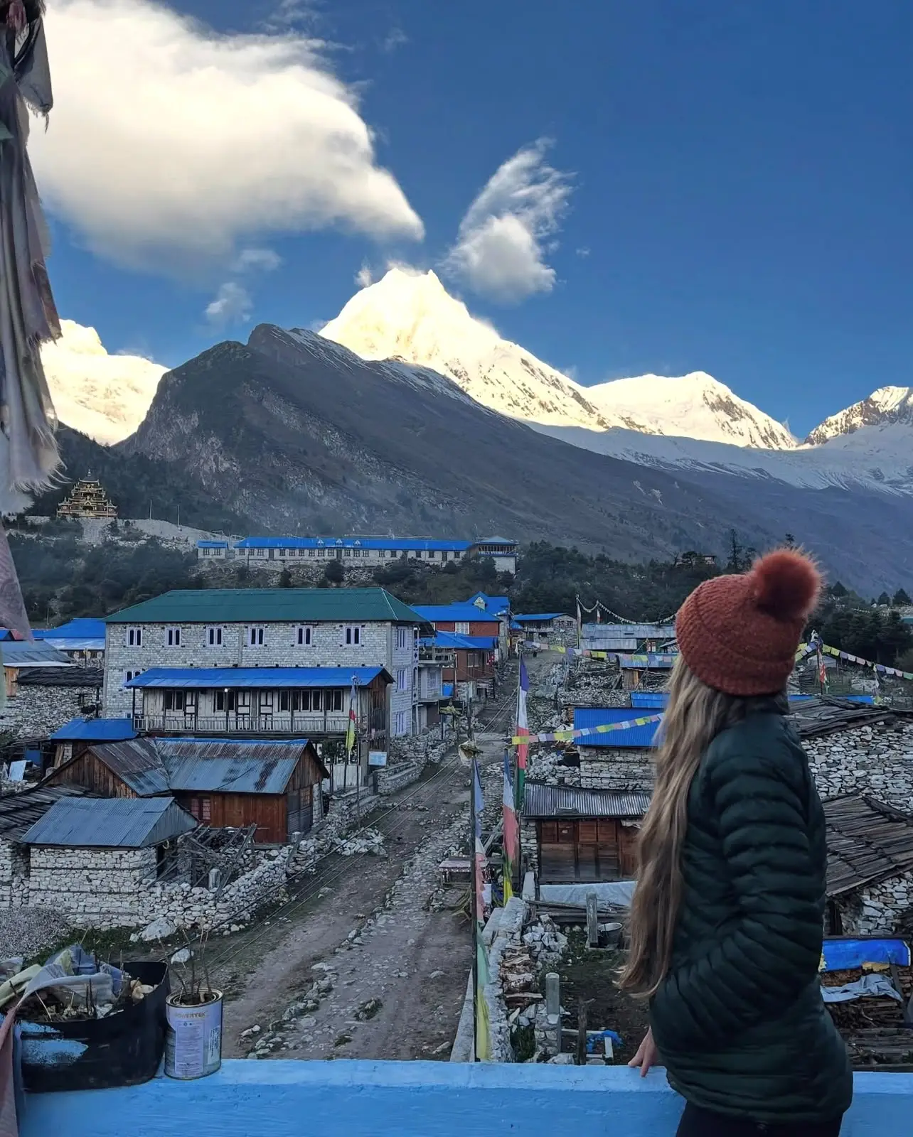
The village occupies a bowl-shaped valley surrounded on multiple sides by high ridges and peaks. The most prominent mountain visible from Samagaun is Mount Manaslu at 8,163 meters, the eighth highest peak in the world. On a clear morning, the wall of Manaslu fills the northern horizon with a scale that is hard to process at ground level. Himalchuli at 7,893 meters and Naike Peak at 6,760 meters form additional points in the skyline, and the surrounding ridgelines carry glaciers that feed small streams through the village area.
Samagaun sits between two other villages on the Manaslu Circuit route. Below it to the south is Lho at approximately 3,180 meters. Above it to the north is Samdo at 3,860 meters. The trail connecting these three villages is the main trekking path through this section of the valley, and it is well marked and maintained.
The Manaslu Conservation Area covers about 1,663 square kilometers and protects the biodiversity around the entire Manaslu massif. Samagaun is inside this protected zone, which means development within the village is controlled and the surrounding forests and wildlife are under formal protection. The area around the village contains pine, rhododendron, and fir trees at lower elevations, transitioning to alpine shrubs and bare rock at higher altitudes.
| Detail | Information |
|---|---|
| Elevation | 3,530 meters (11,581 feet) |
| District | Gorkha District |
| Province | Gandaki Province |
| Municipality | Chumanuwri Rural Municipality |
| River | Budhi Gandaki |
| Protected Area | Manaslu Conservation Area |
| Village above | Samdo (3,860m) |
| Village below | Lho (3,180m) |
| Nearest high point | Larke La Pass (5,106m) |
The People of Samagaun: The Nubri Community
The people of Samagaun belong to the Nubri community, sometimes written as Nubba. They are a Tibetan speaking group who settled in the Budhi Gandaki valley centuries ago. The word Nubri refers to the western valleys of this region, and the people take their identity from the land itself. They are culturally and linguistically closer to Tibetans than to the hill peoples of lower Nepal, and their way of life reflects this clearly.
The Nubri people follow Tibetan Buddhism. Every aspect of daily life in Samagaun has a Buddhist dimension. The village pathways pass mani walls, which are long stone structures with carved Buddhist mantras. Prayer flags string between houses, along ridgelines, and at passes. Chortens (stone stupas) mark the entrance and exit points of the village and stand at important junctions on nearby trails. The morning and evening prayer sessions at the monastery are part of the daily rhythm of the village.
The traditional economy of Samagaun combined highland animal husbandry with trade across the Tibet border. Yaks were central to this economy for centuries, providing milk, butter, meat, wool, and transport. The opening of the Manaslu Circuit Trek to foreign trekkers in 1992 introduced a new income source: teahouse and guesthouse operation. Today most families in Samagaun earn part of their income from trekking tourism, but traditional activities continue alongside the newer economic activities.
Visitors to Samagaun often notice the stone architecture of the village houses. The buildings are constructed from local stone with wooden window frames and flat or low-pitched roofs designed to handle heavy snow loads. The interiors are dark and warm, and the cooking is done on clay or metal stoves using wood or gas. The residential compounds are compact, with animals sometimes kept on lower floors in winter for the warmth they generate.
Language and Communication
The Nubri people have their own dialect, which is distinct from standard Tibetan though mutually intelligible with it. Younger residents who have had access to education often speak Nepali as well, and those working in the trekking industry may speak basic English. Older residents primarily speak Nubri. Communication for trekkers works through guides, who typically handle all practical interactions with the village.
How to Reach Samagaun
Samagaun is not accessible by road. There is no motorable track leading to the village. The only way to reach it is on foot, following the Manaslu Circuit Trek route up the Budhi Gandaki valley. This means trekkers must walk for 7 to 9 days from the nearest road head to arrive at Samagaun.
Most trekkers start the Manaslu Circuit from one of three points: Soti Khola, Machhakhola, or Arughat Bazaar. A jeep or bus from Kathmandu or Gorkha reaches these starting villages, and the trek begins from there. The trail follows the Budhi Gandaki River upstream through a series of villages and elevation gains over the course of roughly a week before arriving at Samagaun.
| Stage | From | To | Elevation | Walking Time |
|---|---|---|---|---|
| Day 1 | Soti Khola (700m) | Machhakhola (869m) | +169m | 5 to 6 hours |
| Day 2 | Machhakhola | Jagat (1,340m) | +471m | 6 to 7 hours |
| Day 3 | Jagat | Deng (1,860m) | +520m | 5 to 6 hours |
| Day 4 | Deng | Namrung (2,630m) | +770m | 6 to 7 hours |
| Day 5 | Namrung | Lho (3,180m) | +550m | 5 to 6 hours |
| Day 6 | Lho | Samagaun (3,530m) | +350m | 3 to 4 hours |
The trail from Lho to Samagaun is a relatively short and manageable day. The path gains only 350 meters in elevation but the thinning air at these heights makes even moderate climbs feel more demanding than they look on paper. The trail passes through forest sections and open meadows with expanding views of Manaslu as you approach the village.
Permits Needed to Reach Samagaun
Samagaun lies inside the Manaslu Restricted Area, which requires a special permit in addition to the standard Manaslu Conservation Area permit. These permits must be obtained before you start the trek and cannot be purchased at the trailhead or in Samagaun itself. All permit arrangements must be done through a registered trekking agency in Nepal. Independent trekking without agency involvement is not permitted on this route.
| Permit | Cost (per person) | Where to Obtain |
|---|---|---|
| Manaslu Restricted Area Permit (September to November) | USD 100 for first 7 days, USD 15 per extra day | Department of Immigration, Kathmandu |
| Manaslu Restricted Area Permit (December to August) | USD 75 for first 7 days, USD 10 per extra day | Department of Immigration, Kathmandu |
| Manaslu Conservation Area Permit (MCAP) | NPR 3,000 (approximately USD 22) | Trekking agency or conservation office |
| Annapurna Conservation Area Permit (ACAP) | NPR 3,000 (approximately USD 22) | Trekking agency or conservation office |
| TIMS Card | NPR 2,000 (approximately USD 15) | TAAN or NTB office, Kathmandu |
Since 2023, Nepal has changed permit rules for solo trekkers on the Manaslu Circuit. Solo trekkers can now obtain a Manaslu Restricted Area Permit, but they must still be accompanied by a licensed guide and book through a registered agency. The change relaxed the minimum group size rule that previously required at least two paying trekkers, but the guide requirement remains in force.
Acclimatization at Samagaun: Why It Matters and How to Do It
Acclimatization is the main reason Samagaun appears in almost every Manaslu Circuit itinerary as a two-night stop rather than a single overnight. The village sits at 3,530 meters, and the next major checkpoint on the route, Samdo, is at 3,860 meters. The real challenge comes later: Dharamsala camp sits at around 4,450 meters, and Larke La Pass itself is at 5,106 meters. Without proper acclimatization at Samagaun, crossing the pass carries a real risk of altitude sickness.
The standard acclimatization principle is to sleep low and hike high. At Samagaun, this means taking a rest day and going on one of the short side trips that gain altitude during the day before returning to sleep at the village elevation. The Birendra Lake hike, which reaches about 3,691 meters, is the most popular option for an easy acclimatization day. The Pungyen Gompa hike gains significantly more altitude and is better for trekkers who have already spent a night at Samagaun without symptoms.
Recognizing Altitude Sickness at Samagaun
Altitude sickness, or Acute Mountain Sickness (AMS), becomes a real risk above 3,000 meters. The body needs time to produce more red blood cells and adjust to the lower oxygen density in the air. Symptoms of AMS include persistent headache, nausea, vomiting, fatigue, dizziness, and poor sleep. At Samagaun, these symptoms are relatively common on the first night, particularly for trekkers who have moved up from lower altitudes without taking enough rest days.
The rule is straightforward: do not ascend further if you have symptoms. A headache that goes away with water, rest, and paracetamol is manageable. Symptoms that persist or worsen, or any signs of fluid on the lungs (coughing, breathlessness at rest) or brain (severe headache, confusion, loss of balance) are emergencies that require immediate descent. Samagaun has a basic health post, but serious altitude emergencies require helicopter evacuation. Travel insurance that covers helicopter rescue from altitude is not optional on this route.
| Symptom Severity | Examples | Action |
|---|---|---|
| Mild AMS | Headache, mild fatigue, poor appetite | Rest, hydrate, take paracetamol, do not ascend |
| Moderate AMS | Severe headache, nausea, vomiting, dizziness | Rest for another day, consider Diamox under medical guidance |
| Severe AMS or HACE | Confusion, loss of balance, inability to walk straight | Descend immediately, call for help |
| HAPE | Breathlessness at rest, pink frothy cough, bluish lips | Descend immediately, emergency evacuation |
The standard recommendation is to spend two nights in Samagaun. Arrive on the first evening, rest and rehydrate. On the second day, do one of the short hikes to gain altitude before coming back to sleep. On the third morning, if you feel well, continue to Samdo. This schedule builds in enough recovery time for most trekkers to adjust successfully.
The 10-Day Manaslu Circuit Trek is a shorter yet adventure-packed version of the classic Manaslu trek, designed for trekkers who want to…
Three Side Trips from Samagaun Worth Taking
The rest day at Samagaun is best spent on one of three established side trips. Each one offers a different kind of experience and difficulty level. The decision about which one to attempt should factor in your current acclimatization status, fitness level, and the weather on the day.
Birendra Lake (Birendra Tal): The Easiest Option
Birendra Lake sits at approximately 3,691 meters, about 160 meters above Samagaun. The round trip distance is roughly 3 kilometers, and the walk takes between 1 and 2.5 hours depending on your pace. This makes it the most accessible option for a rest day hike, suitable for anyone who feels reasonably well on their first morning in the village.
The trail leaves Samagaun and passes through fields before reaching the monastery, then continues upward to the base of the glacier that feeds the lake. Birendra Lake is a freshwater glacial lake. The water is clear and cold, and the surroundings are open enough that you get unobstructed views of the Manaslu massif from the lake shore. Many trekkers build small stone cairns at the water’s edge, and hundreds of these piles accumulate over the trekking seasons, adding a quiet human dimension to the landscape.
In winter months the lake freezes completely. The frozen surface creates a flat white platform at the foot of the glacier, and the ice can be thick enough to walk on, though this is not recommended without knowledge of the ice conditions. The sight of the frozen lake beneath the Manaslu glacier is striking, and some photographers specifically time their visits for December and January to capture it.
| Detail | Birendra Lake | Pungyen Gompa | Manaslu Base Camp |
|---|---|---|---|
| Distance (round trip) | ~3 km | ~15 km | ~15 to 18 km |
| Elevation gain | ~160m (to 3,691m) | ~776m (to 4,306m) | ~1,270m (to 4,800m) |
| Time required | 1 to 2.5 hours | 5 to 6 hours | 6 to 8 hours |
| Difficulty | Easy | Moderate to Challenging | Challenging |
| Best for | Day 1 of rest, all fitness levels | Experienced trekkers, Day 2 of rest | Fit trekkers with good acclimatization |
Pungyen Gompa: A Monastery with Centuries of History
Pungyen Gompa, also written as Pungen Monastery, is a Buddhist monastery perched on the shoulder of the mountain above Samagaun at approximately 4,306 meters. The round trip hike covers roughly 15 kilometers and takes 5 to 6 hours at a comfortable pace. The elevation gain of about 776 meters makes this a significantly more demanding outing than the Birendra Lake walk.
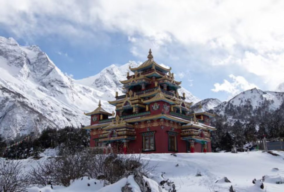
The monastery is approximately 400 years old. It was built by the Nubri people as a place of worship for Lord Pungyen, a deity they believe protects the area around Mount Manaslu. The monastery is also called Pungen Gompa or Pungyen Monastery depending on the transliteration used. The architecture follows the Tibetan Buddhist style with colorful murals painted on the interior walls, prayer wheels at the entrance, and religious relics inside. Monks still live and practice here, and the monastery remains an active religious site rather than simply a historical monument.
The trail from Samagaun begins by heading out through the fields at the edge of the village. The first section passes through forest, which provides shade and some protection from wind. After about an hour the forest thins out and the trail becomes steeper and more exposed. The final approach to the monastery involves a narrow, steep path with a lower gateway at the monastery perimeter and then a short climb to the main buildings. The view from the monastery grounds looking back toward Samagaun and the Budhi Gandaki valley is one of the finest viewpoints on the entire Manaslu Circuit.
The best time to attempt this hike is on a clear morning in spring or autumn when visibility is at its maximum and the temperature is manageable. The descent is steep in places and requires care on loose rock sections, especially if afternoon clouds have brought any moisture to the trail surface.
Manaslu Base Camp: The Hardest and Most Rewarding Option
Manaslu Base Camp sits at 4,800 meters, making this a serious day hike with an elevation gain of approximately 1,270 meters from Samagaun. The round trip takes 6 to 8 hours and should only be attempted by trekkers who are well acclimatized, have already spent at least one night at Samagaun without symptoms, and are physically fit enough to handle a full day of high-altitude walking.
The trail to Manaslu Base Camp passes through diverse terrain: forested slopes in the lower sections, open meadows, rocky moraines, and eventually the glacial terrain at the base camp itself. Along the way, the views expand progressively. You see Samagaun below you, Birendra Lake in the middle distance, and the Manaslu glacier above. The base camp is at the foot of the southwestern face of Manaslu, where expeditions attempting the mountain establish their first permanent camps.
In spring (April and May), which is the primary climbing season for Mount Manaslu, you may encounter expedition teams at or near base camp. Seeing the scale of preparation required for an 8,000-meter summit attempt, with the mountain itself filling the sky above you, gives a perspective on Himalayan mountaineering that no photograph fully conveys. From base camp, you can see not just Manaslu but also Himalchuli at 7,893 meters, Ganesh Himal at 7,319 meters, and Shringi Himal at 7,187 meters.
Descending from Manaslu Base Camp back to Samagaun can feel longer than the ascent due to fatigue. Allow yourself enough daylight hours to descend safely and return to the village before dark. Starting early in the morning, ideally by 6am or 7am, gives you the best conditions and the most time buffer for the return journey.
Samagaun Monastery and Buddhist Culture
The Samagaun Monastery, sometimes referred to as Samagaon Gompa, stands on a hill above the village with views over the surrounding valley. The monastery is the religious center of the community and has been rebuilt and maintained over generations. Daily prayer sessions take place in the morning and evening, and the sound of monks chanting carries across the village during these times.
Visitors are generally welcome to enter the monastery and observe, provided they remove their footwear before entering the prayer hall, walk clockwise around stupas and mani walls (this is the direction of respect in Tibetan Buddhism), and behave quietly during prayer sessions. Photographs inside the prayer hall should be taken with permission from the monks.
The village itself functions as a cultural landscape shaped by Buddhist practice. Mani walls at the village entrances are carved with the mantra Om Mani Padme Hum repeated thousands of times across the stone slabs. Prayer flags in colors representing the five elements (blue for sky and space, white for air and wind, red for fire, green for water, yellow for earth) flutter from lines strung between buildings and poles. Chortens containing religious relics or ashes of important lamas mark significant points in the landscape.
The annual monastery festival, held in spring, is the most important community event in the Samagaun calendar. Monks perform ritual dances (cham) in elaborate costumes representing various deities and symbolic figures. The festival draws residents from surrounding villages and is also attended by some trekkers who time their visit to coincide with it. The exact dates change each year according to the Tibetan lunar calendar, so confirming the date in advance requires checking with a guide or the monastery directly.
The 10-Day Manaslu Circuit Trek is a shorter yet adventure-packed version of the classic Manaslu trek, designed for trekkers who want to…
Where to Stay in Samagaun: Lodges and Teahouses
Samagaun has better accommodation than most villages at similar altitudes on the Manaslu Circuit. The village has developed its lodging infrastructure over three decades of trekking tourism, and the options available today range from very basic to reasonably comfortable by high-altitude standards.
Most lodges offer simple rooms with wooden or metal-framed beds, mattresses, and blankets. Private rooms with attached bathrooms are rare at this altitude; most bathrooms are shared. Hot showers are available at most lodges for an additional charge, typically between NPR 200 and NPR 500. This is a significant comfort given the cold temperatures, and most trekkers consider it worth the cost. Lodges run hot water through solar or gas-heated systems, and availability can depend on weather and time of day.
| Lodge Name | Notable Feature | Best For |
|---|---|---|
| Norbu Guest House | Solar charging available, reliable food quality | Comfort and consistency |
| Tashi Guest House | Central location in the village, good dining area | Groups and social dining |
| Rojen Guest House | Friendly management, excellent dal bhat | Budget-conscious trekkers |
| Mount Manaslu Hotel and Lodge | Some rooms with attached bathroom | Those wanting more privacy |
| Gyalzen Guest House | Close to the monastery, simple and affordable | Budget and cultural proximity |
| Peace Heaven Guest House | Quiet corner of village, sunny yard | Rest and relaxation |
| Karsang Lodge | Family-run, clean rooms | Genuine local hospitality |
Lodge prices at Samagaun follow a standard pattern: the room itself is inexpensive (sometimes free or very cheap per night) but trekkers are expected to take meals at the lodge. Rooms typically cost NPR 300 to NPR 600 per person per night. Meals are charged separately. It is standard practice on the Manaslu Circuit to eat where you sleep, and lodges may decline service or charge premium rates if trekkers want to sleep in one lodge and eat at another.
During peak season (October, November, and late March to early May), Samagaun lodges can fill up, especially if a large group arrives ahead of smaller parties. Starting the day early and reaching Samagaun by early afternoon is a useful strategy for securing your preferred lodge.
Food in Samagaun: What to Eat and Drink
The food available in Samagaun covers the standard range of Nepali and Tibetan mountain cuisine. Dal bhat (lentil soup with rice, vegetables, and pickles) is the foundational dish and appears on every lodge menu. Tsampa (roasted barley flour mixed with tea or water) is the traditional Tibetan staple and is available in some lodges, particularly those run by Nubri families. Tibetan bread, fried and served with butter or jam, is a common breakfast item.
Noodle soups, fried rice, fried noodles, potato dishes, and vegetable curries are standard items. Momos (steamed or fried dumplings filled with vegetables or meat) appear regularly. At this altitude, meat quality and freshness can be variable, and many experienced trekkers choose vegetarian options above 3,000 meters to reduce the risk of food-related illness. The cooking at Samagaun lodges is generally reliable, and portions are generous.
| Food Category | Examples | Typical Price Range |
|---|---|---|
| Main meals | Dal bhat, fried rice, noodle soup, potato curry | NPR 400 to NPR 700 |
| Breakfast items | Tibetan bread, porridge, eggs, tsampa | NPR 250 to NPR 500 |
| Snacks and sides | Momos, spring rolls, biscuits | NPR 150 to NPR 350 |
| Hot drinks | Tea (black, milk, ginger, butter), coffee | NPR 100 to NPR 200 |
| Cold drinks | Soft drinks (limited), mineral water | NPR 150 to NPR 300 |
Drinking water is an important topic at Samagaun. Tap water and stream water at this altitude should not be consumed without treatment. Most lodges sell boiled or purified drinking water, but prices increase with altitude, and the cost adds up over multiple days. Carrying a water filter or iodine/chlorine tablets allows you to treat water from taps or streams without paying for bottled water at every stop.
Appetite tends to decrease at high altitude, which is a normal physiological response. Even when you do not feel hungry, maintaining caloric intake and hydration is important for performance and acclimatization. Dal bhat is nutritionally balanced and easy to digest, which is one reason experienced trekkers often choose it repeatedly at altitude despite the limited menu variety.
Facilities and Practical Matters in Samagaun
Samagaun is one of the better-equipped villages on the Manaslu Circuit, but its facilities remain basic by lowland standards. Understanding what is and is not available helps you prepare properly before leaving lower villages where resupply is easier.
Electricity and Charging
Most lodges have electricity supplied by solar panels or small hydropower systems. Device charging is available at most lodges for a fee, typically NPR 200 to NPR 400 per device. Bring appropriate charging cables and consider carrying a power bank, as power availability can be limited on cloudy days when solar generation drops. The electricity supply is not consistent enough to charge multiple devices simultaneously, and some lodges prioritize their own lighting over guest charging.
Wi-Fi and Phone Signal
Wi-Fi is available in some lodges at Samagaun, but the connection is slow and unreliable. Some lodges charge separately for Wi-Fi access. Mobile phone signals from Ncell and Nepal Telecom networks are weak or absent in parts of the village. Some locations within the village may have enough signal for text messages or low-bandwidth internet. Do not plan on reliable communication from Samagaun; inform your emergency contacts in advance about the expected period of limited connectivity.
ATM and Cash
There are no ATMs in Samagaun. Cash is the only accepted payment method at all lodges and shops. The nearest ATMs are in Gorkha or Arughat, which is many days of walking from Samagaun. Before starting the Manaslu Circuit, calculate your cash needs for the entire route including tips for guides and porters, lodge accommodation, meals, permits, charging fees, and any extra costs like hot showers or medication purchases, and carry that full amount from Kathmandu. Banks in Arughat sometimes have ATM facilities, but their reliability is not guaranteed.
Medical Facilities
Samagaun has a basic community health post with limited supplies. This can handle minor injuries and illnesses but is not equipped for altitude emergencies requiring oxygen, specialist assessment, or surgery. For serious medical situations, helicopter evacuation to Kathmandu is the only viable option. The cost of a helicopter evacuation from Samagaun ranges from USD 2,500 to USD 5,000 or more depending on conditions. Travel insurance that specifically covers helicopter rescue from high altitude is an absolute requirement for this trek.
Trekkers should carry a personal first aid kit that includes paracetamol for pain and fever, oral rehydration salts, ibuprofen, blister treatment, adhesive bandages, antiseptic, Diamox (acetazolamide) for altitude sickness prevention (discuss with a doctor before the trek), antidiarrheal medication, and antihistamines. Guides on reputable treks carry group first aid supplies as well, but individual kits add an important layer of self-sufficiency.
Weather and Best Time to Visit Samagaun
Samagaun is cold in every season. The elevation of 3,530 meters ensures that nighttime temperatures drop below freezing for much of the year, and even summer days rarely feel warm in the way lowland Nepal does. Understanding the seasonal weather patterns helps you choose the right time for your trek and pack appropriately.
| Season | Months | Daytime Temp | Nighttime Temp | Conditions | Trekking Suitability |
|---|---|---|---|---|---|
| Spring | March to May | 8°C to 15°C | -3°C to 2°C | Clear days, some afternoon cloud buildup, rhododendrons in bloom | Excellent |
| Summer/Monsoon | June to September | 5°C to 12°C | 0°C to 5°C | Heavy rain at lower altitudes, cloud and occasional rain at Samagaun, landslide risk on lower trail | Possible but challenging |
| Autumn | October to November | 5°C to 12°C | -8°C to -2°C | Clearest skies, best mountain views, stable weather, cold nights | Excellent |
| Winter | December to February | -5°C to 3°C | -15°C to -8°C | Heavy snowfall possible, very cold, fewer trekkers, some lodges close | Difficult, not recommended |
Autumn: The Best Season for Most Trekkers
October and November bring the clearest skies and the most stable weather on the Manaslu Circuit. The monsoon ends in late September, leaving the air washed and clean. Mountain views from Samagaun in October can be exceptional, with Manaslu appearing in full clarity on most mornings. Nights are cold (temperatures regularly drop below -5°C in October and colder still in November), so a warm sleeping bag rated to at least -10°C is necessary.
Spring: Rhododendrons and Climbing Season
March, April, and May bring warming temperatures and the spectacular bloom of rhododendron forests on the lower sections of the trail approaching Samagaun. By the time you reach Samagaun itself in spring, the rhododendrons below are at their peak color, and the days are longer and slightly warmer than autumn. Spring is also the main Manaslu climbing season, so you may encounter expedition teams if you time your visit to coincide with April or May. Weather is generally good but some pre-monsoon cloud activity can reduce visibility in afternoons.
What to Pack for Your Stay in Samagaun
Packing for Samagaun requires thinking about both the trekking approach and the conditions at altitude. The golden rule of mountain packing is: everything should earn its weight. At 3,530 meters, carrying an unnecessarily heavy pack increases fatigue and reduces the enjoyment of the walking.
| Category | Essential Items |
|---|---|
| Clothing | Down jacket (at least 600 fill power), waterproof shell jacket, fleece mid-layer, thermal base layers, trekking pants, warm hat, gloves, neck gaiter, wool or synthetic hiking socks (multiple pairs) |
| Footwear | Waterproof trekking boots (broken in before the trek), camp sandals or light shoes for the lodge |
| Sleeping | Sleeping bag rated to -10°C or lower, sleeping bag liner |
| Navigation | Offline maps downloaded to phone, paper map backup, headlamp with spare batteries |
| Health | Personal first aid kit, Diamox (if prescribed), water purification tablets or filter, sunscreen, lip balm with SPF |
| Documents | Permits (all of them), passport, cash in Nepali rupees, emergency contact list |
| Electronics | Power bank, solar charger, camera, extra memory cards, all necessary cables |
| Extras | Trekking poles (highly recommended at this altitude), sunglasses with UV protection, snack foods from Kathmandu |
Samagaun in the Context of the Full Manaslu Circuit Trek
To understand why Samagaun matters so much, it helps to see it within the full arc of the Manaslu Circuit Trek. The circuit is typically completed in 14 to 18 days and covers a loop around Mount Manaslu, crossing the Larke La Pass to connect the northern and southern sections of the Budhi Gandaki valley.
Samagaun comes roughly at the midpoint of the circuit in terms of days walked, but it is the most critical logistical and physiological checkpoint before the highest section of the trek. Everything before Samagaun has been building toward the altitude and terrain you encounter above it. Trekkers who have been moving steadily, eating well, sleeping adequately, and not rushing typically arrive at Samagaun in good condition. Those who have moved too fast or ignored early warning signs of altitude stress arrive needing more rest than the itinerary allows for.
| Section | Key Villages | Altitude Range | Approximate Days |
|---|---|---|---|
| Lower circuit (approach) | Soti Khola, Machhakhola, Jagat, Deng, Namrung, Lho | 700m to 3,180m | Days 1 to 5 |
| Samagaun (acclimatization) | Samagaun | 3,530m | Days 6 to 7 |
| Upper circuit (high altitude) | Samdo, Dharamsala, Larke La Pass, Bhimtang | 3,860m to 5,106m | Days 8 to 11 |
| Lower circuit (descent) | Tilje, Dharapani, Besisahar | 5,106m to 760m | Days 12 to 14 |
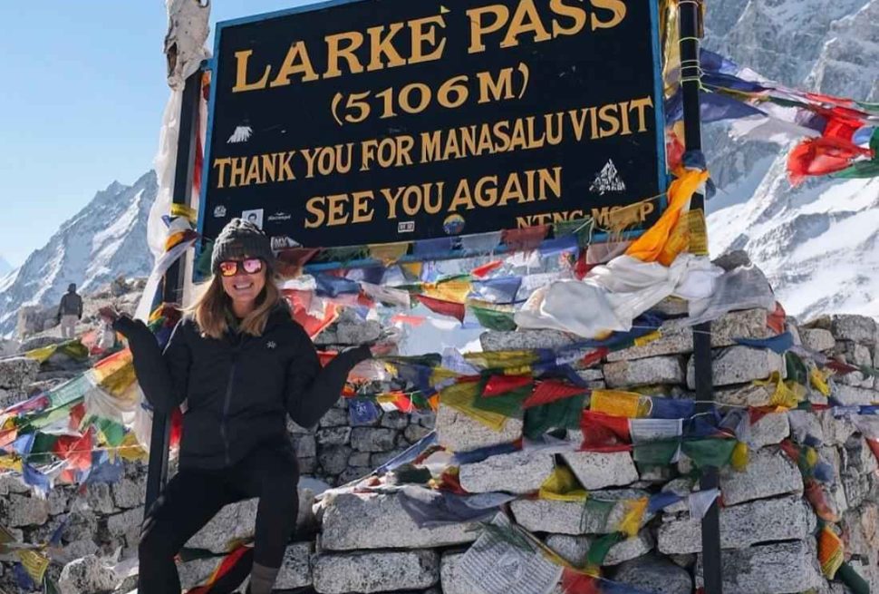
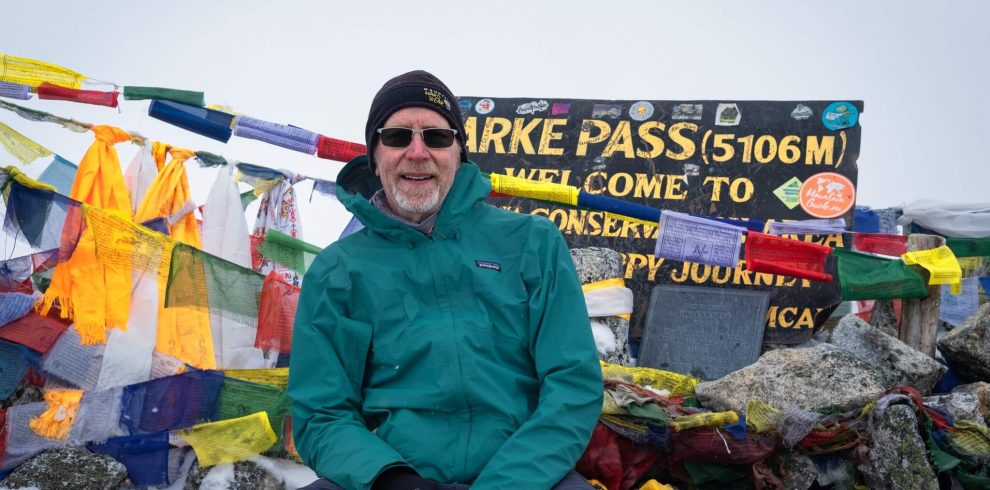
After leaving Samagaun, the route continues to Samdo (3,860 meters) and then to Dharamsala at around 4,450 meters, the last shelter before the pass. The crossing of Larke La at 5,106 meters is the physical and psychological high point of the trek, offering 360-degree views of the Himalayan range on a clear day before the long descent to Bhimtang and eventually Besisahar. The rest and acclimatization you do in Samagaun directly determines how that crossing goes.
Samagaun Compared to Other High-Altitude Villages on the Manaslu Circuit
The Manaslu Circuit passes through many villages, but Samagaun stands out for the combination of altitude, facilities, and access to side trips. A comparison with other major stops on the route shows why it receives the most attention in trek planning discussions.
| Village | Altitude | Lodge Quality | Cultural Interest | Side Trips Available | Days Typically Spent |
|---|---|---|---|---|---|
| Jagat | 1,340m | Basic | Moderate | None major | 1 |
| Namrung | 2,630m | Basic | High | Village walks | 1 |
| Lho | 3,180m | Good | High | Ribung Gompa | 1 |
| Samagaun | 3,530m | Best on route | Very High | Birendra Lake, Pungyen Gompa, Manaslu Base Camp | 2 |
| Samdo | 3,860m | Basic to Good | High | Tibet border viewpoint | 1 |
| Dharamsala | 4,450m | Very Basic | Low | None | 1 |
Environmental Responsibility at Samagaun
The Manaslu Conservation Area has faced increasing environmental pressure from trekking tourism over the past two decades. Samagaun, as the most visited stop on the high-altitude section of the circuit, sees concentrated traffic and its cumulative impact is visible in some areas around the village. Responsible behavior by trekkers makes a genuine difference.
Carry all non-biodegradable waste out of Samagaun and the national park. Plastic water bottles purchased at altitude create waste that is difficult to dispose of properly. Using a water filter and a reusable bottle eliminates this problem entirely. Do not pick flowers, disturb wildlife, or cut vegetation. Stay on established trails to prevent erosion of the fragile high-altitude terrain. Pay fair wages if you hire local porters directly, and ensure your trekking agency does the same.
The wood fire ban in the Manaslu Conservation Area means that lodges must use gas or kerosene for cooking rather than cutting local trees for fuel. Trekkers can support this policy by not requesting open fires and by accepting that the available fuel affects how some food items can be prepared. Some lodges have invested in solar cooking equipment that reduces fuel use further.
If you are trekking with Manaslu Treks, ask about their waste management and porter welfare policies before booking. Responsible operators have written policies on both and are transparent about them. An operator who cannot explain their environmental and social practices in concrete terms is likely not investing in them.
Frequently Asked Questions About Samagaun
What is the altitude of Samagaun?
Samagaun sits at 3,530 meters above sea level, which is approximately 11,581 feet. The village occupies a broad valley at this elevation, with the surrounding ridgelines and peaks rising significantly higher. At this altitude, the air contains roughly 65 percent of the oxygen available at sea level, and most people notice the reduced oxygen within their first few hours in the village.
How many nights should I spend in Samagaun?
Two nights is the standard recommendation, and most organized itineraries build this in. The first night allows your body to begin adjusting to the altitude. The rest day that follows gives you time for an acclimatization hike and further adjustment before continuing upward to Samdo and eventually Larke La Pass. Trekkers who feel unwell on the first night should extend their stay and not continue until they feel well.
Can I trek to Samagaun independently without a guide?
No. The Manaslu Circuit is a restricted trekking area in Nepal, and all trekkers regardless of experience or nationality are required to trek with a licensed guide hired through a registered Nepali trekking agency. The requirement applies to solo trekkers as well as groups. This rule is enforced at checkpoints along the route where permits are inspected, and trekkers found without a guide face fines and are turned back.
Is there mobile internet at Samagaun?
Mobile internet is weak and unreliable in most parts of Samagaun. Some lodges offer Wi-Fi, but speeds are very slow and the connection drops frequently. Ncell has marginally better coverage than Nepal Telecom in some spots, but neither network is reliable enough to count on for video calls or large file transfers. Downloading offline maps, guidebook content, and any entertainment you might need before leaving lower villages with better connectivity is a sensible approach.
What mountains can I see from Samagaun?
The dominant peak visible from Samagaun is Mount Manaslu at 8,163 meters, the eighth highest mountain in the world. Its north and northwest faces are clearly visible from the village and the surrounding ridges. Himalchuli at 7,893 meters and Naike Peak at 6,760 meters are also visible. From the higher viewpoints near the village, including Pungyen Gompa and Birendra Lake, the panorama expands to include additional peaks of the Manaslu Himal group.
What should I do if I get altitude sickness in Samagaun?
If you develop symptoms of altitude sickness in Samagaun, the first step is to stop ascending and rest. For mild symptoms (headache, mild nausea, fatigue), rest, drink fluids, take paracetamol, and monitor your condition. Do not take another upward step until you have been symptom-free for at least 24 hours. For moderate or severe symptoms, descent is the most effective treatment. Your guide should be informed immediately, and they should be able to arrange support for descent if needed. If symptoms are severe or deteriorating rapidly, call for helicopter evacuation through your tour operator or travel insurance provider.
Is Samagaun suitable for trekkers who have never been above 3,000 meters before?
Yes, but with appropriate caution and preparation. Samagaun is reachable by fit trekkers without previous high-altitude experience, provided they follow the gradual acclimatization schedule built into the Manaslu Circuit itinerary. The key is not to rush. Take the full number of rest days at each major acclimatization stop, listen to your body, and do not continue upward if you feel unwell. Previous exposure to altitudes above 3,000 meters is helpful but not required if the schedule is followed correctly.
Is Samagaun safe for solo female trekkers?
Samagaun and the Manaslu Circuit are generally considered safe for solo female trekkers, particularly because all trekkers on this route are required to travel with a licensed guide. The presence of a guide provides companionship, local knowledge, and an additional layer of security. The Nubri community in Samagaun is welcoming and respectful toward visitors. Dressing modestly (covering shoulders and knees, especially when visiting the monastery) is appreciated as a sign of respect for local cultural norms.
How far is Samagaun from Larke La Pass?
Larke La Pass at 5,106 meters is approximately 3 to 4 walking days from Samagaun, depending on the itinerary and pace. The standard route goes from Samagaun to Samdo (3,860m) on day one, then to Dharamsala (4,450m) on day two, and crosses the pass on day three with a long descent to Bhimtang (3,590m). Total distance from Samagaun to the pass is approximately 25 to 30 kilometers of trail.
What is the best side trip from Samagaun for a first-time visitor?
For a first-time visitor to Samagaun, the Birendra Lake hike is the best option on the first rest day. It is short enough to complete in a few hours without causing excessive fatigue, gains enough altitude to help with acclimatization, and offers excellent views of the surrounding landscape. If you feel well after Birendra Lake and have a second rest day, the Pungyen Gompa hike provides more dramatic mountain views and a genuinely interesting cultural destination at the monastery itself.
From Samagaun Onward: What Comes Next on the Manaslu Circuit
Leaving Samagaun, the trail climbs northeast toward Samdo, a smaller settlement at 3,860 meters with fewer facilities. From Samdo it is possible to take a short side trip toward the Tibet border, where the valley opens into a high plateau with views into the Tibetan plateau to the north. This perspective is one of the more unusual moments on the circuit, offering a glimpse into the landscape across the border.
From Samdo the trail climbs to Dharamsala, also sometimes called Larke Bazaar, which is the last shelter before the pass. Accommodation here is extremely basic, and the night before crossing Larke La is typically cold and short on sleep. Most trekkers start the pass crossing at 4am to 5am to ensure they reach the top before afternoon clouds and wind develop.
The descent from Larke La drops steeply into the Dudh Khola valley on the western side of the pass, reaching Bhimtang at 3,590 meters. This is typically the first warm meal and comfortable sleep after the pass crossing, and trekkers often describe the combination of physical exhaustion, altitude, and the dramatic landscape as one of the most memorable days of their trekking life.
The final section of the circuit descends through Tilje, Thonje, and Dharapani to the main road at Besisahar. From there, jeep or bus transport connects to Kathmandu, completing a circuit that takes most trekkers between 14 and 17 days in total. Samagaun, in the middle of this journey, remains the village that most trekkers remember most clearly: the mountain views, the cold nights, the monastery above the village, and the clarity that comes from two days of rest at altitude after a week of walking.
Why Trek with a Registered Manaslu Trekking Agency
The permit requirements for the Manaslu Circuit make a registered trekking agency not just convenient but legally mandatory. But beyond the permit logistics, there are practical reasons why trekking to Samagaun and beyond with a reliable company produces a better experience than trying to organize the logistics independently through informal channels.
A good trekking agency handles all permits before departure, employs licensed and experienced guides who know the route and the altitude risks, provides porters with proper equipment and fair wages, has emergency protocols in place for altitude sickness or injury, and can make flexible itinerary adjustments when a trekker needs more rest days without the stress of rebooking independent accommodation.
When selecting an agency, ask specifically about their guide’s first aid training and altitude sickness response protocols, their porter welfare policy (loads, clothing, shelter), and their emergency communication setup. Ask how many times their guides have led groups over Larke La Pass and specifically to Samagaun. Experience on this particular route matters: the altitude challenges, the permit checkpoints, the lodge dynamics, and the weather patterns are all specific to the Manaslu region in ways that general Himalayan trekking experience does not automatically cover.
Manaslu Treks specializes in the Manaslu region. Our guides have crossed Larke La Pass dozens of times and know the acclimatization requirements for reaching Samagaun safely. We handle all permits, employ certified guides, and have established relationships with lodges throughout the circuit that help our trekkers get proper rooms even during peak season. If you are planning a Manaslu Circuit Trek and want to ensure your time in Samagaun is part of a well-managed and enjoyable experience, contact us to discuss the right itinerary for your schedule and fitness level.
The 10-Day Manaslu Circuit Trek is a shorter yet adventure-packed version of the classic Manaslu trek, designed for trekkers who want to…