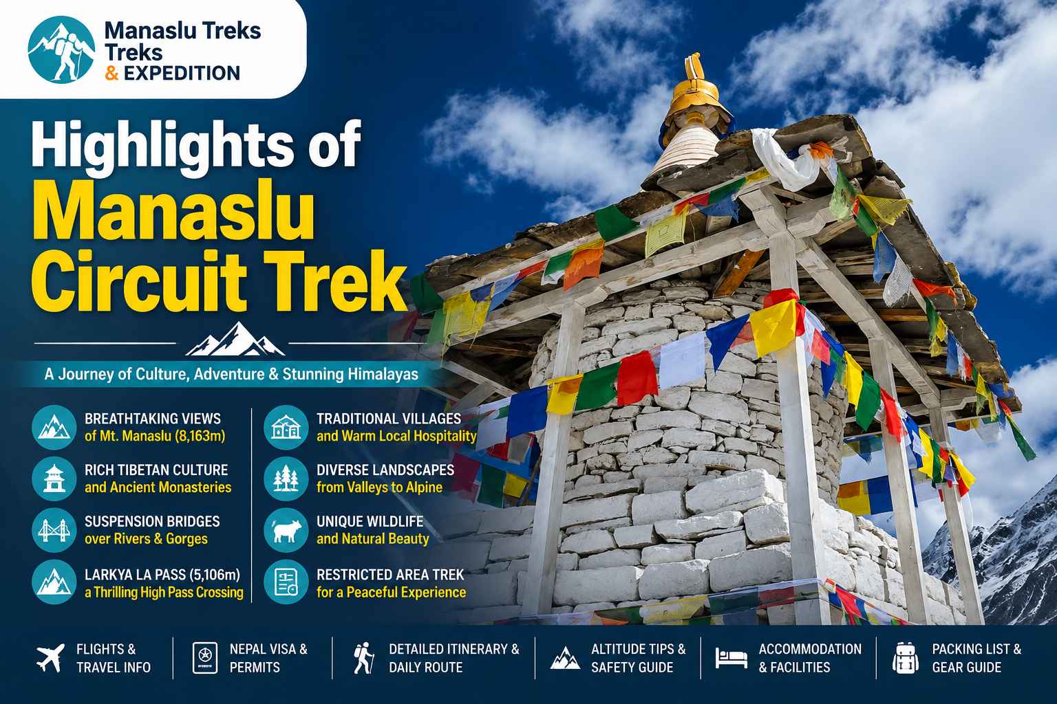
Highlights of the Manaslu Circuit Trek include crossing the Larkya La Pass at 5,160 metres, taking in close views of Mount Manaslu, exploring remote Himalayan villages, experiencing Tibetan Buddhist culture, and trekking along some of the quietest trails in Nepal. The route passes through deep river gorges, pine and rhododendron forests, glacier valleys, suspension bridges, and traditional settlements like Namrung, Lho, Samagaon, and Samdo.
One of the most memorable parts of the Manaslu trek Nepal experience is the changing landscape. The lower section follows the Budhi Gandaki River through waterfalls, terraced hills, and narrow gorge trails, while the upper region becomes more open and alpine with snow covered peaks and glacial terrain.
The Larkya La Pass trek is the biggest physical and scenic highlight of the journey. The early morning climb to the pass is challenging, but the mountain views from the top make it one of the best high pass crossings in Nepal. Trekkers can see Himlung Himal, Cheo Himal, Kang Guru, Annapurna II, and other surrounding peaks from the pass.
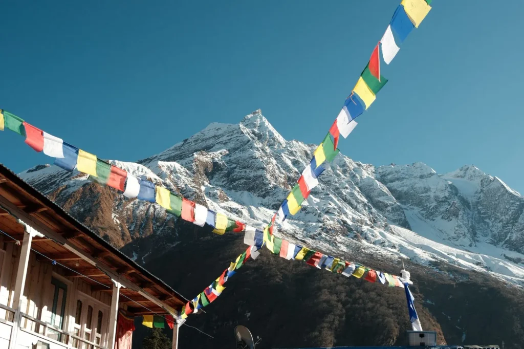
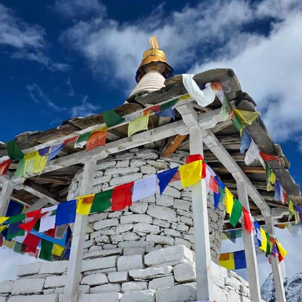
Another major highlight of the Manaslu Circuit Trek is the culture. The region has strong Tibetan Buddhist influence, and daily life in villages near the Tibetan border still follows old Himalayan traditions. Along the trail, trekkers pass monasteries, mani walls, prayer flags, and ancient chortens that reflect the spiritual importance of the region.
Compared to Everest Base Camp and Annapurna Circuit, the Manaslu Circuit Trek remains much less crowded. Tea houses are simple and locally operated, giving the trek a more authentic and remote feeling. The combination of mountain scenery, cultural experience, and quieter trails is what makes the Manaslu Circuit Trek one of the best trekking adventures in Nepal.
Planning the Manaslu Circuit Trek and need help with permits, route, or itinerary?
WhatsApp us Email usWhy Manaslu Circuit Trek Is Unique
Several qualities set the Manaslu Circuit Trek apart from every other major trek in Nepal.
It is a true restricted area trek. The section between Jagat and Dharapani is classified as a restricted zone by the Government of Nepal. Permits cannot be obtained independently. This regulation actively limits the number of trekkers entering the region, and the effect is felt immediately on the trail. Paths are quieter, teahouses are fewer per village, and the sense of wilderness is far more genuine than on popular corridors like the Annapurna or Everest regions.
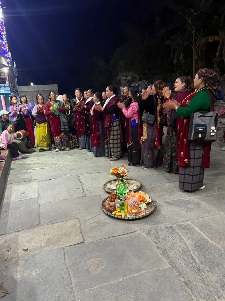
The cultural range is extraordinary. You begin the trek in lowland Gurung and Magar villages in the Gorkha foothills, walking through Hindu majority settlements with terraced rice and millet fields. As you ascend into the Nubri Valley, the cultural character shifts entirely. The communities around Samagaon, Samdo, and Lho are Tibetan Buddhist in language, custom, architecture, and daily life. Ancient monasteries, prayer wheels, mani stones stacked along the trail, and the smell of juniper incense burning in gompa courtyards make this cultural transition one of the most memorable parts of the entire route.
The mountain scenery never lets up. From the first clear morning view of Himal Chuli above Namrung to the full panoramic sweep from the top of Larkya La, with Manaslu, Himalchuli, Ngadi Chuli (Peak 29), Ganesh Himal, Himlung, Cheo Himal, and Annapurna II filling the horizon, the peaks are rarely out of sight for long. Unlike some Himalayan treks where summit views are limited to one or two key moments, the Manaslu Circuit keeps you in close visual range of major peaks for the better part of a week.
It remains genuinely off the beaten track. Visitor numbers on the Manaslu Circuit stay dramatically lower than on the Everest Base Camp or Annapurna Circuit routes. In peak autumn season you will share the trail with other trekkers, but a quiet evening in Samagaon or a clear morning on the Larkya La is still entirely possible.
Top Highlights of Manaslu Circuit Trek
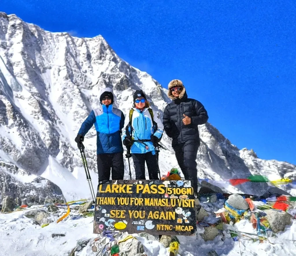
1. Crossing the Larkya La Pass (5,160m)
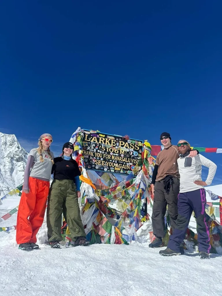
The Larkya La Pass is the centrepiece of the trek. Crossing it requires an early start, usually around 3:00 to 4:00 AM from Dharamsala, and a long, demanding day on glacial moraine and snow. The views from the top are unlike anything else in Nepal. Manaslu’s north face dominates the skyline. Himlung, Cheo Himal, Kang Guru, Annapurna II, and Ngadi Chuli are all visible in a single sweeping panorama. The descent to Bhimthang through meadows and past glacial streams is one of the most beautiful stretches of terrain on the entire circuit.
2. Mount Manaslu Up Close
The summit of Manaslu stands at 8,163 metres and is visible for much of the upper section of the trek. The closest and most dramatic views come from Samagaon, the Manaslu Base Camp trail at 4,800 metres, and from the Larkya La itself. On a clear morning from Samagaon, Manaslu’s summit tower and surrounding glacier are clearly visible without binoculars. Standing in a village at 3,520 metres looking up at one of the world’s highest peaks is an experience that stays with you long after the trek ends.
3. Samagaon Village and Surroundings
Samagaon is the largest village in the upper Nubri Valley and the cultural heart of the trek. Set at around 3,520 metres, it has a cluster of teahouses, a centuries old monastery called Ribung Gompa, and access to two outstanding day hikes: the trail to Manaslu Base Camp at 4,800 metres and the path to Birendra Lake at around 3,450 metres, surrounded by ice and rock. The acclimatisation rest day in Samagaon is one of the most rewarding parts of the entire itinerary.
4. Birendra Lake
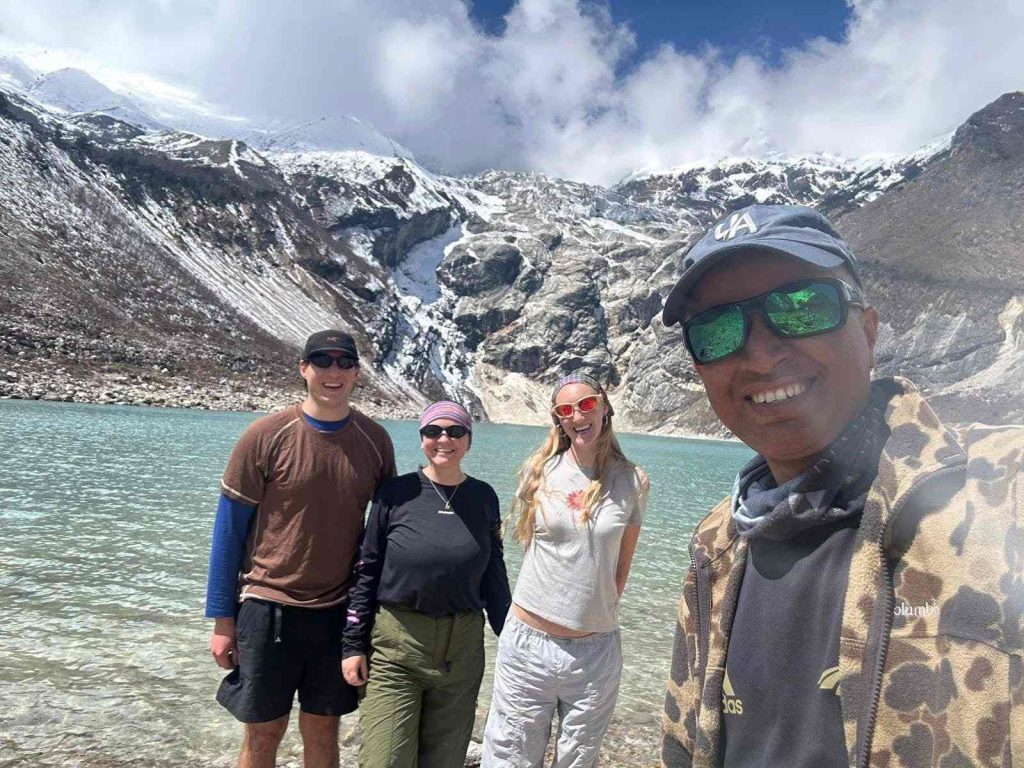
Birendra Lake sits above the moraines near Samagaon. Named after the late King Birendra of Nepal, it is a glacially fed lake of extraordinary colour, deep greenish blue under clear skies, surrounded by ice walls and rock. The short walk to the lake takes about 45 minutes from Samagaon and is an excellent option on the acclimatisation day.
5. The Budhi Gandaki River Gorge
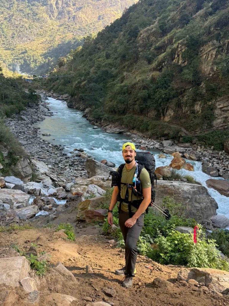
The lower section of the circuit follows the Budhi Gandaki River through one of the most dramatic river gorges in the Himalayas. Vertical cliffs, narrow trail sections cut directly into rockface, suspension bridges swinging over white water, and waterfalls cascading onto the trail make this gorge section between Machha Khola and Deng one of the most spectacular stretches of the route, even though the altitude is still low.
Planning the Manaslu Circuit Trek and need help with permits, route, or itinerary?
WhatsApp us Email us6. Tibetan Buddhist Monasteries
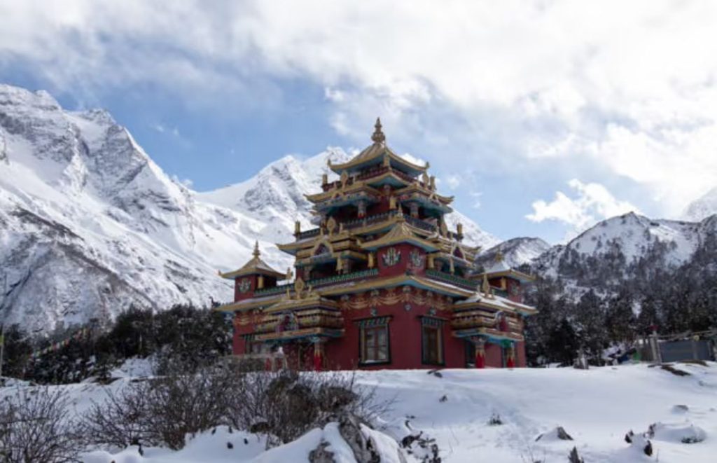
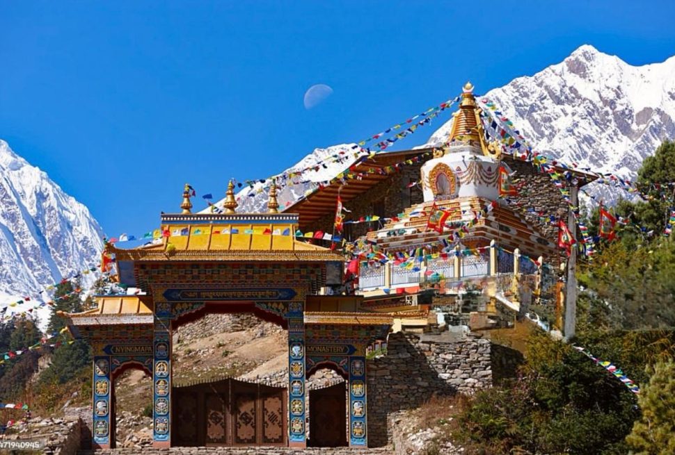
The monasteries along the Manaslu Circuit are genuinely ancient and actively in use. Ribung Gompa at Samagaon, Pungyen Gompa above Samagaon which is about a 1.5 hour walk from the village, Lho Monastery with its view of Manaslu’s west face, and the small gompa at Samdo are all worth spending time at. These are working religious sites rather than tourist attractions, and approaching them with respect opens real conversations with the monks and local community.
7. Bhimthang Valley
Bhimthang, the first overnight stop after crossing the Larkya La, sits in a broad alpine valley at around 3,720 metres. After the hardest day of the trek, arriving in this wide flower dotted meadow ringed by snow peaks is a deeply satisfying feeling. Teahouses here are surprisingly comfortable given the remoteness, and the views of the surrounding peaks on a clear evening are outstanding.
8. Wildlife in Manaslu Conservation Area
The Manaslu Conservation Area is home to Himalayan tahr, musk deer, ghoral, pika, and Himalayan marmots. Snow leopards also inhabit the region. Rare sightings have been documented here, including a confirmed sighting by a trekking group in May 2025. Griffon vultures and other high altitude raptors are commonly seen around the upper sections of the route.
Day by Day Manaslu Circuit Trek Highlights with Altitude
The standard 14 day Manaslu Circuit Trek itinerary below represents the route used by Manaslu Treks and Expedition, beginning from Machha Khola, which is the current recommended trailhead, and finishing at Dharapani.
Day 1: Drive from Kathmandu to Machha Khola (930m)
Walking Hours: No trekking today. Drive of approximately 9 to 10 hours.
Key Highlight: The drive from Kathmandu follows the Prithvi Highway along the Trishuli River before turning north into the Gorkha district. Road conditions are good until Arughat. After Arughat, the road narrows considerably and becomes rough and bumpy alongside the Budhi Gandaki River gorge. Depending on the season, dust and ongoing road construction can slow the journey. A private jeep reaches Machha Khola in roughly 9 hours while a public bus takes longer and is less comfortable on this stretch.
Trail Condition Note: Driving directly to Machha Khola is the current best practice. The section between Soti Khola and Machha Khola is now mostly a jeep track, so beginning your trek on foot from Machha Khola the following morning is the recommended approach used by Manaslu Treks and Expedition.
Accommodation: Basic teahouses in Machha Khola with simple rooms and shared facilities. Four to five guesthouses are available in the village.
Day 2: Trek from Machha Khola (930m) to Jagat (1,340m)
Walking Hours: 5 to 6 hours
Key Highlight: This is where the trekking properly begins. The trail climbs and descends along the east bank of the Budhi Gandaki, crossing the river on a wire suspension bridge near Dobhan and climbing to the village of Jagat. The gorge scenery here is immediate and dramatic, with vertical cliffs, waterfalls, and the constant sound of the river below. Jagat serves as the first official permit checkpoint for the Manaslu restricted area, so ensure all documents are in order before arrival.
Village Experience: Jagat is a Gurung majority village with a mix of teahouses and local family homes. The stone paved streets and traditional houses give you the first proper feel of life on the trail.
Trail Condition Note: The trail between Khorlabesi and Jagat has steep and slippery sections, particularly after rainfall. The path hugs cliff edges in places. Trekking poles are useful from this point onward.
Mountain Views: Distant glimpses of lower ridges on clear days.
Day 3: Trek from Jagat (1,340m) to Deng (1,860m)
Walking Hours: 6 to 7 hours
Key Highlight: A longer day that takes you deeper into the Nubri Valley. The trail passes through Salleri, Sirdibas, and Ghatta Khola, crossing and recrossing the river multiple times on suspension bridges. The first mani walls and Buddhist prayer flags begin to appear as the cultural character of the communities gradually shifts northward. The Tsum Valley junction at Pewa village is passed today and serves as a reminder that this region extends far beyond the main circuit for those who have extra time.
Village Experience: Deng is a small, basic village with simple teahouses. The landscape around Deng begins to open into wider valley views as you continue north.
Acclimatisation Note: Altitude gain today is moderate. Sleep well, hydrate properly, and avoid alcohol in the evening.
Day 4: Trek from Deng (1,860m) to Namrung (2,630m)
Walking Hours: 6 to 7 hours
Key Highlight: The terrain becomes noticeably more dramatic through this section. Rock tunnels cut into cliff faces, carved mani stones, and the first dense rhododendron forests mark this stretch of trail. The route passes through Rana, Bihi, and Prok before the final ascent to Namrung. Prok is a particularly photogenic village with traditional stone houses, Buddhist stupas, and views up the valley that give you the first real sense of what is waiting higher up.
Mountain Views: Namrung offers the first strong views of Siringi Himal and Ganesh Himal. On a clear evening, the light on these peaks is genuinely beautiful and worth stepping outside for.
Trail Condition Note: Some exposed sections between Bihi and Prok require careful footing in wet conditions.
Day 5: Trek from Namrung (2,630m) to Lho (3,180m)
Walking Hours: 5 to 6 hours
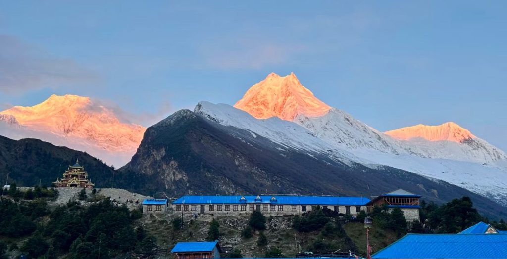
Key Highlight: Today the trail enters the upper Nubri Valley and the cultural landscape becomes unmistakably Tibetan. The village of Lihi, known for its barley terraces and strings of chortens, is one of the most picturesque settlements on the entire circuit. The final approach to Lho through forest and open hillside is rewarded by the first clear view of Mount Manaslu. Most trekkers describe this first sighting as one of the most powerful moments of the journey.
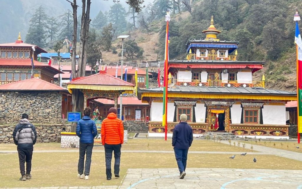
Mountain Views: Lho provides one of the finest views of Manaslu’s west face available anywhere on the circuit. The Lho Monastery sits on a ridge above the village with the peak directly behind it. In the late afternoon, the light on Manaslu from this spot is outstanding.
Acclimatisation Note: You are now above 3,000 metres. The altitude is noticeable. A short afternoon walk around the village and monastery helps with acclimatisation before the next day’s stage.
Day 6: Trek from Lho (3,180m) to Samagaon (3,520m)
Walking Hours: 4 to 5 hours
Key Highlight: A shorter day by distance but the views become increasingly immersive. The route passes through Shyala village, where Himal Chuli and Ngadi Chuli frame the eastern horizon and Manaslu looms ahead. The optional detour to Pungyen Gompa, about a 1.5 hour return walk from Shyala, is one of the highlights of the entire trek. The monastery sits on a ridge above a glacier and commands sweeping views of Manaslu and the surrounding peaks that are genuinely difficult to match elsewhere on the circuit.
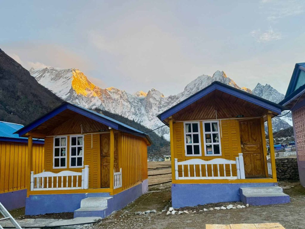
Village Experience: Samagaon is the largest settlement in the upper valley. It has multiple teahouses with reasonable facilities, a traditional Tibetan gompa called Ribung Gompa, mani walls, and a genuine sense of community life. Tibetan is spoken here alongside Nepali. You can feel the proximity to Tibet in everything from the architecture to the food and the daily routines of local people.
Mountain Views: Close and dramatic views of Manaslu’s summit, north face, and glacier.
Day 7: Acclimatisation Day in Samagaon (3,520m)
Walking Hours: Optional 3 to 6 hours depending on the chosen hike
Key Highlight: This rest and acclimatisation day is genuinely essential rather than optional. Spending a full day at Samagaon before ascending to Samdo and Dharamsala reduces altitude related risk significantly. The two best options for the day hike are Manaslu Base Camp at 4,800 metres, which is a 5 to 6 hour return walk through moraine and glacier terrain, and Birendra Lake at around 3,450 metres, which is a shorter and easier walk of about 1.5 to 2 hours return. Most trekkers choose Manaslu Base Camp on this day for the close up views of the mountain.
Mountain Views: From Manaslu Base Camp you stand directly beneath the south face of the mountain. The glacier, seracs, and summit tower are all visible at close range on a clear day.
Acclimatisation Note: Do not skip this day. The altitude jump from Samagaon to the Larkya La, going from 3,520 metres to 5,160 metres, is significant and the body needs time to adjust properly. Drink at least 3 to 4 litres of water throughout the day and go to bed early.
Day 8: Trek from Samagaon (3,520m) to Samdo (3,875m)
Walking Hours: 3 to 4 hours
Key Highlight: A short but meaningful day. Samdo is the last permanent settlement before the Larkya La. The village sits in a high open valley close to the Tibetan border. On a clear day, the ridgeline on the Nepal and Tibet border is visible from the village itself. Samdo has a small monastery and a quiet high altitude atmosphere quite different from the busier feel of Samagaon.
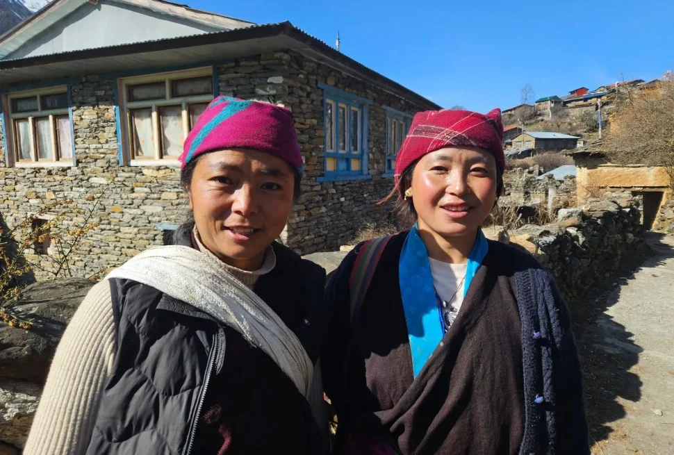
Village Experience: The community here is small and close knit, predominantly Tibetan Buddhist. Prayer flags mark every rooftop. Yaks graze the surrounding pastures. The pace of life at this altitude is noticeably slower and more deliberate.
Acclimatisation Note: The altitude gain today is short. Use the afternoon for a walk of 200 to 300 metres above Samdo and then return to sleep at village level. This pattern of climbing high and sleeping low is the most effective preparation for the pass crossing days ahead.
Day 9: Trek from Samdo (3,875m) to Dharamsala or Larkya Phedi (4,460m)
Walking Hours: 3 to 4 hours
Key Highlight: Dharamsala, also known as Larkya Phedi or High Camp, is the final stop before the Larkya La Pass. The walk from Samdo is short but ascends steadily through open moraine and boulder fields. Dharamsala itself is basic. A handful of stone teahouses with limited capacity serve trekkers here. Arriving early in the day is important during peak season because beds fill quickly and there is no overflow option at this altitude.
Trail Condition Note: At 4,460 metres, the cold is significant even in autumn. Warm layers including a down jacket, fleece, gloves, and a warm hat are essential from this point. Wind can be a factor on exposed sections. Trekking poles and gaiters are useful.
Acclimatisation Note: An early dinner and early sleep are both critical tonight. Most groups aim to begin the pass crossing between 3:30 and 4:00 AM the following morning. Eating a warm meal before sleep, keeping yourself hydrated, and laying out your gear the night before all make the pre dawn start more manageable.
Planning the Manaslu Circuit Trek and need help with permits, route, or itinerary?
WhatsApp us Email usDay 10: Trek from Dharamsala (4,460m) over Larkya La Pass (5,160m) to Bhimthang (3,720m)
Walking Hours: 9 to 11 hours, the longest and most demanding day of the trek
Key Highlight: The Larkya La crossing is the defining experience of the Manaslu Circuit Trek. The pre dawn start in darkness, the long ascent through snow and moraine by headtorch, and the arrival at the pass as the sun rises over Manaslu are moments that most trekkers carry with them for the rest of their lives. The summit views encompass Manaslu at 8,163 metres, Himlung at 7,126 metres, Cheo Himal at 6,820 metres, Kang Guru at 6,981 metres, Ngadi Chuli, and on clear days Annapurna II at 7,937 metres. The descent to Bhimthang is steep and long through glacial terrain before opening into beautiful alpine meadows.
Trail Condition Note: Snow and ice are present on the pass from approximately November onward. Crampons may be required in winter. In autumn, the trail is typically snow free or carries light snow near the top. Wind at the pass can be severe. Groups should not attempt the crossing in poor weather. Your guide from Manaslu Treks and Expedition will assess conditions before departure and make the appropriate call.
Mountain Views: The most expansive mountain panorama of the entire trek.
Day 11: Trek from Bhimthang (3,720m) to Tilche (2,300m)
Walking Hours: 5 to 7 hours
Key Highlight: A long descent day through some of the most beautiful terrain on the lower circuit. The trail drops from alpine meadow to rhododendron and pine forest, following the Dudh Khola also known as the Milk River. The transition from high altitude snowscape to lush subtropical greenery happens within a single day of walking, which is one of the remarkable contrasts of the Manaslu Circuit. Tilche is a pleasant village at a much warmer altitude and the first real taste of the lower Marsyangdi Valley.
Mountain Views: Looking back toward the Larkya La area, views of Manaslu and surrounding peaks are visible for much of the morning descent.
Day 12: Trek from Tilche (2,300m) to Dharapani (1,860m) and Drive to Besisahar or Kathmandu
Walking Hours: 2 to 3 hours trekking followed by a drive of 6 to 8 hours
Key Highlight: The restricted area ends at Dharapani. From here, jeeps can be arranged for the return drive to Besisahar and onward to Kathmandu or Pokhara. The return to a tarmac road, mobile signal, and familiar amenities happens quickly after the remoteness of the upper circuit. Most trekkers overnight in Besisahar or travel all the way to Kathmandu depending on their departure arrangements.
Trail Condition Note: The road from Dharapani to Besisahar has improved significantly in recent years and is now generally passable by jeep throughout the year, though monsoon damage can occasionally cause short delays.
Current Trail and Road Conditions
Road access to the Manaslu Circuit has changed noticeably in recent years. The road from Kathmandu via Arughat now extends all the way to Machha Khola, making Machha Khola the practical and recommended starting point for the trek. The section between Soti Khola and Machha Khola is now largely a jeep track rather than a proper trekking trail, so beginning your actual walking from Machha Khola is the approach used by Manaslu Treks and Expedition and most experienced local operators today.
Road conditions from Arughat to Machha Khola are rough and narrow. A private jeep makes this journey considerably more comfortable, though public buses operate the same route at lower cost. Expect dust during the dry season and mud during and after the monsoon.
Further along the route, road construction has continued past Jagat and Deng in recent years. This has improved emergency access to the lower villages, but the central section of the circuit from Namrung upward remains a genuine walking trail with no vehicle access. The character of the trek above Deng is unchanged.
At higher altitudes above 3,500 metres, trails are rocky and in places poorly marked. A licensed local guide is not just a permit requirement on paper. It is genuinely practical at this stage of the route where trail junctions are not always obvious to a first time visitor. TIMS cards are no longer required for the Manaslu Circuit Trek. The permit system now uses QR coded permits that are scanned at checkpoints including Jagat, Philim, Deng, and Samdo.
Larkya La Pass Crossing Experience
Crossing the Larkya La Pass deserves its own section because for most trekkers it is the single most memorable experience of their entire Nepal journey.
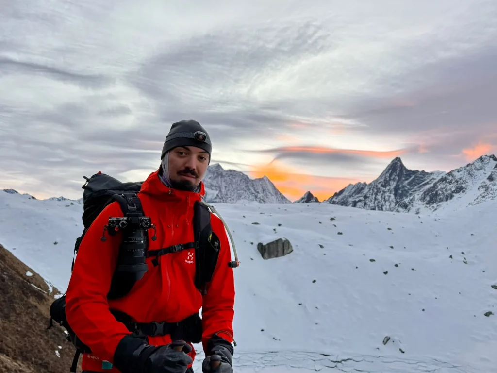
The crossing day begins before dawn, typically between 3:00 and 4:30 AM. The temperature at Dharamsala in October is often between minus 5 and minus 15 degrees Celsius overnight. Trekkers start moving in darkness, navigating by headlamp across rocky moraines before reaching the snowfield approach to the pass. At this altitude, above 5,000 metres, the thin air is immediately noticeable. Steps become deliberate and slow. Breathing takes real conscious effort.
The final ascent to the pass takes 3 to 4 hours from Dharamsala. As dawn breaks, the surrounding peaks catch the first light. Himlung’s pyramid and Cheo Himal’s elegant ridgeline come into view, and then, as you near the top, Manaslu’s entire north face fills the sky ahead of you. The actual summit of the pass at 5,160 metres is marked by prayer flags and a small cairn. In autumn, the views are typically clear and sharp. In spring, cloud build up can obscure the panorama by mid morning, which is one reason the early start is non negotiable.
The descent from the pass to Bhimthang takes 4 to 6 hours through steep rocky terrain and loose scree before softening into alpine meadows. By the time you reach Bhimthang, most trekkers have been walking for 9 to 11 hours. It is the hardest day of the trek by a clear margin and also the most rewarding.
Cultural and Village Highlights
The Manaslu Circuit passes through two distinct cultural worlds, and the transition between them is one of the trek’s most remarkable qualities.
Lower villages from Machha Khola to Namrung: The communities here are predominantly Gurung and Magar, with Hindu and animist traditions alongside Buddhism. Stone houses with carved wooden windows, terraced fields of millet, rice, and mustard, and busy roadside teahouses characterise this section. The people here are warm, accustomed to trekkers, and often speak reasonable English.
Upper villages from Lho to Samdo: Everything changes north of Namrung. Language, architecture, religion, and daily life are Tibetan Buddhist. Homes are built from stone with flat roofs stacked with firewood for the long winters. Prayer wheels line the paths into every village. Mani stones carved with the mantra Om Mani Padme Hum border the trail for hundreds of metres at a stretch. Monasteries dominate the village hilltops. Women in traditional chuba robes carry loads on wicker back baskets. The Nubri people who live here have maintained their cultural identity through centuries of relative isolation, and that isolation, preserved in part by the restricted area permit system, is still palpable today.
The Tsum Valley extension adds an additional layer of cultural immersion for those with more time available. The Tsum Valley, accessible via a junction north of Pewa village, is a hidden glaciated valley considered sacred in Tibetan Buddhism. Its monasteries, including Mu Gompa and Rachen Gompa, are among the oldest and most significant in Nepal. The valley community has maintained traditions that have largely disappeared elsewhere in the region.
Best Scenic Viewpoints
Lho Village: The first clear view of Manaslu’s west face is visible from the village itself and from Lho Monastery on the ridge above the settlement.
Shyala Village: Surrounded by Manaslu, Himal Chuli, and Ngadi Chuli, Shyala is one of the most photographed locations on the circuit.
Pungyen Gompa: About a 1.5 hour walk above Shyala, this monastery sits directly above a glacier with Manaslu filling the northern horizon. It is one of the best vantage points on the entire trek and well worth the short detour.
Manaslu Base Camp (4,800m): The closest accessible point to the Manaslu summit without technical climbing equipment. The south face glacier and the full height of the mountain are clearly visible on a clear day.
Birendra Lake (approximately 3,450m): A glacial lake reflecting ice walls and sky. The early morning light here is particularly beautiful.
Larkya La Pass (5,160m): The finest mountain panorama of the trek. Manaslu, Himlung, Cheo Himal, Kang Guru, Annapurna II, and Ngadi Chuli are all visible in a single 360 degree sweep.
Bhimthang Valley: The view looking back toward the Larkya La after the descent, with alpine meadows in the foreground and the Himalayan wall behind, is among the most peaceful and beautiful anywhere in Nepal.
Tea House and Food Experience
The Manaslu Circuit Trek is a full teahouse trek. You do not need to carry camping equipment. The teahouse network is well established from Machha Khola all the way through to Dharapani. The quality and range of facilities, however, vary considerably with altitude.
Lower villages from Machha Khola to Jagat: Basic rooms with wooden beds, thin mattresses, and shared bathrooms. Hot showers may be available, usually solar heated. WiFi is limited and unreliable at this stage.
Mid altitude villages from Deng to Namrung: Facilities are similar to the lower section. Some teahouses at Namrung have improved their amenities and offer private rooms. Food options begin to narrow. Dal bhat, noodles, fried rice, and eggs are reliable choices throughout the route.
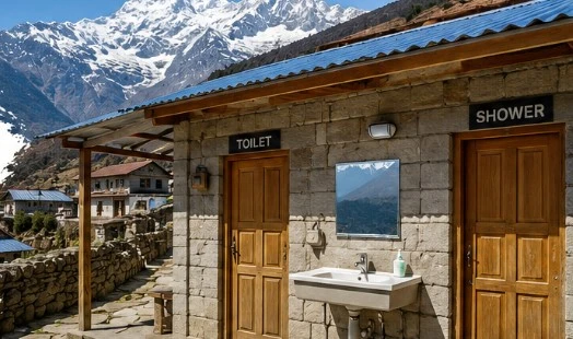
Upper villages from Lho to Samdo: Rooms are basic with wooden bunks, thin mattresses, and blankets. The communal dining room with a central stove is where trekkers gather in the evening. At Samagaon, which has the widest selection of teahouses on the upper circuit, the facilities are better than elsewhere at this altitude. Some teahouses in Samagaon now offer 4G mobile connectivity. Hot showers are available at extra cost of approximately 200 to 300 Nepali rupees. Charging devices costs around 200 to 500 rupees per charge depending on the device.
Dharamsala at 4,460 metres: Very basic stone lodges with minimal facilities and limited food choices. Book your bed in advance during peak season as capacity here is small and demand is high.
Bhimthang at 3,720 metres: Surprisingly comfortable relative to Dharamsala, with warm dining rooms and a decent selection of food to recover with after the crossing.
Food across the route: Dal bhat is available everywhere and is the best caloric and nutritional choice for trekking days. Tibetan influenced dishes including tsampa porridge, thukpa noodle soup, and Tibetan butter tea become available in the upper villages. Eggs, potatoes, and fried noodles are reliable options at all altitudes. Above 4,000 metres, food takes longer to cook, portions are smaller, and prices are higher. Carry cash in Nepali rupees because there are no ATMs after Arughat.
Manaslu Circuit Trek Difficulty and Acclimatisation
The Manaslu Circuit is a challenging trek. It is not a technical mountain climb, but it demands solid aerobic fitness, previous trekking experience ideally at altitude, and the mental readiness to sustain effort across 12 to 16 days in genuinely remote terrain.
Key difficulty factors to understand before you go:
Daily walking of 5 to 9 hours on trails that are often steep, rocky, and uneven. The maximum altitude of 5,160 metres at the Larkya La Pass places this in serious high altitude territory. The Larkya La crossing day runs 9 to 11 hours and is the longest and physically hardest day. The remote location above Samagaon offers limited evacuation options if something goes wrong. Weather in the upper sections can change rapidly and without much warning.
Acclimatisation strategy:
The standard 14 day itinerary builds in adequate acclimatisation with a rest day at Samagaon before pushing to Samdo and Dharamsala. This structure works well for most fit trekkers. The principle of climbing high and sleeping low applies throughout. The acclimatisation day hike to Manaslu Base Camp at 4,800 metres before sleeping at Samagaon at 3,520 metres follows this principle correctly and prepares the body well for the pass crossing days ahead.
Warning signs of altitude sickness including persistent headache, nausea, loss of appetite, shortness of breath at rest, or confusion must be taken seriously. The only effective treatment is descent. Your guide from Manaslu Treks and Expedition is trained in altitude sickness recognition and will make descent decisions without hesitation when a trekker shows concerning symptoms.
Preparation recommendations: Begin training at least 2 to 3 months before departure. Regular cardio exercise including hiking, stair climbing, and cycling builds the foundation needed. Carry a personal first aid kit including altitude medication. Consult your doctor about acetazolamide before the trek. Drink a minimum of 3 to 4 litres of water per day throughout the journey.
Planning the Manaslu Circuit Trek and need help with permits, route, or itinerary?
WhatsApp us Email usUpdated Permit Information (2026)
Three permits are required for the Manaslu Circuit Trek. All must be arranged through a registered trekking agency because individual applications are not accepted.
1. Restricted Area Permit (RAP or MRAP)
This is the most important permit and is mandatory for the section between Jagat and Dharapani.
Cost during autumn from September to November: USD 100 per person for the first 7 days, and USD 15 per person per additional day.
Cost during the off season from December to August: USD 75 per person for the first 7 days, and USD 10 per person per additional day.
Important update from March 2026: Nepal’s Department of Immigration changed the solo trekker rule on March 22, 2026. Solo trekkers can now obtain the RAP as individuals without needing a second foreign trekker named on the same permit. However, the mandatory licensed guide requirement remains strictly in force and was not changed by this update. You cannot legally trek the restricted section without a government licensed guide registered through a Nepal Tourism Board affiliated agency. This requirement is enforced at checkpoints at Jagat, Philim, and Samdo. Trekkers without a guide are turned back at these points.
2. Manaslu Conservation Area Permit (MCAP)
Required from Philim village onward. The fees fund conservation efforts, wildlife protection, and local community development within the Manaslu Conservation Area.
Cost is approximately NPR 3,000, which is around USD 23, for non SAARC nationals. SAARC nationals pay NPR 1,000.
3. Annapurna Conservation Area Permit (ACAP)
Required after crossing the Larkya La Pass as the trail descends into the Annapurna Conservation Area toward Dharapani.
Cost is approximately NPR 3,000, which is around USD 23, for non SAARC nationals. SAARC nationals pay NPR 1,000.
Additional Local Fee
A mandatory NPR 1,000 Chumnubri Rural Municipality fee is collected along the trail to support local community development.
Note: TIMS cards are no longer required for the Manaslu Circuit Trek. Permits now use a digital QR code system for faster processing at checkpoints. All permit costs are subject to change. Manaslu Treks and Expedition will confirm current fees at the time of your booking.
Best Time for Manaslu Circuit Trek
Autumn: September to November (Peak Season)
Autumn is the most popular and generally the best season for the Manaslu Circuit Trek. Skies clear after the monsoon, visibility is excellent, and temperatures are comfortable at lower altitudes. October in particular offers the finest combination of clear mountain views and manageable walking conditions. By late November, the Larkya La begins to accumulate significant snow and crossing conditions become more demanding.
Best months: October and early November.
Spring: March to May
Spring is the second best season. Rhododendron forests bloom with red and pink flowers across the middle altitude sections in March and April, and the days are warm. The main challenge in spring is the progressive build up of cloud and afternoon haze as the season advances toward pre monsoon conditions. Mountain views are clearest in the early morning. May can work at higher altitudes but cloud cover increases through the month.
Best months: Late March, April, and early May.
Monsoon: June to August (Not Recommended)
The Manaslu region receives heavy monsoon rainfall from June through August. Trails become slippery and prone to landslides, river crossings can be dangerous, and mountain views are almost entirely obscured. The Larkya La is technically passable but conditions are poor throughout this period. Manaslu Treks and Expedition does not recommend monsoon trekking on this route for most trekkers.
Winter: December to February (For Experienced Trekkers Only)
Winter brings snow to the upper sections and heavy snowfall to the Larkya La area. The pass may require crampons and ice axes in deep winter. Teahouses at the highest points sometimes close for the season. The trail below 3,500 metres is calm, clear, and uncrowded. For experienced high altitude trekkers who are properly equipped and fully prepared, a winter Manaslu Circuit is possible, but it requires careful planning and genuine flexibility around weather windows.
Why Trek with Manaslu Treks and Expedition
When you are planning a restricted area trek in a genuinely remote region of Nepal, the company you choose matters far more than on an open trail. The Manaslu Circuit is not a route where problems with permits, logistics, or safety planning can easily be fixed once you are on the trail.
Manaslu Treks and Expedition is a government licensed trekking company in Nepal with direct specialist knowledge of the Manaslu region. Unlike general trekking agencies that offer Manaslu as one option among many, our focus is the Manaslu region and its surrounding valleys. Our guides are from this area. They know the checkpoints, the teahouse owners across the circuit, the alternative routes when trails are affected by weather or construction, and the altitude warning signs that come from years of real experience rather than classroom training.
Permit expertise: We handle all Restricted Area Permit, MCAP, and ACAP paperwork on your behalf, correctly and on time. Permit errors or processing delays can derail an entire trek. We prevent that from happening.
Licensed and experienced guides: All our trekking guides hold Nepal Tourism Board licences and have extensive Manaslu Circuit experience. Many have crossed the Larkya La Pass dozens of times across all seasons and conditions.
Customised itineraries: The 14 day Manaslu Circuit Trek itinerary is our most popular format, but we build every itinerary around the individual client. If you want to include a Tsum Valley extension, add an extra acclimatisation day, or adjust the route based on your fitness level, we make those changes. We do not run rigid fixed departures that ignore individual needs.
Honest pre trek briefings: We tell you what the trail is actually like. The rough road to Machha Khola, the basic stone lodges at Dharamsala, the pre dawn start required on Larkya La day, and the limited food options at high altitude are all things we discuss with you before you book, not surprises that surface on the trail itself.
Local connections: Our long standing relationships with teahouse owners across the circuit mean we can secure accommodation during peak season when beds are genuinely scarce, particularly at Dharamsala where capacity is very limited.
Tsum Valley expertise: If you are considering combining the Manaslu Circuit with the Tsum Valley Trek, our local knowledge of that sacred valley including its monasteries, communities, and permit requirements is built from years of working directly in the region.
The Manaslu Circuit Trek, in the right conditions and with proper preparation and support, is one of the finest trekking experiences in Asia. A locally rooted specialist company with real experience in the restricted area makes the difference between a trip that runs smoothly and one that encounters problems that could have been prevented.
If you are ready to start planning your Manaslu Circuit Trek, reach out to us at Manaslu Treks and Expedition. We will listen to your timeline, your fitness level, and your specific interests and build you an itinerary that puts the real highlights of this remarkable route within your reach.
Planning the Manaslu Circuit Trek and need help with permits, route, or itinerary?
WhatsApp us Email us